
Step onto a path where Florida’s railroad past still pulses beneath your feet.
Steel rails once thundered here — now wheels hum softly through whispering pines and sunlit wetlands.
The route stretches south from Tallahassee toward the Gulf, tracing a corridor carved nearly two centuries ago.
Freight trains once hauled cotton and timber.
Today, cyclists and walkers chase salt-tinged breezes instead.
Shadows of longleaf pines stretch across smooth pavement.
Marsh birds lift from shimmering water.
The air slowly shifts — earthy woods giving way to briny coastal air near St. Marks.
History doesn’t sit quietly here.
It moves beside you, mile after unforgettable mile.
A Journey Through Time and Landscape

Start rolling from Tallahassee and you feel the past breathing along the path. What used to be iron rails is now a smooth ribbon inviting easy miles, where the cadence of your pedals syncs with wind through pine needles.
You glide beneath tall canopies, then emerge into open wetlands that hint at the Gulf’s salty pull.
This journey reads like a living timeline. Forest shadows cool the north, while sunlit marshes widen toward St. Marks, tying together habitats that once framed a freight route.
You sense the old corridor’s purpose reborn, carrying people instead of cotton and timber, trading whistles for birdsong.
As you ride, subtle grade changes, old mile markers, and straight sightlines reveal the railroad’s sturdy geometry. Today it is welcoming and human scaled, a place for families, fitness, and quiet reflection.
By the time coastal breezes brush your face, the transformation feels complete.
You have traveled through story and landscape at once. Each vista turns a historical footnote into something you can see, smell, and hear.
It is a rare corridor where memory and motion move together, mile after mile.
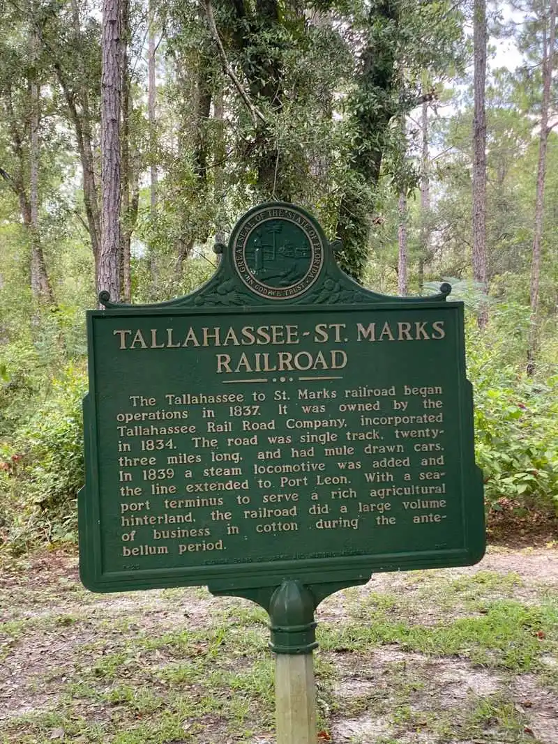
Historic Roots: Florida’s First and Longest-Operating Railroad

Picture the 1830s, when Tallahassee needed a route to the Gulf to move cotton and goods efficiently. The Tallahassee St. Marks Railroad answered, laying a lifeline to coastal shipping at St. Marks.
For nearly 150 years it hauled freight, passengers, and wartime supplies, threading commerce through forests and floodplains.
During the Civil War, the line became a strategic artery, feeding logistics that shaped Florida’s role in a larger conflict. You can still sense that gravity in the corridor’s unwavering alignment.
Every straightaway whispers of locomotives, crossties, and crews who braved heat, storms, and swarms of insects to keep trains moving.
Later decades brought standardization, upgrades, and eventual decline as highways took the lead. Yet the railroad’s cultural imprint never vanished.
When you roll its path today, you are tracing the state’s first and longest operating railroad legacy with every turn of the wheel.
Those origins deepen each mile with meaning. Freight depots and sidings are mostly gone, but the narrative remains stamped in the landscape.
This is not just a trail it is a museum without walls, honoring grit, ingenuity, and Florida’s early economic heartbeat.
The Rail-to-Trail Transformation

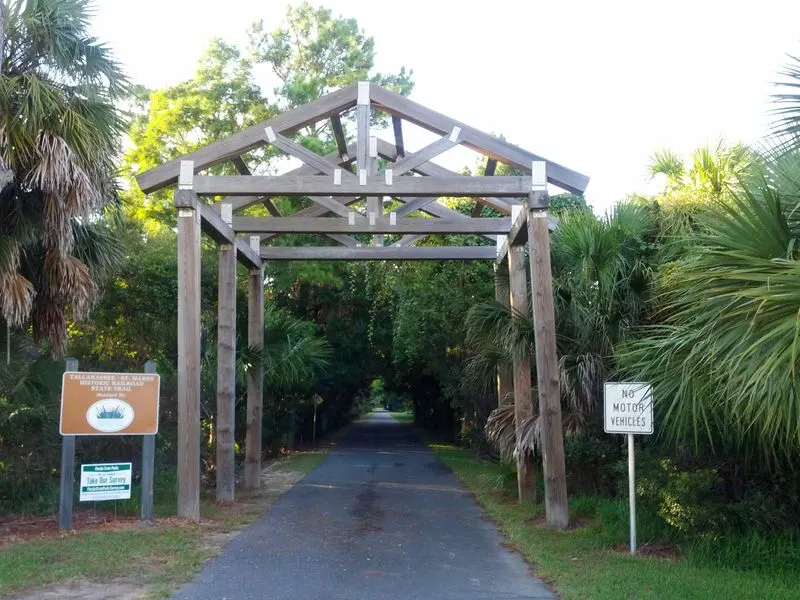
When the last trains stopped, the corridor could have vanished into weeds and memory. Instead, visionaries protected the right of way and reimagined it as Florida’s first paved rail trail.
Asphalt replaced ballast, interpretive signs replaced timetables, and new users arrived on bikes, skates, and running shoes.
This conversion stitched history into a living greenway, part of the state’s growing network of connected paths. The designation as a National Recreation Trail affirmed what locals already felt that preservation can serve people and place together.
You travel safely, separated from traffic, while habitat edges gain continuity and breathing room.
Rail to trail projects succeed because they respect the line’s bones. Gentle grades, generous sightlines, and durable surfaces invite all ages and abilities.
Here, those principles shine, from well marked crossings to shaded benches where the past invites you to pause.
Repurposing infrastructure is powerful conservation. It saves stories from erasure and landscapes from fragmentation, turning decline into daily use.
Ride it once and you will see how practical design and heritage can share the same corridor, mileposts guiding a new kind of journey.
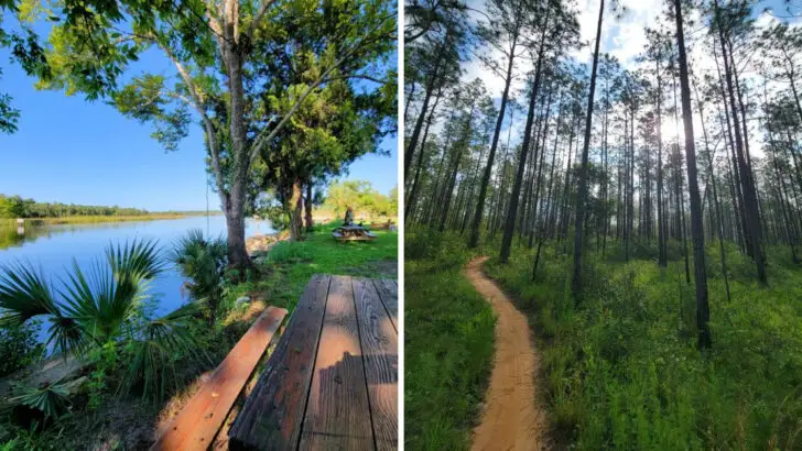
Trail Route and Terrain: From Capital City to Coastal Marshes

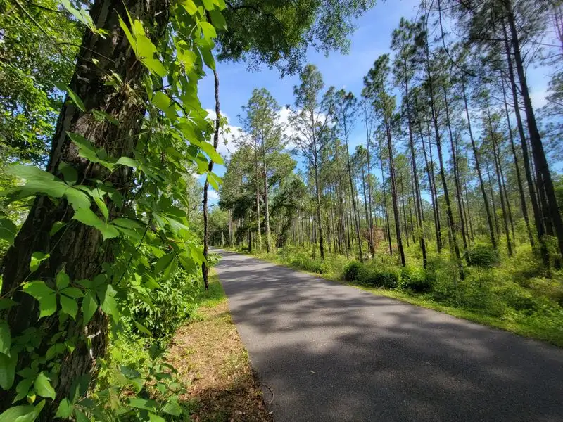
Set out from the capital’s south side and you quickly find a rhythm on near level pavement. The trail presses south through Leon into Wakulla County, its line purposeful and calm.
Expect roughly 16 to 20 plus miles of continuous movement, depending on spurs and where you join.
Forested stretches dominate early, with longleaf pines and wiregrass lending shade and scent. Rural gaps follow, where fences, pasture edges, and birds on wires frame the horizon.
Farther on, the landscape opens, and low shining wetlands signal your approach to the coast.
Wayfinding is straightforward. Crossings are marked, mileage signs steady, and amenities cluster near major trailheads.
The grade remains friendly throughout, which makes distance feel attainable for families, casual riders, and anyone chasing fitness without steep climbs.
As St. Marks nears, breezes pick up and the light changes, brighter and more reflective. You can almost hear water before you see it.
The route’s consistency is reassuring, but its scenery keeps evolving, a steady glide from shaded neighborhoods to tidal edges and river confluence.
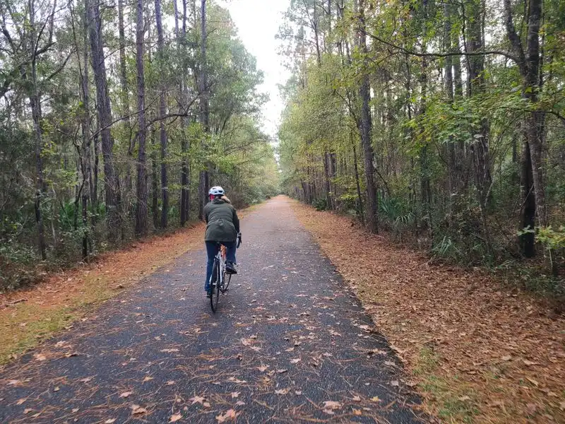
Towering Pines and Forest Enclaves
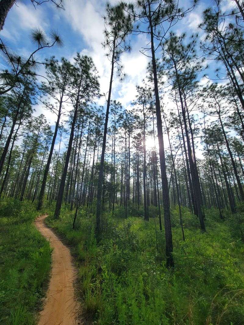

Under longleaf pines the air feels resin sweet and cool, even in summer. Sunlight flickers through high crowns, painting moving coins of light across the asphalt.
You hear red bellied and pileated woodpeckers tapping like distant metronomes, while squirrels scold from loblolly perches.
These forested segments shelter you from traffic and heat. Wiregrass, gallberry, and saw palmetto define the understory, with seasonal wildflowers stitching color along the edges.
It is easy to settle into a conversational pace here, miles slipping by under green cathedral aisles.
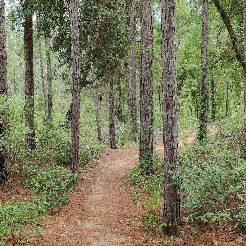
Connections deepen the immersion. Spurs toward Munson Hills and the greater Apalachicola National Forest invite sandier, more rugged side quests.
If you crave texture beyond pavement, you can branch off for rolling pine uplands before returning to the mainline’s smooth cadence.
Look carefully and you might spot gopher tortoise burrows or a soaring kite cruising thermals. The forest holds stories of fire ecology and restoration, too, where prescribed burns keep habitats healthy.
You are not just passing through woods you are visiting a living system shaped by time, flame, and patient stewardship.
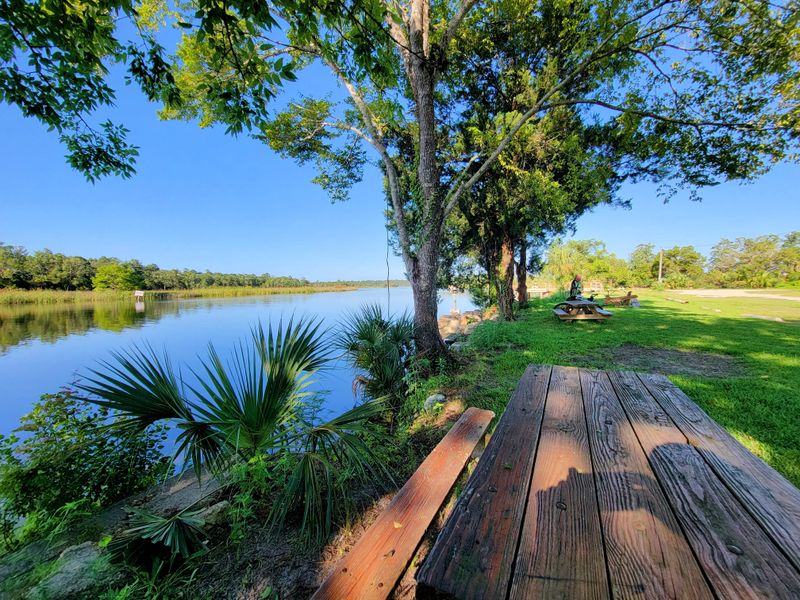
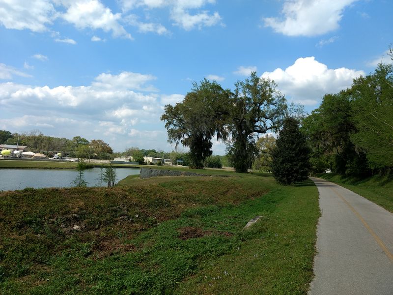
Marshlands and Waterside Vistas
South of the forests the horizon softens, and the ground grows glassy with water. Cordgrass leans in the breeze, silver channels snake through the flats, and egrets stitch white commas across the sky.
You pedal more slowly, not from fatigue, but because the scene insists.
Near the St. Marks River, tides breathe in and out, and salt tolerant plants claim their zones with quiet order. Ospreys patrol overhead, while fiddler crabs busy the edges like tiny typewriters.
On cooler days the air holds a sweetness that mixes river and gulf, something you feel in your chest.
Pull over and listen. The marsh hums with insects, wingbeats, and distant splash, a chorus that rewrites the tempo you brought from town.
It is both exposed and calming, a sky dominated amphitheater for weather and light.
These vistas remind you that the trail is more than transport it is revelation. Here, Florida’s coastal heartbeat is visible, tangible, and generous.
Let the wind push your shoulders, then roll on toward seafood shacks and the working waterfront that still knows these waters well.
Recreation and Outdoor Activities

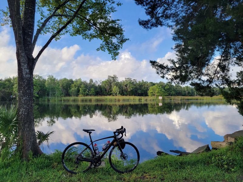
This trail is a democracy of motion. Cyclists spin easy centuries, kids wobble on first bikes, and runners tick off tempos under steady shade.
Inline skaters carve smooth arcs, strollers glide, and dog walkers find rhythm in the generous shoulder.
An adjacent unpaved track opens the corridor to horseback riders, adding hoofbeats to the trail’s soundscape. You can choose endurance or dawdling, sunrise starts or golden hour cool downs.
Branch connections tease longer journeys, including links toward the Florida National Scenic Trail for those chasing bigger miles.
Etiquette keeps everyone flowing. Call out when passing, hold lines at crossings, and share the width with a smile.
Benches and pocket parks offer reset points for snacks, stretching, and adjusting layers when the breeze swings from inland warm to coastal crisp.
Whether you are training for a century or coaxing a friend back into movement, the surface and grade help you succeed. Safety comes baked in with separation from traffic and consistent sightlines.
Every outing becomes a small victory, chalked up in miles and uncomplicated joy.
Trail Access and Amenities
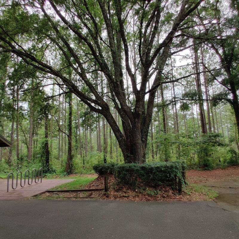

Getting on the trail is refreshingly simple. Major trailheads near Woodville Highway and in St. Marks anchor the route, with clear signage and roomy parking.
From there you roll straight onto pavement without fuss, a clean launch for families and first timers.
Amenities sweeten the experience. Expect benches, restrooms, playgrounds, and picnic spots placed where they are actually useful, not just decorative.
Water fountains and occasional fix it stations help keep your day moving when tires soften or thirst sneaks up.
Wayfinding boards map distances and connections so you can tailor an out and back. Crossings feature marked cues and, in busier zones, safety enhancements that calm the interface with roads.
Shade structures pop up right where sun and effort usually collide.
Because the corridor is linear, you can stage vehicles or ride a shuttle with friends for one way trips. Either way, you stay oriented and supported.
The result is time spent outside, not searching maps, just simple logistics that make room for the ride you came to enjoy.
Cultural and Community Touchpoints

Roll into St. Marks and the pace shifts from miles to moments. Bikes lean against railings while anglers cast from piers, and the smell of fresh seafood drifts from porches.
It feels like a finish line and a front porch rolled into one.
San Marcos de Apalache Historic State Park sits nearby, guarding centuries of stories at the river’s fork. You can tour the grounds, trace stonework, and picture ships loading cargo when the railroad fed the port.
History does not just sit in a case here it breathes with the tide.
Local joints welcome dusty calves and helmet hair. Grab grouper, hushpuppies, or a cold drink, and trade ride notes with strangers who feel like neighbors.
The scene rewards lingering, not just snapping a photo and turning around.
Community threads through this ending. Events, volunteers, and small businesses keep the corridor alive beyond asphalt.
You arrive for a trail and discover a town that understands water, work, and honest hospitality.
Conservation, History, and Community

What makes this place special is not just mileage or smooth pavement. It is the way a 19th century corridor became a 21st century common ground.
History survives here not as nostalgia, but as purpose that keeps people and habitats connected.
Wildlife slips along the same edge zones you pedal, trading fences for continuity. Families learn local stories at kiosks, then point out herons together a mile later.
Volunteers trim, plant, and advocate, while agencies coordinate burns and maintenance that keep the system resilient.
Every visit is a quiet vote for preservation. You choose health over hurry, habitat over sprawl, and shared space over isolation.
The old railroad did the heavy lifting long ago by carving a path through woods and wetlands now the trail gives that path back to everyone.
Leave with legs pleasantly tired and a mind widened by context. You rode through time, across ecosystems, and into a community that still looks toward the Gulf.
That is conservation at human scale practical, welcoming, and built to last.