From sunlit coastal paths to shaded rail-trails, North Carolina serves up rides that beg you to linger. These routes go beyond simple out-and-backs, delivering river views, small-town eats, and photo stops that turn pedals into memories.
You will find surfaces for every bike and distance for every mood, plus practical tips to stretch a quick spin into a full day. Gear up, grab a friend, and pick your next two-wheeled mini adventure.
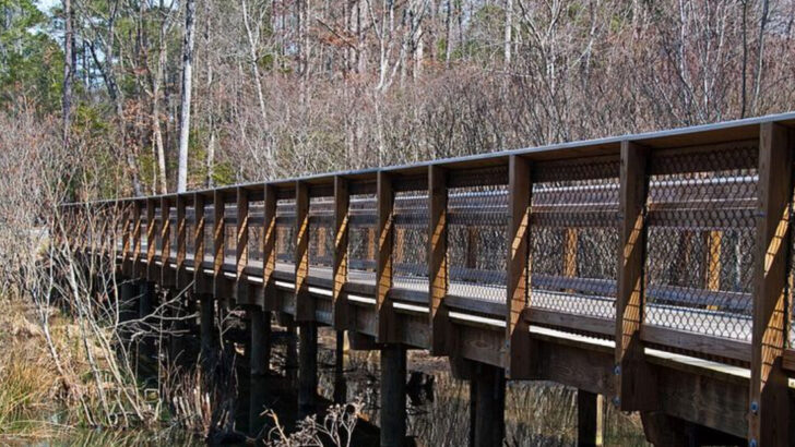
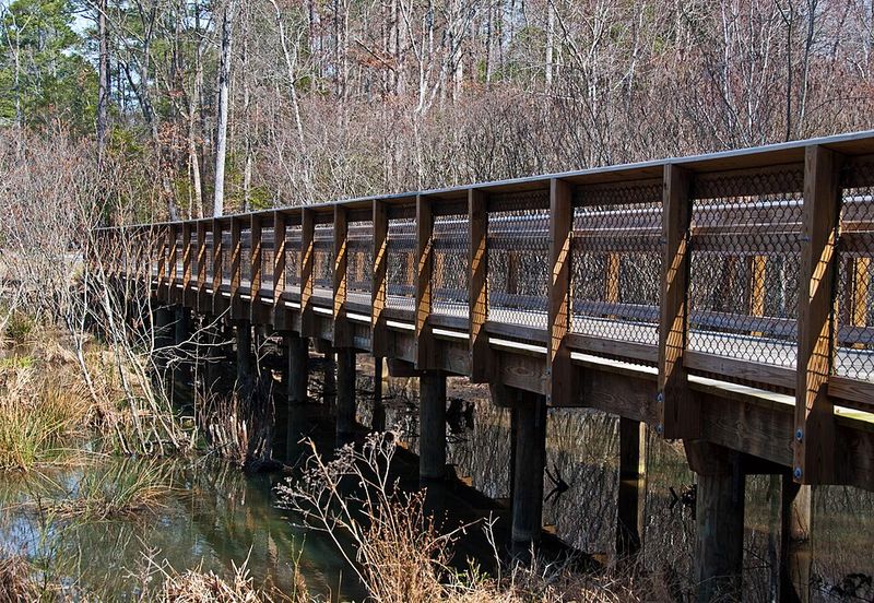
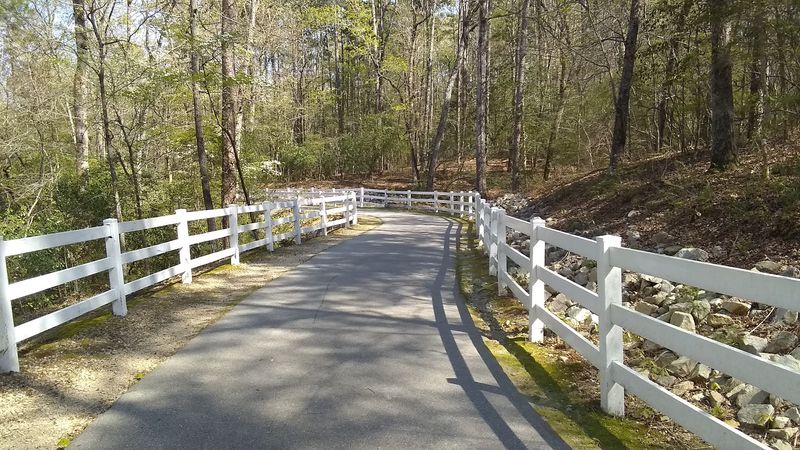
American Tobacco Trail
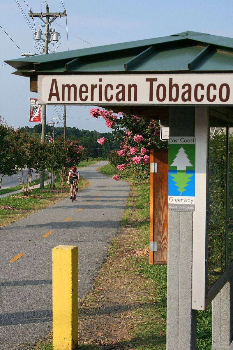
Rail-trail serenity meets city convenience on this shaded corridor stretching from downtown Durham toward rural Chatham and Wake. Expect a crushed-stone surface on the southern half and smooth pavement near the city, so wider tires feel best for the full ride.
Parking is easy at the trailheads by Southpoint Mall and New Hill, and restrooms appear at major parks along the way.
You get little climbs, long boardwalks, and those cinematic tree tunnels that keep summer sun off your shoulders. Families appreciate the road crossings with signals, while distance seekers can stack miles past farm fields and quiet creeks.
Bring lights if you plan an early start, since some segments feel dim at dawn under the canopy.
For a day trip, plan coffee in downtown Durham, then pedal to the White Oak Church Road bridge for photos and a snack break. Food trucks often pop up near trailheads on weekends, and the Streets at Southpoint provides options if you want a sit-down lunch.
Pro tip: carry a bell, because runners, dogs, and kids on scooters share the space, and you will thank yourself when the trail gets lively. Water fountains dot parks, but a backup bottle keeps the pace stress-free.
Neuse River Greenway (Raleigh)
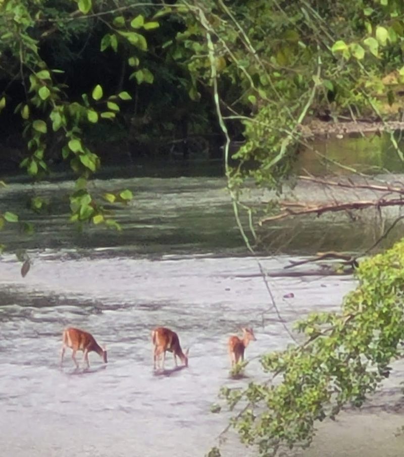
This long, mostly flat ribbon follows the Neuse under broad skies from Falls Lake toward Clayton, linking bridges, wetlands, and quiet neighborhoods. The pavement is smooth and wide, perfect for casual riders and steady training miles.
Trailheads like Anderson Point Park and Buffaloe Road Athletic Park offer parking, restrooms, and water.
Expect sweeping river views, occasional deer sightings, and breezes that feel cooler than nearby streets. Wooden boardwalks can be slick after rain, so brake early and ride predictably.
Weekend mornings get popular, and you will appreciate a bell and courteous passing.
Turn it into a full day by starting with breakfast in North Raleigh, riding downstream to the suspension bridge near Skycrest, then continuing toward Clayton for tacos and iced tea. Wayfinding is solid, yet downloading the greenway map helps when spurs intersect.
Pack sunscreen, because open sections run sunny for miles, and plan bug spray near wetlands if you stop often.
If you prefer loops, connect the Milburnie and Mingo Creek spurs for variety without backtracking. Gravel-curious riders can swap to wider tires and sample nearby park paths, then return to the greenway for an easy roll back to the car.
Waypoints are well signed.
Little Sugar Creek Greenway (Charlotte)
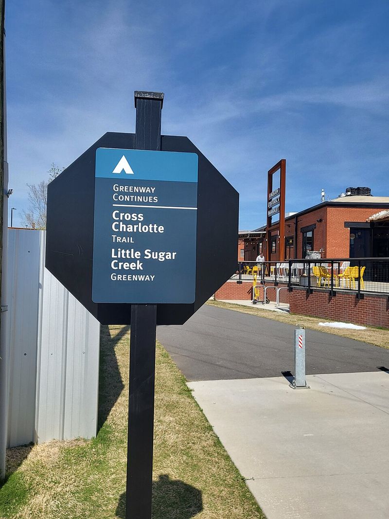
Uptown energy meets creekside calm as this greenway threads through Charlotte past public art, skyline views, and parks. Smooth pavement and regular cross streets make it friendly for riders still building confidence.
Park at Freedom Park or the Metropolitan area garages to start with restrooms and coffee nearby.
You will glide under bridges, spot herons, and catch murals tucked beside the water. Intersections require attention, so call your passes and roll predictably through lights.
Afternoon shade helps in summer, yet carrying extra water keeps stops quick and happy.
Make a day of it by pairing miles with lunch at the Metropolitan, then swing to Freedom Park for a picnic by the lake. Those chasing extra distance can link to the Rail Trail near South End for breweries, treats, and people watching.
Bring a small lock for patio seating, and add lights if twilight photos of the skyline are on your wish list.
Families often choose the section around Pearl Street Park for playground breaks and easy turnarounds. If you prefer a quieter vibe, start early and ride south toward Tyvola before the midday crowd arrives.
Trail maps are posted at intervals, and bike share docks make one-way plans surprisingly simple.
Thermal Belt Rail Trail (Rutherford County)
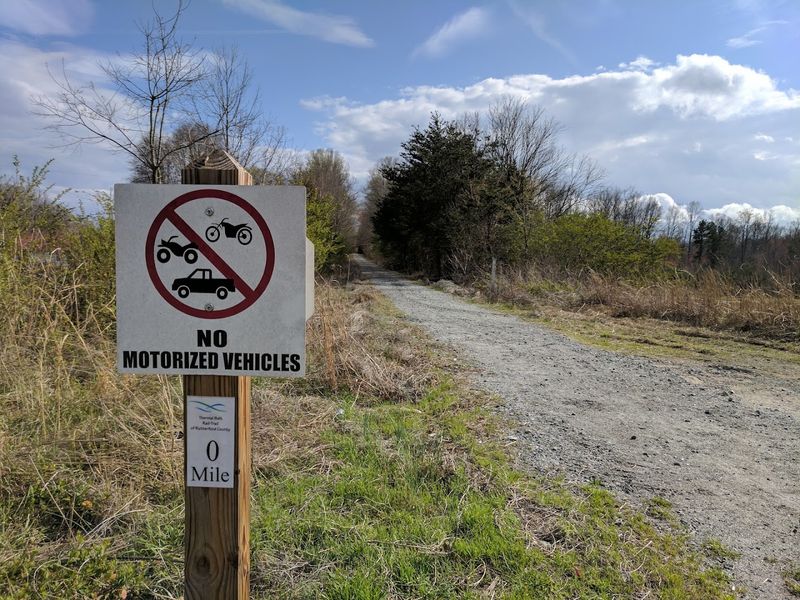
Former railroad grades deliver gentle pedaling across Rutherford County, connecting Forest City, Spindale, and Rutherfordton with small-town character. The surface is mostly smooth asphalt with bright wayfinding, plus frequent benches and pocket parks.
Parking is abundant at the Pavilion on Park Square, with restrooms and water close by.
Expect railroad history signs, public art, and wide sightlines that keep group rides relaxed. Crossings are well marked, yet traffic can be brisk near lunchtime, so time your starts early.
Summer heat reflects off the pavement, making a brimmed cap and electrolytes smart additions.
For a day trip, cruise to Spindale for bakery treats, then roll to Rutherfordton’s Main Street for photos of the courthouse and a sandwich. Families enjoy the purple dinosaur playground near Forest City, while fitness riders stack uninterrupted miles between towns.
Bring a small toolkit and a spare tube, because bike shops are spaced out, and you will want zero delays when the views open up.
If you like detours, hop a block into downtown Forest City for coffee, then rejoin the trail via marked connectors. Evening rides feel welcoming thanks to lighting in busy sections, but a rear blinker still helps.
Keep speeds steady, since walkers, scooters, and strollers share the route.
Catawba River Greenway (Morganton)
River bends, mountain backdrops, and accessible miles make this Morganton favorite a satisfying outing. The paved path mixes open stretches with wooded shade, and boardwalk segments keep you close to the water.
Start at Catawba Meadows Park for easy parking, restrooms, and a playground for pre or post-ride energy.
You will pass boat launches, baseball fields, and picnic areas that invite spontaneous stops. Gentle grades suit all abilities, yet the wind can pick up along open banks, so plan your direction wisely.
After rain, look for sand patches near the edges and give yourself extra braking room.
Stretch the day by riding to downtown Morganton for burgers or a bakery run, then cruise back for sunset along the river. Families appreciate the disc golf course and shaded tables at Catawba Meadows, which make transitions simple.
Pack a light jacket in spring and fall, since temperatures shift quickly beside the water, and a handlebar bag keeps snacks reachable.
Curious riders can add miles on neighborhood streets toward Bethel Road, using low-traffic connectors and cautious crossings. Wayfinding signs appear frequently, and downloadable maps from the city help with spur choices.
Bring a small towel to sit on the riverbank, and savor a few quiet minutes between spins.
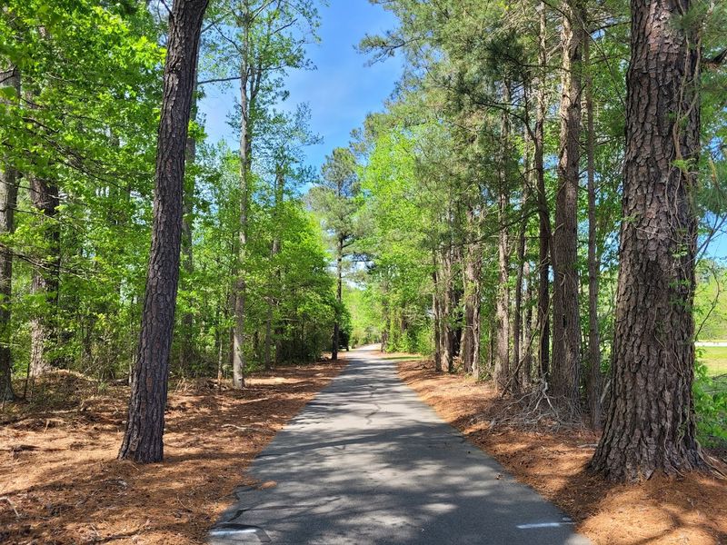
White Oak and Black Creek Greenways (Cary)
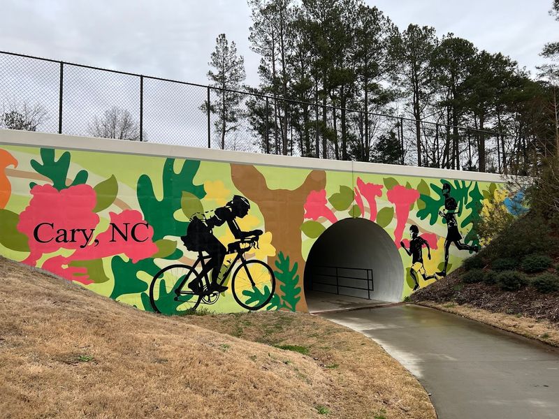
Two Cary favorites link seamlessly to create a scenic run from Bond Park toward Lake Crabtree, ideal for varied distances. Surfaces are paved, with gentle grades and wooden boardwalks that hover above wetlands.
Parking is reliable at Bond Park’s boathouse area, where restrooms and water make staging simple.
You will roll past pines, creeks, and community spaces that welcome quick detours for photos or snacks. After rain, leaves and puddles collect in shaded curves, so keep speeds reasonable.
Weekend mornings bring strollers and dog walkers, and a cheerful bell saves surprises around bends.
Turn the outing into a day by pausing for a paddle at Bond Park, then continuing to Lake Crabtree for planes overhead and breezy views. Those craving extra miles can connect neighborhood spurs or head toward the Black Creek segment that skirts Crabtree’s shoreline.
Bring bug spray in warmer months, pack a spare tube, and screenshot the town map in case cell service hiccups.
For families, the playgrounds at Bond Park make perfect meetups and reward stops. If you prefer quieter moments, start at sunrise and you will share the boardwalks with birds and morning fog.
Wayfinding signs appear frequently, and posted etiquette keeps the flow friendly.
Dismal Swamp Canal Trail (South Mills)
This straight, tree-lined route parallels the historic canal near the Virginia border, delivering calm miles with gentle scenery. The surface is paved and mostly flat, ideal for steady spinning and conversation.
Parking at the South Mills visitor area is straightforward, with seasonal restrooms and shaded picnic spots.
You will notice birdsong, dappled light, and the occasional boat sliding by at an unhurried pace. Wind can funnel along the corridor, so consider starting against it and riding back with a smile.
Because the trail is linear, snacks and water matter, and turning points are easy to plan by mileage.
Make it a day by pairing your ride with a stop at the Dismal Swamp State Park boardwalk and interpretive center. History buffs appreciate canal markers and stories about builders who cut this waterway by hand.
Bring bug spray in warm months, a taillight for overcast afternoons, and a camera if the mirrored water looks irresistible.
For a quiet picnic, choose a shady pullout and watch reflections ripple across the canal. If you enjoy out-and-back efficiency, set a turnaround time and cruise steadily to meet it.
Cell signal can dip, so download a map and share plans with your group.
Cape Fear River Trail (Fayetteville)
Boardwalks and smooth asphalt wind along the Cape Fear River, giving you constant water views and whispering pines. Gentle rollers keep the ride lively without feeling punishing, so families and casual riders settle in quickly.
You will cross wooden bridges, spot herons, and hear cicadas when summer warms the canopy. Wayfinding is straightforward, with mile markers that make turning around simple.
Park at Arsenal Park or Clark Park for easy trailhead access and restrooms. Bring wider tires if you plan little detours onto packed gravel spurs.
After your spin, reward yourself with coffee downtown or a picnic under longleaf pines.
Atlantic and Yadkin Greenway (Greensboro)
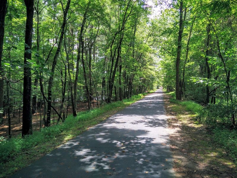
This tree lined corridor follows an old rail bed beside Lake Brandt and Lake Townsend, so wind feels cooler and views linger. The surface is packed gravel with some paved stretches, friendly to hybrids and wider road tires.
Expect gentle grades, quick boardwalks, and trailheads that appear right when you need water.
Start at Country Park to link the loopier segments, or roll from Bur Mil Park for an out and back with fewer road crossings. You might spot deer at dusk.
Afterward, grab tacos on Battleground Avenue, or spread a blanket by the marina and watch paddlers slip past.