At first glance, this Cleveland Heights hike feels like a quiet walk through leafy ravines and old neighborhood edges.
Then the stonework starts appearing – hidden stairs, crumbling walls, and strange built fragments that seem to belong to another time.
What makes this route so fascinating is that the mystery is real, but the story is even better than the rumors.
If you love trails with atmosphere, history, and a little urban archaeology, this is one Ohio walk you will not forget.
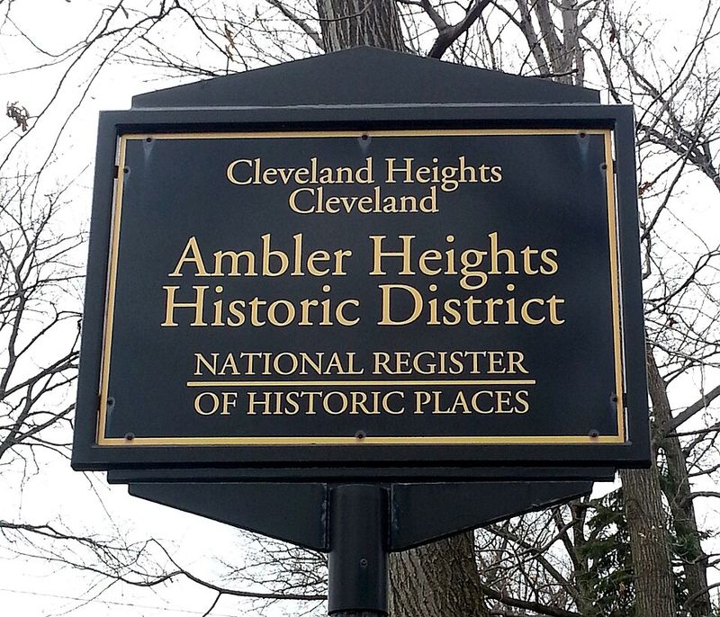
How Ambler Heights Began
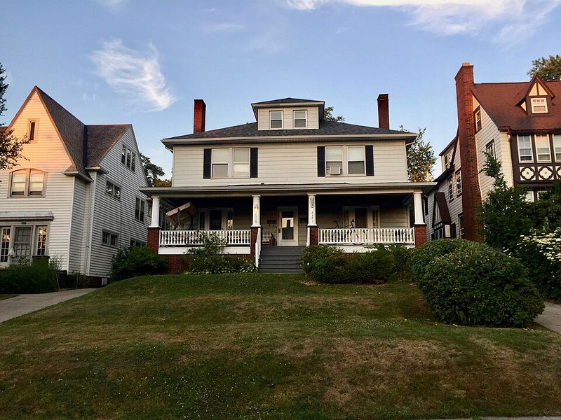
Walking near Ambler Heights feels different once you know how intentionally this neighborhood began. In the early 1900s, developers shaped it as an upscale garden suburb, giving the area winding streets, generous lots, and a carefully composed relationship between houses and landscape.
That design still affects the hike today, because the trail experience is tied to choices made long before anyone thought of it as a place to search for ruins.
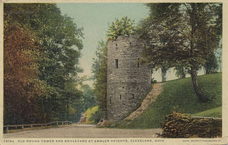
The neighborhood took its name from Dr. Nathan Ambler, a dentist whose fortune and real estate investments helped shape this corner of greater Cleveland. His legacy was not just a name on a map, but a vision of orderly beauty set against ravines, tree cover, and dramatic changes in elevation.
When you walk here now, you can still sense the contrast between polished residential planning above and the rougher terrain dropping away below.
That contrast is what gives this hike its unusual mood. You are never far from stately residential history, yet the landscape keeps pulling you toward hidden edges and forgotten infrastructure.
The story starts with privilege and planning, but it quickly opens into something stranger, where elegant suburbia borders wooded spaces that feel secret, older, and a little haunted.
Before the Neighborhood, There Were Estates

Before Ambler Heights became a planned residential enclave, this area was a patchwork of estate lands, ravines, and undeveloped ground connected to larger property holdings. Much of the surrounding terrain near Doan Brook and Fairhill was shaped less by streets and sidewalks than by private ownership, steep topography, and limited access.
That earlier phase matters because it explains why the land can still feel fragmented and irregular when you hike through it today.
Large estates rarely leave behind one obvious monument after they disappear. Instead, they leave edges, retaining lines, altered grades, service routes, and odd leftover spaces that later development never fully smooths out.
In the Ambler Heights area, those subtle traces became the framework for later public paths, utility corridors, and bits of infrastructure that now appear disconnected from their original purpose.
On the trail, that history translates into a layered feeling that is easy to notice even if you do not know the backstory. A path may look natural at first, then suddenly align in a way that feels planned, as though it once served a carriage lane, maintenance route, or estate boundary.
The mystery of the abandoned structures begins here, in a landscape that was never completely wild and never completely remade.
The Blue Rock Springs Connection
One of the most intriguing layers in this story reaches back to the Blue Rock Spring House era. In the late 1800s, members of the Ambler family helped develop a mineral-water health resort and sanitarium near Doan Brook, part of a period when spring water and restorative landscapes carried real commercial appeal.
The buildings are gone, but the idea of the area as a place of retreat and managed movement through nature left a lasting imprint.
Health resorts depended on access, circulation, and controlled use of the landscape. Paths, small structures, utility lines, drainage improvements, and carefully chosen routes through wooded terrain were often part of the visitor experience, even if they later disappeared or changed purpose.
That helps explain why certain corridors in the ravines feel older than the surrounding suburban fabric, as though the land has hosted several different versions of public wandering.
When you hike here now, you are not looking at a preserved resort complex. What you are seeing is a landscape that was repeatedly adapted, first for health tourism, then for suburban growth, then for municipal use.
That evolving history makes the hidden stairways and stonework feel especially mysterious, because they may belong not to one lost place, but to overlapping chapters of Cleveland Heights development.
When Suburban Cleveland Expanded
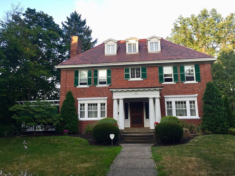
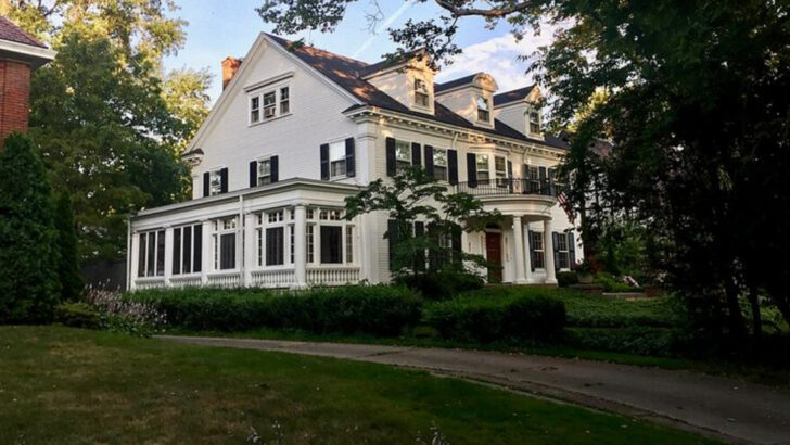
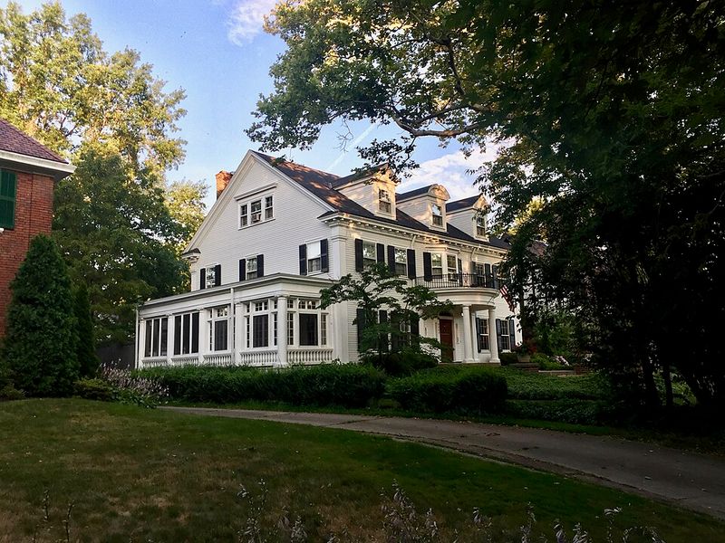
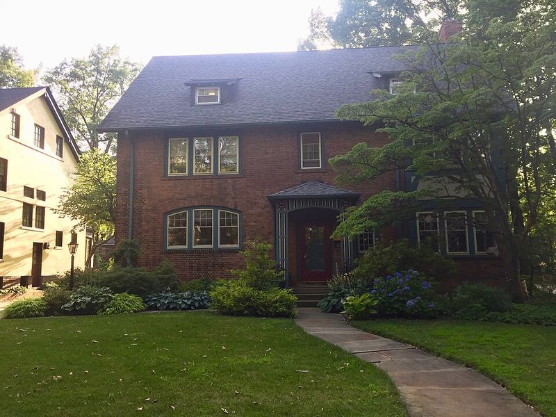
By the early twentieth century, Ambler Heights had fully entered its suburban growth phase. Between about 1900 and 1927, the neighborhood was platted, marketed, and built out with large homes for wealthy Cleveland families who wanted space, prestige, and a carefully designed setting.
That suburban expansion did not erase the ravines around it, though, and that is part of why this hike feels so unusual now.
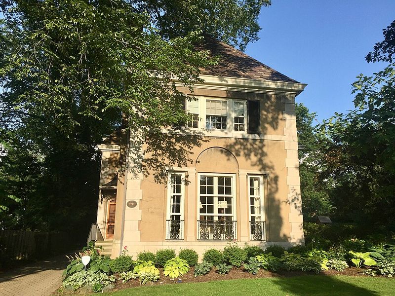
The neighborhood reflected the garden city ideal, which valued beauty, greenery, and a thoughtful relationship between built form and the natural landscape. Instead of flattening everything into a rigid grid, planners worked with curves, elevation, and scenic positioning.
For hikers today, that means the residential area and the wooded corridors beside it still feel interconnected, like pieces of one larger design that slowly drifted apart over time.
You can sense that history in the transitions. One moment you are near gracious homes and established streets, and the next you are following a path into a ravine where stonework and old built fragments emerge from brush and shade.
The abandoned feeling is stronger because these remnants sit so close to a neighborhood that was once marketed as modern, refined, and forward-looking, yet never fully separated from the rugged land beneath it.
Depression-Era Strain on the Landscape
The Great Depression changed how many urban and suburban landscapes were funded, maintained, and used, and the land around Ambler Heights was no exception. While the neighborhood itself remained comparatively affluent, nearby ravines, municipal properties, and park-adjacent spaces faced tighter budgets and shifting priorities.
That pressure often led to practical, modest construction rather than grand development, which is exactly the kind of infrastructure hikers notice today.
Small retaining walls, drainage controls, service paths, and utility-related structures were built to stabilize slopes and keep public land functional. These were not glamorous projects, but they mattered in steep terrain where erosion, water flow, and access needed constant attention.
Because they were utilitarian from the start, many of these features were easy to overlook once they aged, fell out of use, or became partially hidden by trees and undergrowth.
That history gives the hike its eerie charm. You are not stumbling onto a single abandoned mansion or a dramatic ruin with a plaque explaining everything.
Instead, you find scattered evidence of a harder era, when practical public works left behind stone, concrete, and narrow built traces that now seem mysterious precisely because they were never meant to be romantic, only useful, temporary, and quietly durable.
The WPA Footprint in Cleveland Ravines
To understand the abandoned structures on this hike, it helps to think about the larger New Deal footprint across Cleveland. During the 1930s, programs like the Works Progress Administration funded practical improvements in parks, ravines, and public landscapes, often using stone, concrete, and durable labor-intensive construction.
Across the city, that meant steps, drainage channels, footbridges, culverts, and support walls that blended into the terrain while serving everyday needs.
The ravines near Ambler Heights fit that pattern well. Steep slopes and watershed conditions around Doan Brook would have required managed access and erosion control, making public works both necessary and attractive to planners trying to stabilize land with limited resources.
Many of those features were built solidly enough to survive, but not prominently enough to remain legible once regular maintenance declined.
That is why the hike feels like a treasure hunt for half-erased infrastructure. A short staircase disappearing into brush or a line of old stone beside a path can seem almost theatrical, yet it likely began as straightforward civic work.
What makes it compelling now is the mismatch between intention and appearance: these structures were built to be useful and nearly invisible, but time has turned them into atmospheric relics hidden in plain sight.
Hidden Paths in the Doan Brook Watershed
One reason this hike feels more secretive than a typical neighborhood walk is the network of overlooked pathways woven through the ravines. The Ambler Heights area sits near steep terrain in the Doan Brook watershed, where maintenance access, utility routes, and informal footpaths developed alongside more official circulation.
Some were built with a clear purpose, while others emerged through repeated local use over many decades.
As those paths aged, changed hands, or simply lost regular upkeep, they became harder to read. What might have started as a service road can now look like a faint woodland corridor, and a once-practical route may end abruptly at old steps, drainage stonework, or a deadfall-covered edge.
That uncertainty is part of the appeal, because it makes you pay closer attention to the ground, the slope, and the subtle clues that suggest human design.
When you walk here, it often feels as if the forest is concealing a second map beneath the obvious one. There is the path you are on, and then there are hints of earlier routes crossing the ravine in less visible ways.
The mysterious structures make more sense when you see them as anchors in a broader system of hidden movement, where utilities, maintenance, and everyday access once carved order into a difficult landscape.
How the Forest Reclaimed the Ruins
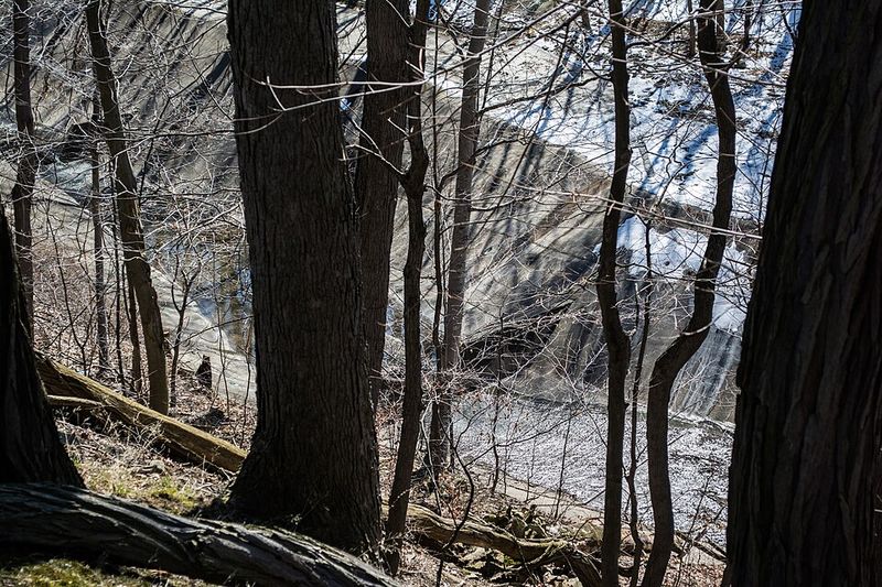
The abandoned feeling on this hike does not come from one dramatic ruin as much as from the way nature has slowly taken possession of human work. Over decades, vegetation spread across stairways, foundations, drainage edges, and retaining walls, softening their lines until they seemed to emerge from the forest itself.
What was once clearly built now appears half-natural, which is exactly why it feels so uncanny when you find it.
Moss, roots, leaf litter, and shade change your perception of age. A short stone wall can look ancient when it is darkened by moisture and framed by mature trees, even if it began as a modest twentieth-century infrastructure project.
In ravine landscapes, that effect is especially strong because the terrain already feels enclosed and slightly hidden, as though the land is actively swallowing evidence of earlier use.
This is where the hike becomes emotionally memorable. You are not just observing old construction materials, but watching a slow collaboration between engineering and ecology.
The forest has not erased the Depression-era or early municipal features completely, yet it has transformed them into something more atmospheric than their builders ever intended. That blend of practical history and patient reclamation is what gives Ambler Heights its quietly mysterious, almost cinematic character.
What the Hike Feels Like Today
Today, hiking around the Ambler Heights ravines feels less like visiting a single abandoned site and more like moving through layers of history. You get wooded trails, steep slopes, quiet neighborhood edges, and sudden encounters with stonework that hint at older systems of movement and maintenance.
That combination makes the route feel immersive, as if each turn is offering another clue rather than a final destination.
What you will actually see depends on season, light, and how closely you look. In leafier months, many features are partially hidden, which makes their appearance feel even more surprising, while colder seasons can reveal stair lines, walls, and drainage structures with much greater clarity.
Either way, the mood stays consistent: this is a place where suburban history, public works, and natural reclamation all meet in the same compact landscape.
That is why the hike stays with you. It offers the atmosphere of mystery without relying on myths, because the real story is already strange and compelling enough.
You are walking through an affluent historic district’s shadow landscape, where Depression-era infrastructure and older land-use patterns still surface in fragments. If you enjoy trails that reward curiosity, Ambler Heights delivers a rare kind of Ohio adventure – subtle, haunted, and deeply rooted in place.