Massachusetts has transformed old railroad corridors into beautiful pathways that anyone can enjoy.
These rail trails wind through forests, along rivers, and past historic sites, giving you front-row seats to the state’s natural beauty.
Whether you’re looking for a quick afternoon ride or a full-day adventure, these trails offer smooth, mostly flat terrain that works for all skill levels.
Pack your water bottle and walking shoes because these paths are waiting to show you a side of Massachusetts you’ve never seen before.
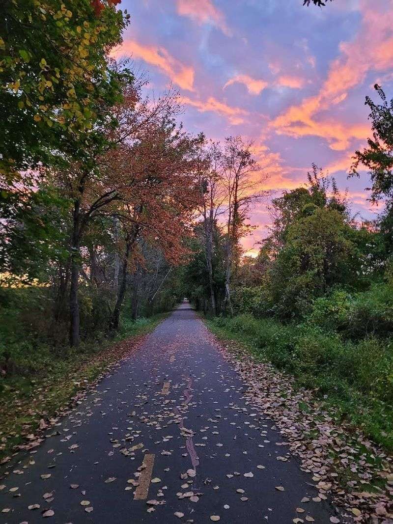
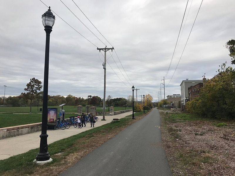
Minuteman Bikeway – Bedford to Cambridge
Revolutionary War history meets modern-day recreation along this famous 10-mile paved pathway. Starting in Bedford and ending at Cambridge’s Alewife Station, this route takes you through Arlington and Lexington, where American independence was born.
Red colonial buildings and historic markers dot the landscape, reminding you that Paul Revere once galloped through these same neighborhoods.
Commuters love this trail because it connects directly to Boston’s subway system, making car-free travel totally doable. On weekends, families fill the path with strollers, bikes, and roller skates, creating a friendly buzz of activity.
The pavement stays smooth and wide enough for everyone to share comfortably.
Tree canopies provide shade during summer months, while fall transforms the trail into a tunnel of red and gold leaves. Local coffee shops and ice cream stands sit just off the path, perfect for quick refreshment stops.
Whether you’re heading to work or exploring history on two wheels, this trail delivers both purpose and pleasure in equal measure.
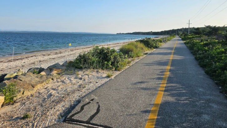
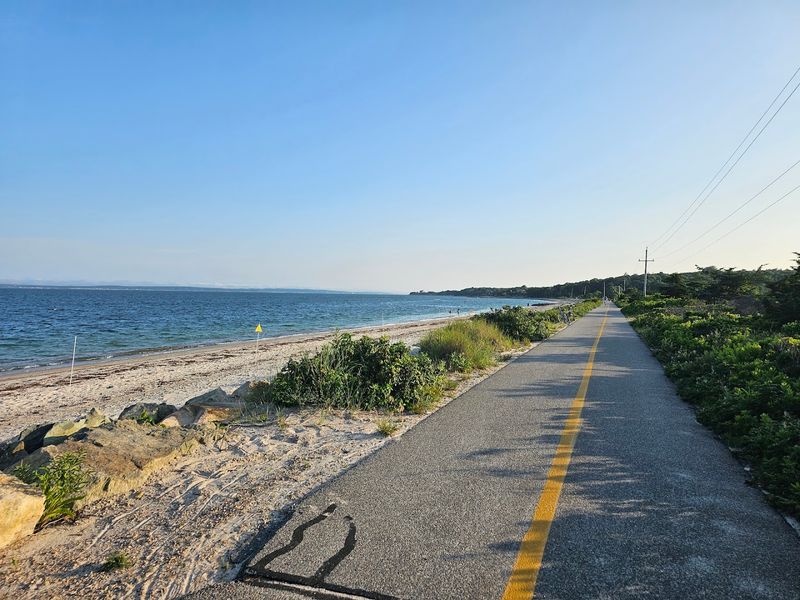
Cape Cod Rail Trail – South Yarmouth to Wellfleet
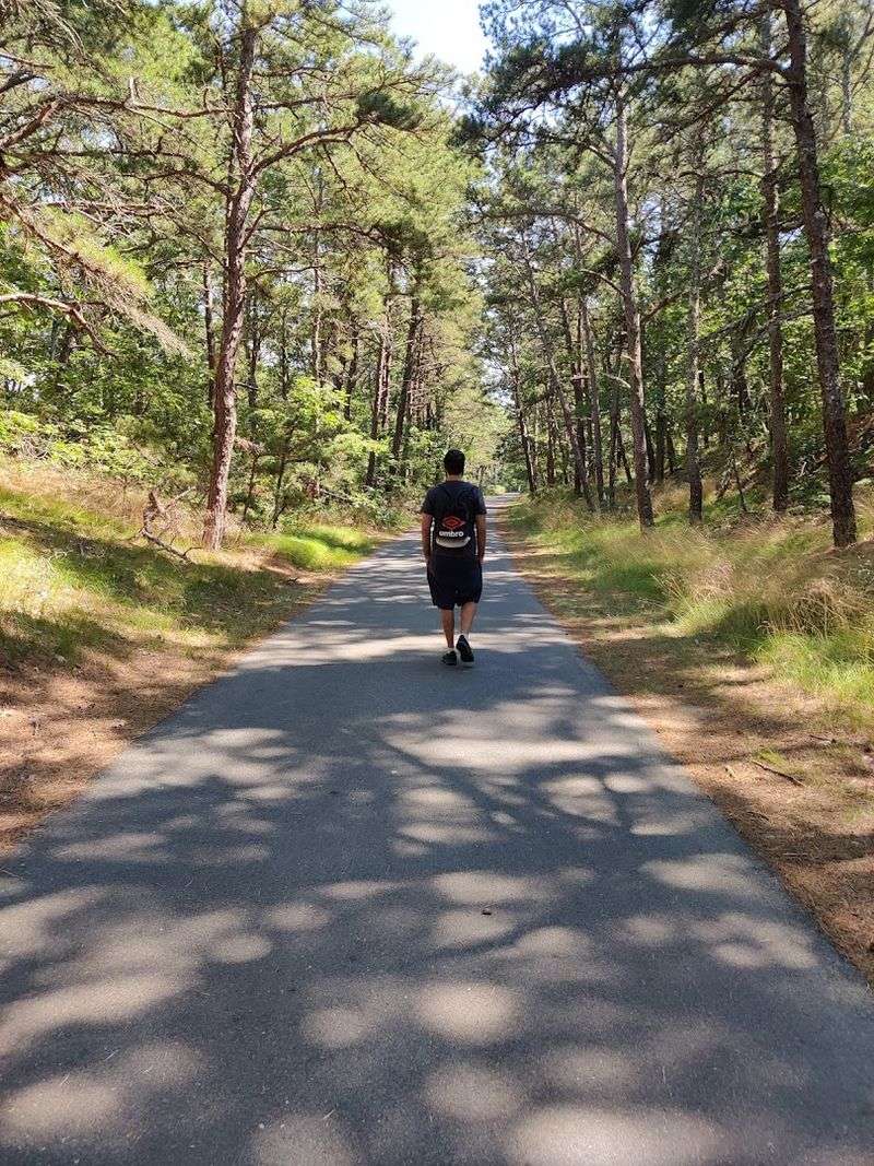
Salt air fills your lungs as you pedal through 25 miles of Cape Cod magic. Six different towns reveal themselves along this paved ribbon that stretches from South Yarmouth all the way to Wellfleet.
Kettle ponds sparkle between pine forests, and the scent of beach roses drifts across the path during summer months.
Nickerson State Park connects directly to the trail, offering picnic spots and swimming beaches when you need a break. Cape Cod National Seashore access points let you explore towering sand dunes and endless ocean views.
The trail surface stays flat and friendly, making distance cycling feel easier than you’d expect.
Cranberry bogs appear alongside the path during certain sections, their deep red berries glowing against green foliage in autumn. Small Cape Cod villages provide chances to grab lunch or browse local shops without straying far from your route.
This isn’t just a bike ride—it’s a full vacation experience compressed into one spectacular trail that captures everything special about Cape Cod living.
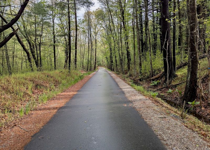
Ashuwillticook Rail Trail – Cheshire to Adams/Pittsfield
Morning mist rises from Cheshire Reservoir while mountains stand guard in the distance. This 14-mile Berkshire County treasure follows the Hoosic River through some of the most peaceful countryside in western Massachusetts.
Herons wade through wetlands while turtles sun themselves on logs, completely unbothered by passing cyclists.
The Berkshire mountains create a dramatic backdrop that changes with every season—snow-capped peaks in winter, wildflower meadows in spring, blazing foliage in fall. Wildlife sightings happen so frequently here that bringing binoculars makes sense.
Beavers, otters, and countless bird species call the riverside home, treating trail users to unexpected nature shows.
Elevation changes stay minimal despite the mountainous setting, keeping the ride accessible for casual cyclists and families. Small parking areas along the route let you start wherever fits your schedule and energy level.
Local residents consider this trail their outdoor living room, a place where stressed-out minds find instant calm. The pavement quality stays excellent throughout, and benches appear regularly for those who prefer walking and resting.
Shining Sea Bikeway – North Falmouth to Woods Hole
Ocean breezes push you gently along 10.7 miles of Cape Cod coastline that many consider New England’s prettiest rail trail. Salt marshes stretch toward the horizon while seabirds call overhead, their cries mixing with the sound of waves.
The name fits perfectly—sunshine really does make the water shimmer like scattered diamonds.
Falmouth’s charming village centers offer ice cream shops, seafood restaurants, and beach access without leaving the trail. Woods Hole ferry terminal marks the southern endpoint, where you can watch boats heading toward Martha’s Vineyard.
The path hugs the coastline closely enough that you’ll taste salt spray during breezy days.
Beach access points appear regularly, tempting you to ditch the bike for quick swims or shell collecting sessions. Cranberry Bog Lane provides a particularly scenic detour through conservation land.
Families appreciate how the trail connects neighborhoods safely, letting kids bike to friends’ houses without worrying about traffic. Sunset rides here become magical experiences, painting the marshes in pink and orange hues that photographers dream about capturing.
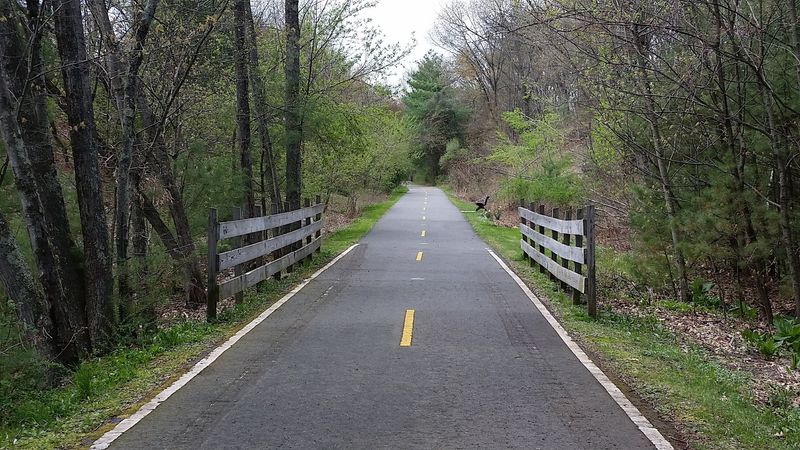
Bruce Freeman Rail Trail – Lowell to Sudbury
Watch history being made as new sections of this expanding trail open regularly. Already completed segments run through Lowell, Chelmsford, Westford, Concord, and Sudbury, with Framingham waiting on the horizon.
Engineers designed this corridor with long-distance cycling in mind, creating smooth connections between multiple communities.
Commuters have embraced this trail enthusiastically, using it to reach work without sitting in traffic. Students bike between neighborhoods while parents push strollers, creating a genuine sense of shared community space.
The path stays wide enough that faster cyclists can pass slower walkers without anyone feeling squeezed.
Historic mill buildings in Lowell contrast beautifully with Concord’s Revolutionary War heritage and Sudbury’s rural landscape. Each town brings different character to your ride, preventing boredom on longer journeys.
Bridge crossings over roads and streams add visual interest while keeping you safe from vehicle traffic. Spring wildflowers bloom along the edges, maintained by volunteer groups who’ve adopted trail sections.
This rail trail represents Massachusetts investing in healthier, greener transportation options that benefit everyone regardless of age or fitness level.
Nashua River Rail Trail – Ayer to Nashua, NH border

Perfect for nervous beginners, this 12-mile pathway forgives every wobble and uncertain pedal stroke. The Nashua River keeps you company throughout, its gentle current matching the trail’s easygoing personality.
Tree canopy coverage provides natural air conditioning during summer heat, making afternoon rides surprisingly comfortable.
Wetlands attract dragonflies that dart across the path like tiny helicopters, while frogs provide background music from hidden spots. The terrain stays flatter than a pancake, eliminating those dreaded uphill struggles that discourage new cyclists.
Wooden bridges cross over streams, adding just enough variety to keep things interesting without creating challenges.
Families with young children dominate weekends, their training wheels clicking rhythmically on the smooth pavement. Bird watchers love early morning visits when wildlife activity peaks and mist still clings to the water.
The trail connects to New Hampshire’s network, letting ambitious riders extend their journey northward. Rest areas with benches appear frequently, acknowledging that not everyone moves at racing speed.
This trail whispers encouragement rather than demanding athletic performance, making outdoor exercise feel welcoming instead of intimidating.
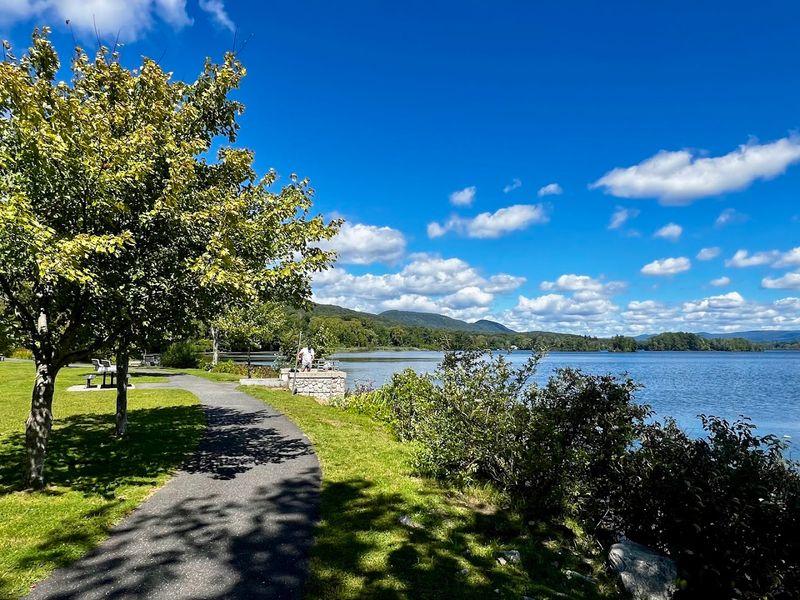
Mass Central Rail Trail (Norwottuck Section) – Northampton to Amherst
College students have turned this valley connector into their personal highway between campuses. Northampton and Amherst sit at opposite ends of this paved stretch, linked by scenery that shows off the Connecticut River valley at its finest.
The Holyoke Range mountains create a jagged silhouette against the sky, particularly stunning during sunset rides.
Book-carrying cyclists mix with recreational riders, creating an energetic atmosphere unique to college towns. Coffee shops near both endpoints stay packed with trail users refueling after rides or walks.
The path runs relatively straight, following the old railroad’s practical route through the valley floor.
Spring brings students outside in waves, celebrating warmer weather with picnics in trailside parks. Local farmers markets set up near access points during growing season, letting you shop while getting exercise.
Mountain views change dramatically with seasons—green carpets in summer, flame colors in fall, stark winter beauty under snow. This segment represents just one piece of the statewide Mass Central Rail Trail project, but it’s already become essential infrastructure for valley residents who value active transportation and stunning scenery equally.
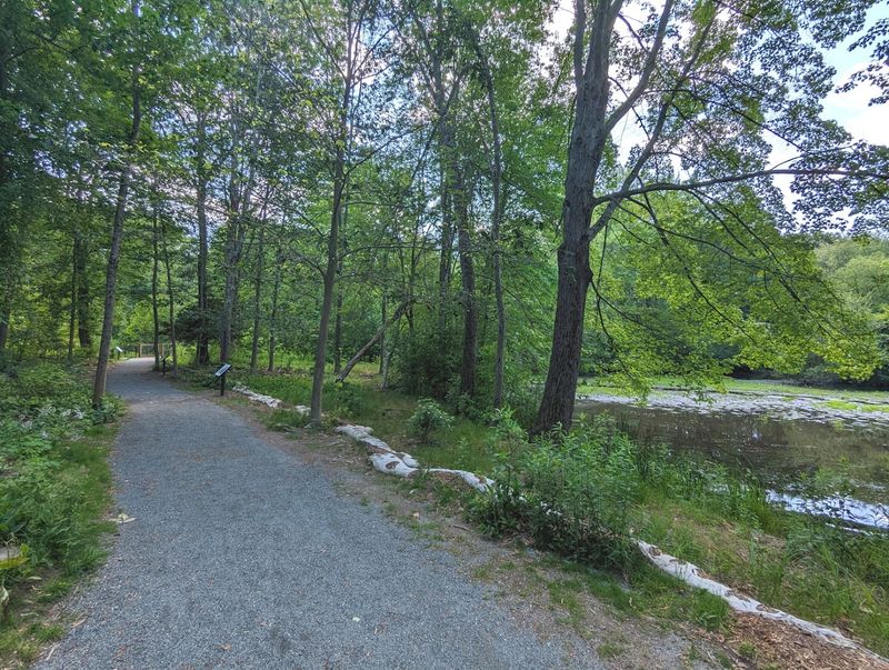
Assabet River Rail Trail – Marlborough to Acton
River life unfolds in slow motion along this partially completed trail that follows the Assabet through suburban landscapes. Great blue herons stand statue-still in shallow water, waiting for fish to swim within striking distance.
Turtles stack themselves on sunny logs like living totem poles, somehow balancing despite gravity’s best efforts.
Completed sections run through Marlborough, Hudson, Stow, and Maynard, with more segments joining the network regularly. Wetland boardwalks let you peer into marshy habitats without getting muddy, revealing frogs, dragonflies, and water plants up close.
The suburban setting means parking access and nearby amenities stay convenient throughout your journey.
Forest corridors provide green tunnels between developed areas, creating surprising pockets of wilderness. Local conservation groups maintain native plantings along trail edges, attracting butterflies and songbirds.
Families use this trail for nature scavenger hunts, checking off species on homemade bingo cards. Morning walks often reveal deer tracks in soft earth beside the pavement.
The Assabet River itself has recovered remarkably from industrial pollution, now running clear enough to spot fish swimming beneath the surface.
Northern Strand Community Trail – Everett to Lynn
Neighborhood voices mix with bicycle bells along this 10-mile urban connector north of Boston. Everett, Revere, Malden, Saugus, and Lynn get stitched together by this pathway that proves cities need green spaces too.
Public art installations add color and creativity, turning concrete corridors into outdoor galleries that celebrate community identity.
Unlike rural trails, this one pulses with city energy—basketball courts, playgrounds, and pocket parks appear regularly. Commuters zip past morning dog walkers while evening joggers share space with teenagers on skateboards.
The trail democratizes outdoor access for neighborhoods where private yards stay small and transportation options often feel limited.
Murals depicting local history cover sound barriers, transforming utilitarian structures into storytelling canvases. Community groups organize cleanup days and safety patrols, fostering ownership and pride.
Lighting along certain sections extends usable hours beyond daylight, accommodating work schedules. Small businesses near access points benefit from trail traffic, selling water bottles, snacks, and bike repairs.
This isn’t wilderness escape—it’s urban connectivity that acknowledges city residents deserve safe, pleasant routes for walking and cycling through their own neighborhoods.
Blackstone River Greenway – Worcester to Rhode Island
Industrial Revolution ghosts whisper stories along this historic corridor that follows the Blackstone River southward. Old mill buildings stand like brick sentinels beside the water, their massive windows reflecting clouds where cotton looms once clattered.
Canal systems that powered America’s early manufacturing still carve through the landscape, now peaceful rather than productive.
This greenway connects Worcester to Rhode Island, forming part of a larger regional trail network. Mill villages appear like time capsules, their architecture frozen in the 1800s when textile production ruled these valleys.
Interpretive signs explain how waterpower transformed rural communities into industrial powerhouses.
The Blackstone River itself has recovered dramatically from pollution, now supporting fish and wildlife populations that disappeared for generations. Stone locks from old canal systems create fascinating engineering exhibits along the route.
Local historians lead occasional walking tours, pointing out features casual visitors might miss. Rhode Island sections connect seamlessly, letting ambitious cyclists complete interstate journeys.
This trail teaches American history through landscape, showing how geography shaped economic development and how communities adapt when industries fade.
Canalside Rail Trail – Turners Falls (Montague)
Size doesn’t determine beauty, as this compact 3.7-mile gem proves convincingly. Running along the Connecticut River canal system in Turners Falls, this trail packs serious scenery into a small package.
Bridges cross water channels where canal locks once controlled river traffic, their engineering still impressive after more than a century.
Urban and natural elements blend seamlessly here—industrial bridges frame mountain views while river currents rush beneath your feet. The compact distance makes this perfect for quick exercise sessions or casual evening strolls when longer trails feel too ambitious.
Easy terrain welcomes walkers of all ages without demanding athletic conditioning.
Turners Falls itself adds character with its working-class history and artistic renaissance. Galleries and cafes near the trailhead provide pre-ride coffee or post-walk meals.
The Connecticut River serves as constant companion, its wide expanse creating open sky views unusual in forested Massachusetts. Fishing access points attract anglers casting for shad and bass.
This trail may be shorter than others on this list, but it concentrates western Massachusetts charm into every single mile, proving that great experiences don’t always require marathon distances.