Forget everything you think you know about Virginia’s most jaw-dropping views. The crowds are busy somewhere else, and that works out perfectly for you.
Tucked high above Bath County, Dan Ingalls Overlook feels like the kind of place people accidentally discover and then want to keep quiet. One turn along a twisting mountain road and suddenly the trees open up, the sky stretches wider, and the world below starts showing off.
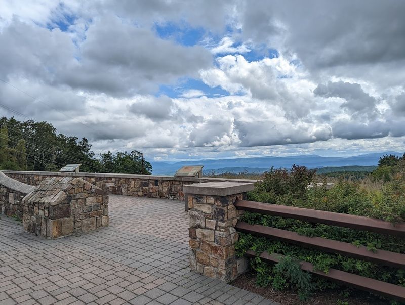
This isn’t the kind of stop where you jump out, snap one photo, and leave. It’s the kind of place that makes you lean against the railing and stare a little longer than planned.
While packed overlooks fill with traffic and chatter, this hidden mountain perch delivers the same big views with a lot more breathing room.
You may even get the whole scene to yourself.
The Hidden Virginia View Most Travelers Still Miss
Most people speed past Bath County without realizing what they’re missing. Tucked away in Virginia’s western highlands, Dan Ingalls Overlook delivers mountain majesty on a scale that stops first-time visitors in their tracks.
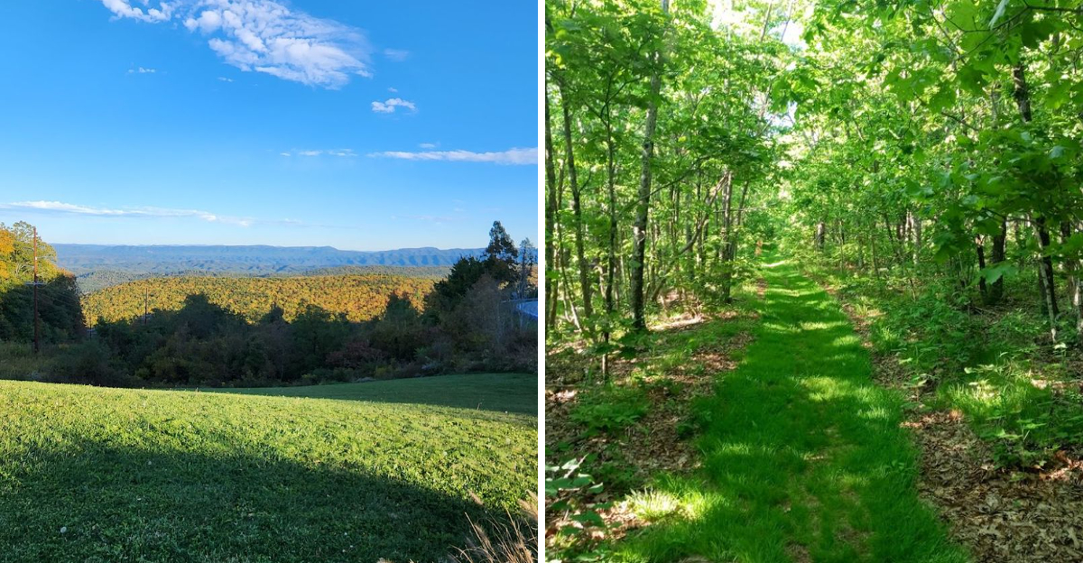
The view stretches for miles across forested valleys and rolling peaks that seem to go on forever.
What makes this place truly special isn’t just the scenery. Walking up to the viewing area, you’ll often find yourself completely alone or sharing the space with just a handful of other nature lovers.
There are no tour buses, no crowded parking lots fighting for spaces, and no long lines of selfie-takers blocking your view.
The overlook sits at an elevation that gives you a bird’s-eye perspective without requiring a difficult hike. Pull off Route 39, step out of your car, and within seconds you’re standing before one of the most impressive mountain scenes in Virginia.
Many visitors say they stumbled upon it by accident while driving through.
Once they see it, they make sure to return on every future trip through the area.
Where Dan Ingalls Overlook Is Located
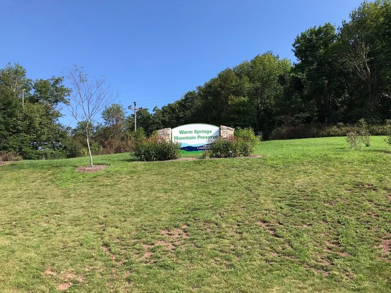
Geography matters when understanding why this place remains so wonderfully undiscovered. Dan Ingalls Overlook perches atop Warm Springs Mountain along Virginia Route 39, right in the heart of Bath County’s Allegheny Highlands.
This isn’t somewhere you pass through on the way to somewhere else—you have to intentionally come here.
Bath County ranks among Virginia’s least populated counties, with more deer than people calling it home. The overlook sits roughly 30 miles northwest of Lexington and about 25 miles from West Virginia’s border.
No major highways cut through this region, meaning visitors need to take scenic backroads to reach it.
Route 39 itself winds through George Washington National Forest, connecting the towns of Warm Springs and Goshen. The overlook appears roughly midway along this stretch, marked by a small parking area on the north side of the road.
While the location isn’t exactly secret, its distance from interstate corridors keeps it off most tourists’ radar.
That remoteness preserves the peaceful atmosphere that makes visiting here feel like discovering your own private mountain hideaway.
The Scenic Drive That Becomes Part of the Experience
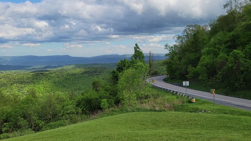
Getting there matters just as much as arriving. Route 39 transforms the journey into an adventure before you ever reach the overlook.
The road ribbons through dense hardwood forests, crosses babbling mountain streams, and climbs steadily upward through some of Virginia’s most beautiful backcountry.
Every curve reveals something new—maybe a rushing creek below, maybe a moss-covered boulder formation, maybe a break in the trees offering a teaser view of distant ridgelines. The pavement quality stays good, but the road demands your attention with its twists and elevation changes.
You’re not rushing here; you’re experiencing mountain driving at its finest.
Different seasons paint completely different pictures along this route. Spring brings bright green new growth bursting from winter-bare branches.
Summer creates cool forest tunnels that offer relief from heat. Fall explodes with colors so vivid they almost don’t look real.
Even winter has its charm, with snow-dusted evergreens and frozen waterfalls clinging to roadside cliffs.
Many visitors say the drive alone justifies the trip, with the overlook serving as the perfect reward for navigating these gorgeous mountain miles.
What Makes the View So Unforgettable
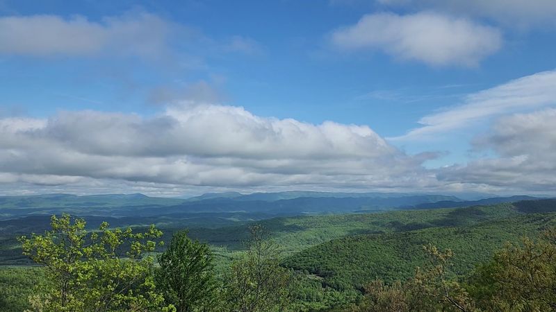
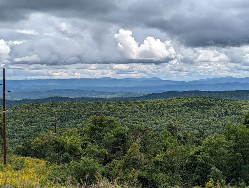
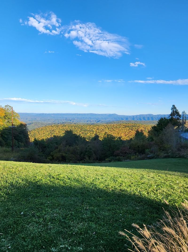
Standing at the overlook feels like looking at a living painting that constantly changes. Below stretches the Cowpasture River Valley, a green ribbon of bottomland flanked by steep mountainsides.
Beyond that, ridge after ridge stacks up toward the horizon, each one slightly hazier and bluer than the last. The effect creates an almost dreamlike quality.
Weather transforms everything about this view. Morning fog sometimes fills the valleys while mountain peaks float above like islands.
Afternoon thunderstorms roll through with dramatic cloud formations that cast moving shadows across the landscape. Clear days let you see for 30 miles or more, picking out individual features on distant ridgelines.
Light plays tricks here too, especially during golden hour when the sun sits low. Late afternoon sunshine paints the western slopes in warm amber while eastern faces slip into shadow, creating incredible depth and contrast.
Photographers love this spot because no two visits ever look exactly alike.
The combination of elevation, unobstructed views, and ever-changing atmospheric conditions makes Dan Ingalls Overlook genuinely unforgettable once you’ve stood here and soaked it all in.
Why Crowds Still Haven’t Discovered It
Bath County’s isolation works in visitors’ favor. With fewer than 4,500 residents spread across 540 square miles, the entire county feels worlds away from Virginia’s busy urban corridors.
No Interstate highways slice through here. You won’t find chain restaurants or shopping centers cluttering the landscape.
Compare this to Skyline Drive, where bumper-to-bumper traffic crawls through Shenandoah National Park on nice fall weekends. Or Humpback Rocks, where you’ll circle the parking lot hoping someone leaves.
Dan Ingalls Overlook requires more effort to reach, which naturally filters out casual tourists looking for quick, easy stops along major routes.
The overlook also lacks the extensive promotion that comes with National Park status. There’s no entrance fee, no visitor center, no gift shop selling postcards.
It simply exists as a roadside pull-off maintained by the Forest Service. Many Virginia travel guides don’t even mention it, and GPS directions sometimes struggle with the exact location.
This quiet anonymity has preserved the overlook’s character as a place for people who genuinely love mountains and solitude.
The very things that keep crowds away—remoteness, minimal facilities, and low-key atmosphere—are exactly what make it special.
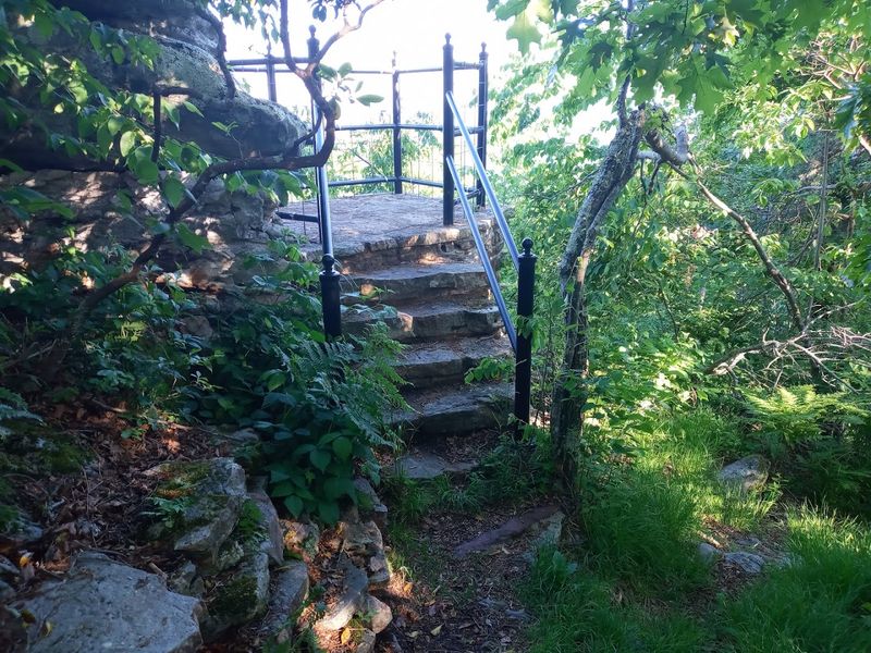
Beyond the Pull-Off: The Ingalls Overlook Trail
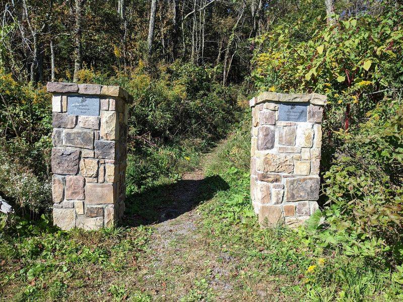
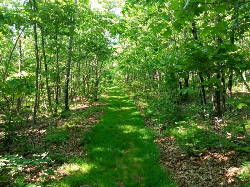
The paved overlook is just the beginning for those wanting more adventure. Behind the parking area, a moderately challenging trail loops 2.4 miles through the forest, offering perspectives you can’t get from the roadside.
The path features interpretive signs explaining the local ecosystem, geology, and human history of Warm Springs Mountain.
Expect some uphill sections that’ll get your heart pumping, along with stretches of loose gravel and exposed roots that require watching your footing. Nothing here counts as extreme hiking, but you’ll want real shoes, not flip-flops.
The trail rewards effort with additional viewpoints that face different directions, each revealing unique vistas across the highlands.
Rock formations dot the route, some large enough to scramble up for even better views. In certain spots, you’ll find yourself walking along exposed ridgeline with trees opening up on both sides.
The trail sees far less traffic than the overlook itself, meaning you might complete the entire loop without encountering another person. Hikers consistently rate this trail as one of Bath County’s best-kept secrets within a secret.
Budget about 90 minutes for the full loop, longer if you stop frequently to enjoy the scenery.
Wildlife and Natural Beauty Around Warm Springs Mountain
Nature lovers find much more than scenery here. Warm Springs Mountain supports diverse ecosystems that attract an impressive variety of wildlife throughout the year.
Birdwatchers bring binoculars knowing they might spot migrating raptors riding thermal currents above the ridges. Hawks, eagles, and vultures circle overhead, especially during spring and fall migration periods.
White-tailed deer browse the forest edges, particularly visible during early morning and dusk hours. If you stay quiet and observant, you might glimpse wild turkeys scratching through leaf litter or hear their distinctive calls echoing through the woods.
Black bears roam these mountains too, though they typically avoid human contact and stay deeper in the forest.
Wildflowers paint the forest floor each spring, with trilliums, violets, and wild azaleas blooming in sequence as temperatures warm. The area harbors several rare plant species found only in Virginia’s highland regions.
Forest composition varies with elevation—oak and hickory dominate lower slopes while giving way to mixed hardwoods higher up.
This biological diversity makes every visit interesting beyond just the views, offering something new to discover whether you’re a serious naturalist or simply enjoy being surrounded by thriving wild spaces.
The Best Seasons and Times to Visit
Each season brings completely different experiences to Dan Ingalls Overlook. Spring arrives late at this elevation, typically peaking in May when wildflowers carpet the forest floor and trees leaf out in fresh, bright green.
The air smells clean and new, with mountain streams running full from snowmelt.
Summer wraps the mountains in deep forest green, with the overlook offering cooler temperatures than lower elevations. Afternoon clouds often build dramatically, creating spectacular light shows.
Fall steals the show, though, with October typically delivering peak color. The mix of hardwood species creates a painter’s palette—scarlet maples, golden hickories, orange oaks—all set against evergreen backdrop.
Winter brings stark beauty when trees stand bare, revealing views obscured by leaves during warmer months. Snow occasionally dusts the mountains, creating postcard-worthy scenes.
Timing matters as much as season. Sunrise visits reward early risers with soft light and often fog-filled valleys.
Late afternoon offers dramatic shadows and golden hour magic. Midday works fine but lacks the atmospheric quality of lower-angle light.
Weekdays almost guarantee solitude, while even busy fall weekends rarely feel truly crowded here compared to Virginia’s famous overlooks.
Tips for Visitors: What to Know Before You Go
Practical planning makes any trip better. Parking at Dan Ingalls Overlook accommodates maybe eight vehicles, so arriving early during peak fall weekends increases your chances of snagging a spot.
Otherwise, you might need to wait or continue down the road and return later.
Facilities are nonexistent here—no restrooms, no food vendors, no water fountains. Plan accordingly by using facilities in Warm Springs or Goshen before driving Route 39.
If you plan to hike the trail, bring your own water, especially during summer when temperatures climb and humidity rises.
Footwear matters more than many people expect. The overlook itself is paved, but any trail exploration requires real hiking shoes with good tread.
Loose gravel and steep sections make sneakers or sandals risky choices. Cell phone service gets spotty throughout Bath County, so download maps before leaving areas with reliable coverage.
Wildlife crossings happen frequently along Route 39, particularly during dawn and dusk when deer move between feeding areas. Drive alertly and watch road edges.
Fall color season, roughly mid-October, brings the most traffic this area sees all year, though crowds remain modest by Virginia standards.
Early morning visits almost always guarantee peace and quiet regardless of season.