Michigan is stitched together by rivers that haul freighters, cradle trout, power cities, and quietly link inland forests to the Great Lakes, which means a map here never feels still, it feels like water is always on the move.
In this lineup, you will meet ten of the state’s biggest rivers, from industrial heavyweights near Detroit to cedar-lined classics up north, and each one carries a story about geography, commerce, wildlife, and the places Michiganders love most.
Some are working rivers with bridges and ports, some are paddler candy with clear bends and bird calls, and some somehow manage both, because Michigan likes its beauty with a side of utility and its history served a little splashy.
So grab your curiosity, maybe your binoculars, and follow the current, because these rivers do far more than fill the scenery – they explain how the state moves, works, and wanders today beautifully.
1. Detroit River
Steel, skyline, and serious current give the Detroit River a grand entrance.
Flowing about 28 miles between Lake St. Clair and Lake Erie, it separates Detroit from Windsor, Ontario, while acting as one of North America’s busiest international waterways.
If rivers had resumes, this one would arrive in a sharp suit.
Despite the name, the Detroit River is technically a strait, but nobody standing on its banks mistakes it for a small feature.
Massive freighters move grain, iron ore, and other cargo through the Great Lakes system, while fishing boats chase walleye in the same broad channel.
That contrast is the river’s magic trick.
The Detroit Riverwalk gives you a front row seat to the action downtown, and Belle Isle adds green space, wetlands, and postcard views.
Downriver communities like Wyandotte, Trenton, and Gibraltar reveal marinas, parks, and a more relaxed rhythm.
The whole corridor feels urban, industrial, and unexpectedly alive with wildlife.
It is also a major conservation story.
The Detroit River International Wildlife Refuge protects habitat for birds, fish, and migratory species in a landscape many people wrongly assume is all concrete.
Come for the ships, stay for the surprising reminder that a hard working river can still wear a wild side beautifully.
2. St. Clair River
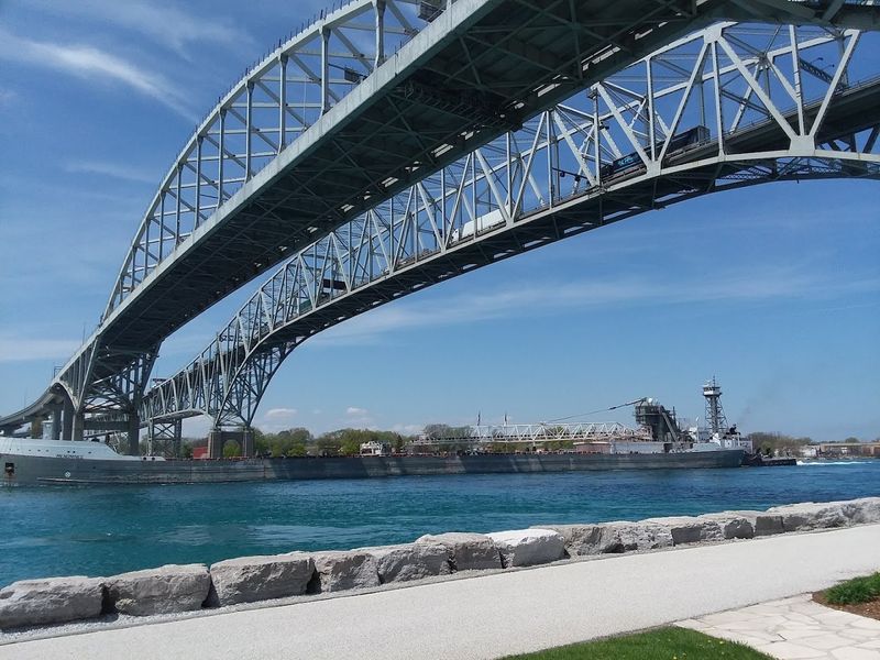
Some rivers look busy, but the St. Clair River looks busy and polished.
Running roughly 40 miles from Lake Huron to Lake St. Clair, it forms part of the boundary between Michigan and Ontario and passes Port Huron, Marysville, St. Clair, and Algonac.
Its water often appears startlingly blue and clear.
This river is a crucial shipping link in the Great Lakes chain, and freighters glide through with almost theatrical confidence.
Near Port Huron, the Blue Water Bridge frames the scene like a giant steel picture frame.
You could watch boats here for an hour and call it productive research.
Below the surface, the St. Clair River supports excellent fishing, especially for walleye, smallmouth bass, muskie, and perch.
The famous St. Clair Flats near the delta create a maze of channels, marshes, and islands that feel like a watery puzzle box.
Birders, paddlers, and anglers all find reasons to linger.
What makes the river memorable is its balance.
It feels industrial without feeling joyless, scenic without becoming sleepy, and historically important without acting like a museum piece.
If you want a river that connects lakes, nations, and very different moods in one smooth run, the St. Clair River absolutely earns its place near the top.
3. St. Marys River
Up in Michigan’s Upper Peninsula, the St. Marys River does not bother with subtlety.
It connects Lake Superior to Lake Huron and stretches about 75 miles, running past Sault Ste.
Marie where giant ships and the famous Soo Locks steal the spotlight.
This is Great Lakes engineering with a wild northern accent.
The river has rapids, islands, channels, and strong commercial significance that dates back centuries.
Before locks tamed the elevation change, the St. Marys Rapids created a barrier that required portage and shaped trade routes.
Today, vessels carrying bulk cargo still depend on this corridor.
Sault Ste.
Marie is the best place to appreciate the river’s scale and personality.
You can watch freighters rise and fall in the locks, tour the observation areas, or head toward Rotary Island and nearby shorelines for calmer views.
Even the air feels busier here, as if logistics itself learned to breathe.
Yet beyond the machinery, the St. Marys River supports fishing, boating, and remarkable habitat.
Its mixture of developed waterfront and northern scenery makes it feel both strategic and beautiful, which is not an easy combo to pull off.
For anyone curious about how Michigan physically connects its largest lake to the rest of the basin, this river is the living hinge.
4. Grand River
Michigan’s longest river arrives with a name that sounds bold because it is.
The Grand River runs about 252 miles from southern Michigan through Jackson, Lansing, Ionia, and Grand Rapids before emptying into Lake Michigan at Grand Haven.
That route gives it a little bit of everything.
Historically, the river powered mills, anchored trade, and helped cities grow where the current could do practical work.
Grand Rapids itself owes much of its development to the river, even though the original rapids were later altered by dams and urban change.
You still feel that civic pulse beside the water.
Along the way, the Grand becomes many rivers in one.
Near Lansing, it winds past parks and neighborhoods, while farther west it opens into broader, slower reaches where anglers chase catfish, bass, and steelhead in season.
At Grand Haven, the river mouth meets Lake Michigan with beaches, lighthouses, and vacation energy.
It is easy to appreciate this river because it stays relatable.
The Grand River does not perform for postcard fame alone, yet it quietly ties together farms, college towns, state government, industry, and shoreline tourism.
If Michigan had a main street made of moving water, the Grand would make a very convincing case for carrying that title.
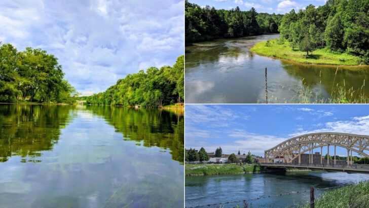
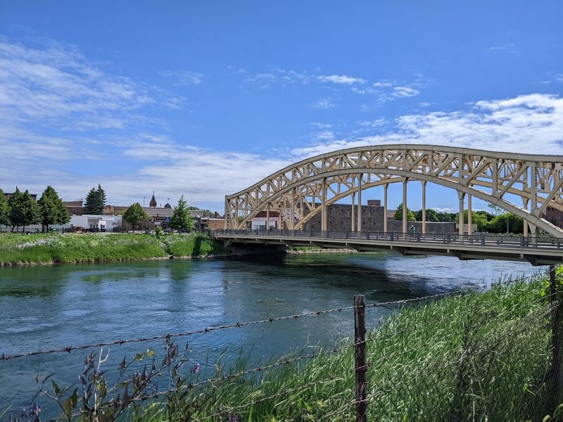
5. Kalamazoo River
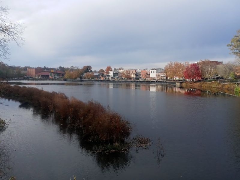
The Kalamazoo River has a name people love to say, and thankfully the river itself is just as memorable.
It runs roughly 130 miles across southern Michigan, beginning near Hillsdale County and flowing west through Battle Creek, Kalamazoo, Allegan County, and finally into Lake Michigan at Saugatuck.
That is a pretty scenic itinerary.
For much of its history, the river supported mills, factories, and paper production, which left a complicated environmental legacy.
Extensive cleanup and restoration efforts have improved conditions, making the Kalamazoo a strong example of a working river that is steadily healing.
That redemption arc deserves real respect.
Paddlers often love stretches near Plainwell, Otsego, and Allegan, where the river bends through wooded banks, wetlands, and open views.
At the west end, the lower river and harbor area near Saugatuck and Douglas feel breezy, artsy, and distinctly coastal.
It is a river that changes costume without losing character.
Fishing, birding, and boating all help keep the Kalamazoo in local conversation.
You may not rank it first for fame, but it rewards anyone willing to look beyond the headline cities and notice how much landscape this river stitches together.
By the time it reaches Lake Michigan, it has traveled through industry, restoration, and some of southwest Michigan’s most inviting scenery.
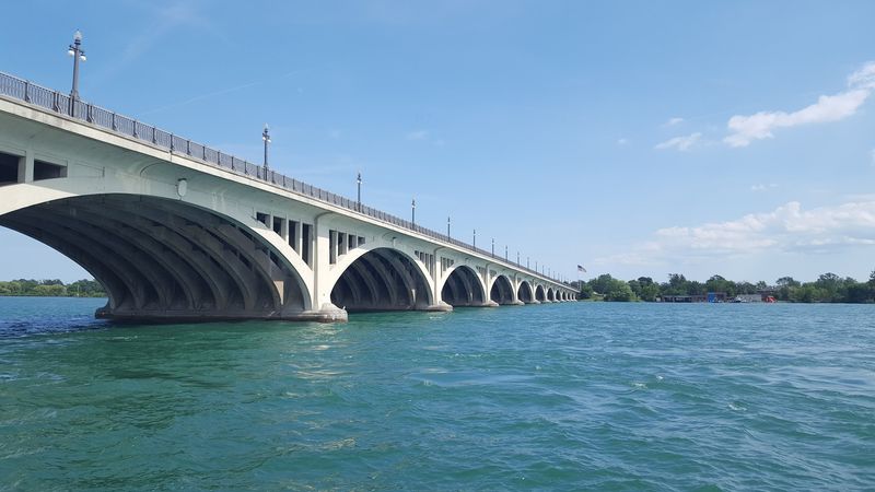
6. Saginaw River
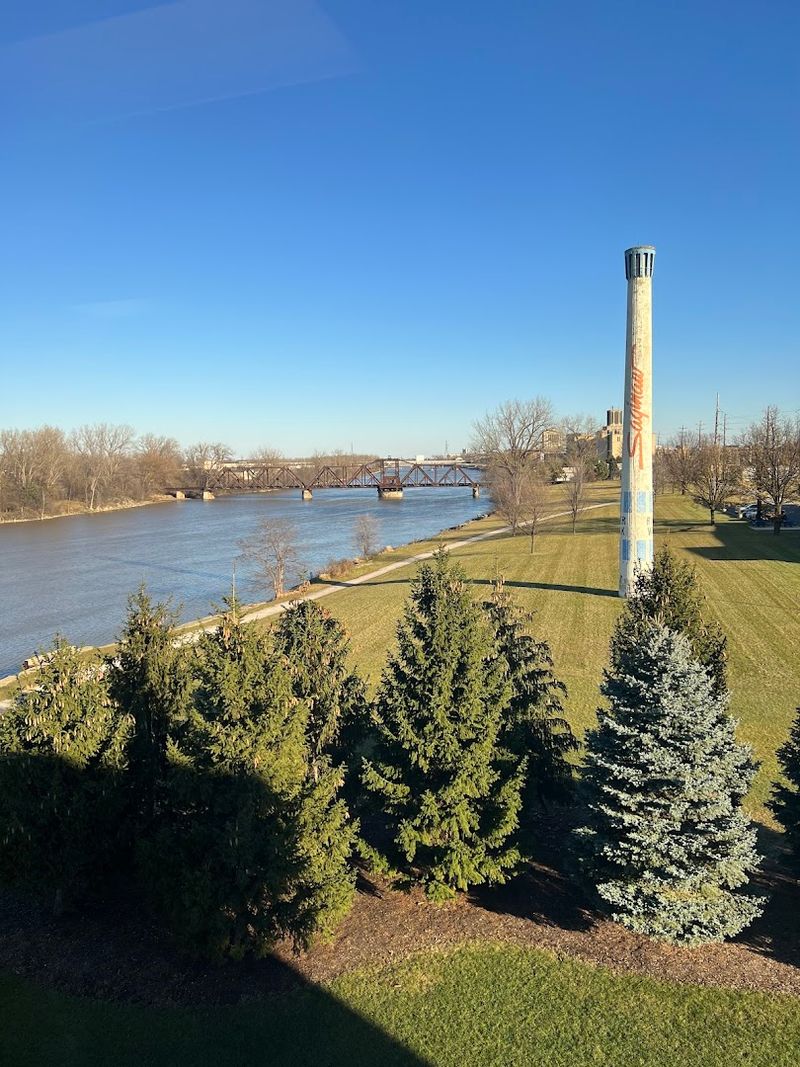
Broad, brown, and unapologetically useful, the Saginaw River feels like a river that came to work.
It is only about 22 miles long, formed by the confluence of the Tittabawassee and Shiawassee rivers in Saginaw, then flowing north through Bay City into Saginaw Bay on Lake Huron.
Short route, big impact.
This river powered lumbering and industrial growth during the nineteenth century, helping transform the Saginaw Valley into a major economic center.
Bay City especially grew with the river, and the waterfront still reflects that maritime heritage through bridges, docks, and active channels.
History here smells faintly like sawdust and diesel.
The Saginaw River may not win beauty contests against northern trout streams, yet it has a gritty charisma that grows on you.
Walleye fishing draws serious attention, and birdlife around the bay and lower river adds another layer for visitors who like binoculars with their geography.
Even the drawbridges feel like part of the show.
Its importance comes from connection.
The Saginaw drains a huge watershed through its tributaries and funnels inland water and commerce toward Lake Huron, linking central Michigan to the broader Great Lakes network.
When you stand along the waterfront in Saginaw or Bay City, you are looking at a river that punches well above its modest length.
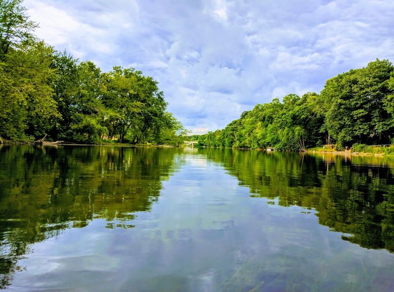
7. Muskegon River
Cold air, cedar shade, and the sound of current over gravel make the Muskegon River instantly likeable.
Running about 216 miles, it begins at Houghton Lake, crosses central and western Michigan, and empties into Muskegon Lake before reaching Lake Michigan in the city of Muskegon.
That gives it both inland and coastal credentials.
The river once served Michigan’s logging era, floating timber through a landscape that was far busier than it looks today.
Now it is far better known for recreation, especially world class fishing for trout, steelhead, and salmon in different seasons.
Anglers talk about it with the kind of devotion usually reserved for pie recipes.
Popular stretches near Newaygo, Croton, and Big Rapids offer excellent paddling, guided floats, and easy access to scenic banks.
The tailwater below Croton Dam is especially famous, thanks to stable flows and productive habitat.
Even beginners can sense they have arrived somewhere special.
What makes the Muskegon stand out is its generous personality.
It is big enough to feel substantial, accessible enough for casual visitors, and beautiful enough to satisfy people who simply want to sit still and watch the river do river things.
From quiet upstream reaches to the broader waters near Muskegon, this river connects the state’s interior to Lake Michigan with real style.
8. Au Sable River
If a river could whisper and brag at the same time, the Au Sable would manage it.
This celebrated northern Michigan river runs about 138 miles through Crawford, Oscoda, Alcona, and Iosco counties before entering Lake Huron near Oscoda.
It is famous, but not obnoxious about it.
The Au Sable is one of the country’s best known trout rivers, with cold, clear water that draws fly fishers from everywhere.
Branches, impoundments, and long forested reaches create variety without sacrificing the sense of intimacy that makes the river feel personal.
Even the name sounds like it belongs on a vintage tackle box.
Canoeists and kayakers flock to stretches near Grayling, Mio, and Alcona, where the current is gentle enough for scenic trips yet lively enough to stay interesting.
The surrounding Huron National Forest adds pines, wildlife, and that clean north woods feeling people try to bottle and sell as cabin decor.
Thankfully, the real thing is better.
Hydroelectric dams have shaped parts of the system, but the river remains a recreational jewel with deep cultural weight in Michigan.
Its connection to Lake Huron gives it broader geographic significance, while its upper reaches feel secluded and almost meditative.
For many visitors, the Au Sable is not just a river to see, it is a river to return to repeatedly.
9. Escanaba River
In the Upper Peninsula, the Escanaba River flows with less fame than some neighbors and plenty of quiet confidence.
The system, including its branches, drains a large area of Marquette, Delta, and Dickinson counties before reaching Little Bay de Noc at Escanaba on Lake Michigan.
It is a river that rewards attention.
The Middle Branch is especially well known among anglers for trout and salmon runs, while other stretches offer warmwater fishing and paddling opportunities.
Forested banks, occasional rocky areas, and a generally less crowded feel make the Escanaba appealing if you prefer elbow room with your scenery.
Not every great river needs a loud publicist.
As the river approaches Escanaba, the landscape opens and the water becomes part of a broader coastal setting tied to the bay.
That transition from inland Upper Peninsula terrain to Lake Michigan shoreline gives the river an important connective role.
It also makes the geography feel satisfyingly complete.
Historically, the watershed supported logging and local industry, though today recreation and habitat matter deeply to residents and visitors.
You can experience the Escanaba as a fishing destination, a paddling route, or simply a reminder that Michigan’s biggest rivers are not all clustered in the Lower Peninsula.
Sometimes the best travel companion is the river that never felt the need to show off.
10. Manistee River
Mist on the water makes the Manistee River look like it woke up before everyone else.
This northwest Michigan river runs roughly 190 miles from near Kalkaska County through forested country before entering Manistee Lake and Lake Michigan at the city of Manistee.
It balances size, scenery, and recreation with unusual ease.
Like several Michigan classics, the Manistee once played a major role in the logging industry.
Today, it is far more likely to be praised for salmon, steelhead, and trout fishing, plus canoeing and camping along stretches that feel pleasantly remote.
The river traded log drives for leisure without losing its backbone.
The upper river near Grayling and Mancelona is narrower and intimate, while middle sections around the Manistee River Trail corridor deliver some of the state’s best river scenery.
Farther downstream, the river broadens and heads toward the Lake Michigan shore with increasing confidence.
It is essentially a road trip made of water.
The city of Manistee gives the river a fitting finale, with a harbor, lighthouse views, and access to the lake.
That mouth connection matters, but so does the journey through forests, wildlife habitat, and recreation rich country.
If you want one river that captures Michigan’s talent for combining working history with outdoorsy charm, the Manistee makes a very persuasive closing argument.