Virginia was quite literally built along waterways that shaped travel routes, trade networks, and the locations of early settlements for centuries.
Many of the state’s most distinctive small communities still sit near those same shores, where historic streets and working waterfronts continue to influence everyday life.
These places demonstrate how rivers and coastal waterways remain central to local identity long after the era of sailing ships, canal boats, and river steamers.
A combination of natural scenery and deep historical roots helps explain why these communities have retained their character while continuing to attract visitors seeking a slower pace.
Here is a detailed guide to 13 river communities in Virginia that blend nature, history, and authentic small-town life.
Each destination offers a unique opportunity to experience traditions that continue to flow alongside the rhythms of modern daily life.
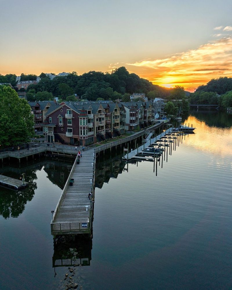
Scottsville
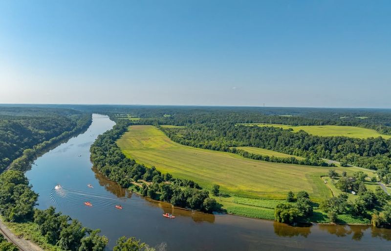
Set along the James, this former canal and river port grew because goods once had to move through a narrow transportation corridor between interior farms and eastern markets.
Tobacco, flour, and other products passed through warehouses here, while batteaux and later canal boats tied the settlement to a much wider commercial world.
Floods periodically reshaped that relationship, yet the river still explains the town’s layout and much of its memory.
Today, the old commercial blocks remain a visible record of nineteenth-century prosperity.
Brick facades, elevated entrances, and narrow streets hint at years when merchants, boatmen, and travelers treated the landing as a practical crossroads rather than a scenic backdrop.
Nearby canal remains and interpretation help connect the surviving buildings to the region’s larger story of internal improvements.
Recreation now gives the waterfront a different rhythm.
Paddlers use public access to launch kayaks and canoes, anglers work the river, and cyclists and drivers arrive seeking a landscape that still feels defined by movement.
Because daily life continues beside an active waterway, history here reads as something lived, not staged.
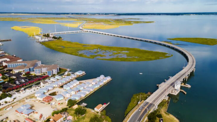
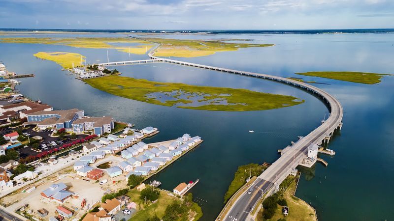
Colonial Beach
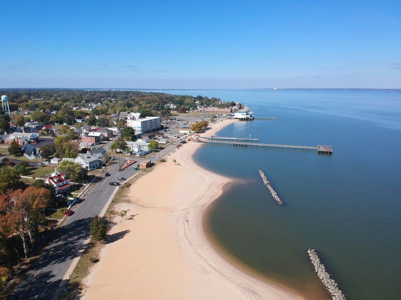
Facing the Potomac, this riverfront town developed around a shoreline that encouraged both resort life and local fishing.
Steamship connections once helped bring seasonal visitors from Washington, turning the waterfront into an economic engine long before cars dominated regional travel.
Broad views across the river continue to shape the place more powerfully than any inland crossroads.
Beach access remains unusually central to daily life.
A walkable waterfront, public fishing areas, marinas, and small businesses clustered near the shore show how commerce follows the edge between sand and street.
Restaurants, bait shops, lodging, and casual gathering spaces all depend on the simple fact that the river here feels open, visible, and usable.
Yet the geography does more than support tourism.
Storms, erosion, and water quality affect residents directly, while the seasonal swings of visitors alter rhythms for workers and business owners.
That tension helps explain the town’s character. It is a place where recreation and residence overlap constantly, and where the shoreline functions as both neighborhood front yard and economic main street.
Mathews
Across this low-lying county seat and its surrounding waterways, the defining experience is one of edges. Creeks, river mouths, marshes, and open views toward Mobjack Bay create a landscape where land never feels far from tide.
Agriculture, fishing, and small-scale commerce developed within that watery framework, producing settlements that remained dispersed and deeply tied to natural conditions.
Conservation has become especially important because these fragile shorelines support birds, fisheries, and wetland systems that protect the coast itself.
Public access points, quiet roads, and nearby natural areas make birdwatching, paddling, and shoreline observation part of ordinary life rather than niche pursuits.
The area’s appeal lies in how clearly ecological limits still shape human patterns.
Rural character survives here partly because the water complicates large-scale growth.
Views across inlets are wide, traffic is light, and daily routines seem calibrated to weather, season, and distance by bridge or boat.
That slower pace is not nostalgia. It reflects a tidewater geography where conservation, working landscapes, and community continuity remain closely connected.
Yorktown
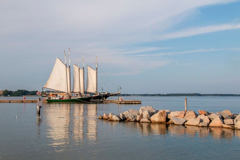
Overlooking the York, this waterfront settlement occupies ground where military strategy, maritime access, and colonial trade converged.
Deep water made the shoreline useful long before the siege of 1781 fixed the place in national memory. British surrender transformed the town into a symbol, but the river had already made it valuable as a point of movement and supply.
Along the modern waterfront, that connection remains easy to read.
Public beach areas, a fishing pier, and access for small craft keep attention focused on the broad channel, while museums and preserved streets explain how eighteenth-century life depended on nearby landings and warehouses.
Historic houses, earthworks, and interpretation prevent the Revolutionary story from floating free of geography.
Meanwhile, preservation shapes the tone of everyday activity.
Visitors walk from the shoreline to colonial-era sites in a matter of minutes, seeing how defense, commerce, and settlement fit together.
Rather than separating heritage from recreation, the town lets the river bind them, which is why the landscape still feels coherent after centuries of change.
Urbanna
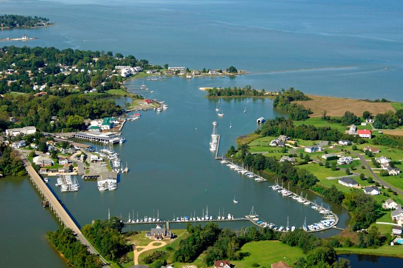
Near the lower Rappahannock system, this old port developed around shallow-water trade, maritime work, and access to rich oyster grounds.
Tobacco inspection once mattered here, but seafood eventually became the stronger cultural marker. Wharves, creeks, and working boats gave the settlement a practical identity tied to tide, season, and market demand.
Waterfront life still feels central rather than decorative.
Marinas, docks, and views across protected inlets reveal why small vessels remain part of the town’s daily visual language, while historic structures recall an era when local commerce depended on the shoreline. The annual oyster festival reinforces that history by connecting present-day gathering with a long industry built on nearby beds.
Elsewhere, modest streets and houses keep the scale intimate.
Seafood culture matters here because it links labor, food, and place in unusually direct ways, from harvesting traditions to regional recipes served across the Middle Peninsula.
Instead of treating the waterfront as a museum piece, the community shows how a maritime economy can persist in adapted form without losing its local character.
Deltaville
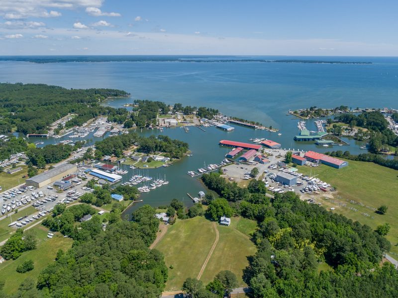
Positioned where the Piankatank approaches the Chesapeake, this community is defined less by a traditional main street than by the infrastructure of boating itself.
Marinas, boatyards, marine services, and channels to open water shape both the landscape and local economy.
Generations of watermen, sailors, and recreational boaters have relied on these protected approaches.
Fishing traditions remain visible alongside pleasure craft.
Charter boats, tackle shops, and working docks show how access to the bay supports both livelihoods and leisure.
Meanwhile, the nearby maritime museum preserves regional vessel types and the practical knowledge needed to build and operate them.
Hurricane history also matters, reminding residents that a harbor economy depends on resilience as much as location.
Unlike places centered on courthouse squares or colonial streets, this settlement explains itself through slips, sheds, ramps, and masts.
Waterfront recreation is not an added attraction here.
It shapes daily life, seasonal routines, and local identity, showing how modern tidewater communities continue to grow around the water.
Cape Charles
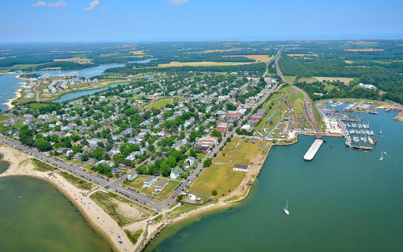
On the lower Eastern Shore, this bayfront community grew from rail and ferry connections that once linked the peninsula to larger markets.
Its historic district preserves the imprint of that era through substantial houses, commercial buildings, and a street plan that still feels unusually walkable for a small coastal town.
Water, transportation, and architecture remain tightly intertwined here.
Along the shoreline, broad bay views and a public beach place environmental resources at the center of everyday experience.
Nearby waters support fishing traditions and bird habitat, while access to marshes and barrier systems reminds visitors that the local landscape is ecologically complex, not merely scenic.
Preservation therefore matters for more than aesthetics. It helps retain a built form scaled to climate, waterfront use, and pedestrian life.
Recent tourism has brought investment, yet local identity still depends on older patterns of work and settlement.
Fishing heritage, neighborhood routines, and the practical use of the harbor keep the community from becoming only a seasonal stage set.
That balance is significant because it shows how a waterfront town can change without severing the connections that made it viable.
Chincoteague
Separated by channels, marshes, and tidal flats, this island community is inseparable from surrounding water and wildlife habitat.
Seafood harvesting, especially crabbing and oystering, long shaped livelihoods, while boat travel connected residents to neighboring islands and mainland markets.
The nearby refuge and seashore later added a conservation dimension that now defines much of the area’s public image.
Nature here is not background scenery.
Egrets, herons, migratory birds, salt marsh grasses, and changing light over shallow water influence how people move, work, and spend free time, whether they are fishing, paddling, clamming, or simply watching tides.
The annual pony swim, though highly visible, makes the strongest sense when understood within a larger island culture shaped by adaptation to wet ground and exposed weather.
Tourism has grown because the landscape feels biologically rich and distinct, yet daily life still turns on practical relationships with channels, docks, and fisheries.
Boardwalks, boat ramps, seafood businesses, and refuge roads all point back to that reality.
Community identity endures here because natural systems remain close enough to keep human routines grounded in place.
Onancock
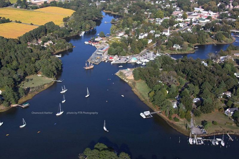
Built around a deep harbor on the Eastern Shore, this port became important because vessels could move goods inland and outward with relative ease.
Trade in agricultural products once animated the waterfront, and the settlement’s commercial confidence still appears in its historic buildings.
Harbor geography gave the town both practical reach and a sense of openness uncommon in small places.
Boating remains part of that identity.
Marinas, slips, and public waterfront views keep that connection visible throughout the town.
Galleries, bookstores, and restaurants also show how an older mercantile center has evolved into a place where arts culture and local business reinforce one another.
The wharf area matters because it links recreation, commerce, and memory in one compact setting.
Unlike communities defined mainly by beaches or battlefields, this one feels shaped by the working logic of a harbor.
Streets lead toward water, businesses rely on pedestrian movement, and public life unfolds within sight of masts and inlets.
That arrangement encourages a strong sense of continuity.
The town still develops in conversation with the shoreline that first gave it purpose.
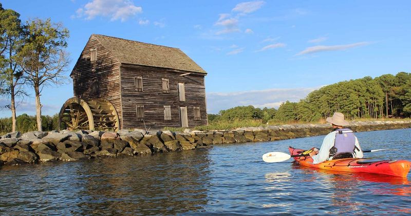
Smithfield

Established on the Pagan, this town gained importance through river access that supported trade, agriculture, and processing.
Colonial history is visible in its street pattern and preserved architecture, but the waterway explains why settlement endured and expanded.
Hogs, crops, and manufactured goods could move more efficiently because the river connected local producers to broader markets.
Food traditions remain central to the town’s public identity, especially the cured ham culture that grew from regional methods of raising and preserving pork.
That reputation can overshadow the waterfront, yet recent riverfront improvements and public access help restore attention to the channel that originally sustained commerce.
Walking near the shore clarifies how economic growth depended on navigation, storage, and exchange.
Historic houses, churches, and commercial buildings create a strong sense of continuity, but the most telling feature is the coexistence of heritage and ordinary use.
Residents fish, stroll, dine, and attend events in spaces tied to older industrial and mercantile functions. Because the river still frames community life, history here feels rooted in infrastructure as much as architecture.
Irvington
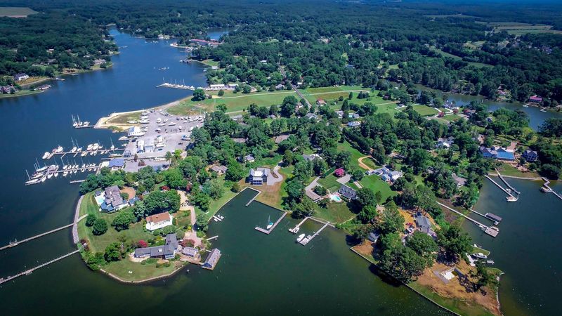
Within the Northern Neck, this small village developed in a landscape shaped by creeks, coves, and easy access to the lower Rappahannock system.
Maritime heritage appears less through large commercial docks than through boatbuilding traditions, sheltered landings, and a long familiarity with sailing waters.
The surrounding scenery gives the place a distinctly tidal character.
Local inns and public spaces contribute to its reputation, yet the strongest impression comes from how thoroughly the waterfront sets the tone.
Sailboats at anchor, narrow roads bending toward creeks, and views across marshy edges all suggest a community organized around leisure and seamanship rather than industrial scale.
That matters because it reflects a broader shift in many bay communities from extraction toward amenity-based economies.
Even so, traces of older working water traditions remain important.
Community events, yacht activity, and maritime storytelling all draw on a past in which navigation, weather knowledge, and small craft were everyday necessities.
The result is a place where social customs and landscape are closely linked, allowing the region’s river culture to survive in quieter but still legible forms.
Tappahannock
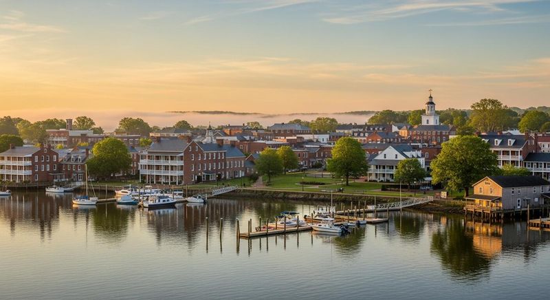
Perched on a high bank above the Rappahannock, this old port has long benefited from a river wide enough to support trade yet close enough to inland routes to attract merchants.
Colonial origins, courthouse history, and later commercial growth all relate to that strategic setting.
Few places show more clearly how a navigable river could anchor regional development for centuries.
Fishing traditions remain part of the local economy and culture, linking present activity to earlier patterns of provisioning and exchange.
Marinas, river views, and public access points keep the waterfront relevant, while the historic district preserves buildings that recall tobacco inspection, mercantile trade, and civic importance.
The river’s breadth also gives the town a visual scale larger than its street grid might suggest.
Because transportation corridors changed over time, the community had to adapt from water-centered commerce to a broader service role.
Still, the old logic never disappeared.
Movement along the channel once brought people, goods, and information, and that connective function explains both the town’s endurance and its layered character better than architecture alone ever could.
Occoquan
Beside the Occoquan, this compact historic district grew from waterpower as much as navigation.
Mills, warehouses, and related industry once used the river’s current to process grain and support trade, making the settlement an important manufacturing point in northern Virginia.
Fires, war, and rebuilding altered the town, but its relationship to the river remained the constant.
Today, preserved streets, galleries, and shops occupy a landscape still shaped by that industrial past. Riverfront trails and overlook areas reveal why the site worked so well for milling, while the museum and surviving buildings connect tourism to specific local history rather than vague nostalgia.
The dam and reservoir upstream further underline how this waterway has long been managed for human use.
Modern visitors often arrive for dining, crafts, and weekend walks, yet preservation succeeds here because it keeps the old scale legible.
Narrow lots, close-set structures, and the descending terrain toward the water explain the town’s original function better than any plaque could.
As a result, recreation and heritage support each other without erasing the place’s working origins.