Michigan has a way of turning a simple drive into part of the experience. One stretch of road might pass quiet lake towns and roadside markets, while another winds toward deep forests where the air cools even on the warmest summer afternoons.
By the time you reach the trailhead, it already feels like you’ve stepped a little farther from everyday life.
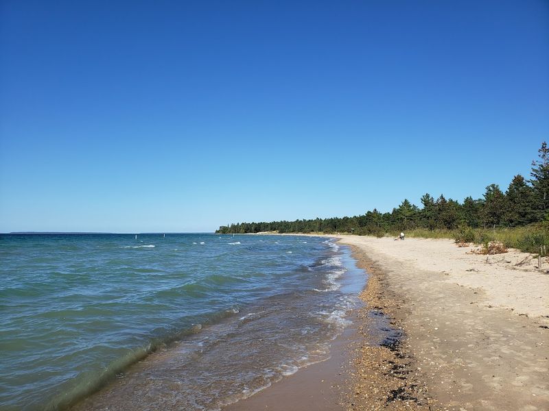
In summer, the state’s landscapes feel especially open—Lake Superior cliffs catching bright light, shaded woodland paths offering relief from the heat, and long, sandy stretches where the water never seems far away. It’s the kind of season that makes you want to linger outside, follow the next bend, and see where the trail leads.
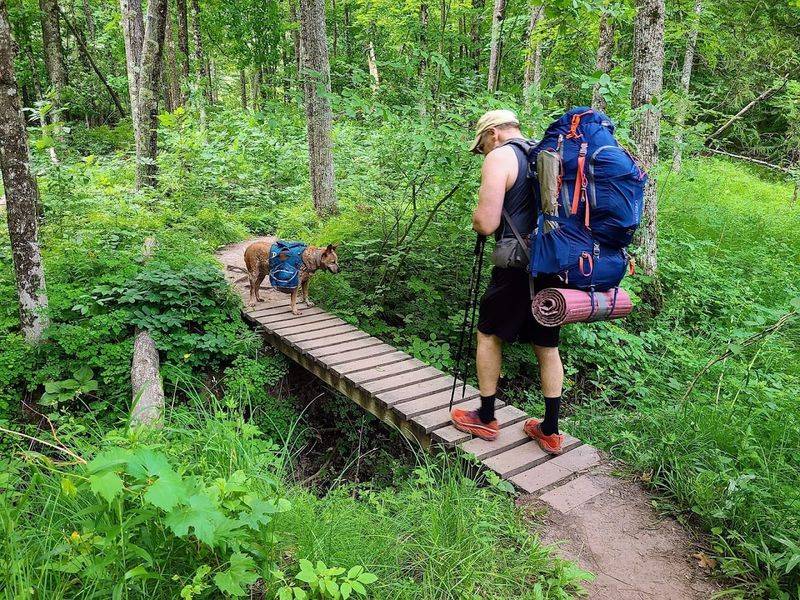
These are not just casual walks. They are the kinds of hikes that ask for a little more time and give a lot more back.
Here are the 11 Michigan trails worth traveling across the state for.
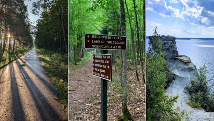
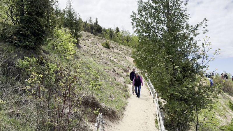
Pictured Rocks National Lakeshore Trail
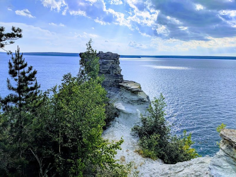
Blue water flashes through the trees, then suddenly the land falls away into one of the most dramatic shorelines in the Midwest. This is the kind of hike that makes you stop talking for a minute, just so you can take it in.
Along the Pictured Rocks National Lakeshore Trail near Munising, every mile seems to reveal another reason people gladly cross Michigan for it.
You can tackle short sections or plan a bigger backpacking trip, which is part of the route’s appeal. The trail strings together famous landmarks like Miners Castle, Chapel Rock, Mosquito Falls, and the Grand Sable Dunes without ever feeling repetitive.
I love that it constantly alternates between deep forest shade and huge Lake Superior overlooks.
What makes this route special is the sheer variety packed into one corridor. In a single outing, you can pass waterfalls, beaches, sandstone cliffs, creek crossings, and windswept viewpoints that feel almost coastal in a wild, northern way.
If you want a trail that delivers iconic scenery instead of just promising it, this is a safe bet.
Plan for changing weather, extra water, and more photo stops than you expect. The official visitor center at 1505 Sand Point Road in Munising is the best starting reference for conditions, maps, and logistics.
For pure Michigan wow factor, this trail belongs near the top of your list.
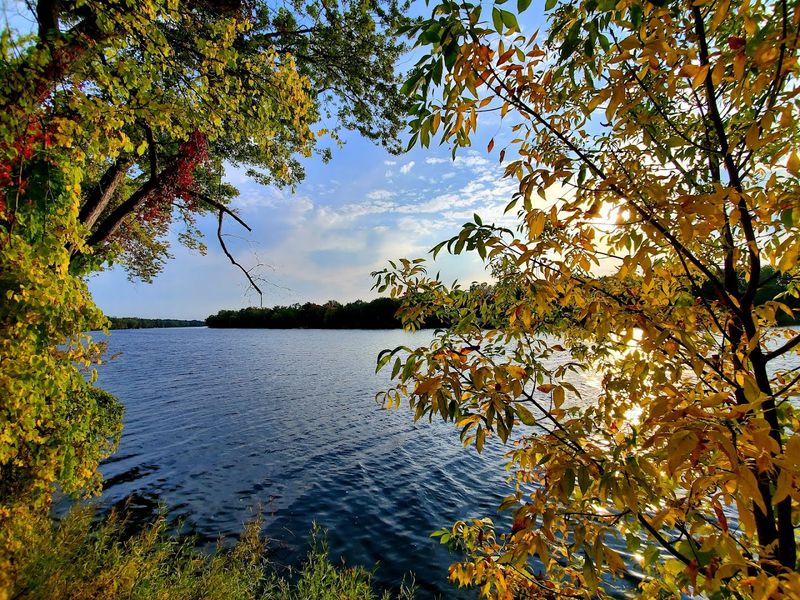
North Country National Scenic Trail (Manistee River Loop section)
There is something deeply satisfying about a trail that gives you river views, forest solitude, and a loop you can actually complete in a weekend. You start hearing water, notice the shifting light through hardwoods, and realize this route has earned its reputation.
The Manistee River Loop section of the North Country National Scenic Trail near Brethren is one of Michigan’s signature hikes for good reason.
This experience combines the North Country Trail with the Manistee River Trail, creating a route full of scenery without needing complicated shuttle plans. You get suspension bridges, blufftop overlooks, peaceful campsites, and long stretches where the river quietly keeps pace beside you.
I think it works equally well for ambitious day hikers and first-time backpackers wanting a memorable overnight.
Fall is especially beautiful here, when the hillsides turn gold and orange above the water. Even outside peak color, the mix of elevation changes and broad river bends keeps the trail visually interesting mile after mile.
Because the terrain is approachable but not dull, you feel rewarded without feeling rushed.
Head toward Seaton Creek Campground on Hodenpyl Dam Road to access the classic loop. Bring sturdy footwear, trekking poles if you like them, and enough time to linger at overlooks.
If you want a trail that feels both iconic and manageable, this one delivers beautifully.
Escarpment Trail
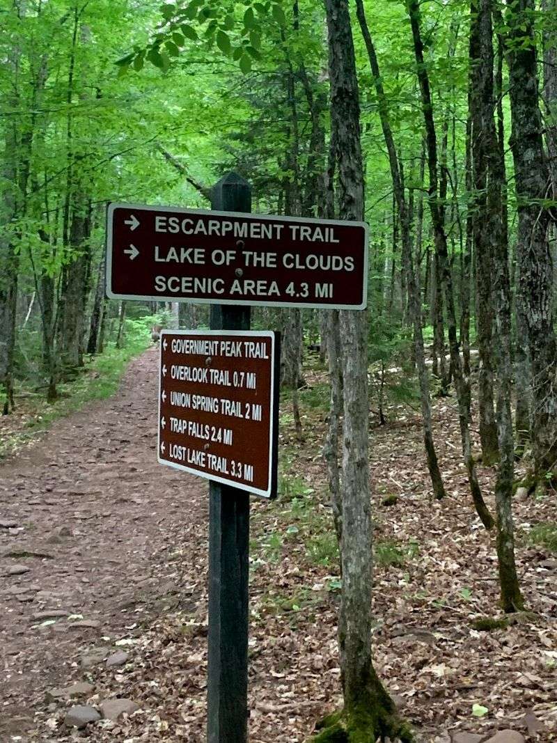
Few hikes in Michigan make such a powerful first impression. The climb, the rocky footing, and the sudden appearance of Lake of the Clouds below all combine into a route that feels bigger than the state usually gets credit for.
On the Escarpment Trail in the Porcupine Mountains near Ontonagon, the scenery arrives with real drama.
This is often called one of Michigan’s best day hikes, and once you are on the ridgeline, that praise makes perfect sense. The trail traces high ground above ancient forest, with repeated views that open toward the lake basin and endless folds of northern wilderness.
I like how the route feels rugged without becoming inaccessible to reasonably prepared hikers.
Autumn is legendary here, but the trail’s appeal goes beyond fall color. Exposed rock, old hardwoods, and changing weather give every trip a slightly different mood, from bright and expansive to moody and almost cinematic.
If you want the kind of landscape that makes you slow down and look twice, this is it.
Start with current park information from the Porcupine Mountains headquarters at 33303 Headquarters Road in Ontonagon. Wear shoes with grip, carry layers, and expect a little honest effort for the best views.
The payoff is one of the most memorable vantage points anywhere in Michigan.
Empire Bluff Trail
Not every unforgettable trail needs to be long or punishing. Sometimes the magic comes from a short walk through quiet woods that suddenly ends in a sweeping Lake Michigan panorama.
That is exactly why the Empire Bluff Trail near Empire keeps drawing people back, even when they have driven a long way to reach it.
Located in Sleeping Bear Dunes National Lakeshore, this trail is one of the best high-reward hikes in the state. The path is family friendly and fairly approachable, yet the final bluff view feels big, cinematic, and surprisingly grand for the effort involved.
I love recommending it to people who want a memorable hike without committing an entire day.
At the overlook, you get a broad perspective of shoreline, open water, and the layered textures that make this region so photogenic. Wildflowers can brighten the trail in warmer months, and sunset often turns the whole scene into something soft and glowing.
Because the route is short, you can pair it with beaches, scenic drives, or other nearby stops.
Use the Empire Bluff Trailhead on Wilco Road as your main access point and check Sleeping Bear conditions before you go. Bring a camera, watch your footing near exposed edges, and give yourself time to simply stand still.
This trail proves short hikes can leave the biggest impression.
Chapel Loop Trail
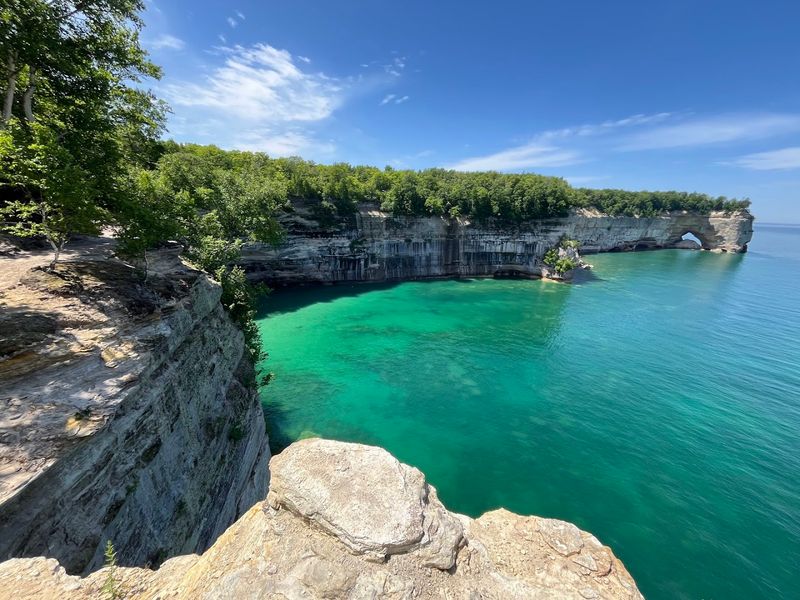
You know a trail is special when it feels like several great hikes stitched into one unforgettable day. Waterfalls, forest, cliffs, beaches, and open Lake Superior views all appear in a single loop that somehow never feels overloaded.
That is the magic of the Chapel Loop Trail near Shingleton in Pictured Rocks National Lakeshore.
This route is one of the park’s premier hikes because it gives you a little bit of everything people come here hoping to see. Chapel Falls is an early highlight, Chapel Rock is iconic, and the shoreline stretches near Mosquito Beach are pure Upper Peninsula drama.
I especially like that the loop format keeps the experience moving forward instead of retracing the same scenery.
The trail can feel adventurous without requiring a full backpacking commitment. You move between inland forest calm and cliffside exposure, which creates a rhythm that keeps the miles engaging.
On clear days, the lake’s shifting shades of blue make the overlooks feel almost unreal.
Access typically begins at the Chapel Road Trailhead on Chapel Road in Shingleton, and conditions are worth checking before you go. Wear solid shoes, carry enough water, and budget more time than the mileage might suggest.
If you want one Michigan hike that captures the essence of Pictured Rocks, this is a superb choice.
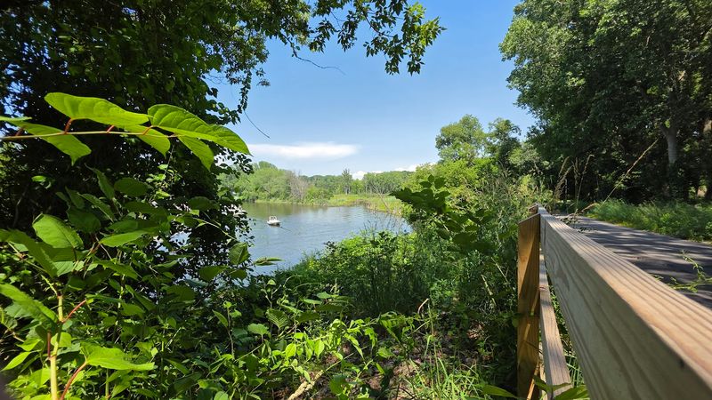
Lost Lake Pathway
Some trails win you over quietly. Instead of towering cliffs or famous overlooks, they offer still water, birdsong, cedar scent, and the kind of calm that makes your shoulders drop without you noticing.
Lost Lake Pathway in Wilderness State Park near Mackinaw City is that kind of place, and it is exactly why many hikers fall for it.
This trail is a great alternative when you want northern Michigan beauty without the crowds that gather at better known destinations. The route moves through forest, wetlands, and around inland water, creating a softer, more intimate experience than the state’s blockbuster coastal hikes.
I think it is especially rewarding if you appreciate wildlife, wildflowers, and quieter details.
Because the setting feels tucked away, the pathway encourages you to slow your pace. You might spot birds moving through the trees, light flickering across the lake, or subtle seasonal changes that are easy to miss on busier trails.
The lack of big spectacle is actually part of the charm.
Use Wilderness State Park, 903 Wilderness Park Drive in Carp Lake, as your key reference point for access and updates. Bug spray can be useful in warmer months, and binoculars are worth bringing if you enjoy birding.
For a peaceful hike near the tip of the Lower Peninsula, this trail is a wonderful surprise.
Dragon Trail
Big loops have a way of turning an ordinary outing into a full adventure. You start thinking about terrain, timing, and which section has the best views, and the trail becomes a destination instead of a quick local walk.
That is exactly the energy surrounding the Dragon Trail in Newaygo County near Hardy Dam.
This roughly 45 mile route around Hardy Pond was designed for hiking, trail running, and mountain biking, giving it a broad appeal that feels refreshingly modern. Suspension bridges, wooded shoreline, and changing terrain keep the experience varied while the scale makes it easy to build your own challenge.
I like that you can sample a section or return repeatedly to piece together more of it.
The trail has earned attention as one of Michigan’s newer destination systems, and it lives up to the buzz. Water views appear often enough to orient you, while technical sections and rolling stretches make the miles engaging.
If you enjoy trails with both infrastructure and adventure, this route strikes an appealing balance.
Hardy Dam County Park at 8215 Newaygo Road in White Cloud is a key reference for accessing the area. Check current maps, choose a section that fits your pace, and bring plenty of water during warm weather.
For a fresh, ambitious Michigan trail experience, the Dragon is absolutely worth the drive.
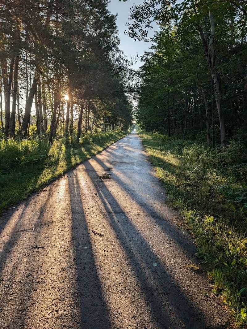
Kal-Haven Trail State Park
Sometimes the best trail trips are not about steep climbs or remote wilderness. They are about covering real distance at an easy rhythm while small towns, fields, and woods roll past in a way that feels wonderfully unhurried.
That is the charm of Kal-Haven Trail State Park connecting South Haven and Kalamazoo.
This former rail corridor stretches about 33.5 miles, which gives you plenty of room to shape the day around your energy and interests. Gentle grades make it approachable for almost any skill level, and the route links rural scenery with interesting stopovers along the way.
I think it is perfect when you want a long outing that feels active but not intimidating.
You pass farmland, forest sections, bridges, and communities that add personality to the miles. Because the surface and elevation are generally forgiving, you can focus more on the journey itself than on technical footing.
It is a trail where conversation, steady movement, and simple scenery become the whole point.
The South Haven Trailhead at 9673 West Swan Creek Road is a practical place to begin if you want a western access point. Check trail conditions, especially after wet weather, and consider snacks if you are planning a longer segment.
For a classic Michigan rail trail with broad appeal, Kal-Haven earns its place easily.
Fred Meijer White Pine Trail State Park
Long trails create a different kind of excitement because they invite you to think beyond a single outing. You can walk a quiet town section, plan a full day of mileage, or imagine the larger journey unfolding over multiple visits.
That is what makes the Fred Meijer White Pine Trail State Park such a compelling Michigan destination.
As the state’s longest paved rail trail, it stretches from the Grand Rapids area north toward Cadillac through a mix of communities, woods, rivers, and open countryside. The surface makes it accessible for many users, but the scale gives it real adventure value.
I like how it can feel casual for an hour or ambitious for an entire weekend.
Historic bridges, river crossings, and changing landscapes keep the route from feeling monotonous. One section may pass through town, while another opens into a quieter, more rural atmosphere that reminds you how much of Michigan this trail touches.
If you enjoy flexible itineraries, this route gives you plenty to work with.
The southern access near 213 Monroe Avenue NW in Grand Rapids is a useful reference point when planning your start. Bring sun protection, water, and a rough mileage goal so the day stays enjoyable.
For travelers who appreciate a long, versatile trail with statewide significance, White Pine is an easy recommendation.
Iron Belle Trail
Some trails are best understood not as a single hike, but as a grand invitation. The idea alone is inspiring: a route that ties together huge stretches of Michigan, linking public lands, shoreline, forests, and communities across the state.
That is the appeal of the Iron Belle Trail, a journey with true statewide scale.
The hiking route extends roughly 1,250 miles, making it the longest designated state trail in the nation. You are not meant to see it all in one visit, of course, and that is part of what makes it exciting.
I think of it as a choose your own adventure corridor where every segment offers a different version of Michigan.
Some stretches highlight Upper Peninsula wilderness, others connect you with Great Lakes coast, inland forests, or more developed regional landscapes. The trail’s significance is not just scenic but connective, showing how varied the state feels when stitched together on foot.
If you love the idea of exploring Michigan piece by piece, few routes are more meaningful.
Ironwood Depot Park at 150 North Lowell Street marks the western terminus and serves as a useful symbolic starting point. Research individual segments carefully, since conditions and surfaces vary widely.
For hikers who value scale, variety, and the thrill of a truly big trail vision, Iron Belle stands apart.
Lost Peninsula Trail
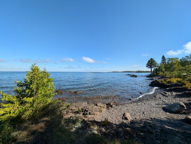
Wind, rock, water, and dense northern forest come together here in a way that feels a little raw and wonderfully far away. The landscape is not polished, and that is exactly why it sticks with you.
Lost Peninsula Trail near Copper Harbor delivers the kind of rugged Upper Peninsula atmosphere adventurous hikers dream about.
Set near Fort Wilkins Historic State Park, this coastal route combines boreal forest with dramatic Lake Superior shoreline. Wildflowers can brighten the path in season, but the bigger story is the contrast between sheltered woods and exposed, rocky water views.
I love that the trail feels both scenic and slightly untamed.
This is a great choice if you want something beyond the usual overlook-driven experience. Instead of one major reveal, the appeal comes from repeated encounters with shoreline texture, changing light, and the sense that you are exploring the edge of the state.
If Copper Harbor already feels remote to you, this trail deepens that feeling in the best way.
Use Fort Wilkins Historic State Park at 15223 US-41 in Copper Harbor as your main planning reference. Weather near Lake Superior can shift quickly, so layers and sturdy footwear are smart.
For travelers willing to go all the way to the Keweenaw for a hike, this trail absolutely justifies the miles.