
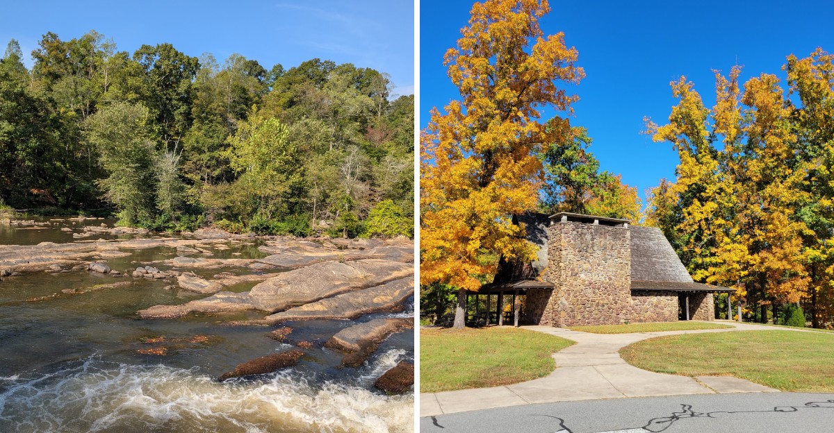
A stone picnic shelter with a giant fireplace sits in the woods, and it was designed by a protege of Frank Lloyd Wright.
That alone made me stop scrolling.
It honestly looks like the set of an adventure movie.
The surprises keep stacking up. Ghostly stone foundations from an old cotton mill hide along the river.
Ancient fish traps built by Native peoples still rest in the riverbed.
I like how this corner of North Carolina mixes history and wild scenery without trying too hard.
Waterfalls spill over rock shelves.
Granite ledges poke out of the forest like forgotten steps.
I can’t imagine a better spot for anyone who grew up wanting to be an explorer.
So where exactly is this place, and how do you see the best parts?
A Picnic Shelter That Looks Like It Guards a Lost Treasure
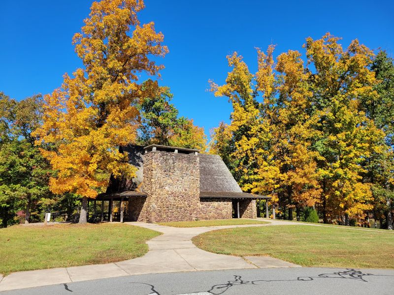
Most picnic shelters are plain wooden roofs over tables. The one at Mayo River State Park looks like it should come with a secret map.
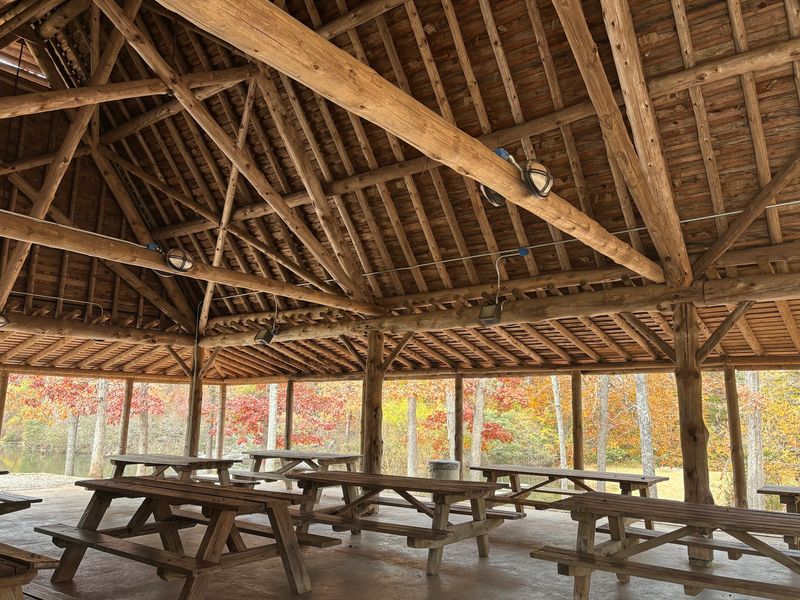
The stone shelter sits at the Mayo Mountain Access. It was designed in the 1940s by Antonin Raymond, a famous architect who once worked with Frank Lloyd Wright.
Raymond wanted his buildings to blend into thick woods. He pulled it off here, and the shelter feels like part of the forest.
Open sides let breezes drift through. A huge fireplace anchors one end, giving the whole space a grand, old-world look.
Its design has been compared to St. Paul’s Catholic Church in Japan, another Raymond project. That’s a pretty fancy cousin for a North Carolina picnic spot.
The shelter is large and can be reserved for gatherings. Grills are nearby, so birthday cookouts and family reunions fit right in.
Plan ahead if you want it for a big event. A fire crackling in that hearth on a chilly fall afternoon sounds like a scene from an adventure film.
Bring a camera, because this shelter steals the spotlight. Your sandwiches may never feel this important again.
Ghostly Ruins of an Old Mill Wait Beside the River
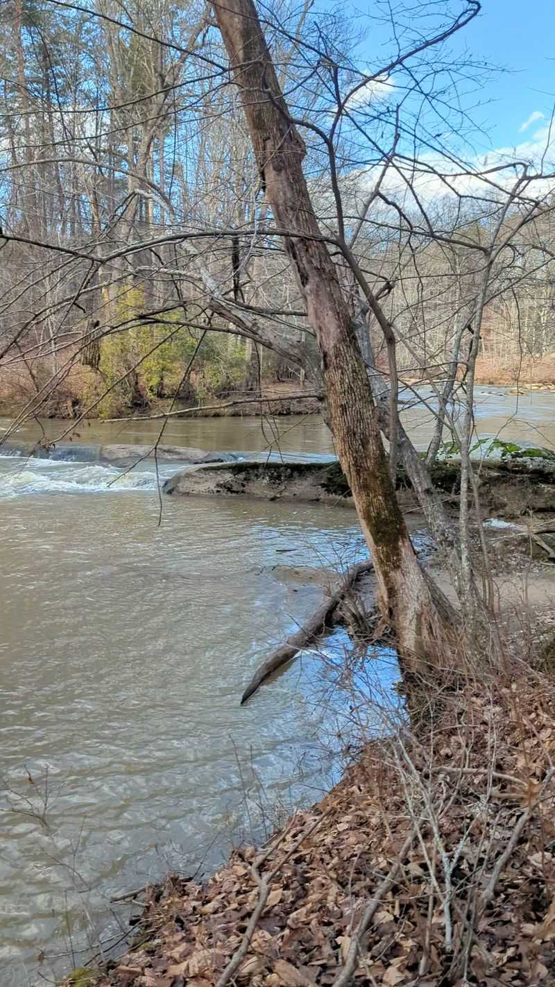
Back in 1899, a cotton mill called Avalon rose along the Mayo River. By 1911, a fire had wiped it out.
What’s left today feels straight out of a temple-ruin scene. Stone foundations and old canal locks still sit in the woods.
The forest has slowly crept back over everything. Moss, roots, and leaves now wrap around walls that once held busy machines.
Hiking past these remains is a quiet, almost spooky experience. You can almost hear the hum of the old mill if you listen hard enough.
Kids especially love spotting the stonework. It turns a regular walk into a real-life history hunt.
Remember that ruins are fragile pieces of the past. Look closely, snap photos, and leave every stone exactly where it rests.
Wear sturdy shoes for this outing. Riverside paths can have roots, rocks, and uneven ground.
Spots like this make history feel close instead of stuck in a textbook. A whole mill community once worked here, and the woods still carry its outline.
That’s a story worth stopping for. Pack a snack and give yourself time to wander slowly.
Ancient Fish Traps Still Sit in the Riverbed
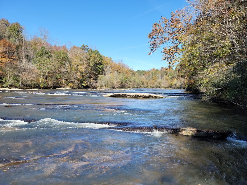
Long before anyone drew a state line, the Saura and Sappony peoples lived along this river. They fished its quick waters with real skill.
Their clever tools still show up today. Stone fish weirs, which worked like underwater traps, remain in the riverbed.
These rock structures guided fish into narrow spots for easy catching. Pretty smart engineering without a single power tool.
Fragments of pottery, pipes, and arrowheads have also been found along the riverbanks. Each piece hints at centuries of people living here.
That gives Mayo River State Park a layer most parks simply don’t have. It’s part nature preserve and part outdoor history lesson.
If you spot something interesting, admire it and leave it be. Artifacts belong to the story of the land, not your backpack.
Low, clear water makes it easier to notice shapes in the river. Take your time and scan the shallows carefully.
Honestly, this might be the closest thing to real treasure hunting in the Piedmont. Just swap the whip and fedora for a good pair of water shoes and a respectful attitude.
Follow the Trail to an 18-Foot Waterfall
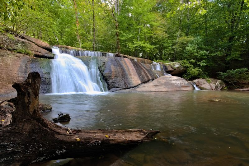
Eighteen feet of falling water is waiting at the Deshazo Mill Access. Fall Creek Falls is the star of the show here.
The best part? The falls sit a short walk from the parking area, so little legs can handle it easily.
The trail continues beyond Fall Creek Falls toward the Mayo River and the North Carolina–Virginia state line. It follows the water down to the Mayo River, then heads north toward the Virginia line.
Along the route, granite and metamorphic rock poke through the forest floor. Those exposed slabs give the scenery a rugged, ancient feel.
Know that this access is separate from the main park office. It’s roughly a 15-minute drive away, so plan your route before you leave.
Cell service can be spotty in these woods. Grab a park map from the office first so you don’t end up guessing at trail forks.
Parking at the waterfall lot is limited. Arriving earlier in the day can make things easier.
Spring often brings stronger water flow after rain. Fall paints the woods in warm colors, which makes every photo look like a postcard.
Rock Ledges With Names Worthy of an Adventure Map
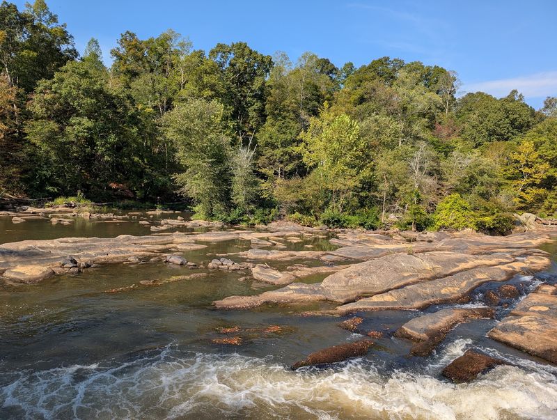
Names like the Grand Staircase and Byrd’s Ledge sound invented for a movie. Both are real spots along the Mayo River.
Upstream, near the Virginia and North Carolina border, wide rock shelves step across the water. These ledges are a big reason the park feels like a carved ruin.
Byrd’s Ledge has serious history attached. Colonel William Byrd used this natural rock formation as a landmark while surveying the state line in 1728.
Think about that for a second. A ledge you can visit today helped draw the border between two states nearly 300 years ago.
The Grand Staircase earns its name too. Water spills over layered rock, creating a scene that looks almost too neat to be natural.
Wet rocks get slippery fast. Move slowly, test your footing, and keep a close eye on children near the water.
Water levels change with rainfall. Check conditions before heading out, especially after storms.
Bring binoculars and a camera for this stretch. You’ll want proof that a riverside staircase this impressive exists in the Piedmont.
Paddlers Get a Rapid Called the Boiling Hole
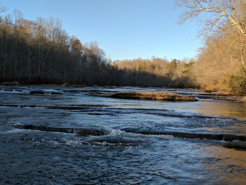
Anyone who owns a kayak just perked up at that name. The Boiling Hole sits near the Anglin Mill Access.
It’s a prominent rapid rated Class II to III, depending on how much water is flowing. Playboaters love it for tricks and surfing.
Not into whitewater? No problem at all.
The Mayo River offers plenty of calmer paddling for canoes and kayaks too. The Anglin Mill and Mayodan accesses are popular launch points.
Tubing is another way to float along on warm days. Just watch for big rocks, especially early in your trip.
Safety matters more than bragging rights. Always wear a life jacket and check water levels before getting on the river.
Rapids can change a lot after heavy rain. A gentle Class II run can turn much stronger with high water.
Paddling with a buddy is the smart move. Let someone at home know your plan and expected return time.
Being on the water lets you see the rock walls and wooded banks from a fresh angle. It might be the most cinematic way to explore the whole park.
Fishing Ponds Make the Slow Days Shine
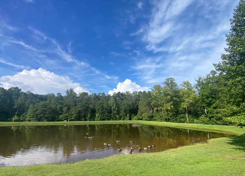
Not every adventure needs a rapid or a ruin. Sometimes a quiet pond and a fishing pole do the trick.
The Mayo Mountain Access has two catch-and-release fishing ponds. They’re a relaxing break from all the exploring.
Benches around the water give you a comfy place to rest. Grandparents and little kids can both enjoy this part of the park.
Swimming isn’t allowed in the ponds, so keep things on dry land. Catch-and-release means every fish goes back home for the next angler.
Make sure you have a valid North Carolina fishing license if one is required for your group. Rules can change, so check before you cast.
Geese and other critters often hang around the water. Bring a camera for wildlife moments.
The ponds also make a nice spot for a gentle walk. A loop around the water is easy for nearly everyone.
Pack a light snack and some patience. Fishing rewards those who sit still, and the peaceful setting makes waiting feel like a treat instead of a chore.
Loop Trails That Climb Up Mayo Mountain
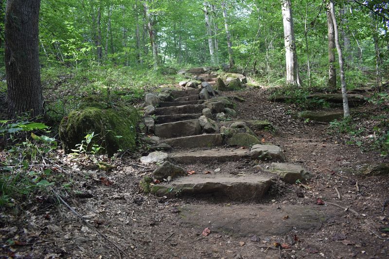
The Mayo Mountain Loop Trail is 2 miles long, and the shorter Mayo Mountain Inner Loop Trail is 0.5 mile; both distances are round-trip.
The shorter loop works well for families with young kids. The longer one adds some climbing and a stronger workout.
Expect roots, rocks, and a few hills along the way. Most hikers would call it easy to moderate.
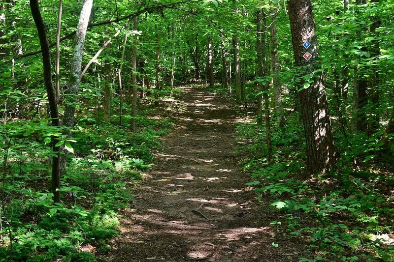
Trail markers help guide you through the trees. Keep an eye out so you stay on the right loop.
Dogs are welcome on a leash, which is great news for pet owners. Please pack out waste so everyone can enjoy clean paths.
The forest shade helps a lot on hot summer days. Still, carry plenty of water no matter the season.
Winter hikes offer clearer views through bare branches. Spring and fall bring fresh green leaves or bright colors.
Head to the park office first for a map. The staff can point you toward trailheads and explain how the different access areas connect, which saves you from wandering in circles.
Bring the Whole Crew to the Group Campground
Scout troops and big friend groups, this one’s for you. Mayo River State Park offers a primitive group campground at the Mayo Mountain Access.
The site is tent-only and can hold up to 40 people. Individual tent and RV sites aren’t offered here.
Amenities keep things simple but useful. You’ll find a pit privy, fire ring, picnic tables, and running water.
Reservations are required, so don’t just show up with tents. Book ahead to lock in your dates.
Primitive camping means fewer comforts than a full campground. That’s part of the charm, honestly.
Campfire stories feel extra spooky after a day of exploring mill ruins. Toss in a few legends about lost temples for fun.
Pack layers, since nights in the woods can turn cool. Flashlights and extra batteries are must-haves too.
Follow Leave No Trace rules during your stay. Clean campsites keep the park beautiful for the next group.
Sleeping under the trees here turns a day trip into a real expedition. Your crew will be talking about it long after the tents are packed away.
Finding Your Way to Every Corner of the Park
Your starting point is 500 Old Mayo Park Rd, Mayodan, NC 27027. That’s the main entrance and park office at the Mayo Mountain Access.
Here’s the twist. Mayo River State Park is spread across several separate access areas.
Deshazo Mill holds the waterfall trail. Anglin Mill, Hickory Creek, and Mayodan accesses each offer their own river views and activities.
Some sit a good drive apart, so plan your day before you go. A paper map from the office makes navigation much easier.
Gates generally open at 8 a.m. and close in the evening, so check current hours before your trip. The park is open year-round except Christmas Day.
Spring and fall bring mild temperatures and colorful leaves. Summer is great for river fun, and winter offers quieter trails.
The park sits in Rockingham County near the Virginia border. That makes it a handy escape from Greensboro and other North Carolina cities.
Bring water, snacks, and a sense of adventure. With ruins, ledges, and a legendary shelter waiting, this place deserves at least one full day.