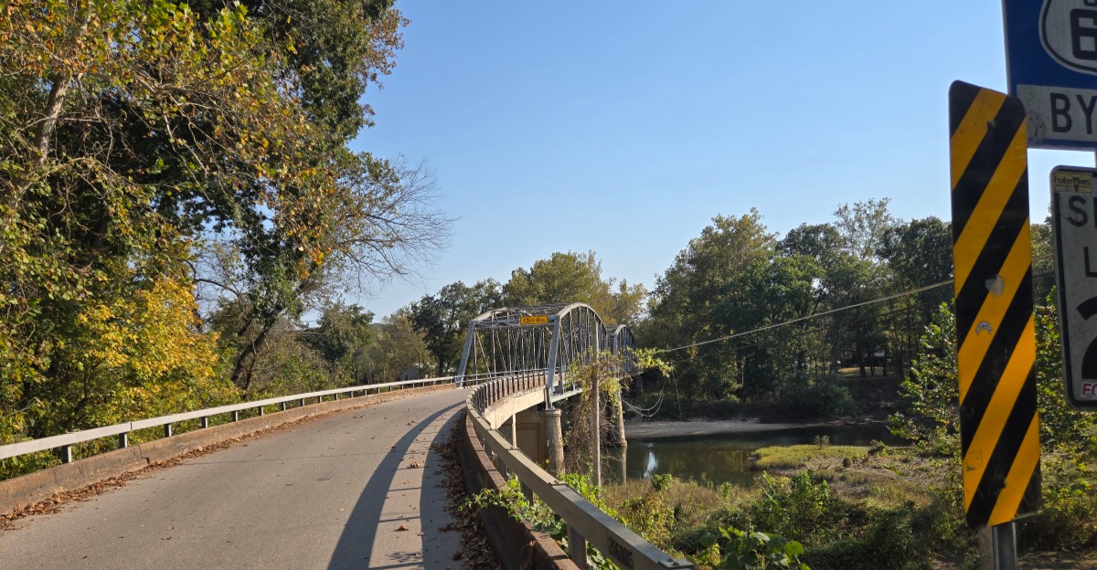
Some roads in the Missouri Ozarks seem to keep secrets after sundown. One narrow stretch of old pavement curls along a river bend, crosses a tired steel bridge, and slips into thick woods where cell signal gets shy.
During the day, it pulls road trippers, photographers, and history fans by the carload.
After dark, many folks who live nearby simply take the interstate instead.
Some say it is the sharp curves and the fog off the water. Others whisper about strange lights, odd tales, and a name that does not exactly calm the nerves.
The real reasons mix old history, wild geography, and a dash of local legend.
A Name That Sets the Tone
Nobody picks a name like Devils Elbow by accident. The community sits in Cullen Township, MO 65457, in Pulaski County, Missouri, right along a historic stretch of U.S.
Highway 66.
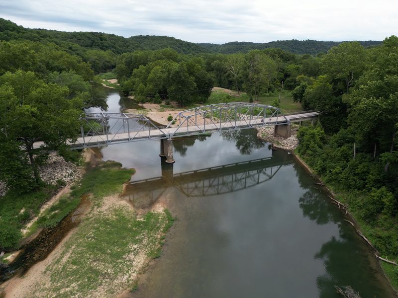
It lies about five miles east of St. Robert, tucked into the hills where the Big Piney River makes a dramatic turn. That turn is the whole story behind the name.
Early timber workers floated logs down the Big Piney toward market. When they hit this tight bend, the logs jammed up again and again.
Loggers reportedly called it a devil of an elbow, and the nickname stuck like river mud on a boot.
Today, the name works like a warning label for first-time drivers. It hints at twists, tricky turns, and a place with a stubborn personality.
Fun fact for trivia night: the river bend is a classic incised meander, a loop the water carved deep into rock over a very long time.
So before a single legend gets told, the map itself already sounds a little bit spooky.
The River Bend That Started It All
Rivers usually take the easy path. The Big Piney had other plans here.
At Devils Elbow, the water swings into a sharp horseshoe loop beneath tall bluffs. From above, the shape looks almost like a bent arm, which explains why loggers felt it fit the nickname so well.
Those bluffs matter for the after-dark reputation too. They block light early in the evening, so shadows arrive sooner than drivers expect.
Fog often settles over the water, especially on cool mornings and nights.
For paddlers, the Big Piney is a popular float river during warm months. Canoes and kayaks drift past the bend, and the scenery makes the trip worth every paddle stroke.
Practical tip: check water levels before floating, since rain can change the river quickly in the Ozarks.
Daylight shows off the bend at its best. Once the sun drops behind those bluffs, though, the same view starts to feel a lot more mysterious.
A Bridge With Plenty of Stories
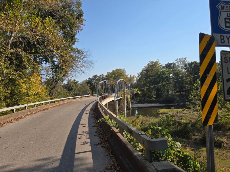
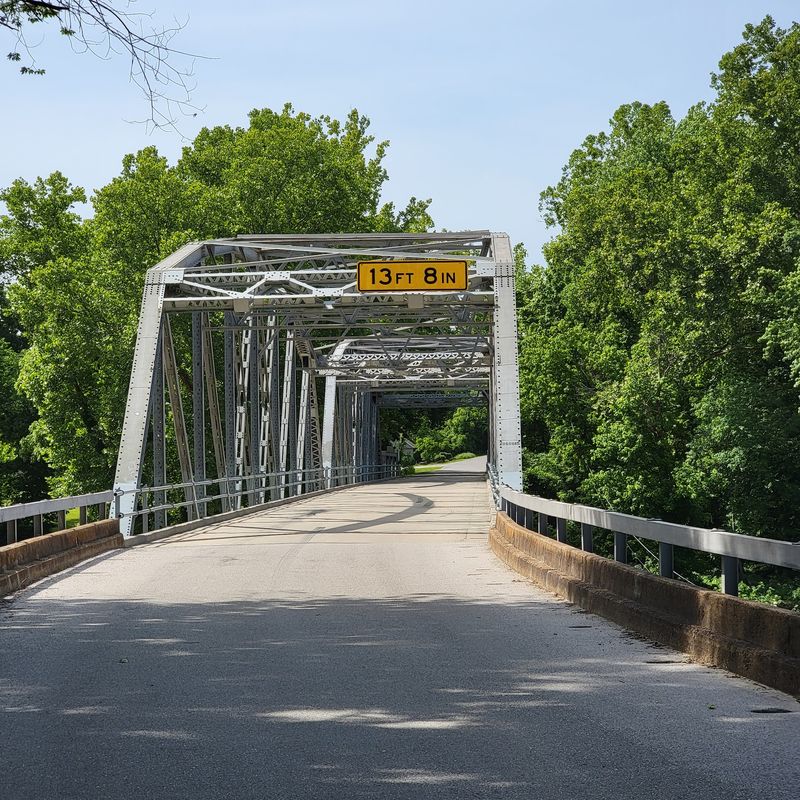
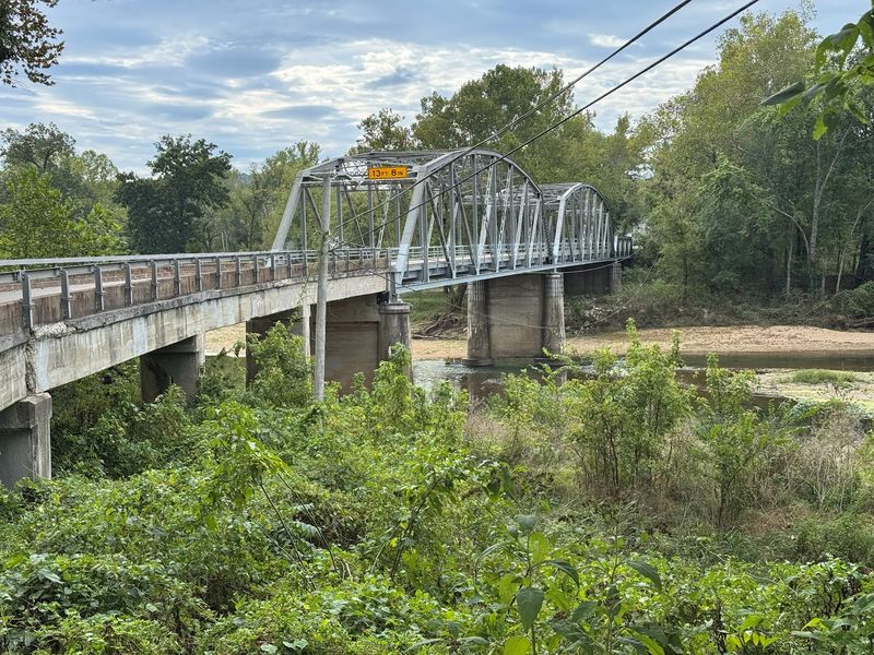
Built in 1923, the Devils Elbow Bridge is the star of the show for many road trippers. The steel truss span crosses the Big Piney River and once carried Route 66 traffic through the valley.
Its narrow deck made sense for early cars. Modern trucks and wide pickups, however, can make it feel snug.
The bridge was rehabilitated in later years and remains open to traffic. It is listed on the National Register of Historic Places, which helps protect its old-school charm.
Here is why night drivers get cautious. The approach curves, lighting is limited, and the bridge appears suddenly around a bend.
Add fog from the river, and a calm crossing can turn tense.
Photographers love it in morning or late afternoon light. Park carefully in safe pull-offs, never on the bridge itself, and watch for traffic coming either way.
Few bridges in Missouri carry this much history, and fewer still look this good doing it.
Curves That Keep Drivers Honest
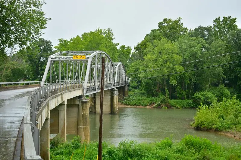
Old highways were built for slower days. The stretch of Route 66 through Devils Elbow proves that point with every bend.
The road dips, winds, and hugs the hillside as it heads down toward the river. Engineers in the 1920s followed the land instead of blasting through it, so the path twists more than a pretzel at a ballgame.
In daylight, those curves feel fun and scenic. At night, they become a different challenge.
Headlights only reach so far, and the woods offer few reflectors or streetlights.
Wildlife adds another surprise. Deer often cross Ozark roads around dusk and after dark, and they do not check for traffic first.
Local habit explains a lot of the hesitation. Many residents prefer Interstate 44 at night because it is wider, brighter, and faster.
The smart move is simple: drive this section slowly, keep headlights clean, and save the leisurely sightseeing for hours when the sun is still on duty.
Whispers, Lights, and Local Legends
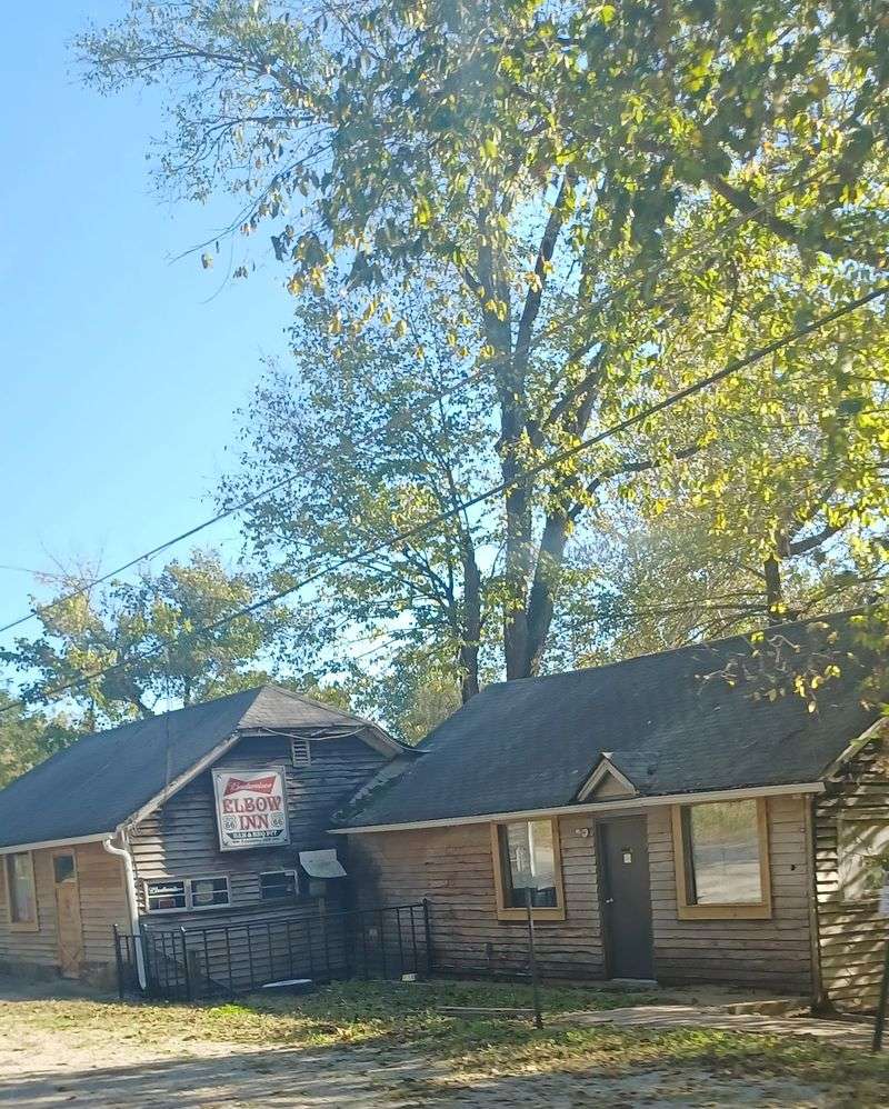
Every small Ozark community has a few campfire tales. Devils Elbow, with its eerie name, collects them easily.
Talk around the area often mentions strange lights near the river, odd shapes in the fog, and a general uneasy feeling along the dark road. These stories pass from friend to friend, usually with a grin and a raised eyebrow.
There is no official proof behind any of it. Still, the setting does a lot of heavy lifting.
Deep woods, a quiet river, an old bridge, and very little traffic make any shadow feel suspicious.
Many of the tales probably grow from real things. Fog drifts in and out, headlights bounce off the bluffs, and wildlife eyes can glow back from the roadside.
For curious folks, the best approach is respectful fun. Enjoy the stories, but stay on public roads and away from private property.
Legends are part of the place, and half the charm is deciding how much to believe.
Route 66 Roots Run Deep
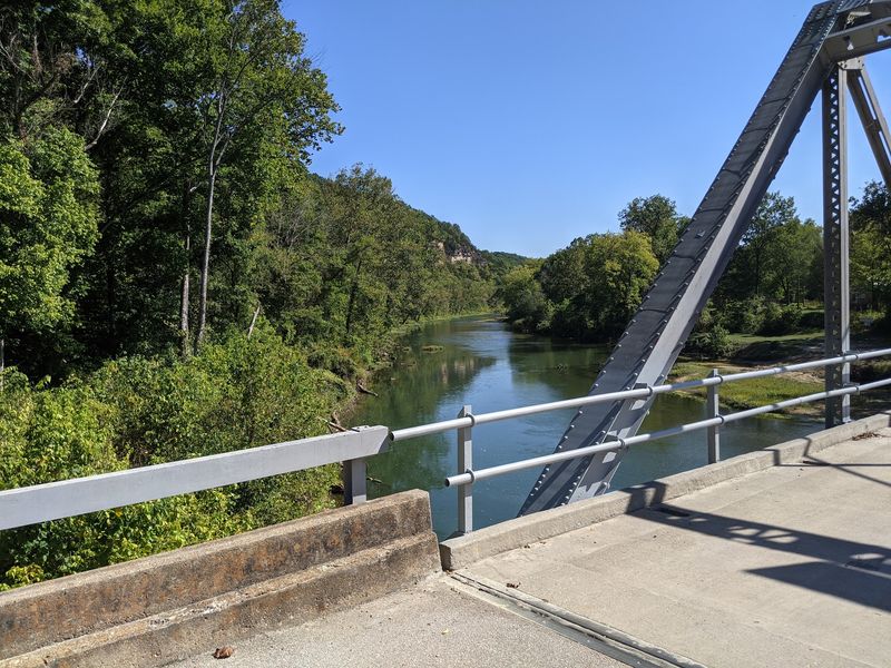
Long before GPS, Route 66 was the road to adventure. Opened in 1926, it linked Chicago to Los Angeles and passed right through this river valley.
Devils Elbow became a well-known stop for travelers who wanted a break in the hills. The scenic bend and bridge gave families a reason to pull over and stretch their legs.
Later, a wider four-lane alignment was built nearby during the World War II era, partly to serve traffic tied to Fort Leonard Wood. Eventually Interstate 44 took over most traffic.
That shift explains the lonely feeling today. The old road still exists, but most cars zip past on the interstate instead.
History fans can trace several alignments in the area. Each layer tells a piece of how American travel changed over the decades.
Quick tip: grab a Route 66 map or guidebook before visiting, since old alignments can be easy to miss.
Driving it today feels like flipping back through a family photo album.
The Rock Cut Nobody Forgets
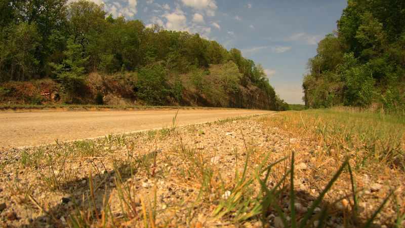
Engineers once decided the hill was simply in the way. Their answer was a massive cut through solid rock near Devils Elbow.
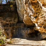
The Hooker Cut was created in the early 1940s for the newer four-lane Route 66 alignment. At the time, it was described as one of the deepest rock cuts in the country.
Driving between those tall stone walls feels impressive in daylight. The layered rock shows how the Ozark hills formed over a very long stretch of time.
At night, the cut adds to the moody reputation of the area. High walls close in on both sides, and darkness seems a bit thicker there.
The project was tied to wartime needs, helping move traffic toward Fort Leonard Wood. It was a big deal for the region back then.
Geology fans should look closely but safely. Avoid stopping in traffic lanes and use proper pull-offs only.
Not every road attraction is a building, and this one proves stone can steal the spotlight too.
Small Community, Big Personality
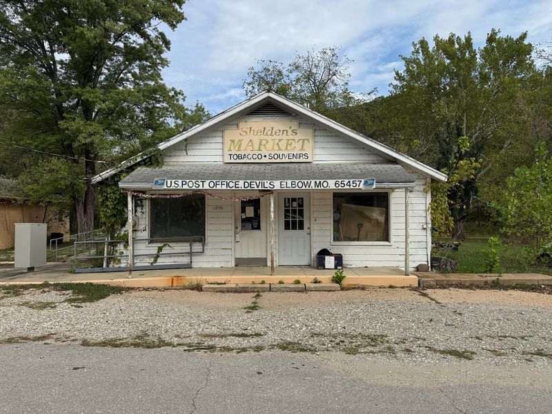
Blink and the community might slip by. Devils Elbow is unincorporated, so it has no city hall or mayor running the show.
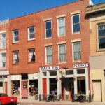
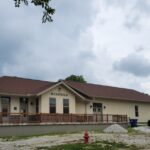
What it does have is character. A handful of homes, old roadside buildings, and long-standing local spots give it a classic Route 66 feel.
Residents tend to know the area well, from flooding patterns on the river to which curves need extra caution. That local knowledge is a big reason so many prefer daylight trips through the valley.
The Ozark culture here leans friendly and laid-back. Folks appreciate travelers who drive slowly, respect private property, and leave places as tidy as they found them.
Nearby St. Robert and Waynesville offer more services, so plan fuel and supplies before heading down the old road.
Remember that small places can have limited hours and options, especially on weekdays or in the off season.
A little courtesy goes a long way, and it may even earn a good story or two in return.
When High Water Takes Over
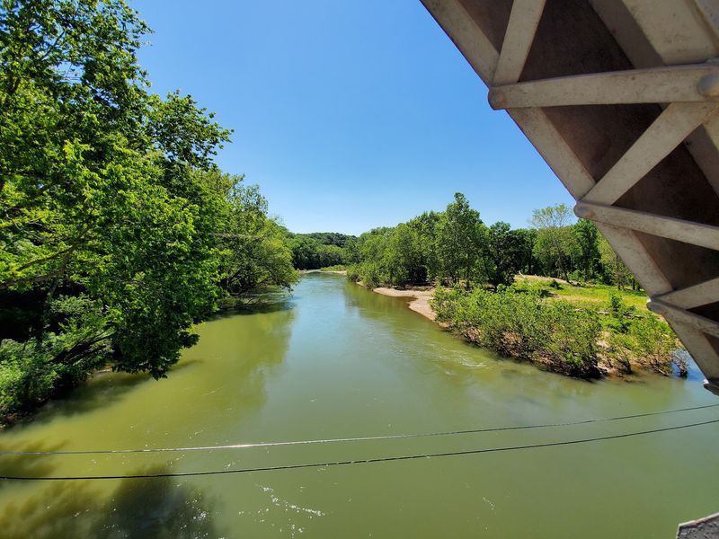
Rivers in the Ozarks can switch moods fast. The Big Piney is no exception, and Devils Elbow has seen serious floods.
Heavy rain in the hills sends water racing into the valley. Low spots near the river can flood, and roads sometimes close until levels drop.
Flooding in 2017 caused notable damage across parts of the region. Events like that leave a lasting mark on how locals view the road, especially at night.
Darkness makes flooded pavement hard to spot. Water over a road can hide washouts or strong currents, and even shallow flow can move a vehicle.
The rule many Missourians follow is simple: turn around, don’t drown. Signs reminding drivers of this appear around the state for good reason.
Before visiting, check weather forecasts and Missouri road condition updates. Spring tends to bring the most rain.
Respecting the river keeps every trip safe, and it lets the bend stay a scenic highlight instead of a hazard.
Best Hours to Explore Safely
Timing is everything on this stretch of old highway. Daylight turns the spooky stories into a fun backdrop instead of a reason to worry.
Late morning through afternoon works best for photos, sightseeing, and slow drives. Fog usually lifts by then, and the bridge and bluffs are easier to enjoy.
Fall is a favorite season, as Ozark trees change color across the hills. Spring brings green woods but also more rain, so plan around storms.
Summer suits river floaters and paddlers, though weekends can get busier. Winter is quieter, but icy patches on shaded curves call for extra care.
Pack basics: a charged phone, a paper map, water, and a full tank. Cell coverage can be spotty in the valley.
Leave before dusk if the woods start feeling a bit too quiet.
Locals have good reasons for their after-dark habits. Follow their lead, enjoy the history in the sunshine, and let the legends stay right where they belong, in the stories.