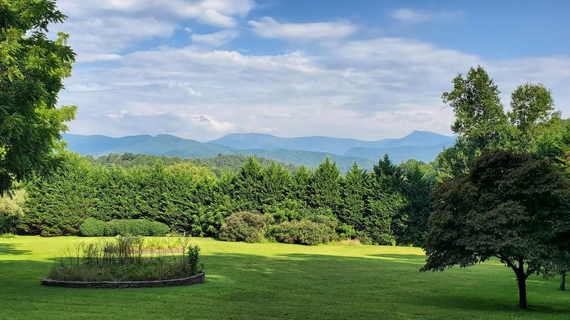
Georgia’s mountain trails offer some of the most stunning scenery in the southeastern United States.
From towering peaks that stretch into neighboring states to dramatic cliff overlooks and cascading waterfalls, these hiking destinations provide unforgettable adventures for outdoor enthusiasts.
Whether you’re an experienced backpacker seeking challenging climbs or a casual hiker looking for breathtaking views, Georgia’s diverse mountain landscape has something special waiting for you.
These twelve trails showcase the very best mountain vistas the Peach State has to offer.
Blood Mountain Trail – Blairsville
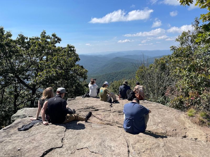
Standing at 4,458 feet, Blood Mountain offers one of the most rewarding challenges along Georgia’s section of the Appalachian Trail. The trail climbs steadily through hardwood forests before breaking into rocky, exposed terrain near the summit.
Experienced hikers love this trail for its dramatic elevation changes and the sense of accomplishment that comes with reaching the top. The final approach requires scrambling over boulders and navigating steep, rocky sections that test your skills.
Once you arrive at the summit, 360-degree views stretch across the Blue Ridge Mountains in every direction.
The historic stone shelter at the peak adds character to your adventure, serving as a perfect spot to rest and soak in the scenery. Plan for a full day hike, bringing plenty of water and snacks.
Weather conditions can change quickly at this elevation, so pack layers even during warmer months.
This trail gets busy on weekends, so consider starting early or visiting on weekdays for a more peaceful experience.
Yonah Mountain Trail – Cleveland
Few trails in Georgia deliver the wow factor quite like Yonah Mountain. The massive granite dome rising 3,166 feet above sea level creates one of the most distinctive landmarks in Northeast Georgia.
Getting there requires determination – the trail gains about 1,400 feet in less than 2.5 miles, making it one of the steeper climbs in the region.
Your effort pays off the moment you step onto the exposed summit. Unlike forested peaks, Yonah’s open granite top provides unobstructed views that seem to go on forever.
Rock climbers often scale the vertical faces below the summit, adding visual interest to your hiking experience.
The trail begins near a private campground and follows a well-maintained path through mountain laurel and hardwoods. About halfway up, the grade intensifies significantly, so pace yourself accordingly.
Wear sturdy boots with good traction since the final approach crosses smooth granite surfaces.
Sunrise and sunset hikes are particularly magical here, painting the surrounding mountains in golden light.
Brasstown Bald Summit Trail – Hiawassee
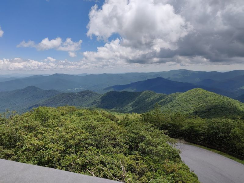
Reaching Georgia’s absolute highest point doesn’t require grueling endurance – just a short, steep walk up a paved path. At 4,784 feet, Brasstown Bald towers above everything else in the state, and the observation deck at the summit delivers views that justify its reputation.
On exceptionally clear days, you can spot landmarks in four different states from the deck. The visitor center features educational exhibits about the mountain ecosystem and Southern Appalachian culture.
A shuttle service runs for those who prefer not to hike, though the half-mile trail only takes about 30 minutes at a leisurely pace.
The paved surface makes this trail accessible for families with younger children, though the grade averages about 12 percent. Many visitors combine this hike with nearby attractions like Vogel State Park or the charming mountain town of Helen.
Arrive early during peak fall foliage season when parking fills quickly. The elevation means temperatures run cooler than surrounding areas, so bring a jacket even when valleys feel warm.
Rabun Bald Trail – Sky Valley
Sometimes the best mountain experiences come without the crowds, and Rabun Bald proves this point beautifully. This 4,696-foot peak ranks as Georgia’s second-highest mountain, yet it sees far fewer visitors than more famous destinations nearby.
The trail winds through peaceful forests filled with birdsong and dappled sunlight before emerging at a restored fire tower. Climbing the tower’s stairs adds an extra thrill to your adventure while providing elevated views that extend for miles.
The summit area feels remote and wild, offering genuine solitude for those seeking to escape busy tourist spots.
Two different routes lead to the top – the shorter but steeper Beegum Gap Trail and the longer, gentler Bartram Trail approach. Both deliver satisfying hikes through beautiful mountain terrain.
Spring wildflowers carpet the forest floor in vibrant colors, while autumn transforms the canopy into a patchwork of reds and golds.
The fire tower structure itself fascinates history buffs, representing an important part of forest management heritage. Pack a lunch to enjoy at the summit.
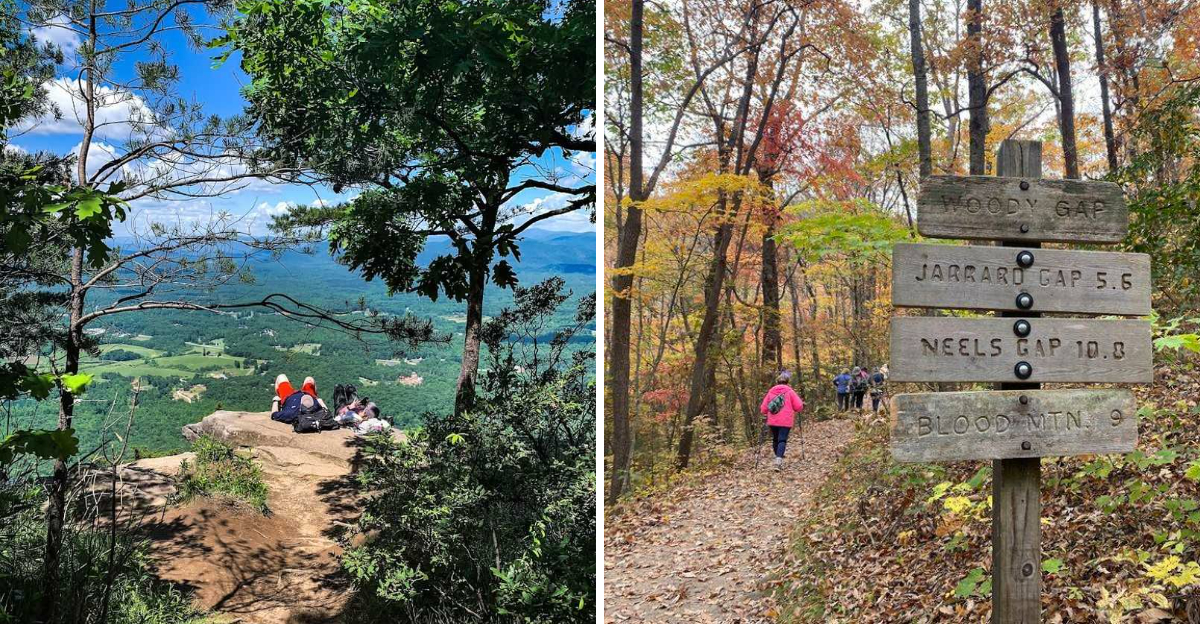
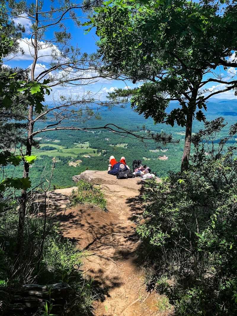
Preacher’s Rock via Woody Gap – Suches
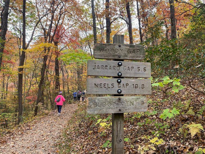
Photographers and sunrise enthusiasts flock to this spectacular Appalachian Trail viewpoint for good reason. Preacher’s Rock juts out from the mountainside like a natural stage, offering front-row seats to one of North Georgia’s finest panoramas.
The relatively short hike from Woody Gap makes this destination perfect for those wanting maximum scenery with moderate effort. Just over a mile of hiking brings you to the exposed rock ledge overlooking the Chattahoochee National Forest.
The open vista faces east, creating ideal conditions for watching the sun paint the valleys in brilliant morning light.
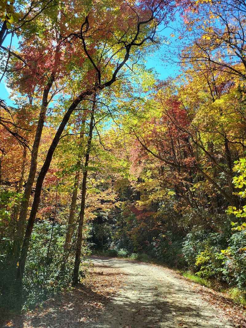
During fall, the surrounding hardwood forests explode with color, transforming the landscape into a living canvas. Winter brings its own magic as bare trees reveal distant ridgelines usually hidden by leaves.
The trail follows white blazes marking the famous Appalachian Trail, adding a touch of thru-hiking culture to your adventure.
Arrive before dawn during popular sunrise viewing times to secure a good spot on the rock. The exposure requires caution, especially in wet or icy conditions when surfaces become slippery.
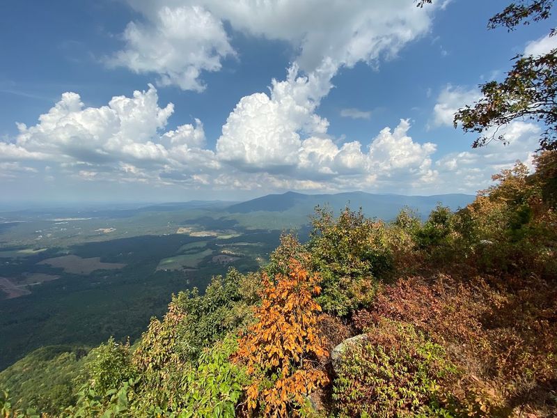
Tray Mountain Trail – Helen
Wild and remote, Tray Mountain rewards hikers willing to venture into Georgia’s backcountry with authentic wilderness experiences. At 4,430 feet, this peak offers both solitude and spectacular scenery without the tourist crowds found at more accessible locations.
The trail meanders through pristine forests where nature feels untouched and wildlife sightings happen regularly. Multiple route options exist for reaching the summit, ranging from moderate day hikes to challenging overnight backpacking trips.
Spring transforms the forest understory into a wildflower wonderland, with trilliums, violets, and lady’s slippers creating colorful displays along the path.
Several scenic overlooks punctuate the journey, each revealing different perspectives of the surrounding mountain wilderness. The summit area itself features a small clearing where views extend across wave after wave of forested ridges.
Water sources along the route require treatment, so bring a filter or purification tablets if planning a longer trek.
This trail connects with the Appalachian Trail system, making it part of a larger network for ambitious hikers. The isolated location means cell service is unreliable, so inform someone of your plans before heading out.
Black Rock Mountain Tennessee Rock Trail – Clayton
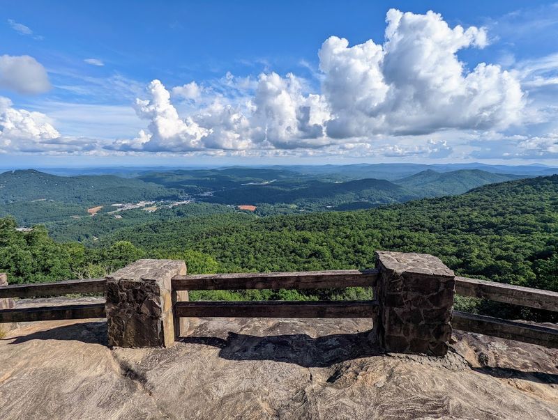
Perched at the highest elevations of any Georgia state park, Black Rock Mountain delivers consistently impressive vistas along its scenic trail network. The Tennessee Rock Trail creates a moderate loop that showcases multiple overlooks, each offering slightly different perspectives of the layered Blue Ridge ranges.
Rocky outcrops punctuate the forested path, providing natural viewing platforms where the mountains seem to roll on forever. Early morning fog often fills the valleys below, creating a sea of clouds effect that looks almost magical.
The park’s elevated position means you’re already starting above 3,000 feet, making the hiking relatively easy compared to trails that climb from lower elevations.
Interpretive signs along the route share information about the unique mountain ecosystem and local geology. Fall weekends draw significant crowds as leaf peepers seek the spectacular autumn colors visible from the overlooks.
The park offers camping facilities, making it possible to experience sunrise and sunset views without rushing.
Well-maintained trails and amenities make this destination family-friendly while still delivering authentic mountain scenery. The visitor center provides trail maps and current conditions information.
Amicalola Falls Approach Trail – Dawsonville

Combining waterfall grandeur with mountain majesty, this strenuous trail serves as the official southern approach to the Appalachian Trail. Starting near Georgia’s tallest waterfall, the route climbs relentlessly through elevation zones, offering constantly changing scenery.
The initial section passes Amicalola Falls, where 729 feet of cascading water creates a thunderous display. Steel staircases cling to the cliff face, providing close-up waterfall views and decent cardiovascular workout.
Beyond the falls, the trail enters a different character entirely, climbing through hardwood forests toward Springer Mountain.
Mountain ridgeline views emerge as you gain elevation, rewarding your effort with expanding vistas. Many Appalachian Trail thru-hikers begin their journey here, so you might encounter adventurers embarking on their 2,000-plus-mile trek to Maine.
The dramatic elevation gain – over 2,000 feet – makes this trail physically demanding but memorable.
Multiple bailout points exist along the route if you decide the full distance feels too ambitious. The state park at the trailhead offers lodging, camping, and dining options for those wanting to split the hike over multiple days.
Panther Creek Trail – Clarkesville
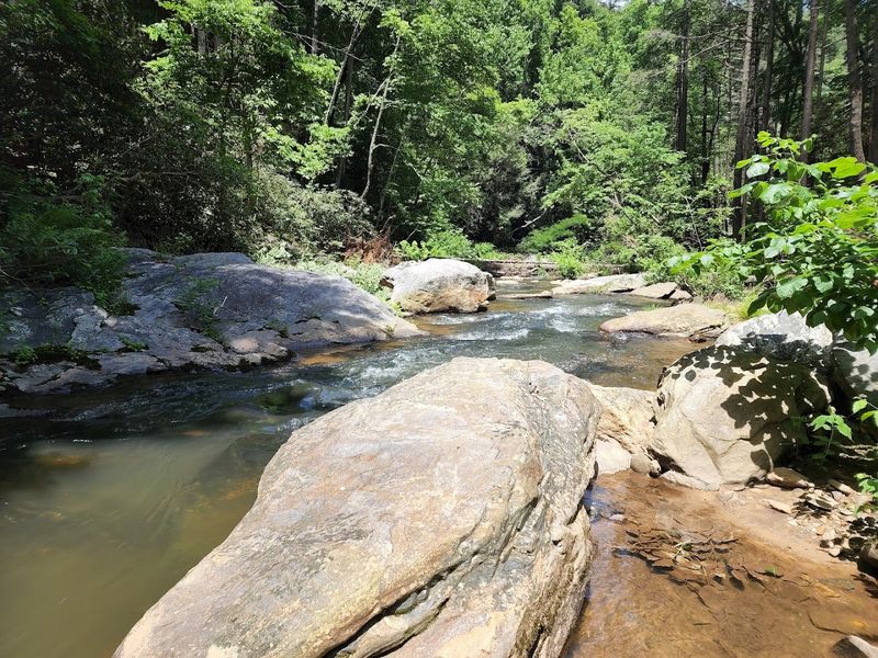
Adventure and beauty combine along this rugged trail that explores one of Georgia’s most dramatic creek valleys. While the waterfall gets most of the attention, the surrounding mountain scenery and challenging terrain make this hike memorable from start to finish.
The trail follows Panther Creek through a steep-sided valley where rocky cliffs rise on both sides. Two suspension bridges span the rushing water, adding excitement to your journey and providing excellent photo opportunities.
The remote location creates a wilderness atmosphere despite being relatively accessible from nearby towns.
Mountain valley views reveal themselves throughout the hike, with seasonal changes dramatically altering the landscape’s character. Spring brings wildflowers and rushing water, while summer offers cooling shade under the forest canopy.
The trail surface varies from smooth to rocky, with some sections requiring careful footing, especially after rain.
Reaching the main waterfall involves scrambling over boulders and navigating steep terrain, so wear appropriate footwear. The creek crossing required during low water adds another element of adventure.
This trail attracts serious hikers who appreciate rugged beauty over manicured paths and easy access.
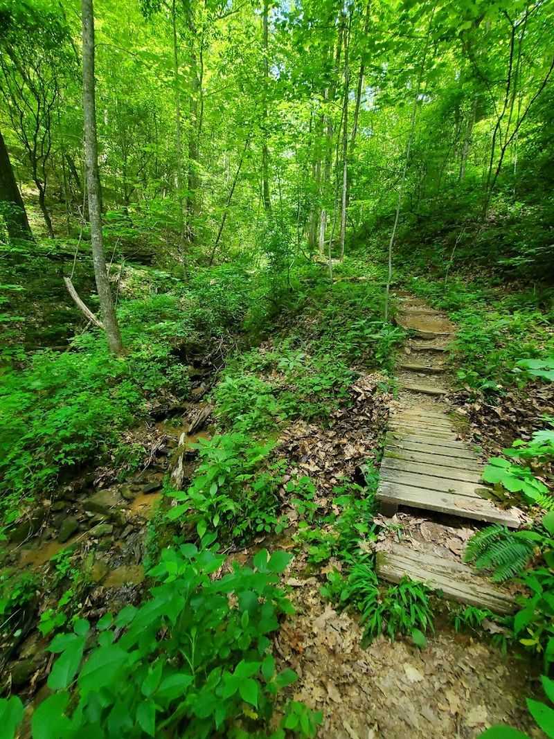
Fort Mountain Gahuti Trail – Chatsworth
Mystery and natural beauty intertwine along this fascinating loop that explores both mountain vistas and ancient history. The trail’s centerpiece – a mysterious 855-foot stone wall – has puzzled historians and archaeologists for generations, adding intrigue to your outdoor adventure.
Winding through mature hardwood forests and across mountain ridgelines, the path delivers consistent scenery punctuated by excellent viewpoints. The elevation changes remain moderate, making this trail accessible to intermediate hikers while still offering satisfying challenges.
Multiple overlooks provide opportunities to rest while enjoying mountain panoramas.
Autumn transforms the forest into a spectacular display of reds, oranges, and golds that contrast beautifully with the weathered stones of the ancient wall. The trail passes through diverse ecosystems, from dense rhododendron thickets to open ridgetop meadows.
Fort Mountain State Park provides well-maintained facilities, including a small lake, camping areas, and a historic fire tower you can climb for even better views.
The combination of cultural history and natural scenery makes this trail particularly appealing for families and history enthusiasts. Interpretive signs share theories about the wall’s origins and construction.
Cloudland Canyon Waterfalls Trail – Rising Fawn
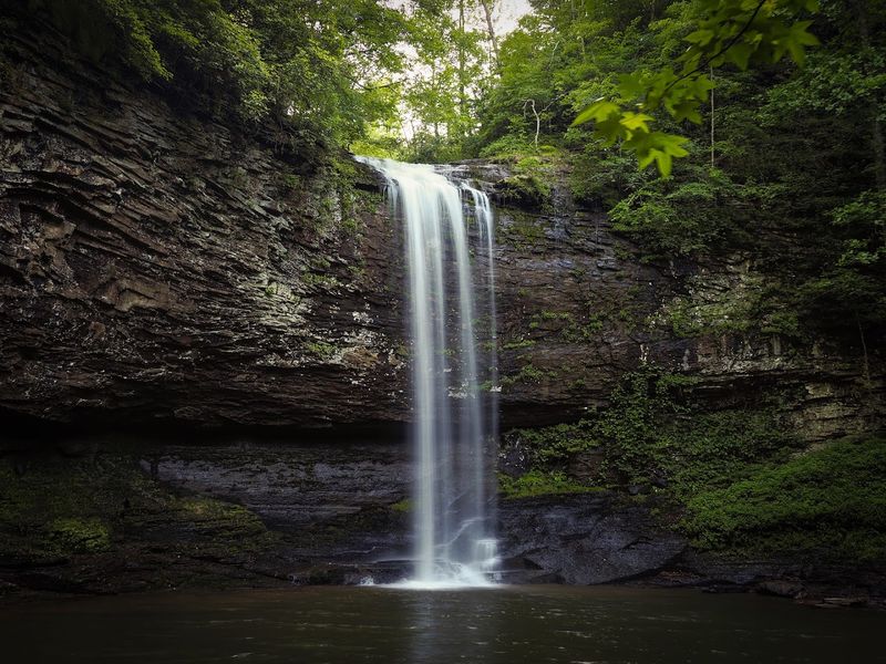
Descending into one of Georgia’s deepest canyons feels like entering another world entirely. Located atop Lookout Mountain, this trail plunges into a spectacular gorge where waterfalls cascade over ancient rock layers and sheer cliffs tower overhead.
The journey begins with a steep staircase descent – over 600 steps leading down into the canyon depths. Your legs will remember this section on the return climb, but the scenery makes every step worthwhile.
Two distinct waterfalls await at the bottom, each tumbling over sandstone ledges into cool, shaded pools.
The canyon walls reveal millions of years of geological history in their layered stone faces. Hemlock trees and rhododendrons thrive in the moist canyon environment, creating a lush ecosystem quite different from the plateau above.
The dramatic topography makes this trail unlike any other in Georgia, with views that rival western national parks.
Plan extra time for the strenuous climb back to the rim, and bring plenty of water. The state park offers spectacular overlooks even for visitors who prefer not to descend into the canyon.
Camping facilities allow overnight stays for those wanting to explore multiple trails.
Coosa Backcountry Trail – Vogel State Park
Experienced hikers seeking genuine backcountry challenges find exactly what they’re looking for on this demanding loop. The trail ventures deep into mountain wilderness near Blood Mountain, where civilization feels far away and nature reigns supreme.
This route demands respect and preparation, with significant elevation changes, multiple creek crossings, and sections of rugged terrain that test your skills. The rewards match the effort – expansive wilderness scenery, ridgeline viewpoints, and the satisfaction of completing a serious mountain trek.
Fewer crowds mean you’ll likely enjoy long stretches of solitude interrupted only by birdsong and wind through the trees.
The trail connects with other backcountry routes, creating options for extended trips and overnight camping. Creek crossings require careful attention, especially after heavy rain when water levels rise significantly.
Wildlife encounters happen regularly in this remote area, so practice proper food storage and bear safety protocols.
Navigation skills prove essential since some trail sections receive less maintenance than popular day hikes. Bring detailed maps, adequate supplies, and let someone know your itinerary.
The challenging nature of this trail keeps it relatively uncrowded even during peak seasons.