
Hidden in the Sierra Nevada foothills of Yuba County, Camptonville is a small California town that most travelers simply drive past without a second glance.
With fewer than 200 residents and no traffic lights in sight, this quiet mountain community sits just a short drive from one of the state’s most dramatic Gold Rush landmarks.
Malakoff Diggins State Historic Park, famous for its towering hydraulic mining cliffs, tells a story of ambition, destruction, and legal history that changed America forever.
If you love history, outdoor adventure, and finding places that feel genuinely off the beaten path, Camptonville deserves a spot on your California road trip map.
A Tiny Sierra Foothills Town Frozen in Time

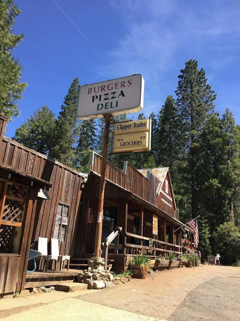
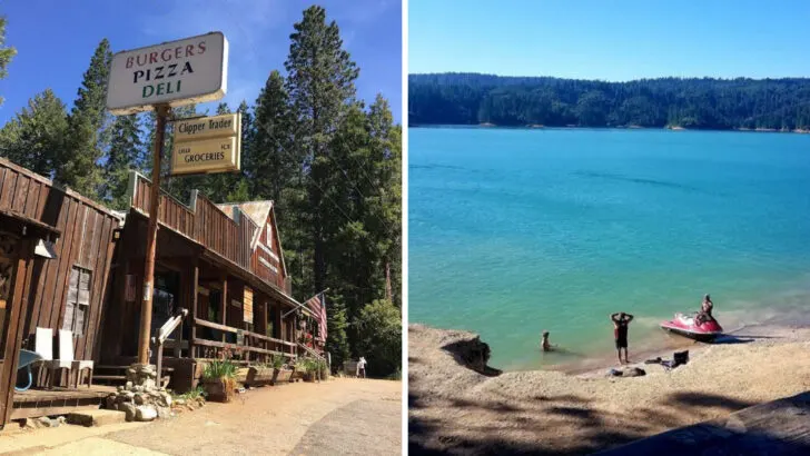
Camptonville doesn’t advertise itself, and that’s honestly part of its charm. Tucked along Highway 49 in Yuba County, this tiny community of just over 150 people sits perched between the North and Middle forks of the Yuba River, surrounded by dense pine forests and rugged canyon terrain.
Walking through town feels like stepping back several decades. There are no chain restaurants, no crowded parking lots, and no tourist traps—just a peaceful mountain setting that moves at its own slow, deliberate pace.
The air is clean, the roads are quiet, and the views are genuinely stunning.
For travelers who feel exhausted by over-touristed destinations, Camptonville offers something increasingly rare: real solitude. The town’s remote location actually works in its favor, keeping it sheltered from the commercial development that has changed so many other Gold Country communities.
Visitors often describe the experience as refreshingly unhurried. If you’re the kind of traveler who prefers wandering over planning, this little Sierra foothill town will feel like exactly the kind of hidden reward you’ve been searching for all along.
Deep Gold Rush Roots Still Shape the Town

Gold was discovered near this ridge in 1850, and the settlement that grew around it moved fast—the way Gold Rush towns always did. Originally called Gold Ridge, the community was renamed Camptonville in 1854, likely after Robert Campton, a local blacksmith who became an early fixture of the area.
The town quickly became an important stop along the Henness Pass route, one of the most heavily traveled wagon roads crossing the Sierra Nevada. Freight haulers, merchants, and miners all passed through, making Camptonville a lively and strategically valuable place during California’s most explosive era of growth.
Even today, that history feels close to the surface. Old structures, local stories, and the town’s layout all carry echoes of the 1850s.
The Gold Rush didn’t just bring people to this region—it built roads, shaped economies, and created communities that have quietly survived for over 170 years. Camptonville is one of those survivors.
Understanding its backstory adds a whole new layer of meaning to even a short visit, turning what might seem like just a small mountain town into a living piece of California’s most defining chapter.
The Perfect Base for Exploring a Legendary Mining Landscape
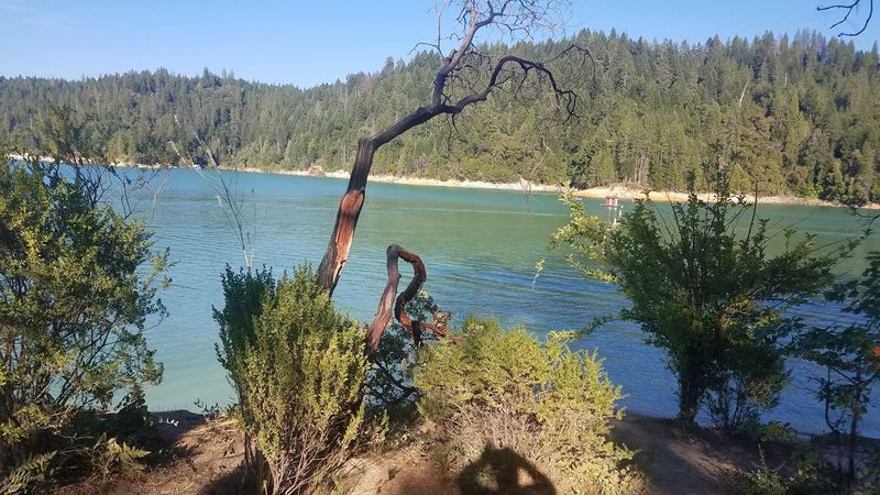

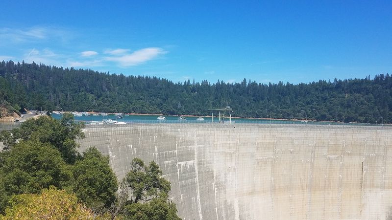
Just a short drive from Camptonville lies one of California’s most visually striking destinations: Malakoff Diggins State Historic Park. This is where the state’s largest hydraulic gold mining operation once roared to life, reshaping entire mountainsides with powerful jets of water and leaving behind a landscape that looks almost otherworldly today.
The cliffs at Malakoff Diggins rise dramatically from the earth in shades of red, orange, yellow, and white—colors created by layers of ancient sediment exposed by decades of high-pressure mining. Standing at the rim and looking down into the carved canyon below is genuinely breathtaking, the kind of sight that makes you reach for your camera immediately.
Using Camptonville as your home base gives you a quieter, more local-feeling alternative to staying in Nevada City. The drive between the two areas takes you through beautiful Gold Country scenery, and arriving at the park from the north side offers a slightly different perspective than the standard approach.
For history lovers and outdoor explorers alike, having Malakoff Diggins this close to a peaceful overnight base is a genuinely excellent travel combination worth planning around.
Where a Ghost Town Tells the Story of Boom and Bust
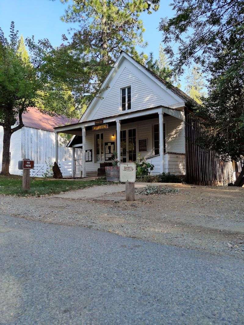
Inside Malakoff Diggins State Historic Park, the ghost town of North Bloomfield waits quietly for curious visitors. At its peak in the 1870s and 1880s, North Bloomfield supported thousands of residents, complete with hotels, saloons, a church, a schoolhouse, and all the chaos of a booming mining economy.
When hydraulic mining was legally shut down in 1884, the town emptied out almost overnight. People packed up and moved on, leaving behind structures that have since been carefully restored by the California Department of Parks and Recreation.
Walking through North Bloomfield today feels genuinely eerie in the best possible way—like the town is simply waiting for everyone to come back.
Guided tours run seasonally and offer fascinating detail about daily life during the mining era. Rangers bring the history alive with stories about the workers, the families, and the dramatic legal battles that ended the operation.
For younger visitors especially, seeing a real ghost town—not a staged theme park version—makes history feel tangible and real. North Bloomfield is one of those places that stays with you long after you’ve driven back down the mountain and returned to ordinary life.
A Landscape That Changed American Environmental Law
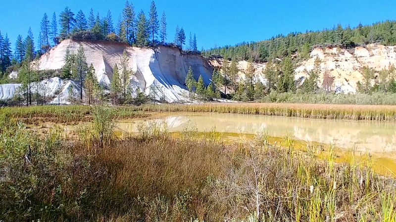
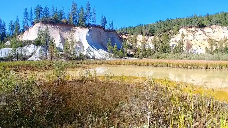
Hydraulic mining at Malakoff Diggins was enormously productive—and enormously destructive. Billions of gallons of water were blasted into hillsides, sending rivers of mud and gravel cascading into the Yuba River and eventually downstream into the Sacramento Valley.
Farms flooded. Towns were buried.
Sacramento itself was threatened.
The backlash came from farmers and valley residents who had watched their land disappear under mining debris. In 1884, Judge Lorenzo Sawyer issued a landmark ruling in the case of Woodruff v.
North Bloomfield, effectively banning hydraulic mining and halting the destruction. It was one of the first times in American history that industrial operations were legally stopped to protect the environment.
That ruling echoes forward into modern environmental law in ways that are still studied in law schools today. Visiting Malakoff Diggins with this context in mind transforms the experience completely.
Those eroded cliffs and scarred hillsides aren’t just dramatic scenery—they’re the physical evidence of a legal and ecological turning point. Few outdoor destinations in California carry this kind of layered historical weight, which makes the park genuinely worth exploring beyond its obvious visual appeal.
Hiking Through a Dramatic Gold-Scarred Wilderness
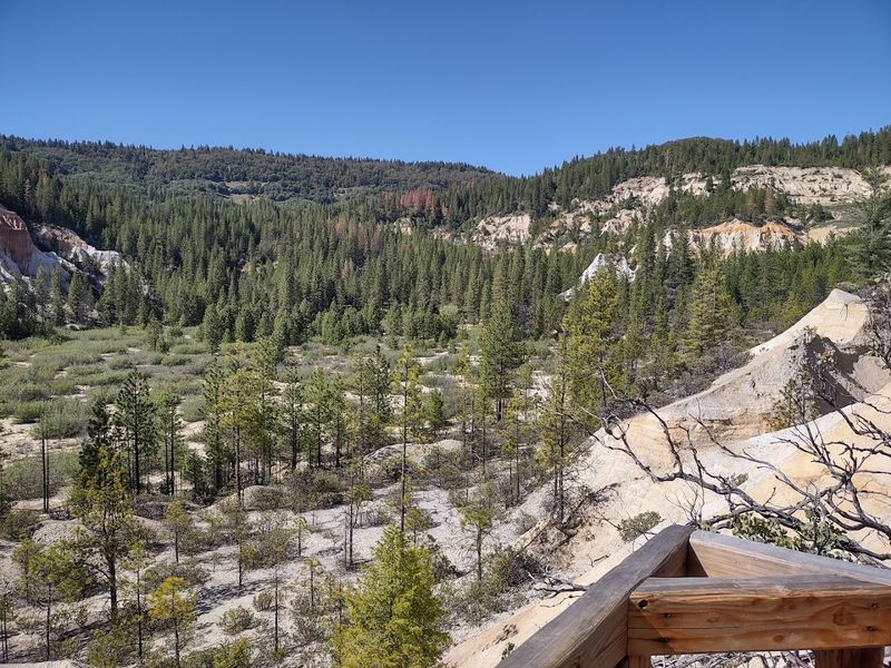
More than 20 miles of trails wind through Malakoff Diggins State Historic Park, offering hikers a rare chance to move through a landscape that looks unlike almost anywhere else in California. The terrain shifts constantly—from shaded pine forest to open canyon rims to exposed mining pits filled with standing water and eerie silence.
The Diggins Loop is one of the most popular routes and for good reason. It takes you directly past the most dramatic cliff formations, where ancient riverbeds and layered sediment tell a geological story stretching back millions of years.
The colors in the rock walls—deep reds, pale yellows, chalky whites—feel more like a painting than a real place.
Trail conditions vary by season, so checking with the park before visiting is always a smart move. Spring brings wildflowers and rushing water, while fall delivers golden light and cooler temperatures that make longer hikes genuinely enjoyable.
Sturdy shoes are a must, as some sections involve uneven terrain. Whether you’re an experienced hiker or someone who just enjoys a scenic afternoon walk, the trails here deliver memorable payoff at nearly every turn without requiring serious technical skill.
A Quiet Gateway to Outdoor Adventure
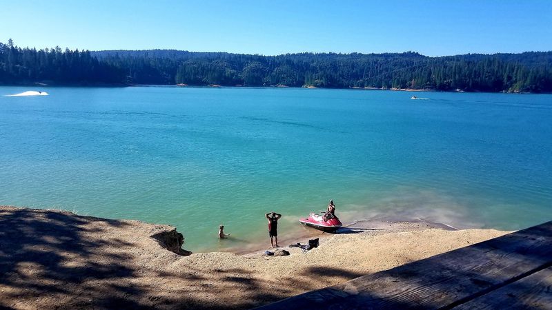
Camptonville sits at an elevation that gives it a little bit of everything when it comes to outdoor recreation. Summer brings warm days perfect for fishing along the Yuba River, hiking forest trails, and camping under a sky full of stars with almost no light pollution in sight.
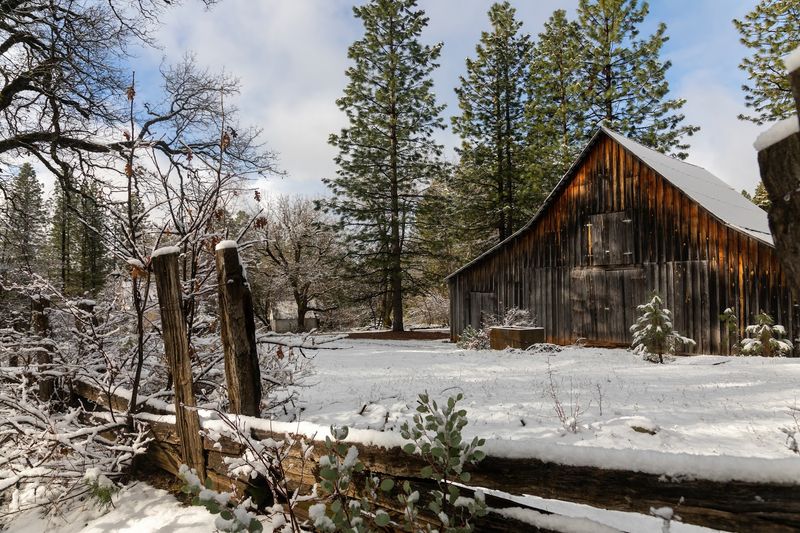
Winter transforms the landscape into something quieter and more introspective. Snowshoeing through the pine forest above town is a genuinely peaceful experience that very few people outside the local community seem to know about.
The roads can get icy, so winter visits require a little more preparation, but the solitude you get in return is absolutely worth the extra planning.
Spring is arguably the most dramatic season in this part of the Sierra foothills. Snowmelt fills the rivers and creeks to roaring levels, wildflowers push through the forest floor, and the whole landscape feels newly alive after months of cold quiet.
The area around Camptonville doesn’t have the polished recreational infrastructure of more famous outdoor destinations, but that’s exactly why it works so well for travelers who prefer their adventures a little rough around the edges and completely crowd-free.
A Community That Still Feels Authentic and Close-Knit
Spend even a few hours in Camptonville and you’ll notice something that’s become genuinely hard to find in California’s more popular destinations: people who actually know each other. This is a community where neighbors look out for neighbors, where local events still draw most of the town, and where strangers are greeted with actual friendliness rather than polite indifference.
The town’s small size has helped preserve that tight social fabric. With fewer than 200 residents, Camptonville hasn’t been overwhelmed by the kind of rapid growth that can quietly hollow out a community’s identity.
The local volunteer fire department, the community center, and informal gatherings along the main road all reflect a place that still functions as a true neighborhood rather than just a dot on a map.
For visitors, this authenticity is part of the appeal. Talking to a long-time resident about the area’s history, grabbing a conversation at the local store, or simply sitting quietly and watching the rhythm of daily life unfold—these small moments often become the most memorable parts of a trip.
Camptonville doesn’t perform for tourists. It simply exists, and that honesty is rarer and more refreshing than any curated attraction could ever be.
Scenic Drives Through California’s Historic Gold Country
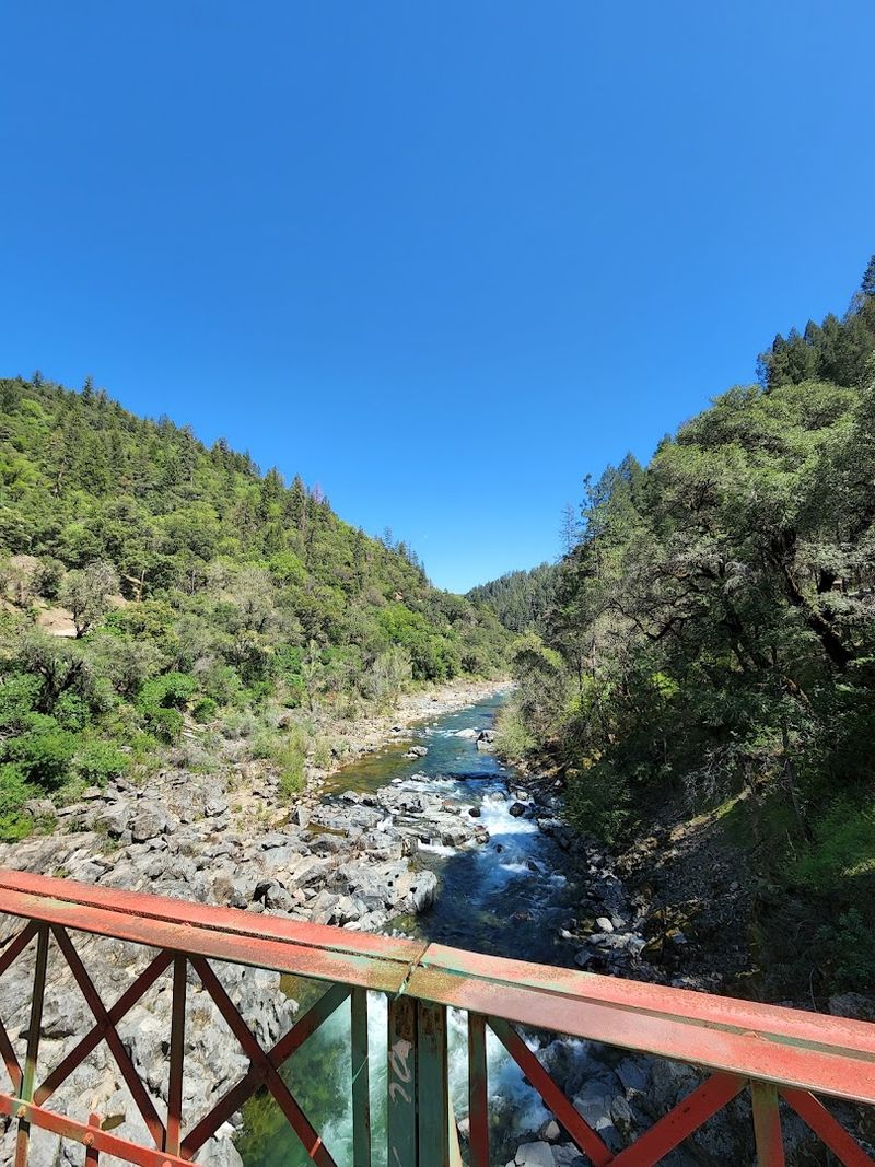
Getting to Camptonville is half the adventure. Highway 49 is one of California’s most scenic drives, threading through the Sierra Nevada foothills past historic mining towns, forested ridges, and deep river canyons that open up unexpectedly around every other bend.
The road itself feels like a history lesson delivered at 40 miles per hour.
Approaching from Nevada City to the south takes you through some of the prettiest Gold Country scenery in the state. Approaching from Downieville to the north means dropping down through steep canyon walls along the North Fork of the Yuba River—a stretch of road that regularly stuns first-time visitors into pulling over just to stare.
Pack a camera, take your time, and resist the urge to rush. The sweeping ridgeline views, the old stone bridges, and the occasional historic marker all reward travelers who slow down and pay attention.
This is not a drive for distracted commuters—it’s a drive for people who still believe the journey matters as much as the destination. Camptonville sits right in the middle of this scenic corridor, making it a natural stopping point that most GPS systems somehow forget to recommend.
Essential Visitor Information for Planning Your Trip
Camptonville sits in northeastern Yuba County along Highway 49, roughly between the towns of Nevada City to the south and Downieville to the north. Both towns make useful reference points when planning your route, and both are worth a stop if you have extra time built into your itinerary.
Malakoff Diggins State Historic Park is approximately 26 miles from Nevada City and can be reached via a combination of paved and partially unpaved roads. The park charges a day-use fee, and facilities include restrooms, picnic areas, hiking trails, and a small visitor center.
Camping is available inside the park at Blair Lake, which offers a genuinely lovely overnight option for those who want to stay close to the historic site.
Spring through fall is generally the best window for visiting, with summer offering the most reliable road conditions and the widest range of activities. Winter visits are possible and can be magical for those who enjoy snowshoeing and quiet mountain solitude, but chains or four-wheel drive may be required on access roads.
Cell service in the area is limited, so downloading offline maps before you leave is strongly recommended for a smoother, less stressful experience overall.