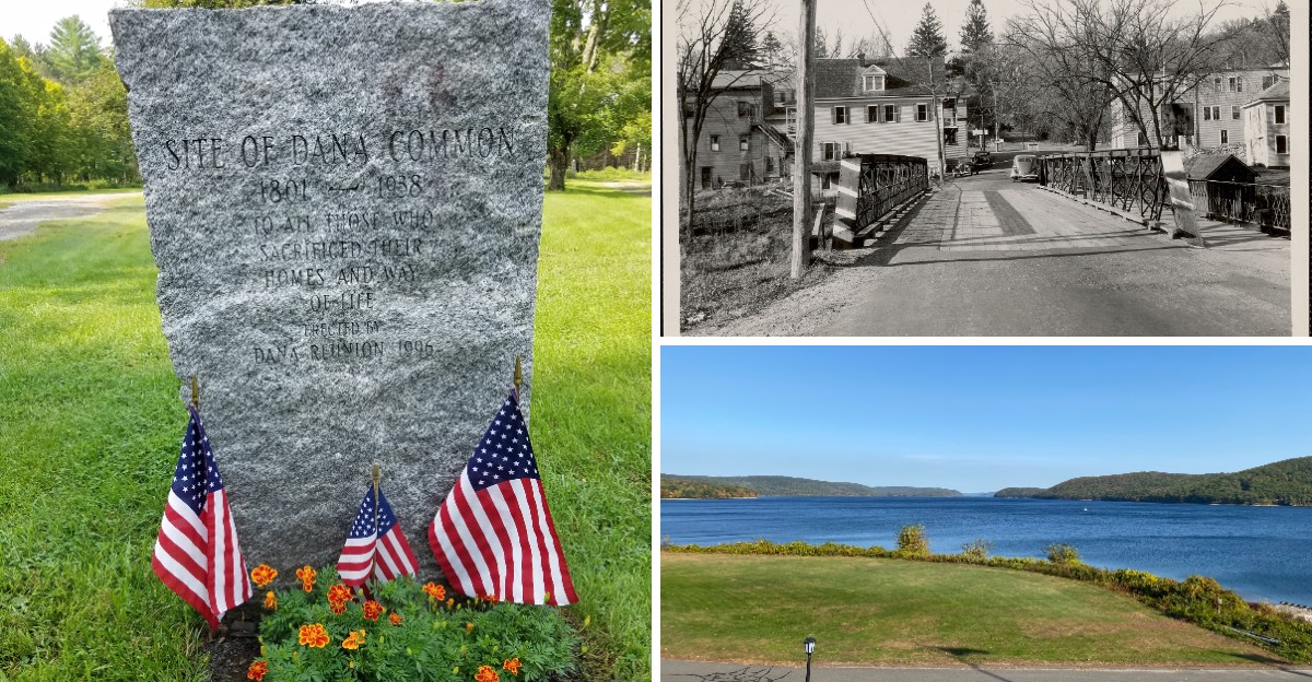
Four Massachusetts towns vanished beneath the water, and the story is stranger than fiction.
Before Quabbin Reservoir stretched across central Massachusetts, the Swift River Valley was home to Dana, Enfield, Greenwich, and Prescott.
Families lived there, farms filled the countryside, churches and schools served their communities, and roads connected neighbors from one town to the next.
Then came a massive water project designed to supply Boston with drinking water.
Homes were removed, cemeteries were relocated, and entire communities were dismantled as the valley prepared to disappear beneath the rising reservoir.
Today, peaceful water covers the places where those towns once stood.
Yet their stories haven’t vanished completely.
Historic remnants, old roads, Dana Common, and visitor sites around Quabbin offer clues to the communities that were lost forever beneath these remarkable waters.
The Quabbin Reservoir Changed the Map of Massachusetts
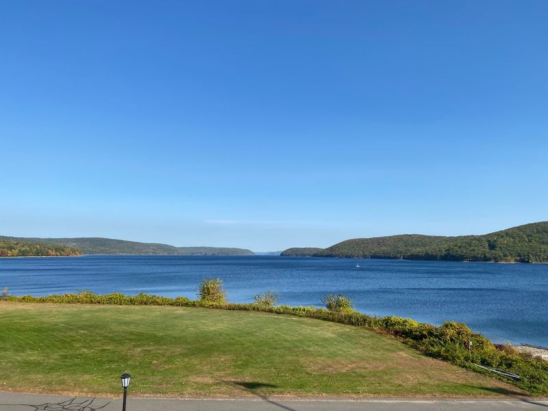
Massachusetts needed to solve a growing problem in the early 1900s. Boston and surrounding cities were running out of drinking water as populations exploded.
State planners looked at maps and found their answer in the Swift River Valley, a rural area about 65 miles west of Boston.
The solution they created became one of the largest public works projects in American history. Quabbin Reservoir now covers roughly 39 square miles and holds an astounding 412 billion gallons of water.
That’s enough to fill over 624,000 Olympic-sized swimming pools.
Building this enormous reservoir meant completely transforming the landscape. Rivers were rerouted, valleys were flooded, and an entire region disappeared beneath the surface.
Today, Quabbin ranks among the largest man-made public water supplies in the United States.
The reservoir doesn’t just provide water for Boston anymore. It serves dozens of communities across eastern Massachusetts, delivering fresh drinking water to millions of people every single day.
The sacrifice of the Swift River Valley made modern life possible for a huge portion of the state’s population.
Four Towns Were Officially Disincorporated in 1938
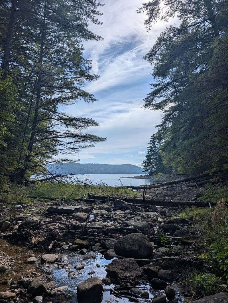
April 28, 1938, marked the end of four Massachusetts towns. Dana, Enfield, Greenwich, and Prescott officially ceased to exist on that spring day.
State officials gathered paperwork, signed documents, and formally removed these communities from the map of Massachusetts.
Disincorporation sounds like a boring legal term, but it represented something heartbreaking. Families who had lived in these towns for generations watched their hometowns disappear.
Churches where people married, schools where children learned, and shops where neighbors gathered all became nothing more than memories.
After disincorporation, the land didn’t just sit empty. Parts of the former towns were absorbed into neighboring communities like Petersham, New Salem, Ware, and Belchertown.
Property lines were redrawn across what used to be town centers and residential neighborhoods.
Historical records preserve the last days of these towns in photographs, census data, and personal accounts. Researchers and descendants still study these materials today, piecing together what daily life looked like before the reservoir changed everything forever.
Dana Was a Farming Community With a Surviving Common
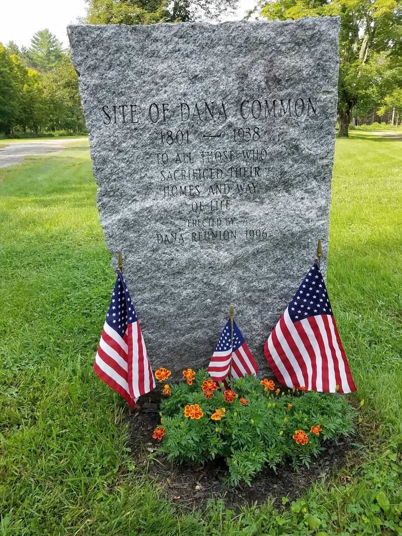
Walk through Dana Common today and you’ll step into a landscape frozen between past and present. Unlike the other lost towns, Dana’s central common area sits on higher ground that stayed above the waterline.
Stone foundations, cellar holes, and a granite monument mark where homes and buildings once stood.
Before 1938, Dana was classic New England farmland. Families raised crops and livestock across rolling hills.
The town had everything a small community needed, including stores, a post office, schools, and several churches serving different congregations.
The National Park Service recognizes Dana Common as the best-preserved and most accessible remnant of the four drowned towns. Visitors can actually walk the same paths residents once traveled.
Trees now grow where houses stood, but the layout of the old village remains visible if you know where to look.
Historical markers help visitors understand what they’re seeing. Old photographs displayed at the site show buildings that disappeared decades ago.
Dana Common serves as an outdoor museum where history comes alive through landscape rather than walls and display cases.
Enfield Was One of the Valley’s Larger Communities
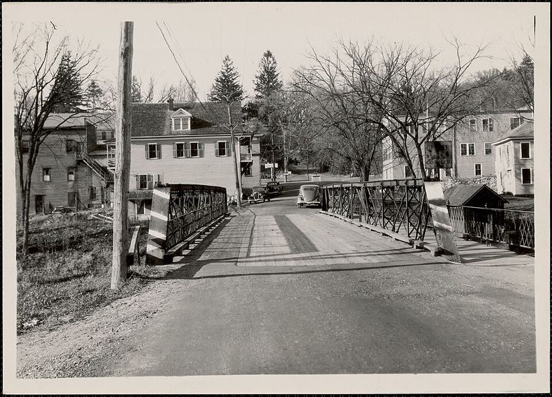
Enfield wasn’t some tiny hamlet that barely showed up on maps. This was a real town with a bustling community life and hundreds of residents calling it home.
In the years right before disincorporation, families worked farms, ran businesses, attended schools, and worshiped in local churches across Enfield’s landscape.
Main Street ran through town just like in countless other New England villages. Kids walked to school along familiar roads.
Adults gathered at stores to buy supplies and catch up on local news. The town had its own identity, its own stories, and its own tight-knit social fabric.
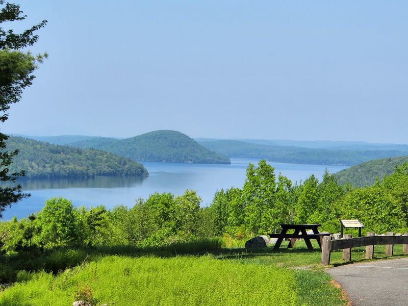
Today, Enfield Lookout provides one of the most poignant viewing spots around Quabbin Reservoir. Standing at this overlook, visitors gaze across the water toward where Enfield once thrived.
On calm days, the reservoir’s surface appears peaceful and timeless.
But beneath those waters lie the foundations of homes, the remains of roads, and the buried history of an entire community. Enfield Lookout reminds visitors that beautiful landscapes sometimes hide heartbreaking stories just below the surface.
Greenwich Had Roads, Railroads, Farms, and Its Own Community Life
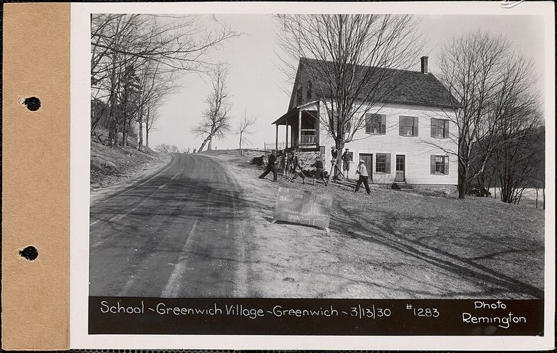
Railroad tracks once cut through Greenwich, connecting the town to the wider world. Trains brought goods, mail, and travelers through the Swift River Valley.
The sound of train whistles echoed across farmland where families had worked the soil for generations.
Greenwich had everything that made a town complete. Schools educated local children.
Churches served as centers for spiritual and social life. Roads connected neighbors to each other and to surrounding communities.
Farms produced crops and dairy products that sustained both residents and regional markets.
Archaeological evidence and historical records now provide the only proof Greenwich ever existed. Much of the landscape disappeared under reservoir waters during the 1930s and 1940s.
Buildings were dismantled, roads were relocated, and the railroad connection through the valley was severed forever.
Researchers still study old maps, photographs, and written accounts to understand Greenwich’s layout and daily life. These materials reveal a complex, functioning community rather than some primitive backwater.
Greenwich residents lived full lives with modern conveniences for their era, right up until the reservoir project ended their town’s existence.
Prescott Was the Smallest of the Four Lost Towns
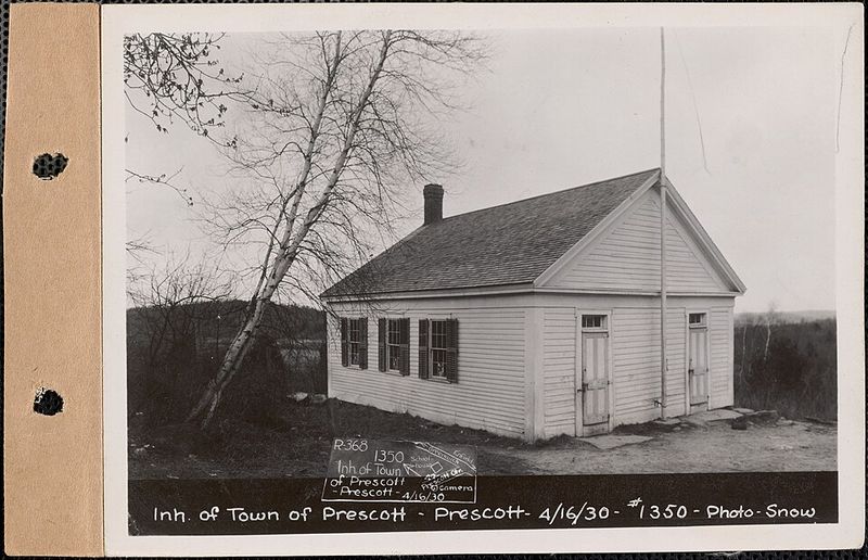
By the time reservoir planners arrived, Prescott had already begun fading away. Census records tell a story of steady decline: 48 residents remained in 1930, but only 18 people still called Prescott home by 1935.
Earlier decades had seen much larger populations living and working throughout the town.
Economic changes had already pushed people away before the state decided to flood the valley. Younger generations moved to cities seeking better opportunities.
Farms struggled to compete with more productive agricultural regions. Prescott shrank while other Massachusetts communities grew.
When workers began clearing the valley, they found fewer structures to remove in Prescott than in the other three towns. Buildings were dismantled or relocated to other areas.
Crews filled in cellar holes and removed evidence of habitation. The clearing process transformed farmland and residential areas into empty landscape ready for flooding.
Prescott’s small size meant fewer families faced displacement, but the loss was no less real for those who had to leave. Each departing resident carried memories of a hometown that would soon exist only in photographs and stories passed down through generations.
More Than 2,000 People Had to Leave the Valley
Imagine being told your hometown will cease to exist. More than 2,000 people faced exactly this reality when Massachusetts decided to create Quabbin Reservoir.
Families who had lived in the valley for generations suddenly needed to find new places to live, new communities to join, and new ways to maintain connections with displaced neighbors.
The reservoir project required removing approximately 650 houses from the valley. Workers also dismantled or relocated hundreds of barns, sheds, businesses, and community buildings.
Some structures were carefully moved to other towns where they still stand today, creating an unusual architectural legacy scattered across the region.
People didn’t just lose homes. They lost the corner store where everyone knew their name.
They lost the church where their grandparents married. They lost the schoolyard where their children played.
They lost cemeteries where ancestors rested. The displacement shattered entire social networks built over lifetimes.
Compensation came in the form of money, but cash couldn’t replace community. Many displaced families stayed in touch with former neighbors, gathering for reunions and sharing memories.
These connections helped preserve the identity of towns that no longer existed on any official map.
Thousands of Graves Were Moved Before the Valley Was Flooded
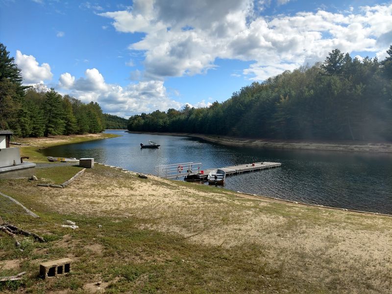
Picture workers carefully opening grave after grave, removing remains that had rested peacefully for decades or even centuries. This haunting task became necessary before reservoir waters could rise.
Cemeteries throughout the valley had to be relocated, creating one of the most emotionally difficult aspects of the entire Quabbin project.
Massachusetts archival records document approximately 7,500 bodies associated with affected cemeteries. State historical material records more than 7,600 known graves that workers disinterred from the valley.
These numbers represent families, individuals with stories, and ancestors whose final rest was disturbed for the sake of public water supply.
Most relocated remains found new resting places at Quabbin Park Cemetery, a specially created burial ground. Workers tried to maintain family groupings when possible.
Headstones and monuments were carefully moved and reset. Despite these efforts, the process remained disturbing for descendants watching their family burial grounds disappear.
Some smaller family cemeteries were relocated to other local graveyards. Historical societies and genealogical organizations maintain records of these moves.
Descendants today can trace where their ancestors were originally buried and where their remains rest now.
The Valley Was Cleared Before the Water Came
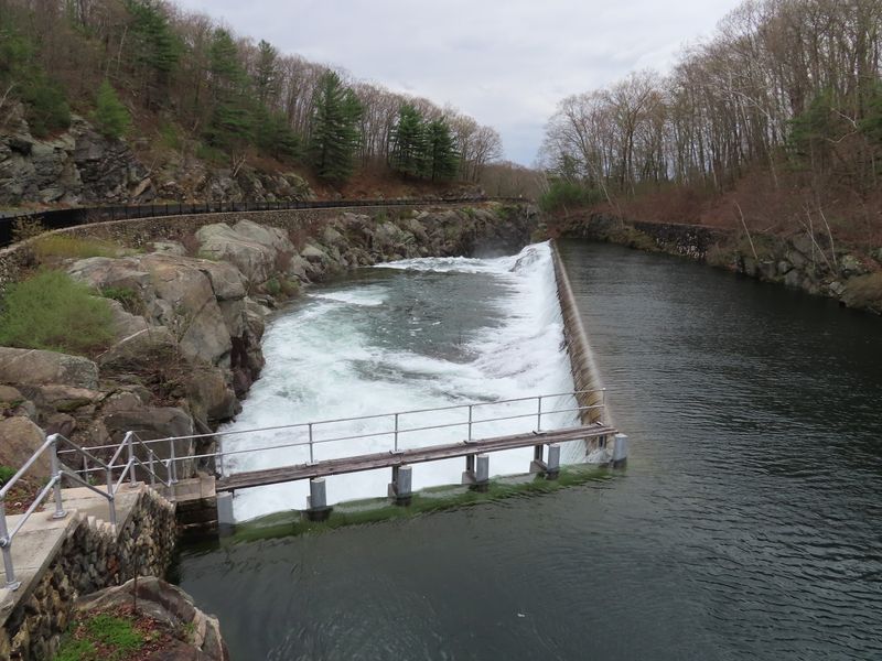
Building Quabbin Reservoir took more than just constructing a dam and waiting. The process stretched across more than a decade of intensive preparation.
Workers systematically cleared the valley of everything that would contaminate the future water supply or create problems as water levels rose.
Homes came down piece by piece. Roads were ripped up and relocated.
Telephone and electric lines were removed. Trees were cut and cleared.
Any structure that would decay underwater needed to go. The valley had to become essentially empty before flooding could begin.
Construction of major structures began in the early 1930s. Winsor Dam, the primary dam, took years to build.
Goodnough Dike provided additional water control. These massive engineering projects required enormous amounts of concrete, steel, and human labor.
Hundreds of workers lived in temporary camps throughout the construction period.
The reservoir didn’t fill overnight. After gates closed and the Swift River was allowed to back up, water gradually rose over several years.
Slowly, the cleared valley transformed into the enormous reservoir visible today. That gradual flooding gave the project a sense of inevitability that made it even harder for former residents to accept.
You Can Still Explore the Story of the Lost Towns Today
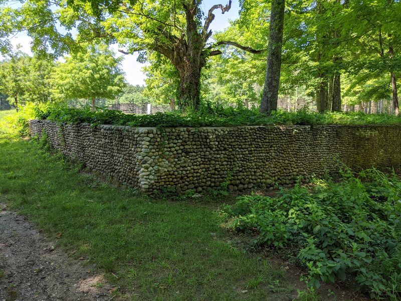
History doesn’t have to stay buried beneath the water. Multiple sites around Quabbin Reservoir help visitors connect with the story of the lost towns.
Enfield Lookout offers panoramic views across the water toward where communities once thrived. Dana Common provides accessible trails through the preserved remnants of that former town.
The Quabbin Visitor Center serves as headquarters for learning about reservoir history. Exhibits display photographs showing towns before destruction.
Maps illustrate where streets and buildings once stood beneath current water levels. Interpretive programs bring the human stories to life through presentations and guided tours.
Archival materials preserved by local historical societies contain even more detailed information. Photographs, census records, newspaper clippings, and personal accounts document daily life in the valley.
Researchers and descendants regularly consult these materials to understand their heritage and preserve memories of the lost communities.
The modern Quabbin operates under strict protection as a drinking water supply. Access and recreation are carefully regulated to maintain water quality.
Visitors must follow rules, but thoughtful management ensures people can still explore this landscape while respecting its current purpose and historical significance.