Iowa has a secret that looks nothing like the rest of the state.
Along western Iowa, the Loess Hills rise in steep, unexpected waves above the Missouri River Valley, creating a drive that feels almost otherworldly.
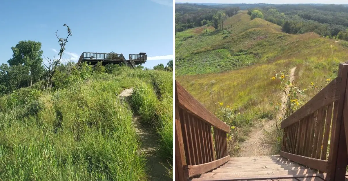
Near Moorhead, the Loess Hills Scenic Overlook puts you right in the middle of it all. An accessible viewing platform opens onto rolling prairie, deep valleys, and ridges that seem to stretch forever.
But the real fun starts when you keep driving.
Gravel roads, quiet trails, wooded hills, and roadside viewpoints turn this stretch of western Iowa into a road-trip adventure.
You can make a quick stop for the views or spend an entire day chasing one scenic turn after another.
Once you see these remarkable hills for yourself, it’s easy to understand why Iowans keep coming back.
Loess Hills Scenic Overlook
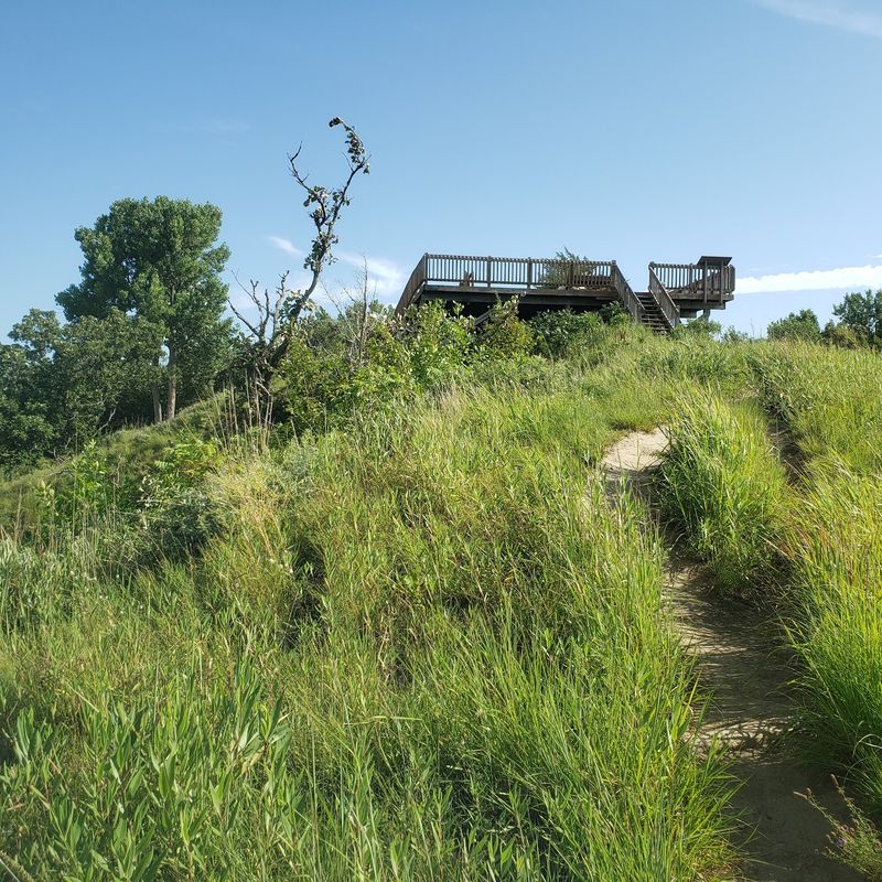
Pull into the small parking area off Oak Avenue and you’ll find one of Iowa’s most striking viewpoints waiting just a few steps away. The wooden viewing platform extends out over the landscape, wheelchair and stroller accessible, giving everyone a chance to stand above the forest and look out across prairie ridges.
Interpretive panels line the deck, offering explanations about how wind-deposited silt built these unusual hills over thousands of years. The landscape feels different from typical Iowa farmland, with steep slopes and narrow ridgetops creating patterns that seem more like the western mountains.
On clear days, the view stretches for miles.
Photography enthusiasts visit at sunrise and sunset when golden light washes across the grasses and shadows define every curve of the hills. Trails branch from the overlook, so a quick photo stop can easily turn into an hour or more exploring the surrounding forest.
It’s the kind of place that rewards both brief visits and longer explorations.
Preparation Canyon State Park
History adds an unexpected layer to this scenic stop. Back in the 1850s, a religious community settled in these hills, preparing for the end of the world.
Their story ended without apocalypse, but the name stuck, and the park now preserves both the unusual landscape and the traces of that curious chapter.
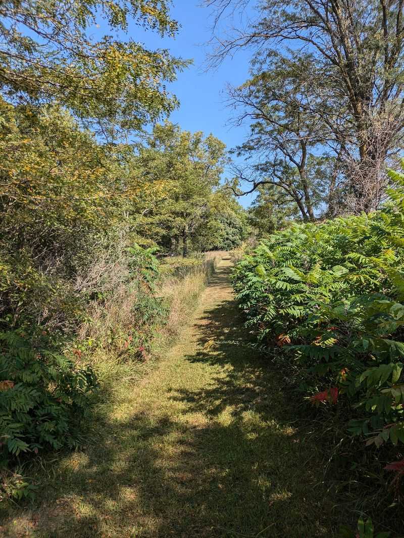
Hiking trails wind through the steep terrain, climbing ridges and dropping into valleys that feel worlds away from Iowa’s gentler landscapes. The park sits right along the scenic drive route, making it an easy addition to any overlook visit.
Spring wildflowers carpet the hillsides, while fall brings prairie grasses in shades of gold and copper.
Most visitors combine the park with the nearby overlook, spending a couple of hours walking trails and taking in views from different angles. The terrain challenges your legs but rewards the effort with perspectives that shift with every turn.
Pack water and wear good shoes, especially if you plan to tackle the steeper sections.
Loess Hills State Forest
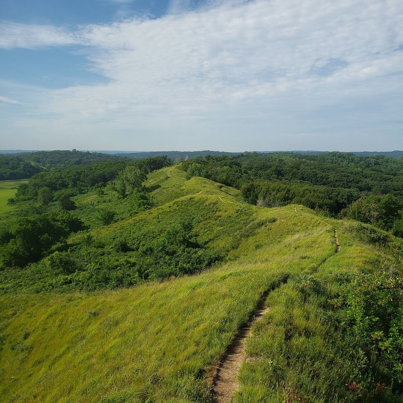
The Preparation Canyon Unit forms just one piece of a much larger protected area that stretches across western Iowa. Thousands of acres of prairie, woodland, and steep terrain create habitat for species rarely found elsewhere in the state.
Driving the forest roads feels like discovering a secret landscape hidden in plain sight.
Rather than rushing between viewpoints, slow down and explore the back roads that crisscross the forest. Gravel tracks lead to quiet spots where prairie grasses wave in the wind and hawks circle overhead.
Some roads climb to ridge tops, while others follow valleys where trees create cool, shaded corridors.
Wildlife spotting improves with patience here. Deer browse the hillsides, wild turkeys cross the roads, and if you’re lucky, you might spot bobcats or coyotes in early morning or evening hours.
The forest feels expansive despite being surrounded by farmland, offering a genuine sense of wilderness. Bring binoculars and allow extra time for unexpected discoveries along the way.
Oak Avenue Scenic Drive
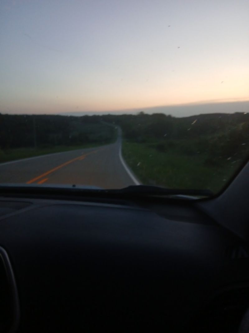
Forget highways and smooth pavement. Oak Avenue takes you deeper into the hills on a route that feels adventurous rather than routine.
The gravel surface means slower speeds, which actually works in your favor when the landscape keeps tempting you to pull over for photos.
This back road approach to the overlook and surrounding recreation areas adds character to the journey. Dust kicks up behind your vehicle, grasshoppers bounce across the hood, and the scenery changes around every bend.
After rain, conditions can get muddy, so check weather and road status before heading out.
Local drivers know this route well, but tourists often stumble upon it by accident and end up calling it the highlight of their trip. The combination of rough road and stunning views creates memories that polished scenic highways rarely deliver.
Cell service can be spotty, so download maps before you go and fill your gas tank in the nearest town. Embrace the slower pace and you’ll understand why this dusty road matters.
Murray Hill Scenic Overlook
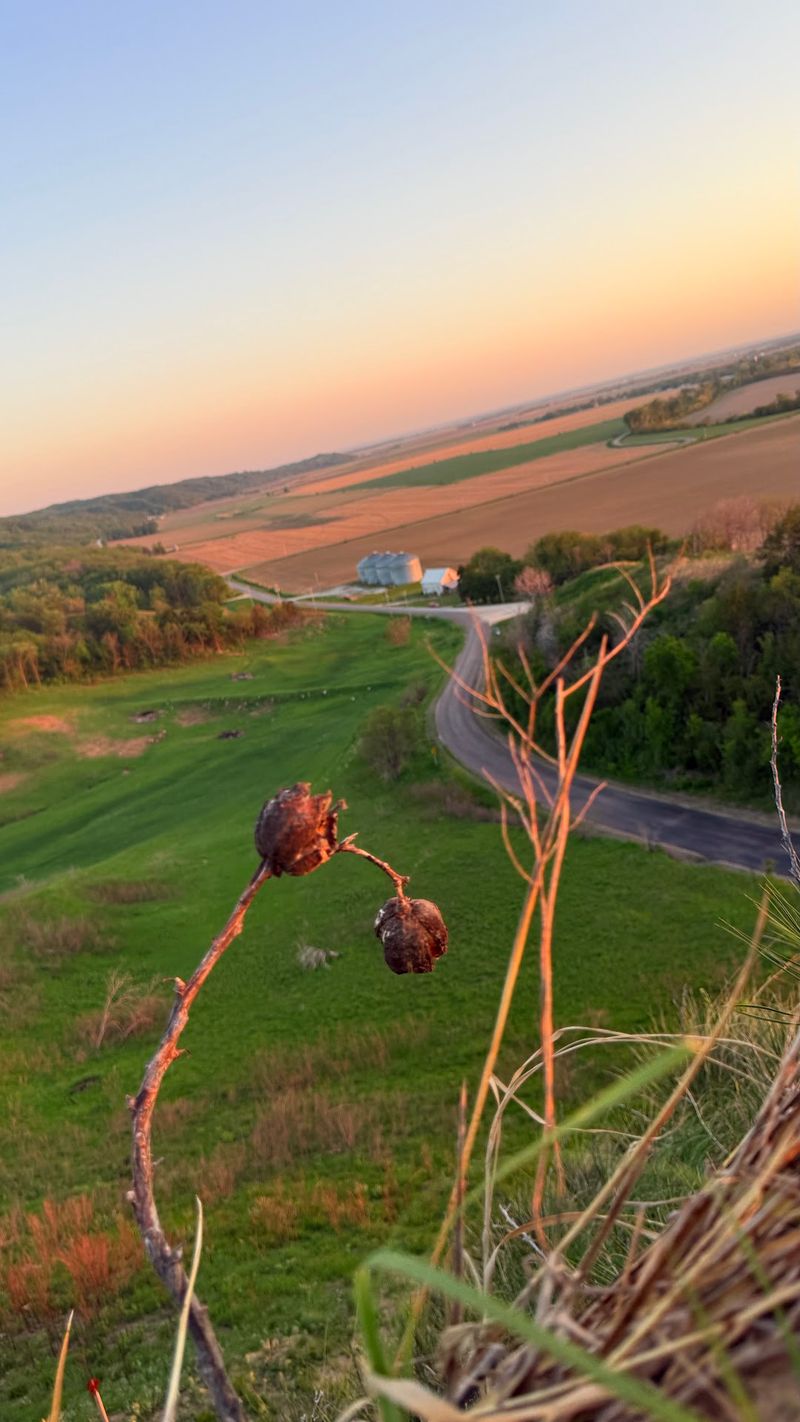
Continue north from Moorhead and you’ll find another reason to stop and climb. Murray Hill requires a short hike through tallgrass prairie to reach the viewpoint, but the effort pays off with panoramic views across the Missouri River Valley.
Interpretive signs along the trail explain the ecology of this rare landscape.
Bird watchers come here deliberately. The overlook sits within a designated Loess Hills Bird Conservation Area, protecting habitat for species that depend on prairie and woodland edges.
Spring migration brings warblers, tanagers, and other songbirds, while summer residents include dickcissels and grasshopper sparrows singing from the grasses.
The trail isn’t difficult, but it does climb steadily through open terrain with little shade. Visit early morning or late afternoon to avoid midday heat, and you’ll also catch the best light for photography.
Binoculars help you pick out details in the valley below, where the broad, flat landscape contrasts sharply with the steep hills. Pack snacks and plan to linger at the top.
Loess Hills State Forest Visitor Center
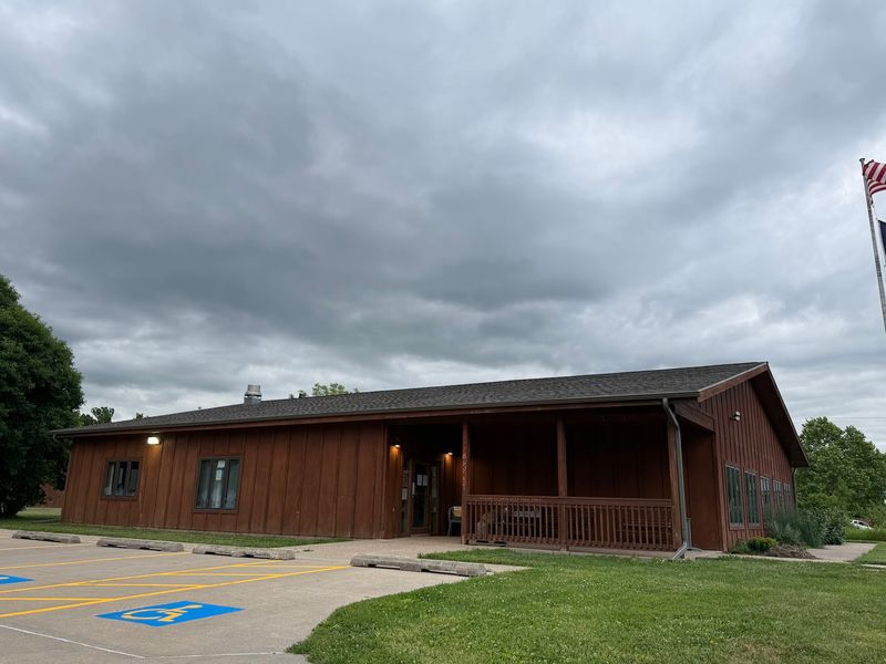
Stop in Pisgah before or after your drive and the visitor center will add context to everything you’ve seen from the road. Exhibits explain how these hills formed, which species call them home, and why this landscape exists in only one other place on Earth.
That fact alone makes the stop worthwhile.
Staff members answer questions about trails, road conditions, and current wildlife activity, helping visitors plan their routes more effectively. Maps show the full extent of the state forest and highlight lesser-known access points worth exploring.
Kids enjoy the hands-on displays that let them touch soil samples and examine prairie plants up close.
Timing your visit to the center before heading into the hills means you’ll know what to look for as you drive. Recognizing bird songs, identifying prairie grasses, and understanding the geological history transforms a pretty drive into an educational adventure.
The center also sells field guides and regional maps if you want to deepen your exploration. Restrooms and water fountains provide a practical reason to stop as well.
Loess Hills National Scenic Byway
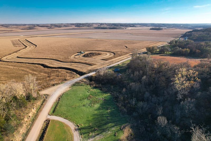
The overlook near Moorhead represents just one highlight along a 220-mile route that strings together dozens of scenic stops across western Iowa. Optional excursion loops add another 185 miles, creating opportunities for multi-day road trips that reveal how varied the terrain actually becomes.
Small towns dot the route, offering cafes, museums, and friendly conversations with locals.
Driving the full byway takes you through more than just hills. Farmland, river valleys, historic sites, and wildlife areas create a tapestry of landscapes that changes with the seasons.
Spring brings wildflowers and migrating birds, summer delivers full prairie grasses and warm evenings, fall paints the hillsides in rust and gold, and winter reveals the bone structure of the land beneath bare trees.
Most visitors tackle sections of the byway rather than driving the entire route in one trip. The Moorhead area provides easy access to some of the most dramatic scenery, making it a natural starting point.
Maps available online and at visitor centers help you plan routes based on available time and interests.
Missouri River Valley Views
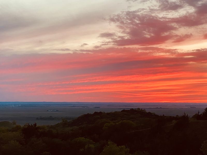
Stand on any high ridge and the contrast becomes obvious. Below you, the Missouri River Valley spreads flat and wide, quilted with farm fields and cut by the meandering river.
Above, the Loess Hills rise sharply, their narrow ridges and steep slopes creating patterns that seem imported from another landscape entirely.
This dramatic difference in elevation and terrain explains much of the region’s appeal. The hills act like an abrupt transition between the Great Plains and the valley bottom, creating microclimates and habitats that support unusual species.
From a visual perspective, the contrast simply makes for stunning photography and memorable views.
Early explorers documented their surprise at encountering these hills rising suddenly from the flatter landscapes around them. Modern visitors share that sense of discovery, especially those expecting Iowa to deliver nothing but gentle farmland.
The valley views remind you that you’re looking at a landscape carved by wind and water over millennia, not just a random collection of pretty hills. Take time at each overlook to appreciate both the immediate foreground and the distant valley beyond.
What to Know Before You Go
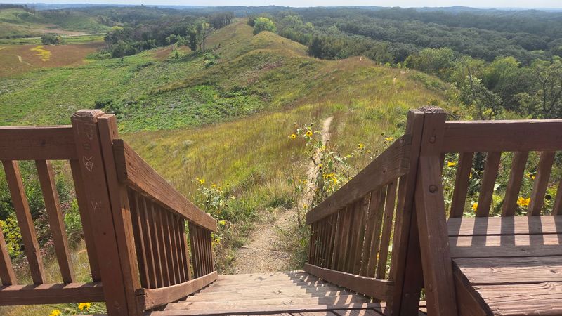
Loess Hills Scenic Overlook sits on Oak Avenue near Moorhead, Iowa 51558. The small parking area accommodates several vehicles, and the viewing platform is fully accessible for wheelchairs and strollers.
Trails connect from the overlook into the surrounding Loess Hills State Forest, offering options for short walks or longer hikes.
Oak Avenue is a gravel road, so conditions matter after heavy rain or during spring thaw. Check local weather and road reports before making the drive, especially if you’re not comfortable on unpaved surfaces.
The overlook itself remains accessible year-round, though winter snow can limit trail access.
Sunrise and sunset provide the best light for photography, with colors shifting across the prairie grasses and long shadows defining the landscape’s contours. Bring water, snacks, and sun protection, as the overlook offers limited shade.
Cell service can be unreliable in the hills, so download maps and directions before leaving town. The nearest services are in Onawa or Missouri Valley, both within reasonable driving distance for fuel and food.