Tucked deep in the forests of Michigan’s Upper Peninsula, Fiborn Karst Preserve holds two incredible secrets: the crumbling ruins of a limestone mining ghost town and the entrance to Michigan’s longest known cave.
This nearly 500-acre protected area in Mackinac County is one of the most geologically unusual places in the entire Great Lakes region.
Whether you love history, hiking, or underground adventures, Fiborn has something that will genuinely surprise you.
A Remote Preserve in Michigan’s Upper Peninsula
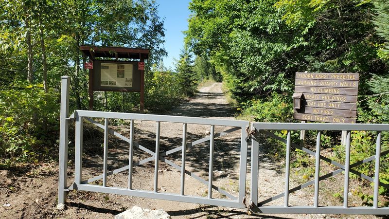
Most people driving through Mackinac County have never heard of Fiborn Karst Preserve, and that is exactly what makes finding it feel like a real discovery. Covering nearly 480 to 500 acres near the small community of Trout Lake, the preserve sits quietly behind a wall of second-growth forest that hides just about everything inside it.
The land protects a rare karst landscape, a type of terrain shaped when water slowly dissolves soluble rock like limestone over thousands of years. The result is a bumpy, hollow, and surprisingly dramatic environment filled with sinkholes, underground streams, and cave openings.
Karst landscapes are not common in Michigan, which makes this one especially worth protecting.
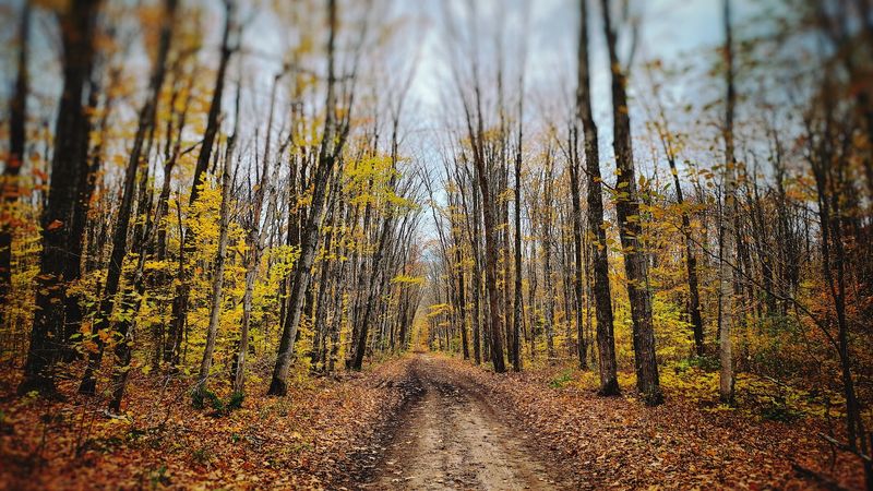
Getting here requires some effort. The preserve is not heavily advertised, and the roads leading in are unpaved.
But visitors who make the trip are rewarded with one of the most geologically rich and historically layered natural areas in the entire Upper Peninsula. Bring good shoes, a sense of curiosity, and plenty of time to wander.
The Ghost Town of Fiborn Quarry
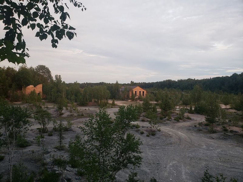
Back in 1905, the land now known as Fiborn Karst Preserve was anything but quiet. That year, the Fiborn Quarry opened for business, and a small but busy community quickly grew up around it.
The quarry was established specifically to harvest the high-quality limestone found in the area and ship it across the border to Algoma Steel in Sault Ste. Marie, Ontario.
At its peak, the operation supported a real village. Families lived in company-owned homes, children attended a local school, and the community even had its own post office.
A railroad spur connected the quarry to the outside world, carrying out loads of crushed and cut limestone on a regular schedule.
For roughly three decades, Fiborn was a working, breathing community built entirely around the rock beneath its feet. The limestone that made the place profitable was the same rock that would later be revealed as one of Michigan’s most fascinating geological treasures.
Few of the original workers could have guessed that the ground they blasted apart for steel production was also hiding an extraordinary underground world.
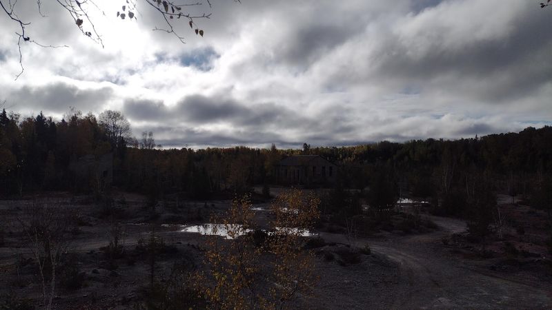
A Village That Vanished Almost Overnight
The Great Depression hit small industrial towns especially hard, and Fiborn was no exception. As steel demand dropped and operating costs climbed, the quarry struggled to stay financially viable through the early 1930s.
By 1936, the operation shut down for good, and the community that had grown up around it simply dissolved.
What happened next was remarkably swift. Once the paychecks stopped, residents packed up and left.
Buildings were dismantled, salvaged, or simply abandoned. Nature moved in fast, reclaiming the cleared land with brush and young trees.
Within a generation, the entire village had nearly disappeared from sight.
There is something quietly haunting about a place that was once so full of life and noise going completely silent. No dramatic disaster struck Fiborn.
No fire burned it down. Economic reality just pulled the rug out, and people walked away.
Today, most visitors have no idea they are standing in the footprint of a former town unless they know exactly what to look for beneath the moss and forest floor. The vanishing of Fiborn is a reminder of how quickly human settlements can be swallowed back into the land.
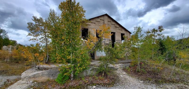
Ruins Hidden in the Forest
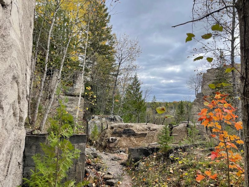
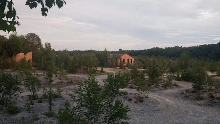
Walk the trails at Fiborn long enough and the forest starts giving things away. Concrete foundations emerge from the leaf litter.
A rusted metal structure rises unexpectedly through the tree trunks. A rectangular depression in the ground hints at where a building once stood.
These are the leftovers of Fiborn Quarry, hiding in plain sight for anyone willing to look closely.
Among the most recognizable remnants are the ore-car loading structures, which were used to fill rail cars with crushed limestone before shipping. The old railroad house foundation is also still visible, along with scattered concrete pads that once supported equipment or buildings.
Each ruin is a small puzzle piece that helps reconstruct what life here once looked like.
Exploring these remnants feels a bit like being an amateur archaeologist. Nothing is roped off or labeled with plaques, so visitors are free to examine things at their own pace.
The Michigan Karst Conservancy, which manages the preserve, encourages respectful exploration while asking visitors not to disturb or remove anything. The ruins are fragile, and every piece left in place helps tell the full story of this forgotten community.
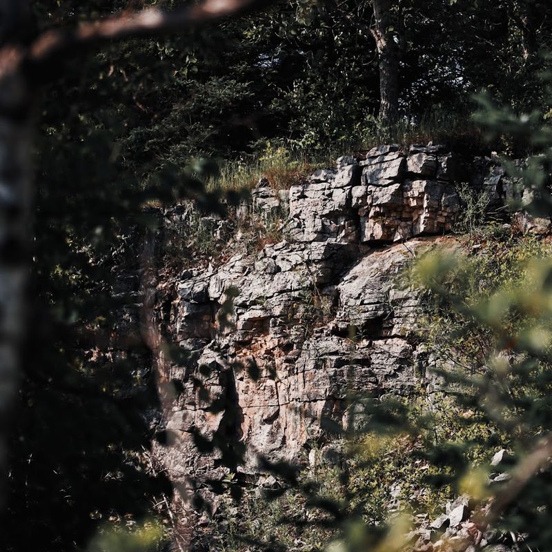
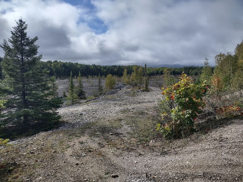
The Karst Landscape Beneath It All
The secret behind everything unusual at Fiborn comes down to geology. The preserve sits along the Niagara Escarpment, a long ridge of ancient limestone and dolomite that stretches across parts of Michigan, Wisconsin, and Ontario.
This rock formation is hundreds of millions of years old, and water has been working on it ever since.
Rainwater and snowmelt slowly seep through cracks in the limestone, picking up carbon dioxide along the way and becoming mildly acidic. Over thousands of years, that slightly acidic water dissolves the rock from the inside out, creating hollow pockets, tunnels, and eventually full cave systems.
The surface above shows the effects too, with sinkholes forming where underground spaces have collapsed or eroded from below.
This whole process is called karstification, and it is responsible for every dramatic feature at the preserve. The sinkholes you hike past, the streams that vanish underground, and the cave beneath your feet all exist because of the same slow geological process.
Fiborn is one of the best places in Michigan to see karst features up close, and understanding the geology makes every trail feature feel that much more impressive.
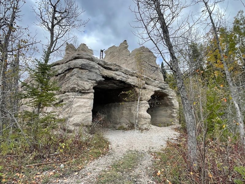
Home to Michigan’s Longest Known Cave
Somewhere beneath the old quarry land, a cave stretches through the darkness for roughly 1,500 feet, making it the longest cave currently documented in Michigan. Known as Hendrie River Water Cave, it was carved by an underground stream that has been eating through the limestone since the last glaciers retreated thousands of years ago.
The cave is not a wide, walk-in cavern. Passages are narrow, the ceiling is low in many sections, and the floor is covered by a flowing stream.
Exploring it requires a willingness to crouch, crawl, and get thoroughly wet. This is not a tourist cave with guided tours and handrails; it is a raw, active underground environment that demands respect and preparation.
What makes Hendrie River Water Cave so remarkable is that it likely still has more to be discovered. Cave explorers, known as cavers or spelunkers, continue to survey its passages.
The 1,500-foot figure represents documented passages, but the system may extend further into areas not yet fully mapped. Michigan is not typically thought of as cave country, which is exactly why this hidden gem surprises so many people who visit the preserve for the first time.
A Cave Still Shaped by Running Water
Most famous caves in the United States are dry, decorated with stalactites and stalagmites formed over centuries of dripping water. Hendrie River Water Cave works differently.
An active underground stream runs along the cave floor year-round, making this a living, constantly evolving underground environment rather than a frozen geological museum.
The water follows a winding path through the cave system until it reaches a flooded section called the Goop Loop, a sump where the passage dips below the water surface and becomes impassable without scuba gear. From there, the water continues underground before resurfacing roughly a mile away at a spring.
Tracing that underground journey is part of what makes the hydrology of this preserve so fascinating to researchers.
Seasonal changes dramatically affect the cave’s character. During spring snowmelt or heavy summer rainstorms, water levels inside can rise surprisingly fast.
What was knee-deep one hour can become shoulder-deep the next. Cavers who explore the system always check weather forecasts beforehand and never venture in alone.
The cave rewards careful, prepared visitors with an experience unlike anything available on the surface, but it demands that every person who enters it takes the risks seriously.
Trails That Reveal the Hidden Landscape
You do not need to be a caver to appreciate what Fiborn has to offer. Two main hiking routes give visitors a ground-level look at the karst landscape and the remains of the old quarry without requiring any specialized gear or experience.
Both trails are free to use and open to the public during appropriate seasons.
The Sinkhole Trail is the shorter of the two options and takes hikers past a series of shallow sinkholes and disappearing stream features. Watching a small creek simply vanish into the ground is one of those moments that genuinely catches people off guard, even adults who consider themselves fairly knowledgeable about nature.
The trail makes the invisible geology visible in a way that no diagram or textbook really can.
The Barbara Ann Patrie Memorial Trail is a longer loop that winds around the old quarry site and through areas of maturing second-growth forest. Along this route, the industrial ruins become part of the scenery, popping up unexpectedly between the trees.
Combining both trails in a single visit gives a well-rounded experience of everything the preserve offers. Wear waterproof boots, carry water, and give yourself at least two to three hours to explore without rushing.
A Rare Mix of Geology, History, and Adventure
Very few places in the Midwest can offer ghost-town ruins, a rare geological landscape, and the entrance to a record-setting cave system all within a single afternoon’s visit. Fiborn Karst Preserve manages to combine all three, which is why it has developed a loyal following among hikers, geologists, history enthusiasts, and amateur cavers alike.
The Michigan Karst Conservancy has managed the site since 1987, working to balance public access with the protection of fragile geological features and sensitive wildlife habitat. Their approach keeps the preserve genuinely wild rather than polished into a theme-park version of itself.
There are no gift shops, no entrance fees, and no guided tours, just the land, the ruins, and the cave beneath it all.
Visiting Fiborn rewards people who come prepared and curious. Read up on karst geology before you go.
Learn a little about the quarry’s history. Understand what the bats need from this place.
When you arrive and stand on ground that was once a quarry floor, then a ghost town, and is now a protected natural area sitting on top of Michigan’s longest cave, the full weight of everything layered beneath your feet becomes genuinely remarkable.