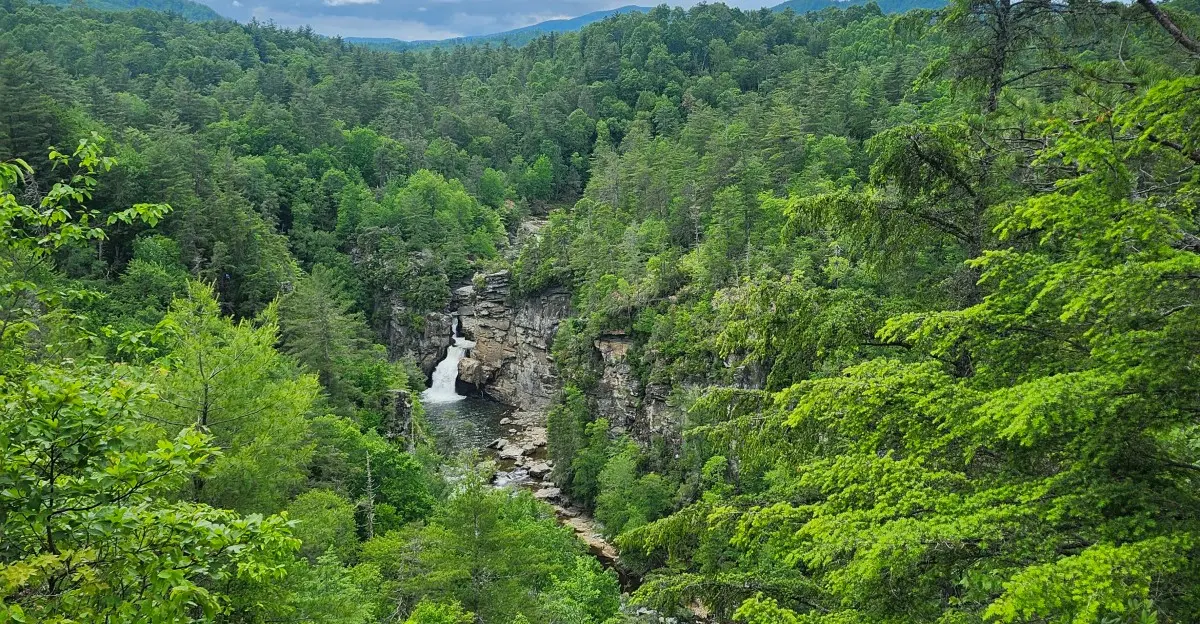
One mountain river tumbles down from Grandfather Mountain, dropping nearly 2,000 feet as it carves its way through a rugged canyon. Many drivers along the scenic Blue Ridge Parkway catch one quick glimpse of Linville Falls and move on.
That’s a shame, because one short trail connects four separate overlooks. Each offers a different view of the upper and lower falls, while the final stop opens onto a gorge nicknamed the Grand Canyon of the East.
What makes this spot special is how much it rewards curiosity without demanding an exhausting hike. The Erwin’s View Trail is about 1.6 miles round trip, making it an easy way to experience some of North Carolina’s most impressive mountain scenery.
I can’t imagine stopping for one photo of the upper falls and missing everything else. So, which overlook would you save for last?
Count The Overlooks Before You Even Think About Leaving
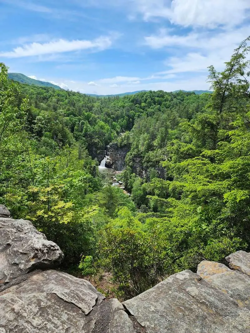
Four overlooks line a single trail at Linville Falls, and plenty of drivers never make it past the first. That’s a lot of scenery left on the table for a 1.6-mile round-trip walk.
The path is called Erwin’s View Trail, and the National Park Service rates it moderate. It begins near the trailhead parking area off the Blue Ridge Parkway spur road at Milepost 316.4.
Each stop builds on the one before it. You get the upper falls first, then Chimney View, then Gorge View, and finally the big finale at Erwin’s View.
Treat it like a book with four short chapters. Reading only chapter one technically counts as a visit, but you’ll miss the plot twist waiting at the end.
The spacing is friendly, too. The first overlook sits about half a mile out, and the last one waits only 0.8 miles from the start.
That means the whole string of viewpoints fits nicely into a road trip stop. Wear decent shoes, bring water, and give yourself time to linger at every railing along the way.
The Upper Falls Make A Pretty Great Warm-Up Act
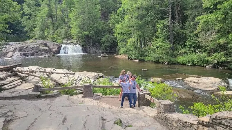
Half a mile. That’s all it takes to reach the first overlook, where the Linville River widens out before its big plunge.
Here the water spreads across the rocks and slides over the upper falls in a calmer mood. It’s the opening act, and honestly, it’s a strong one.
The grade to this spot feels gentler than the later climbs, which makes it a smart pick for a shorter outing. It’s also a handy place to check how your legs feel before going farther.
Swimming in the river is prohibited, and so is climbing on the rocks around the falls. The rules exist for safety, and the rangers take them seriously.
Snap your photos from behind the railing instead. The angle shows the river gathering itself before the real drama begins downstream.
If you stop here and turn around, you’ll still see a lovely waterfall. Keep walking, though, and you’ll understand why this is called one of the most famous waterfalls on the entire Blue Ridge Parkway.
The upper falls are only the first page of the story.
Chimney View Is Where The Lower Falls Finally Show Their Face
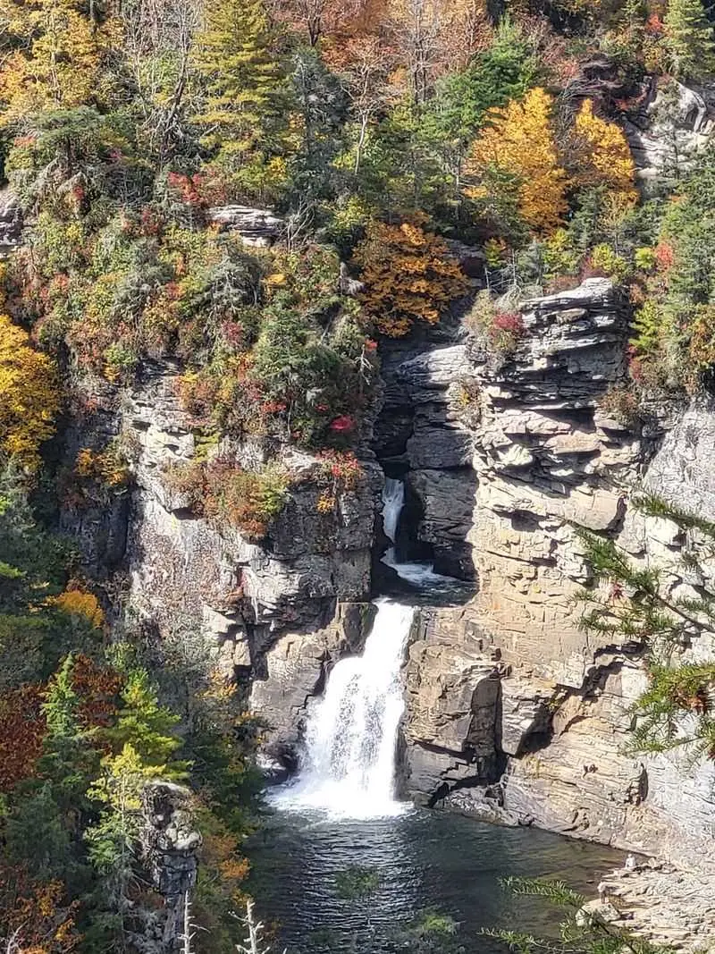
Those tall rock columns rising from the gorge earned this stop its name. Chimney View sits about 0.7 miles from the start, and the formations look a bit like stone smokestacks.
More importantly, this is the first point where the lower falls come into sight. After the calm upper section, the water suddenly gets serious.
The Linville Falls cascade drops about 45 feet in three tiers into a rugged gorge. From here, you start to see how the river squeezes and twists through the rock.
It’s a good spot to slow down and compare the two moods of the river. Upstream it strolls, and downstream it charges like it’s late for something.
Bring a zoom lens if you’ve got one. The chimneys and the falls share the frame nicely, and the shadows shift as the sun moves across the gorge.
Chimney View also makes a fine turnaround point for tired legs. Still, the best two overlooks are just a short stretch ahead, so a quick water break might be the smarter move.
Gorge View Shows The River Doing Its Best Sculptor Impression
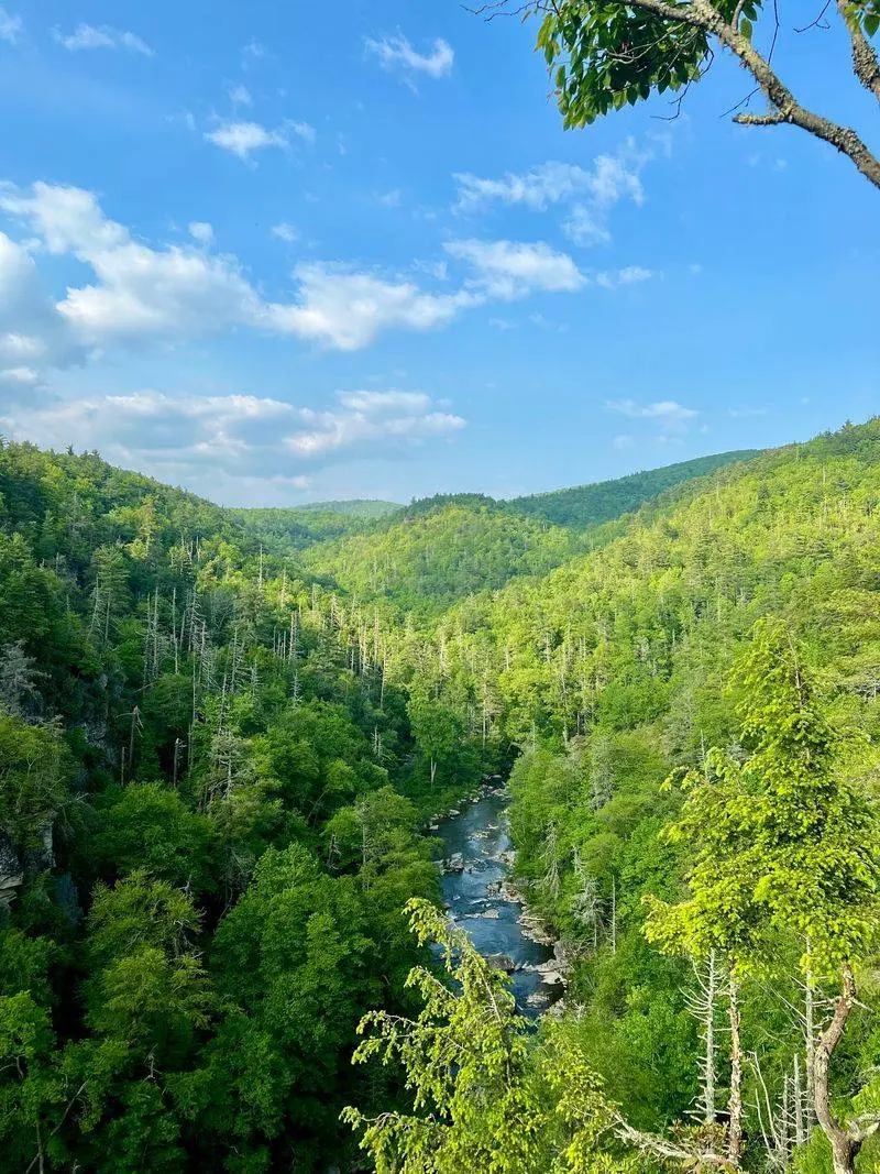
Long before the parkway existed, the Cherokee called this river Ees-ee-ogh, meaning River of Cliffs. One look from Gorge View Overlook, and the name makes perfect sense.
Here the focus shifts from the falls to the canyon itself. You watch the Linville River carve its path into the Linville Gorge Wilderness Area below.
The walls drop steeply, and the forest clings to every ledge it can find. It’s a reminder that water, given enough time, wins every argument with rock.
This overlook often gets less attention than its famous neighbor at the end of the trail. That’s a mistake, because the view down the gorge feels completely different from the waterfall shots.
Look for layers of green ridges fading into the distance on clear days. Cloudy days bring their own charm, with mist drifting through the canyon like slow-moving smoke.
Give yourself a few quiet minutes here. The sound of the river rises from far below, and the scale of the North Carolina wilderness starts to sink in.
Save Your Biggest Gasp For Erwin’s View
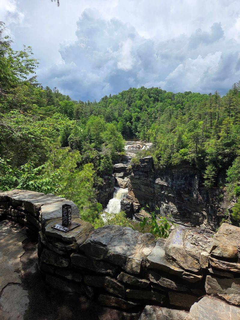
The trail saves its showstopper for last. Erwin’s View Overlook sits about 0.8 miles from the start and delivers the widest panorama of the whole walk.
From this perch, you can see both the upper and lower falls in a single sweep. The Linville Gorge stretches out beyond them, deep and wild.
Getting here includes some climbing, so pace yourself on the way up. Benches along the route offer welcome breaks if your calves start filing complaints.
Once you arrive, the effort pays off fast. The view puts the entire three-tiered cascade into context, from the calm upper ledge to the churning plunge below.
Fall is a fantastic time to visit, when the hardwoods turn the gorge into a patchwork of color. Spring brings fresh greens and blooming rhododendron along the path.
Linger as long as you like before heading back. This is the photo most people never get, simply because they turned around one overlook too soon.
Don’t let that be your story when you drive home along the Blue Ridge Parkway.
Want A Front-Row Seat? Plunge Basin Asks For Sweat First
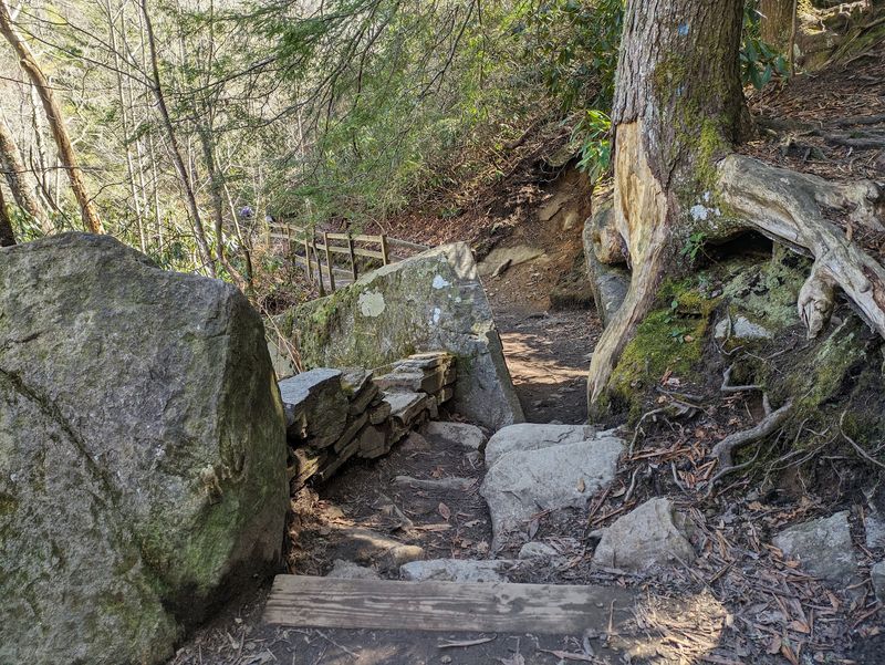
Four overlooks not enough? The strenuous Linville Gorge Trail offers a separate path to Plunge Basin Overlook, about one mile round trip.
This route trades distance for difficulty. Expect steep sections, rocky steps, and tree roots that act like nature’s staircase.
The reward is a closer look at the lower falls and the Chimneys from a different angle. Water crashes into the basin below, and the sound alone feels like a workout cheer.
Another strenuous option continues down toward the bottom of the falls. That one is best for confident hikers with sturdy footwear and plenty of energy for the climb back up.
Remember that swimming and rock climbing around the falls are prohibited. The pull of the water is strong, and staying on the marked trail keeps everyone safe.
Plan this hike for when you have extra time and fresh legs. Pairing it with Erwin’s View Trail gives you the full Linville Falls experience, from the high panorama to the roaring close-up.
Your step counter will be thrilled, even if your knees file a polite protest.
The Forest Walk Is Half The Fun
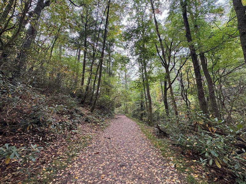
Rosebay, Catawba, and Carolina rhododendron all grow together along these trails. That’s three species sharing one hillside, which makes for a fine show when they bloom.
The paths wind through a mature forest of hemlock, white pine, oak, hickory, and birch. It feels shady and cool, even when the parking area bakes in the sun.
Spring brings native wildflowers to the trail edges. Autumn swaps them out for bright leaves that make every overlook look freshly painted.
Keep your eyes open for wildlife, too. Turkey, fox, raccoon, black bear, and deer all live in these woods, so give any furry neighbor plenty of space.
The Linville River below is home to several kinds of trout. Anglers have long fished these waters, though you should check current park rules before casting a line.
All of this makes the walk between overlooks feel like part of the destination. Slow down, notice the bark and blooms, and let the forest earn a spot in your camera roll alongside the falls.
You’re Standing At The Doorway To A Wilderness First
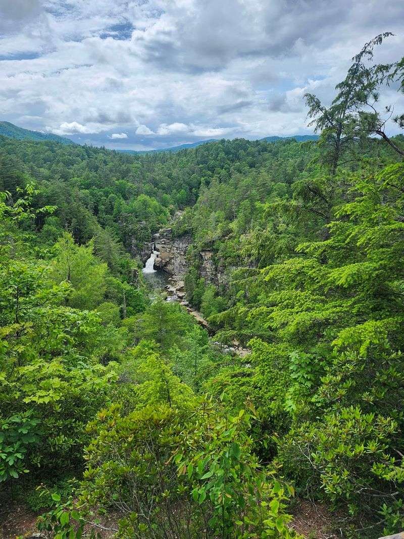
Here’s a bragging right most visitors don’t realize they’re standing next to. Linville Falls marks the gateway to the Linville Gorge, often called the nation’s first officially designated wilderness area.
Its nickname is the Grand Canyon of the Southern Appalachians. The steep walls and deep drop explain that label pretty quickly.
The Linville River begins high on Grandfather Mountain. It drops nearly 2,000 feet through the gorge on its way out of the high country.
Wilderness means the land stays rugged and largely untouched. There are no snack stands down there, just cliffs, forest, and a river with somewhere to be.
From the overlooks, you get a safe, easy taste of this wild landscape. Serious backcountry hikers explore deeper, but the railing view still delivers plenty of drama.
Knowing this backstory changes how the falls feel. You’re not just looking at pretty water in North Carolina, you’re peering into one of the most protected landscapes in the eastern mountains.
That’s quite a lot of wow for a short walk from a parking lot.
A Generous Gift Is Why Anyone Can Walk Here
Once upon a time, seeing these falls cost money. A landowner named F.W.
Hossfeld charged visitors a fee to take a look.
Later, his daughter Giulia Luginbuhl owned the land. Philanthropist John D.
Rockefeller Jr. bought it for about one hundred thousand dollars and gave it away for the public good.
The land first went to the State of North Carolina. It was then transferred to the National Park Service in 1952, becoming part of the Blue Ridge Parkway.
Long before any of that, the Cherokee lived and hunted here. They gathered food in these woods and sourced mica for tools and trade.
The parkway itself began construction in 1935. It took decades to finish, with the nearby Linn Cove Viaduct opening to the public in 1987.
So every overlook you visit carries a little history with it. Thanks to that gift, the gorge belongs to everyone, and the best views don’t require a ticket booth or a private invitation.
Not a bad deal at all.
Plan Smart Before You Hit The Spur Road
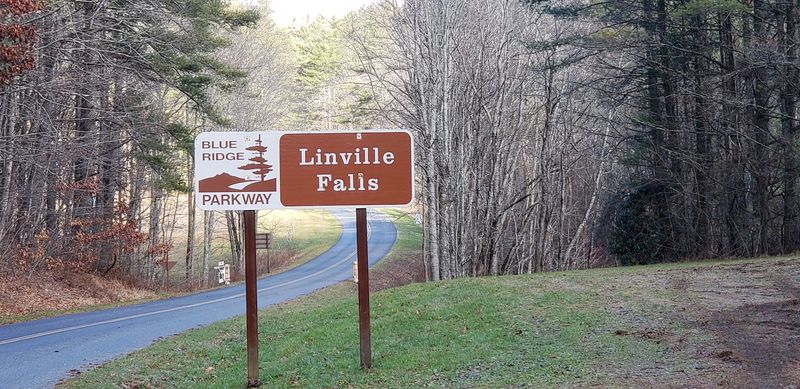
Hurricane Helene left a big mark on this area. The Linville Falls Visitor Center, Campground, and Picnic Area are closed for the 2026 season.
The good news is that the Linville Falls Spur Road is open. It leads from Milepost 316.4 to the trailhead parking, so the overlooks remain within reach.
For your map app, the official address is Blue Ridge Parkway, Milepost 316.4, Linville Falls, NC 28752, USA. Follow the main signs once you’re close rather than trusting every turn your GPS suggests.
Some trails in the area may still be closed during recovery work. Check current National Park Service conditions before you leave home, since updates can change quickly.
When facilities reopen in normal seasons, they typically run from April to November. The campground offers 70 sites along the river, split between tents and RVs.
Pack water, snacks, and sturdy shoes for now, since services are limited. Then take your time, visit every overlook, and leave the speeding to everyone else on the parkway.