Tucked into the northern Berkshires of Massachusetts, Mount Greylock stands at 3,491 feet — the tallest peak in the entire state. At its summit sits a 93-foot stone tower built in 1932, and on a clear day, you can spot five states from the top.
Whether you drive up the winding road or hike through miles of forest trails, Greylock delivers something most people never expect to find so close to home. From literary legends to overnight lodges and through-hikers on a 2,000-mile journey, this mountain holds more stories than most people realize.
Massachusetts Has a True Summit and Most People Have Never Been There
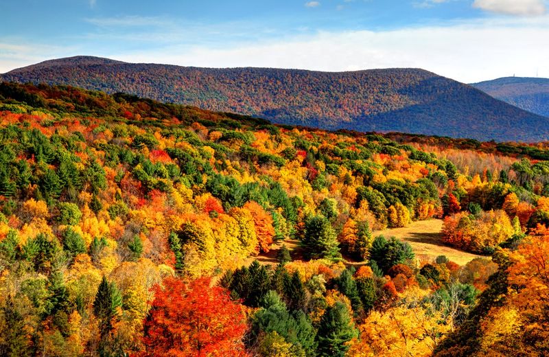
Most Massachusetts residents could name the state capital without blinking, but ask them about the highest point in the state and you might get a blank stare. Mount Greylock rises to 3,491 feet above sea level, sitting at the heart of a 12,500-acre state reservation in the northern Berkshires — a region that already feels like a world apart from Boston or Worcester.
What makes this especially surprising is how easy it actually is to get there. A paved road winds all the way to the summit, meaning you do not need hiking boots or a trail map to experience the view.
Yet even during peak fall foliage weekends, the summit rarely feels packed with crowds.
Established in 1898 as Massachusetts’ very first public land for forest preservation, Greylock carries a quiet kind of importance. The mountain was here long before the state thought to protect it, and it will outlast every debate about whether it deserves more attention.
The Berkshires as a Region
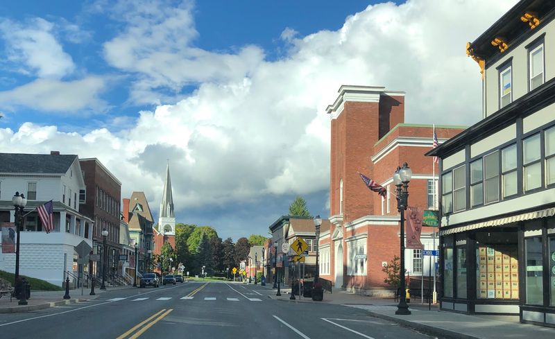
Pull up a map of western Massachusetts and you will notice Mount Greylock sitting like a knuckle pressed up against the Vermont border, flanked on either side by the former mill towns of Adams and North Adams. These communities were once powered by textile factories, and their brick mill buildings still line the rivers running through town — many now converted into art galleries, breweries, and creative studios.
The northern Berkshires have a noticeably different personality than the southern end of the region around Lenox and Stockbridge, which skews more toward summer estates and polished cultural venues. Up here, the landscape feels genuinely working, with farmland tucked between forested ridgelines and small diners that have been open since before your grandparents were born.
MASS MoCA, one of the largest contemporary art museums in the country, sits just a short drive from the mountain’s base in North Adams. The combination of industrial history, outdoor access, and unexpected art makes this corner of the state worth far more than a single-day visit.
War Memorial Tower
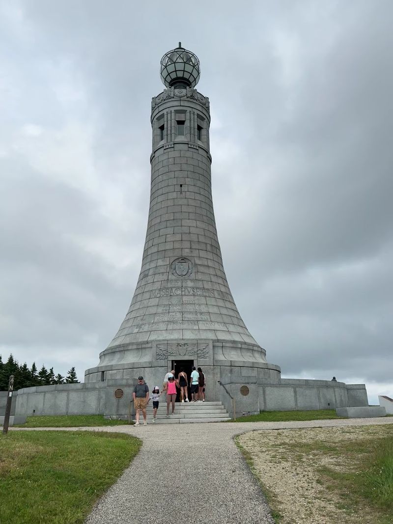
There is something almost unexpected about reaching the top of a mountain and finding a lighthouse-style stone tower waiting for you. The Veterans War Memorial Tower was completed in 1932, constructed from local granite and standing 93 feet tall on a summit that already sits well above everything else in the state.
It was built to honor Massachusetts veterans of World War I, and its beacon light was designed to be visible from the valleys below.
Climb the interior staircase and the circular observation deck at the top gives you a full 360-degree view that covers five states on a clear day — Massachusetts, Vermont, New Hampshire, Connecticut, and New York. The views shift dramatically depending on which direction you face, ranging from tight forest ridgelines to wide agricultural valleys stretching toward the horizon.
Visitors often describe the moment of stepping onto the deck as genuinely disorienting in the best way. The scale of what you can see from up there does not fully register until you are actually standing in it.
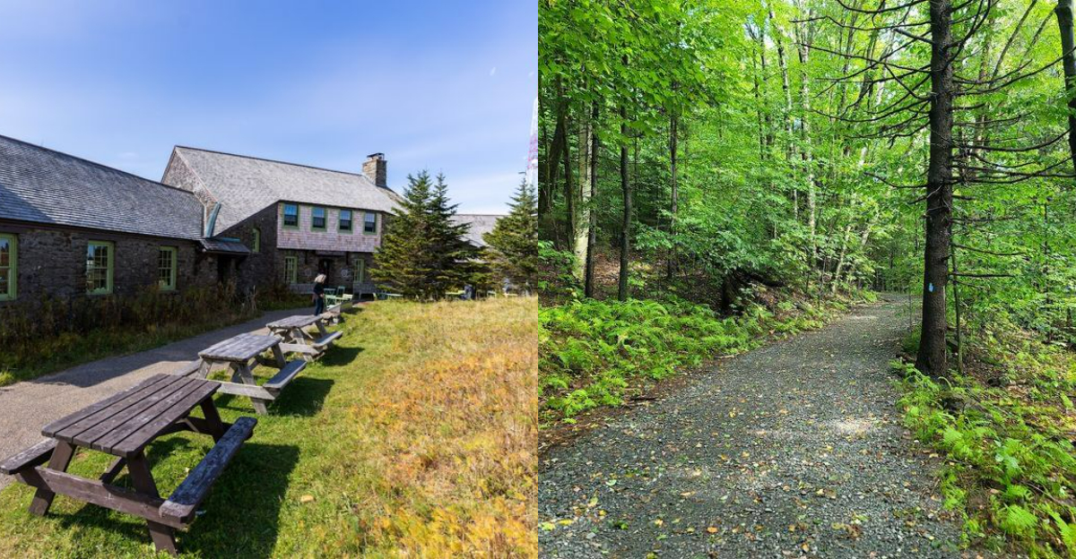
Bascom Lodge
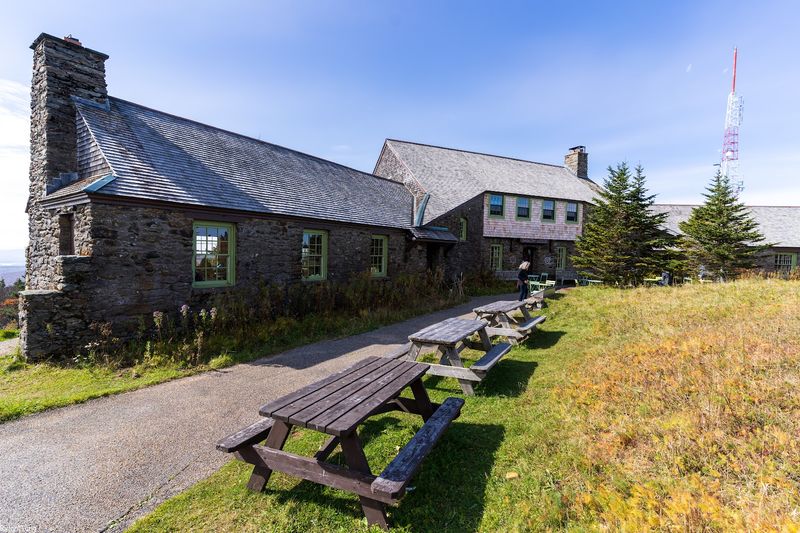
Imagine waking up already at the top of the mountain, watching fog roll through the tree line while the rest of the world is still deciding whether to get out of bed. That is exactly what Bascom Lodge offers overnight stays in a stone-and-timber building constructed by the Civilian Conservation Corps in the 1930s, perched just below the Greylock summit.
The lodge operates seasonally, generally from late spring through mid-fall, and it fills up faster than most people expect. Rooms are simple and well-maintained, more about function than luxury, but the experience of having the summit mostly to yourself after the day visitors have driven back down is genuinely hard to replicate anywhere else in the state.
Meals are served at the lodge, and the dining room has a warm, communal feel that tends to bring hikers, families, and through-hikers from the Appalachian Trail together around the same tables. Booking ahead is strongly recommended, especially for weekends in September and October.
The Drive to the Summit
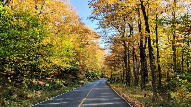
Not every summit experience requires a trail map and a pack full of energy bars. Rockwell Road and Notch Road both offer fully paved routes to the top of Greylock, and the drive itself is worth doing slowly.
The forest changes noticeably as you gain elevation trees get shorter and more windswept, the air coming through a cracked window gets cooler, and the canopy starts thinning as you approach the ridgeline.
The whole trip from the base takes roughly 20 to 30 minutes, and several pull-offs along the route give you early views across the surrounding valleys before you have even reached the summit parking area. These mid-drive stops are easy to skip but genuinely worth taking, especially on a clear afternoon when the light hits the valley farms at a low angle.
Drivers should know that the road is seasonal, typically open from late May through early November depending on snowfall. Winter access on foot or snowshoes is possible, but the paved route closes once conditions make it unsafe for vehicles.
Hiking Trails
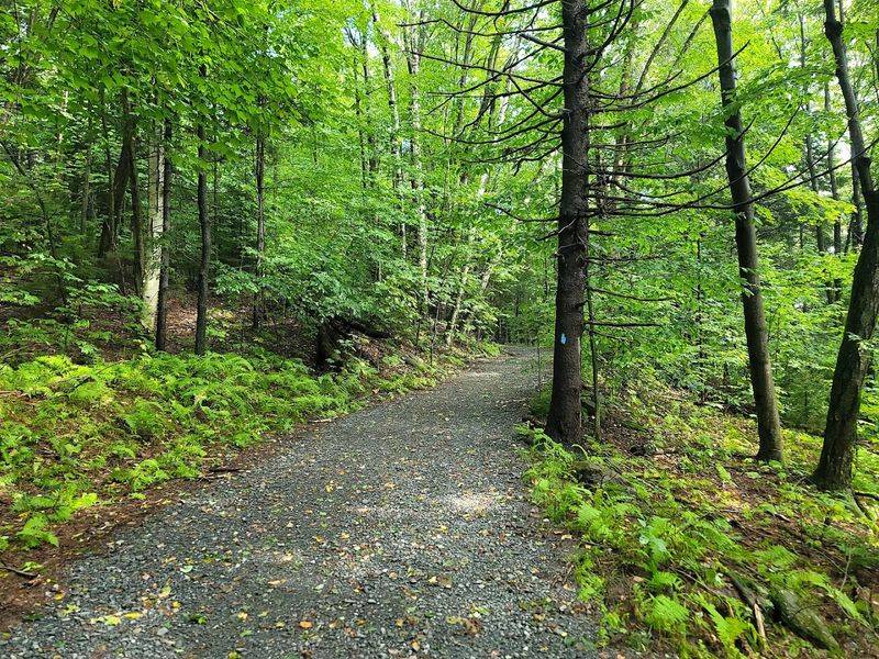
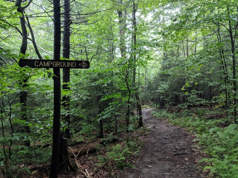
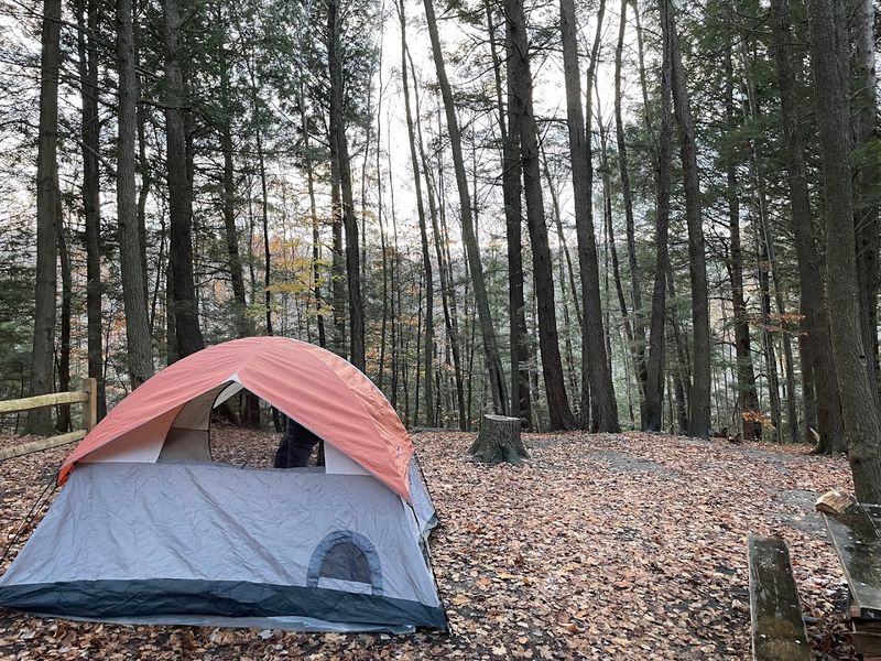
With over 70 miles of trails winding through the reservation, Mount Greylock offers far more than a single route to the top. Trail options range from gentle walks along lower ridgelines to serious ascents that gain thousands of feet over just a few miles.
The Cheshire Harbor Trail from Adams is one of the most popular direct routes, climbing about 2,400 feet over roughly 3.5 miles of terrain that moves through hardwood forest and eventually breaks into open summit conditions.
One detail hikers often mention is how the summit tower stays hidden for most of the climb. It appears suddenly above the tree line only in the final quarter mile, which gives the approach a satisfying reveal that a drive-up visit simply cannot replicate.
Trail surfaces vary from well-maintained gravel paths to rooty, rocky stretches that require real attention underfoot. Trekking poles are useful, especially on descent, and proper footwear matters more than most first-time visitors anticipate.
The trails are well-marked throughout the reservation, though a paper map is still worth picking up at the visitor center.
The Appalachian Trail Connection
Every year, thousands of hikers attempt to walk the entire Appalachian Trail from Georgia to Maine a journey of roughly 2,190 miles that crosses through 14 states. Mount Greylock sits directly on that route, making it one of the most recognizable waypoints along the whole stretch.
The AT passes right over the summit, and through-hikers moving north or south pass through here during the spring and summer months with a regularity that gives the mountain a genuinely different energy than most day-use parks.
Stopping to talk with a through-hiker at Bascom Lodge or on the trail is a real possibility here. These conversations tend to shift how you think about the place Greylock stops being just a destination and becomes a single point on something much larger and longer.
For day hikers, the 11.5-mile Appalachian Trail segment within the reservation offers one of the more scenic stretches of the AT in Massachusetts, passing through wildflower meadows, dense forest, and open ridgeline with long views in multiple directions.
Cloud and Weather Conditions
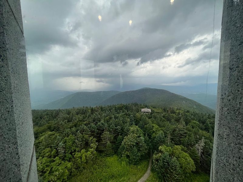
Here is something the summit road brochure does not always make obvious: Greylock makes its own weather. The mountain sits high enough above the surrounding valleys that it regularly pulls in clouds and fog even when the towns below are enjoying clear skies and sunshine.
Arriving at the summit to find yourself inside a cloud is a common enough experience that seasoned visitors build it into their expectations rather than their disappointments.
Checking the forecast for summit-level elevation specifically — rather than the nearest town — is genuinely useful trip planning advice. Conditions can shift by 10 to 15 degrees and several visibility categories within just a few vertical miles.
Wind on the observation deck amplifies the cold significantly, especially once you stop moving.
That said, a foggy summit has its own appeal. Hikers who have visited on both clear and overcast days often describe the misty version as hauntingly beautiful — the tower emerging from the clouds, the forest going quiet, everything muffled and close.
Both versions of Greylock are worth experiencing.
Melville, Thoreau, and the Mountain’s Cultural History
Herman Melville wrote Moby-Dick while living at Arrowhead, his farmhouse in Pittsfield, where the long curved profile of Greylock was visible from his study window on clear days. Literary historians have long suggested that the mountain’s whale-shaped ridgeline and its habit of disappearing into heavy clouds fed directly into the imagery of the novel — a white, elusive shape that dominates the horizon and resists easy understanding.
Henry David Thoreau also visited Greylock and wrote about the experience in his 1849 book A Week on the Concord and Merrimack Rivers. He described camping near the summit and waking above the clouds, a passage that still reads with surprising freshness nearly 175 years later.
Having documented connections to both Melville and Thoreau puts Greylock in genuinely rare company among American natural landmarks. Most mountains get a paragraph in a regional guidebook.
This one helped shape two of the most significant works in 19th-century American literature, which is a different kind of legacy entirely.
Timing, Parking, and What to Bring
A few practical details can make the difference between a frustrating trip and a genuinely great one. The summit road opens around late May and closes by early November, though exact dates shift depending on snowfall and road conditions each year.
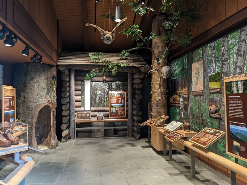
The visitor center on Rockwell Road in Lanesborough is a smart first stop staff there can give you current trail conditions, parking availability, and weather updates for the summit specifically.
Parking at the summit fills up on busy fall weekends, so arriving before 10 a.m. gives you a real advantage. Trailhead parking at lower access points like Cheshire Harbor is generally easier to find throughout the day.
Layered clothing is worth packing no matter what the forecast says at lower elevations. Temperatures at the summit run 10 to 15 degrees cooler than in surrounding towns, and wind on the observation deck can make a warm afternoon feel sharply cold once you stop moving.
Water, snacks, and a paper trail map round out a sensible packing list for any visit to Greylock.