Stand on this peak and the entire eastern United States drops away beneath your feet.
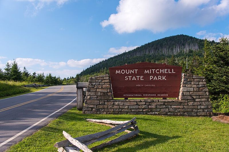
Mount Mitchell State Park in Burnsville, North Carolina rises to 6,684 feet, claiming the highest point east of the Mississippi River. The climb pulls you upward through cool forests and shifting mist until the world below feels distant and unreal.
At the summit, the air turns sharp and cold, even in summer. Spruce and fir trees twist in the wind, holding onto a climate more common in Canada than the southern Appalachians.
Clouds slide through the ridges like slow-moving rivers.
The view doesn’t sit still for long. One moment you’re staring across endless blue folds of mountains, the next you’re wrapped in fog so thick it swallows everything.
This is a place where elevation changes everything—light, sound, and even time seem to move differently up here.
The Drive to Mount Mitchell State Park
Your adventure starts before you even reach the summit. The journey along the Blue Ridge Parkway and NC-128 transforms into something magical as you climb higher into the mountains.
Winding curves carry you through elevation changes that make your ears pop while the landscape shifts around every bend.
Notice how the air feels different as you ascend? That’s because you’re entering a completely different climate zone.
The temperature drops noticeably, and if you’re visiting during cooler months, you might even drive through clouds that settle between the peaks.
Hairpin turns reveal breathtaking overlooks where you can pull off and catch your breath. The drive itself becomes part of the experience, not just transportation.
Mist often clings to the mountainsides, creating an almost mystical atmosphere that hints at the alpine environment waiting above.
Plan for about 45 minutes from the Parkway entrance to the summit parking area. The road conditions vary seasonally, so checking ahead ensures a smooth journey.
This scenic approach builds anticipation perfectly for what awaits at the top.
Black Mountain Range Overview
Ancient geology tells a powerful story here. The Black Mountains formed over a billion years ago, making them some of the oldest mountains on Earth.
These peaks have witnessed continental collisions and countless climate shifts while maintaining their imposing presence.
What makes this range truly remarkable? The dramatic elevation gains pack more vertical rise into a shorter distance than almost anywhere else in the eastern United States.
The Black Mountains earned their name from the dark green spruce and fir forests that blanket their slopes, appearing nearly black from a distance.
This subrange of the Blue Ridge Mountains contains several peaks exceeding 6,000 feet. Mount Mitchell stands as the crown jewel among them, but its neighboring summits create an impressive skyline.
Together, they form a natural barrier that influences weather patterns across western North Carolina.
Geologists study these mountains to understand Appalachian formation and erosion patterns. The exposed rock tells stories of ancient seas and volcanic activity.
Standing among these peaks connects you to deep time in a way few places can match.
Highest Peak East of the Mississippi

At exactly 6,684 feet above sea level, Mount Mitchell claims a title no other eastern peak can touch. This isn’t just a number on a sign—it represents something genuinely special.
Standing here places you higher than anywhere else east of the Mississippi River, a fact that feels real when you experience the climate.
The altitude creates conditions more similar to southern Canada than typical North Carolina. Temperatures run 20-30 degrees cooler than nearby valleys, even during summer months.
Your body notices the thinner air immediately, especially if you hike rather than drive.
Why does this elevation matter so much? It creates unique ecosystems that can’t survive at lower altitudes in this latitude.
Plants and animals adapted to cold mountain environments thrive here while being hundreds of miles from their normal ranges.
Scientists and nature enthusiasts have celebrated this peak for nearly two centuries. The summit represents more than just bragging rights—it’s a living laboratory for studying climate zones.
Every visit reminds you that dramatic landscapes aren’t exclusive to the western United States.
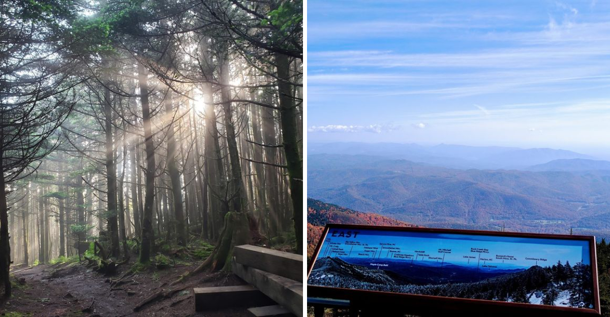
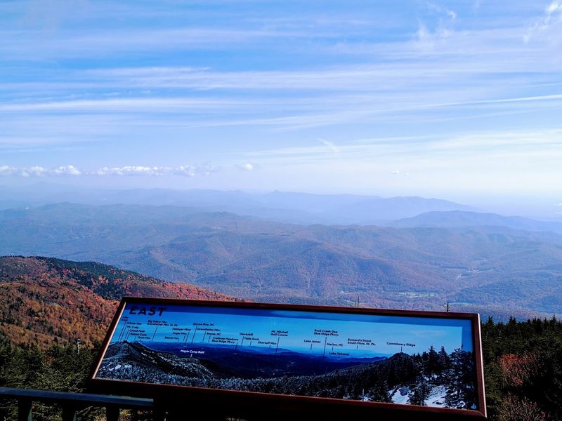
The Summit Observation Deck Views
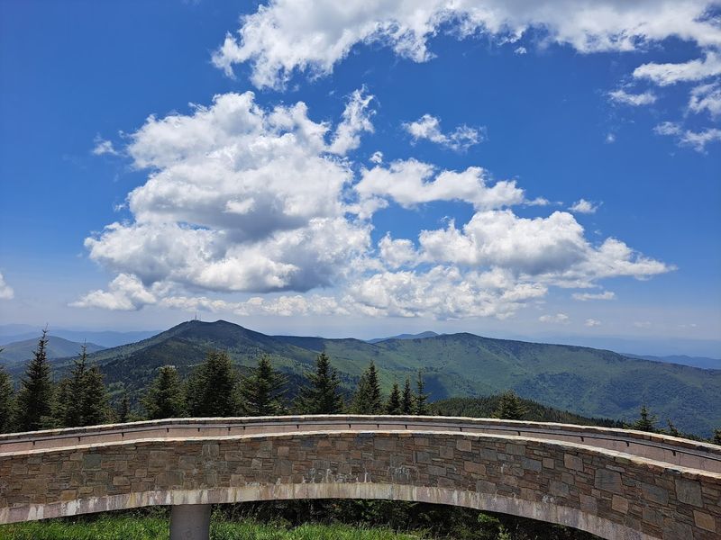
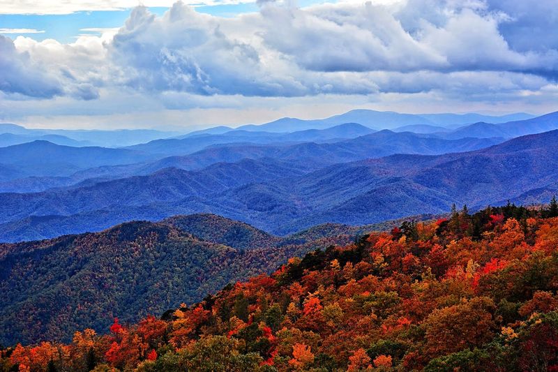
Step onto the stone observation platform and prepare for visual overload. This circular deck provides unobstructed 360-degree views that stretch your perspective to its limits.
On exceptionally clear days, visibility can extend over 100 miles across the Appalachian ranges.
Layer upon layer of mountain ridges fade into soft blue hues toward the horizon. Each ridge catches light differently, creating a natural gradient from deep green nearby to pale purple in the distance.
It’s like looking at a living topographic map spread beneath your feet.
Weather conditions dramatically affect what you’ll see. Morning visits often feature fog filling the valleys while peaks pierce through like islands in a white sea.
Afternoon light brings out the texture of forested slopes and rocky outcrops.
Bring binoculars if you have them—they reveal distant features and help identify specific peaks. The observation deck includes interpretive signs pointing out notable landmarks visible from this vantage point.
Photographers especially love golden hour when warm light paints the ridgelines. Don’t rush this experience; the views deserve your time and attention.
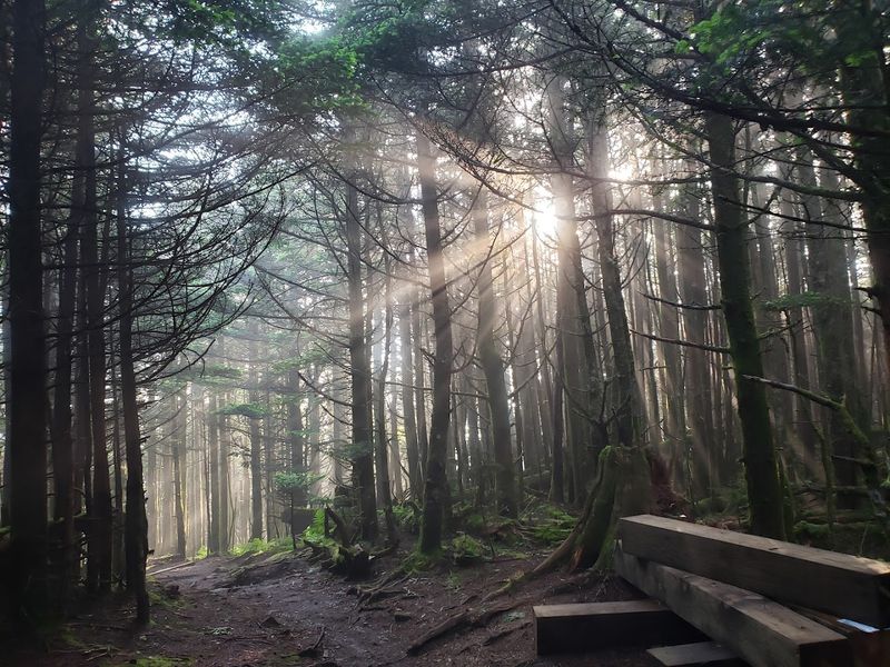
The Unique Spruce-Fir Forest
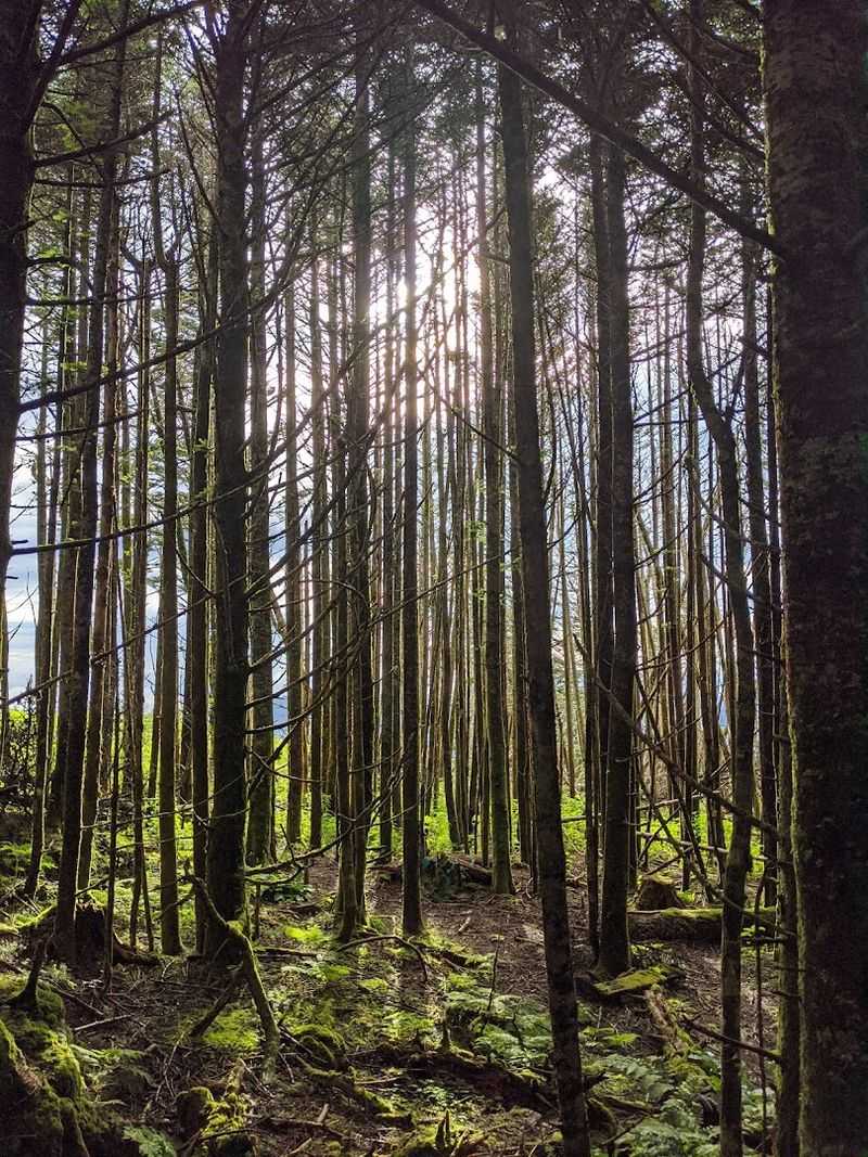
Walking through this forest feels like teleporting to the boreal forests of Maine or Canada. The summit supports one of the southernmost examples of spruce-fir forest in North America, a rare ecosystem existing as a “sky island” surrounded by completely different plant communities below.
Fraser fir and red spruce trees dominate here, their branches often draped in moss that thrives in the constant moisture. Dense fog is common, creating an ethereal atmosphere where trees emerge from mist like ghostly figures.
The air smells different too—fresh, crisp, and filled with evergreen scent.
Why does this forest survive so far south? The elevation creates temperatures cold enough year-round to support these northern species.
Without this altitude, these trees couldn’t survive North Carolina summers.
Sadly, this ecosystem faces challenges. Invasive insects and acid rain have damaged many trees over recent decades.
Conservation efforts work to protect what remains while studying how climate change affects these sensitive high-elevation communities. Walking these trails connects you to something truly precious and irreplaceable.
Elisha Mitchell’s Historic Legacy
Behind every great mountain stands an interesting human story. Professor Elisha Mitchell, a scientist from the University of North Carolina, became obsessed with measuring these peaks during the 1830s.
His meticulous work using barometric pressure measurements proved this summit was indeed the highest point in the eastern United States.
The professor’s dedication went beyond simple curiosity. He returned multiple times to verify his calculations and defend his findings against doubters.
Tragically, during an 1857 expedition to remeasure the peak, Mitchell fell from a waterfall and died on the mountain that would eventually bear his name.
His grave rests near the summit, marking both a scientific achievement and a life devoted to understanding these mountains. The story adds depth to your visit, connecting modern recreation to historical exploration.
Mitchell’s measurements opened this region to wider recognition and eventually led to its protection as a state park. Without his work, we might not appreciate this peak’s significance as clearly.
His legacy lives on through every visitor who stands atop the summit he worked so hard to document and understand.
Mount Mitchell Museum & Exhibits

Curious minds shouldn’t miss the small but information-packed museum near the summit. This facility explains the complex geology that formed these ancient mountains over a billion years.
Interactive exhibits make scientific concepts accessible without overwhelming visitors with technical jargon.
Ecology displays showcase the unique plants and animals calling this high-elevation environment home. You’ll learn which species only survive at these altitudes and why they’re so vulnerable to environmental changes.
Conservation stories highlight ongoing efforts to protect the spruce-fir forest from invasive pests and pollution.
Historical sections document early exploration and the park’s establishment in 1915, making it North Carolina’s first state park. Photographs show how the summit area looked decades ago compared to today.
The changes tell important stories about human impact and preservation efforts.
Museum staff and volunteers often share additional insights and answer questions about what you’re seeing outside. Spending 20-30 minutes here before exploring trails helps you appreciate the landscape more fully.
The exhibits provide context that transforms a simple mountain visit into a richer educational experience you’ll remember and share.
Hiking to the Summit Trails
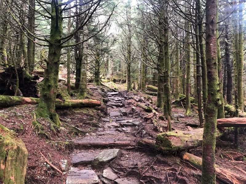
While many drive to the top, hiking these trails offers a completely different experience. Several routes approach the summit from neighboring peaks, with the most popular being the steep climb from Black Mountain Campground.
These trails don’t mess around—expect serious elevation gain and challenging terrain that tests your endurance.
Ridge-line hikes provide spectacular views but demand respect. The Deep Gap Trail covers about six miles one-way with rocky sections requiring careful footing.
Exposed areas leave you vulnerable to rapidly changing weather conditions that can turn dangerous quickly.
Why hike when you can drive? The physical effort creates a deeper connection to the mountain’s scale and power.
Earning the summit through your own effort makes the views more meaningful. Plus, you’ll see ecosystems gradually shift as you climb through different elevation zones.
Proper preparation is essential. Bring extra layers even in summer, as temperatures drop significantly with altitude.
Pack plenty of water, snacks, and navigation tools. Tell someone your hiking plans before heading out.
These trails reward prepared hikers with unforgettable experiences while punishing carelessness with potential danger.
Seasonal Weather & Changing Conditions
Mountain weather operates by its own rules here. Conditions shift faster than you might expect, especially at this elevation.
What starts as a sunny morning can deteriorate into fog, wind, and even snow within hours, regardless of the season.
Temperature differences shock first-time visitors. While valleys around Asheville might reach 80 degrees, the summit could hover around 50 degrees with biting wind making it feel even colder.
Winter brings genuinely harsh conditions with ice, snow, and wind chills far below zero.
Why such dramatic differences? The altitude places you above warmer air masses, exposing you to weather patterns typically found much farther north.
Winds encounter no obstacles at the summit, creating conditions that feel more extreme than the thermometer suggests.
Always check forecasts before visiting and prepare for worse conditions than predicted. The park sometimes closes during severe weather, particularly in winter when ice makes roads impassable.
Fog can reduce visibility to just a few feet, eliminating those famous views entirely. Flexibility in your plans helps ensure both safety and enjoyment when mountain weather doesn’t cooperate with your schedule.
What to Know Before You Go

Planning ahead makes all the difference for this destination. The physical address is 2388 NC-128, Burnsville, NC 28714, accessed primarily through the Blue Ridge Parkway.
Services operate seasonally, with some facilities closed during winter months when snow and ice make access difficult.
Cell phone service is essentially nonexistent at the summit. Don’t count on GPS navigation or emergency calls working reliably.
Download maps beforehand and tell someone your plans. Food options are extremely limited, especially off-season, so bring snacks and drinks.
That temperature difference deserves emphasis—expect it to be 20-30 degrees colder than nearby towns. Pack layers even if you’re visiting during summer heat.
A light jacket might seem unnecessary in the parking lot but becomes essential on the windy observation deck.
The Blue Ridge Parkway itself closes sections during bad weather, potentially blocking your access entirely. Check road conditions before making the drive.
Limited amenities mean you should fuel up beforehand and use restrooms when available. Despite these considerations, proper planning ensures a smooth, memorable visit to this remarkable mountain.