Most people think Florida means flat beaches and palm trees, but hidden near Inverness lies a trail that feels more like Appalachia than the Sunshine State.
The Trail to Lizzie Hart Sink stretches four miles through rocky terrain dotted with caves, limestone walls, and a massive sinkhole that surprises even experienced hikers.
This unusual adventure showcases Florida’s underground geology in action, offering dramatic scenery you wouldn’t expect to find in the subtropics.
Whether you’re a geology enthusiast or just looking for a hike that breaks the mold, this trail delivers something completely different.
Why This Trail Feels Like It Isn’t in Florida
Picture white sand beaches, swaying palms, and endless flatness—that’s what most visitors imagine when they think about exploring Florida. This trail flips those expectations upside down from the first step.
Instead of boardwalks over marshes, hikers encounter jagged limestone, scrambling over rocks, and navigating genuine elevation changes that leave calves burning.
The geology here tells a different story than coastal Florida. Ancient limestone bedrock pushes through the surface, creating terrain that resembles Tennessee or Kentucky more than Tampa Bay.
Caves pock the landscape where groundwater dissolved the stone over countless centuries.
First-time visitors often stop mid-hike, genuinely confused about whether they accidentally wandered into another state. The subtropical plants remain, but they grow from cracks in stone walls rather than sandy soil.
That combination of familiar Florida greenery draped over completely unfamiliar rocky terrain creates an experience that challenges everything people assume about hiking in the Sunshine State.
Where the Trail to Lizzie Hart Sink Is Located
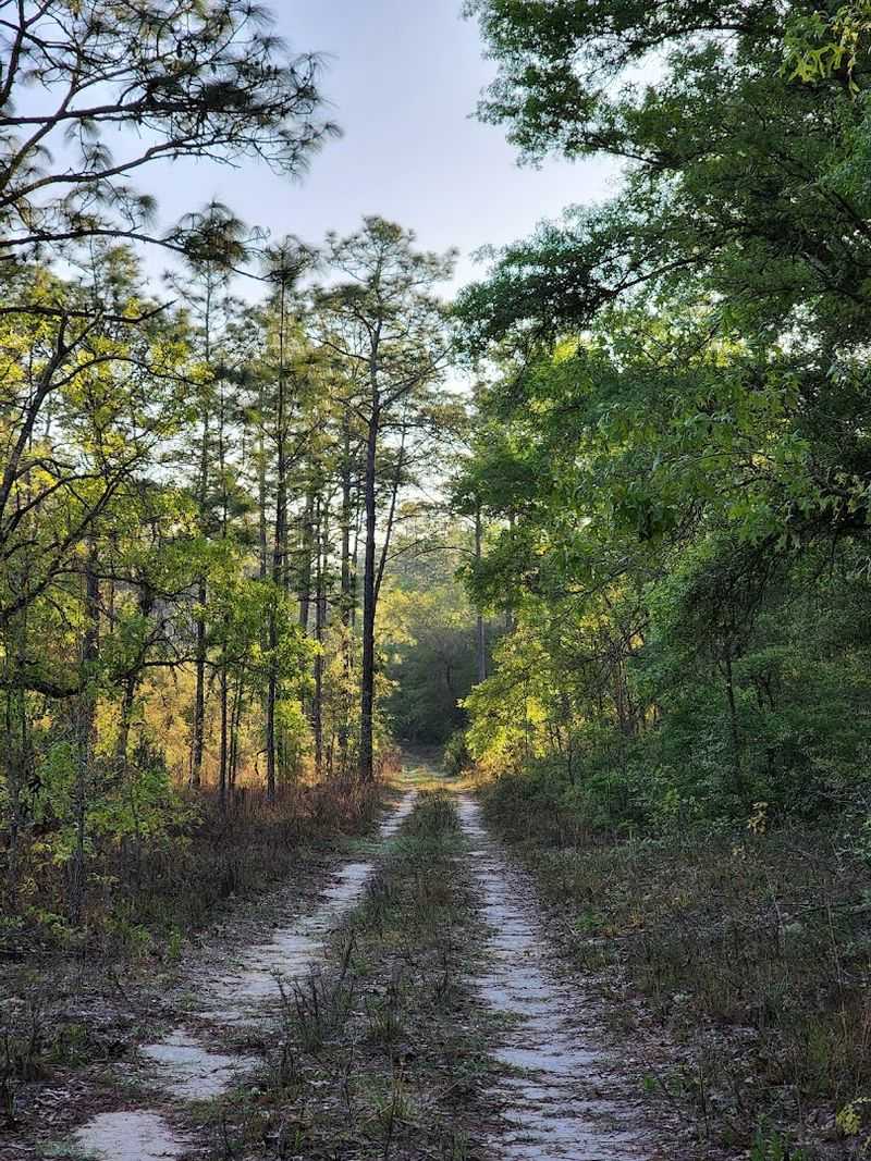
Finding this geological oddity requires heading to the Citrus Tract within Withlacoochee State Forest, positioned between Inverness and Floral City in central Florida. This particular section of state forest sits atop one of Florida’s most dramatic karst regions.
The location matters because this area’s underlying limestone creates the caves and sinkholes absent from much of the peninsula.
Withlacoochee State Forest spans multiple disconnected tracts across several counties. The Citrus Tract specifically protects this geologically active landscape where sinkholes periodically swallow sections of forest whole.
Getting there involves driving county roads through rural Citrus County, passing cattle ranches and orange groves before reaching the forest boundary.
The remote setting adds to the adventure—you won’t find crowds here like at state parks closer to major cities. Limited cell service and minimal signage mean proper planning matters.
Locals know about this trail, but it remains wonderfully under-visited compared to Florida’s coastal attractions.
The Unexpected Beginning: Hidden Trailhead and Quiet Forest Roads
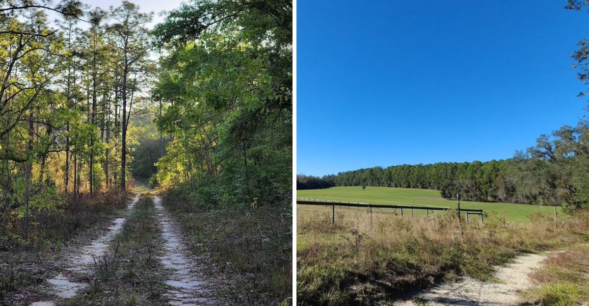
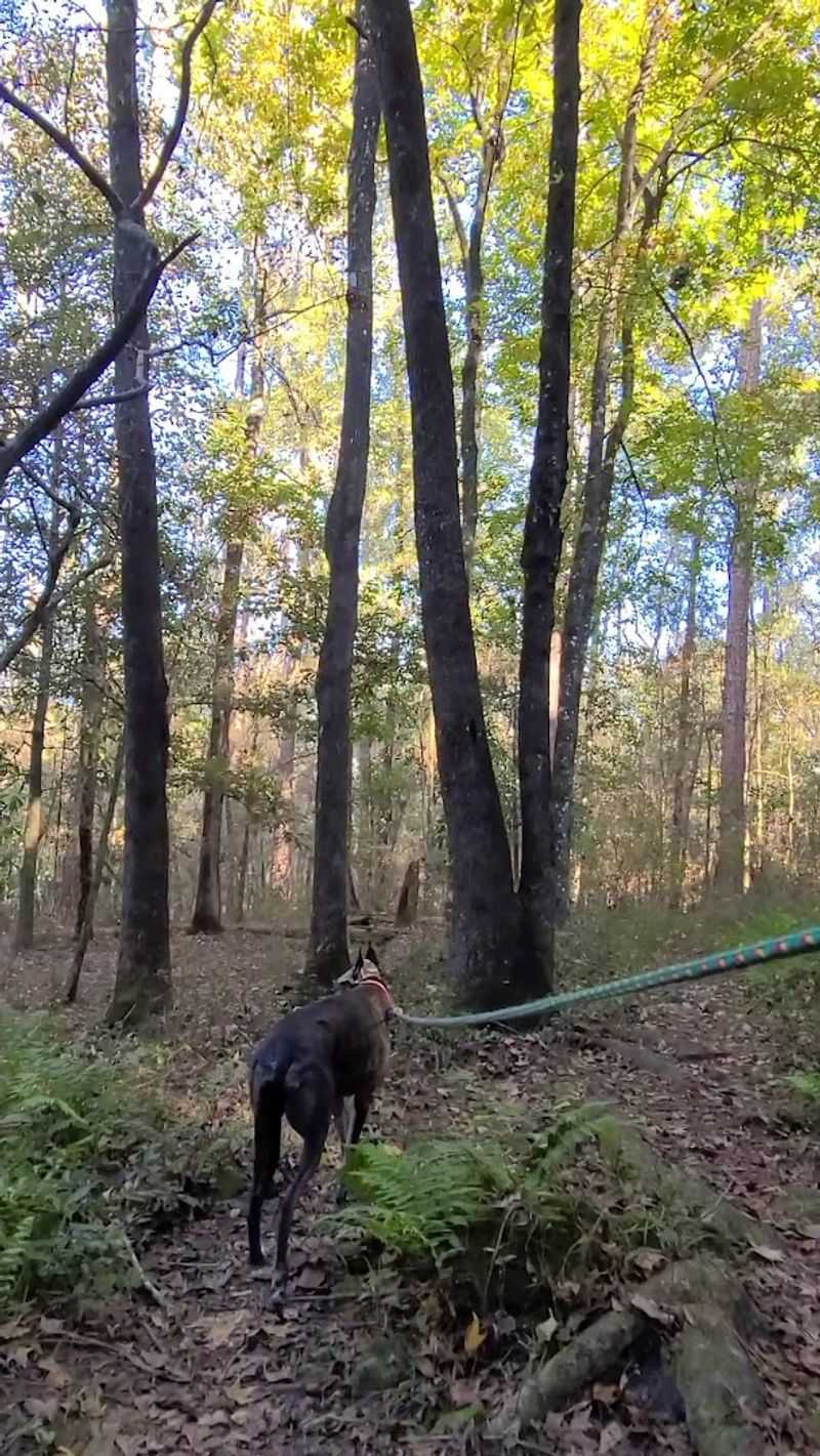
Don’t expect dramatic entrance gates or fancy visitor centers at this trailhead. The hike starts almost apologetically along a former forest service road, flat and sandy, giving no hint of the geological drama waiting ahead.
Many hikers question whether they’re on the right path during these first easy stretches through typical pine flatwoods.
The sandy road section allows muscles to warm up gradually. Palmetto bushes line the route while tall pines filter sunlight overhead.
It feels like countless other Florida trails during this beginning phase, deliberately lulling hikers into thinking they know what to expect.
After roughly a mile of gentle walking, the character shifts completely. The sandy path gives way to harder-packed earth, then exposed limestone appears underfoot.
Tree roots cross the trail more frequently. Suddenly hikers realize they’ve transitioned from easy stroll to legitimate adventure.
That gradual escalation works perfectly—bodies acclimate before the terrain demands more serious attention and footwork.
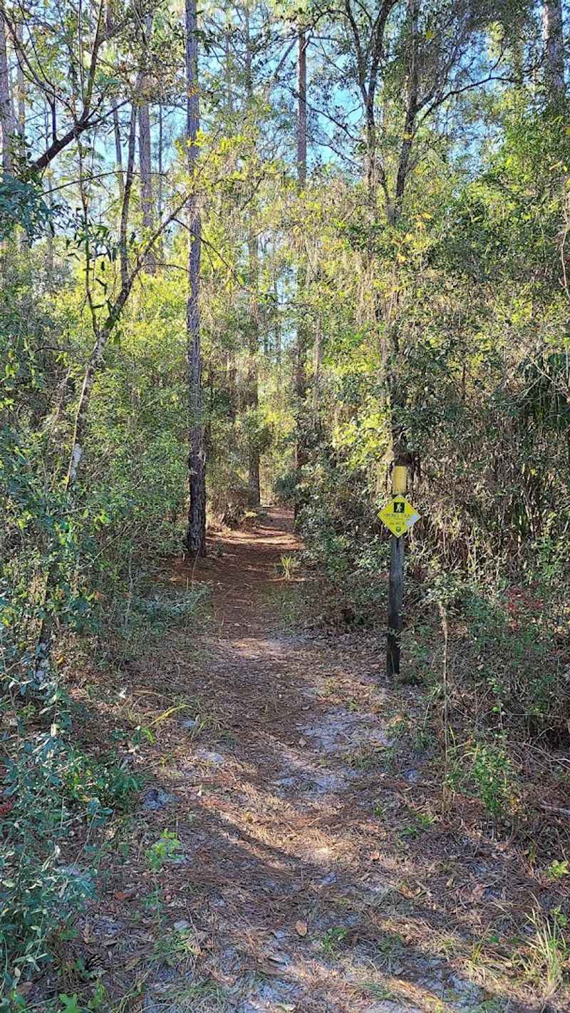
Following the Florida Trail Into Rugged Terrain
Orange blazes mark where this route joins the legendary Florida Trail, the statewide hiking path stretching from Big Cypress to the Panhandle. Joining this famous footpath feels significant, but the terrain change matters more than the trail name.
Within minutes, the path narrows considerably while the ground transforms from forgiving sand to unforgiving stone.
Tree roots snake across the trail like natural tripwires. Exposed limestone creates uneven footing that demands constant attention.
The easy, mindless walking from earlier becomes impossible here—every step requires deliberate placement to avoid twisted ankles.
Hikers unused to technical terrain sometimes struggle with this transition. Kids who bounded ahead during the flat section now move more carefully.
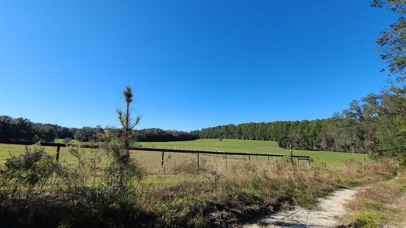
The forest closes in tighter too, with hardwoods replacing pines and creating darker, cooler conditions. This is where the hike earns its reputation as Florida’s most un-Florida-like trail.
Breaking free from state stereotypes becomes physical reality rather than abstract concept when you’re carefully stepping over limestone ledges.
The Karst Landscape That Created Florida’s Hidden Caves
Karst isn’t a word most people use daily, but understanding it unlocks why this trail exists. Karst topography forms when slightly acidic rainwater slowly dissolves limestone bedrock over geological timescales.
Florida sits on a massive limestone platform laid down when ancient seas covered the peninsula. That foundation makes the entire state vulnerable to karst processes.
Rainwater picks up carbon dioxide from decaying vegetation, creating weak carbonic acid. This acid eats away at limestone, grain by grain, century by century.
Eventually, underground voids develop—some small like closets, others large enough to swallow buildings. When these underground chambers collapse, sinkholes appear at the surface.
The Citrus Tract showcases this process beautifully. Hikers literally walk through an active geological classroom where limestone dissolves in real time.
Small caves represent early-stage karst development. Larger sinkholes show advanced stages.
Everything visible along this trail took millions of years to create but continues changing today with every rainstorm that soaks through the forest floor.
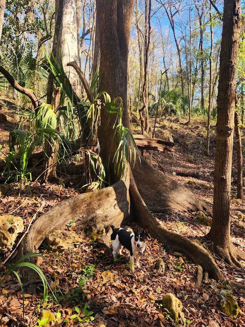
Rock Walls and Limestone Outcrops That Resemble Mountain Country
Vertical stone walls rise beside the trail at several points, reaching heights that genuinely surprise hikers expecting Florida’s typical flatness. These limestone outcrops show clear sedimentary layering—horizontal bands marking ancient sea floors compressed into solid rock.
Running your hand across the stone reveals fossilized shells embedded millions of years ago.
Photographers love these sections because the lighting through forest canopy creates dramatic shadows across textured stone surfaces. The walls range from waist-high ledges to imposing barriers taller than most adults.
Some sections require minor scrambling where the trail passes through gaps in the rock.
Out-of-state visitors frequently comment that these formations remind them of Appalachian hiking experiences. The comparison holds water—same ancient limestone, just exposed differently.
While mountain trails climb elevations measured in thousands of feet, this Florida version condenses similar geology into a more accessible four-mile package. The stone itself tells equally ancient stories, just without the mountain altitude.
Many hikers photograph these outcrops specifically to show friends back home that yes, Florida really does have rocks.
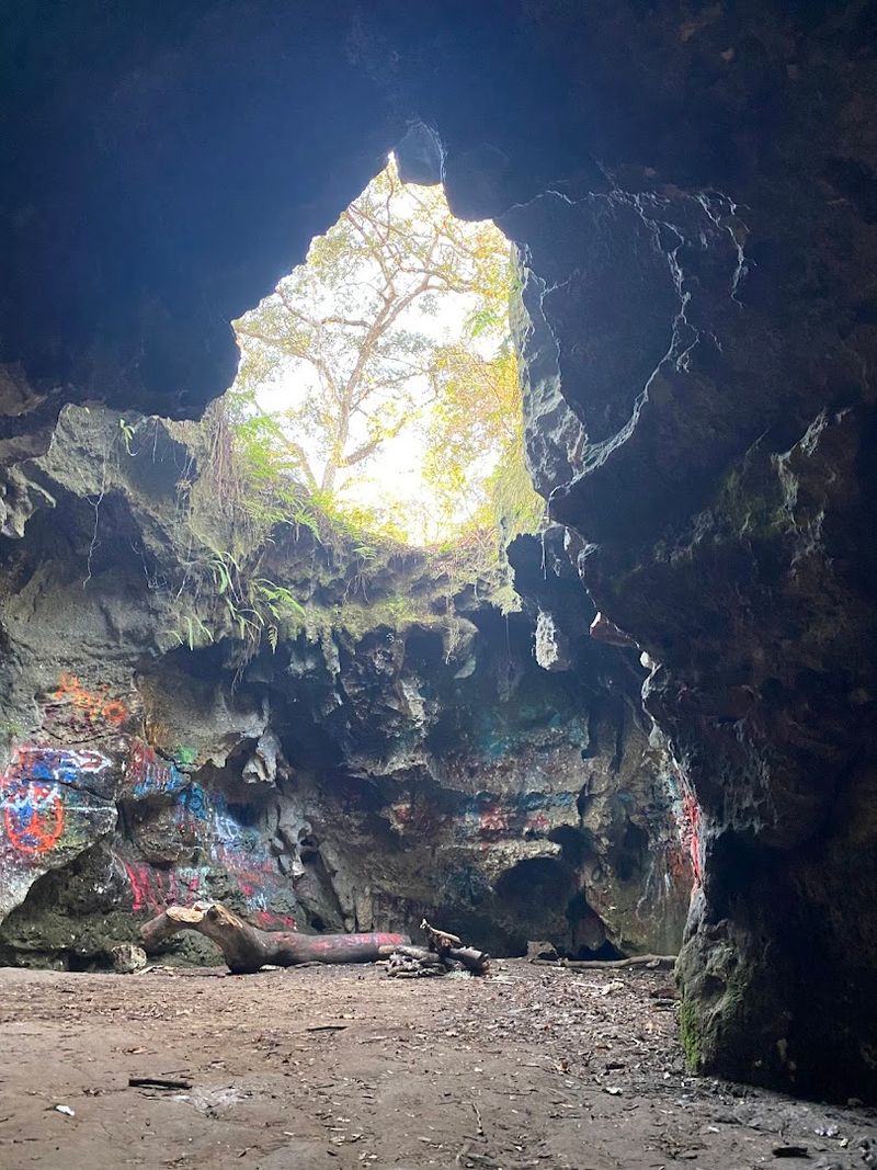
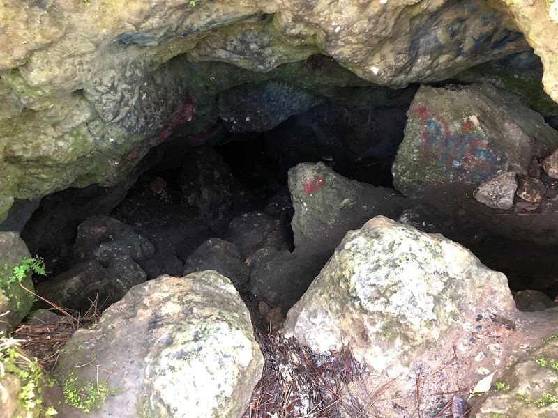
Exploring the Small Caves Hidden Along the Route
Calling them caves might oversell the experience slightly—these are more accurately shallow rock shelters and deep recesses rather than spelunking destinations. Still, they provide genuinely cool features that hikers don’t expect on Florida trails.
Most caves appear as horizontal openings at the base of limestone outcrops, protected by overhanging ledges above.
Some recesses extend back only a few feet. Others create genuine sheltered spaces where hikers can duck inside and peer into darker depths.
The temperature drops noticeably inside these stone alcoves—natural air conditioning courtesy of the earth. Moss and ferns often grow near cave entrances where moisture collects.
Wildlife uses these sheltered spaces too, particularly during hot summers. Snake skins occasionally appear near cave mouths where reptiles shed in protected areas.
Respect for these habitats matters—look but don’t disturb. Some hikers bring headlamps specifically to peer deeper into the larger recesses, though nothing here requires actual caving experience.
The caves add discovery elements to the hike without creating dangerous situations for casual adventurers.
Lizzie Hart Sink: The Geological Star of the Hike
Everything builds toward this moment—the massive sinkhole that gives the trail its name and purpose. Lizzie Hart Sink opens dramatically as hikers approach, suddenly revealing a huge depression that plunges downward through the forest floor.
The scale shocks most visitors, measuring over 100 feet across and dropping 50-plus feet to the basin below.
Steep limestone walls encircle the sink, layered and textured from millions of years of geological forces. Standing at the rim creates genuine vertigo—one moment you’re walking level trail, the next you’re peering into an enormous pit that swallowed part of the forest.
Trees grow both above and below, creating multiple canopy levels.
The sinkhole’s name honors an early settler, though local lore varies on specific details. What remains consistent is the dramatic visual impact.
This single geological feature justifies the entire hike. Some visitors spend 30 minutes just walking the rim, photographing from different angles.
The sink represents karst processes taken to their ultimate conclusion—complete collapse of underground cavities, creating this spectacular earth-opening spectacle.
How the Trail Changes With the Seasons
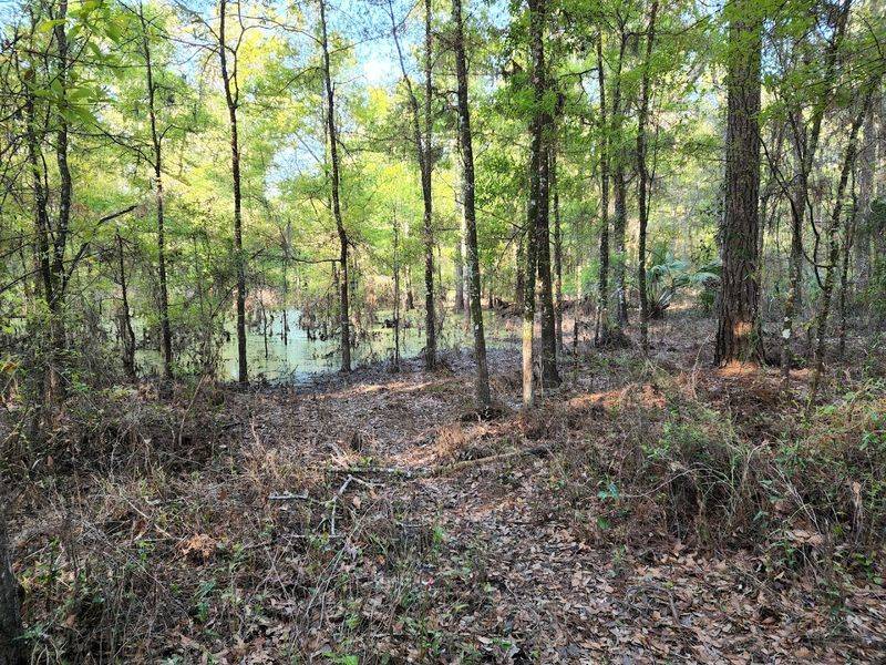
Timing your visit dramatically changes what you’ll experience on this trail. Florida’s distinct wet and dry seasons transform Lizzie Hart Sink from water-filled basin to exposed geological cross-section depending on monthly rainfall patterns.
Summer’s afternoon thunderstorms often fill the sinkhole with standing water, creating a surprising pond deep in the forest.
During wet periods, the sink becomes a temporary wetland habitat. Frogs chorus from the water’s edge.
Wading birds sometimes hunt in the shallows. The water obscures much of the limestone structure but adds different visual appeal.
Dry season offers opposite experiences. Winter and early spring often see the sink completely drained, exposing every rock layer and allowing hikers to appreciate the full depth and scale.
Some adventurous visitors carefully descend into the dry basin to examine the stone up close. Trail conditions also vary seasonally—wet periods create muddy sections and slippery rocks, while dry season allows faster, more comfortable hiking.
Checking recent rainfall before visiting helps set appropriate expectations.
Tips Before Hiking This Unusual Florida Trail
Proper footwear makes or breaks this experience. Forget beach sandals or flimsy sneakers—the rocky terrain demands real hiking boots with ankle support and aggressive tread.
Several hikers each season turn back early because inappropriate footwear makes the limestone sections painful or dangerous.
Trail navigation requires attention since this route isn’t heavily marked beyond Florida Trail blazes. Download offline maps or bring paper copies since cell service disappears in the forest.
Carrying two liters of water per person matters even in cooler months—the physical demands and Florida humidity drain hydration quickly.
Watch for wildlife including snakes, especially around rock outcrops and cave entrances where reptiles shelter. They’re rarely aggressive but deserve respectful distance.
Plan extra time beyond what GPS estimates suggest—slow, careful hiking reveals more geological details and keeps ankles intact. Many experienced trail users recommend 3-4 hours for the full experience rather than rushing through.
The geology rewards patient observation more than speed records. Finally, tell someone your hiking plans since the remote location means help isn’t immediately available.