

Think you know Florida as flat, sandy, and predictable? This 4 mile loop in Withlacoochee State Forest flips that script with caves, rock walls, and a dramatic sinkhole that feels downright prehistoric.
Tucked near Inverness, the Trail to Lizzie Hart Sink gives you rugged elevation changes, shadowy karst features, and limestone textures that do not look like typical Florida.
Lace up and keep reading, because this route rewards curiosity at every turn.
Trailhead Essentials and First Steps


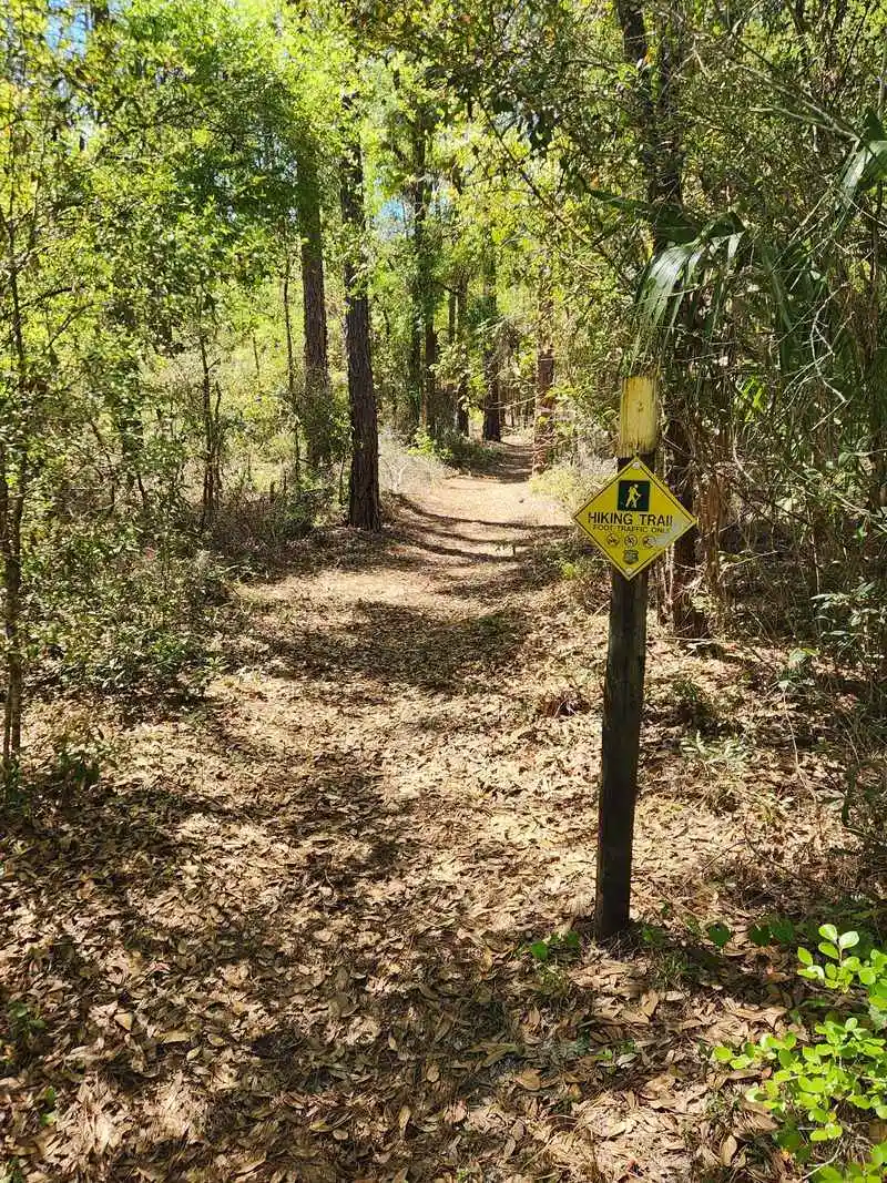
Start at 129 W Stage Coach Trail, Inverness, and you will find a modest parking pullout and the signed Trail to Lizzie Hart Sink. The first steps ease you into oak and pine shade, with palmetto fans brushing your calves and sandy tread giving way to firmer limestone flecks. You will hear woodpeckers and the distant drumming of insects, a small welcome committee to this surprising loop.
Grab water, bug spray, and sturdy shoes, because the surface changes often underfoot. The path is generally obvious, but look for blazes and subtle rock margins that cue upcoming features. I like to snap a quick photo of the map at the kiosk so you can keep bearings when the forest closes in.
The rating on Google Maps is solid, and you will understand why within the first quarter mile. This is Florida, yet the textures feel hill country, with shallow swales and knobby roots. Early light filters through Spanish moss, softening the limestone hues and making the trail glow gently.
Give yourself time to settle into the rhythm. The loop is about four miles and offers more than one worthy detour. Keep a steady pace and let the forest soundscape set expectations for the rocky surprises ahead.
Karst Geology Explained on the Trail

What makes this loop feel not Florida is the karst. Water dissolves limestone over time, carving cavities, cracks, and the labyrinth like features you will notice throughout the route. Every pitted rock and shallow cave lip tells a story of ancient seas and patient chemistry.
As you walk, watch for solution holes like tiny bathtubs in the stone. They collect leaf litter, moisture, and life, from millipedes to fern sprouts. The rock walls along certain bends rise suddenly, creating a corridor that looks borrowed from Appalachia.
Step lightly near edges where limestone undercuts create hollow sounding sections. You might see moisture beading in shaded pockets even on dry days. Those pockets feed microhabitats, so resist the urge to poke and pry, and leave crusts and moss intact.
Geology here begins beneath your soles and continues in the canopy, where roots exploit fractures to anchor trees. You can almost map the subsurface by noticing where vegetation changes abruptly. Understanding this living stone context will sharpen your senses before you reach the sinkhole centerpiece.
Navigating the Loop and Wayfinding


The loop is straightforward, but junctions appear where side paths invite curiosity. I recommend carrying a downloaded map and watching for painted blazes and small wooden markers. When in doubt, stay on the most worn tread that arcs toward the sink feature.
Elevation undulates more than expected for Florida. Short rises lead to rocky shelves and then dip into shallow hollows. Poles help on loose limestone chips, especially after rain when tread becomes slick.
Cell signal can be spotty in pockets. Save an offline map and note that the loop runs generally west and south before curling back. If you ever feel turned around, pause, listen for road hum to the north, and reorient calmly.
Wayfinding is part of the fun here because the forest hides and reveals views in quick succession. You will recognize the main loop by persistent rock features and the sense of a broad arc. Keep your eyes up for wildlife while maintaining awareness of footing.
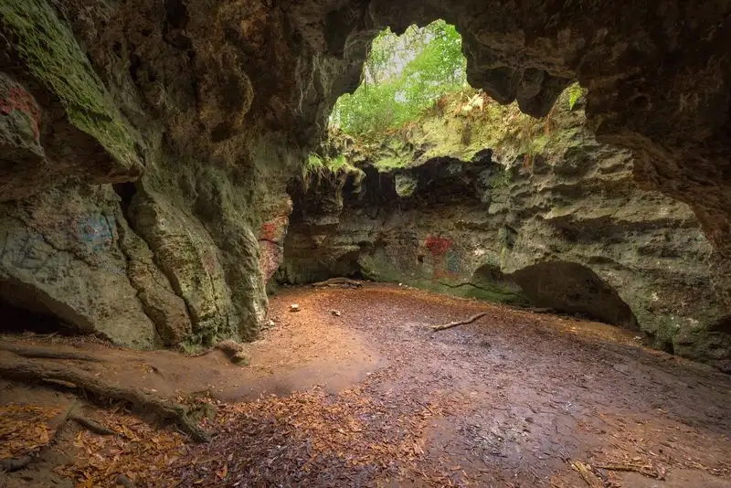
Caves and Rock Walls: What to Expect

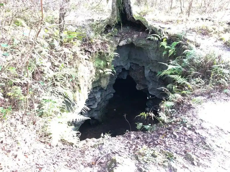
The caves on this loop are shallow limestone recesses rather than deep spelunking systems. You will see overhangs, small alcoves, and rugged rock walls that look cinematic when light slants in. They are photogenic, but remember they are fragile and sometimes home to bats or insects.
Approach carefully and avoid touching soft formations. Limestone can flake, and every palm print leaves oils. Keep kids and dogs close so no one scrambles onto unstable ledges, especially after rains.
Listen for cool air venting gently from shaded holes. That temperature shift tells you voids lie beneath. It is natural air conditioning and a hint of the slow geological engine still at work below the trail.
These features are why this place feels off map for Florida. The stone ribs and pocketed surfaces create a tactile, almost mountainous ambiance. Take your time composing photos, using the darker rock to frame brighter foliage for dramatic contrast.
Lizzie Hart Sink: The Feature and Its Story

Lizzie Hart Sink is the showstopper, a steep walled depression with limestone rings and a quiet hush. As you approach, the forest sound dampens and the air cools. It feels like a hidden amphitheater, carved by water and time rather than tools.
Stay behind any posted barriers and keep wide of undermined edges. The slope can be deceptively loose with marbles of limestone. Your best vantage is from the stable rim where trees arc inward like an audience leaning closer.
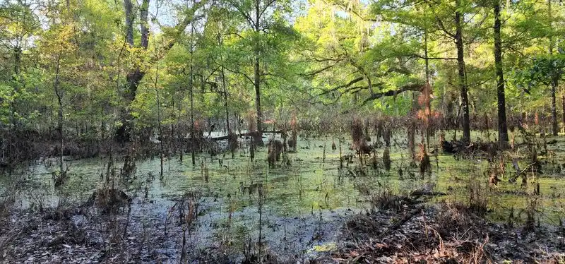
Local lore ties the name to historic land usage, though records vary. What is clear is the hydrology. During wet periods, the sink can collect water, then slowly drain through underground passages.
Stand still for a minute and you will hear leaves ticking as they slide downslope. The scene is serene, almost cathedral like, a place that encourages thoughtful silence. Snap a photo, then pocket the phone and let your eyes adjust to the subtle layers.
Flora and Fauna Along the Route

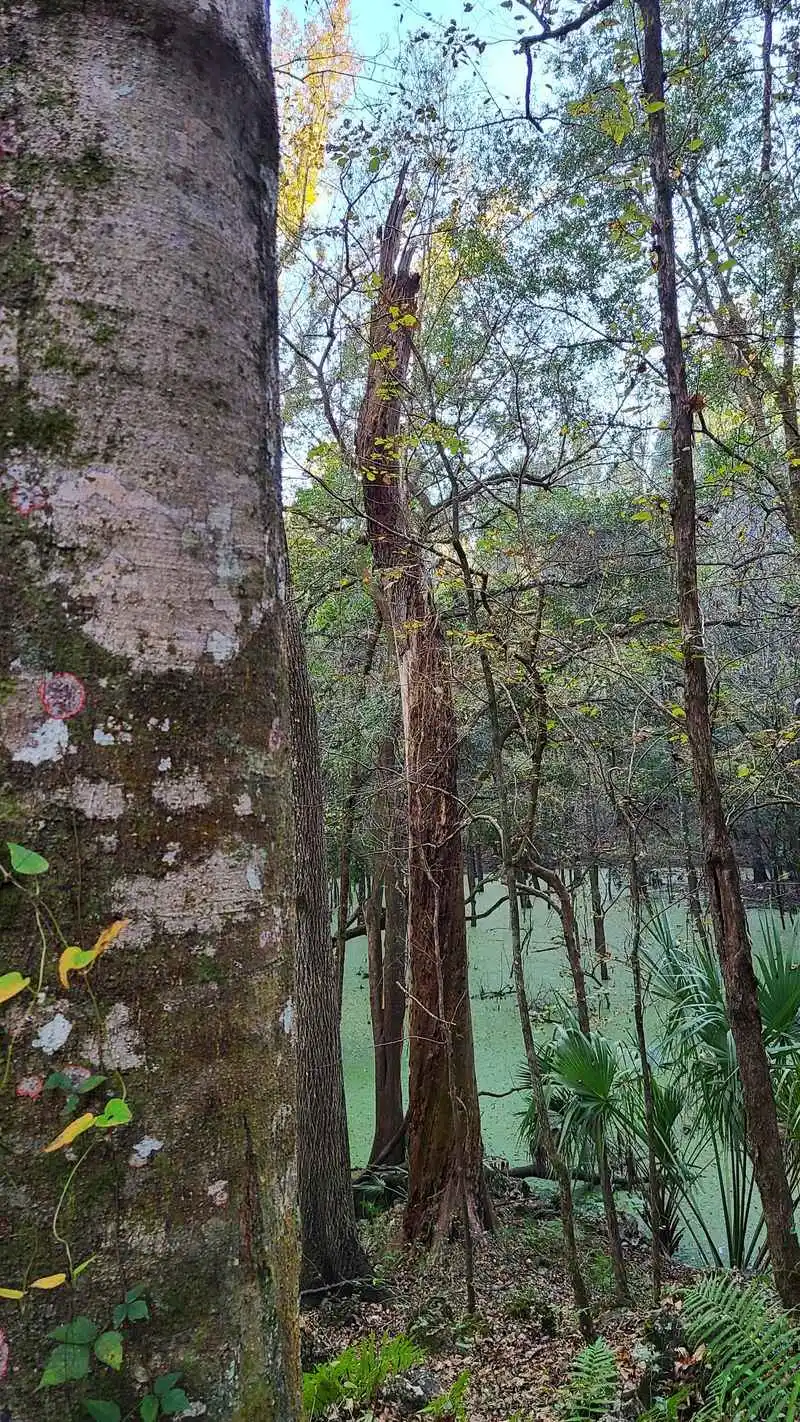
Expect a blend of longleaf pine, live oak, and pockets of hardwood hammock that thrive in limestone influenced soils. Saw palmetto borders the path, while resurrection ferns green up after showers. Look closely for coralbean blooms and tiny wildflowers tucked in rock crevices.
Birdlife is lively, with red bellied woodpeckers, titmice, and hawks riding thermals above the canopy. You might notice zebra longwing butterflies following sun flecks. Early or late hours often bring deer stepping cautiously across the tread.
On the ground, watch for gopher tortoise burrow aprons and give them a wide berth. Snakes may bask on warm limestone, so keep awareness high and pets leashed. Sound travel is muted in the sink area, letting you hear rustles you would miss elsewhere.
Seasonal shifts change the palette from dusty green to glossier, rain washed tones. After storms, mushrooms bloom along fallen logs and shallow cave lips. Bring a small lens cloth to wipe humidity from your camera and capture those fleeting textures.
Best Seasons, Weather, and Timing


Cooler months are prime for this loop because humidity drops and bugs chill out. Winter sun slants low, spotlighting limestone textures and the sinkhole rim. Arrive early to beat heat and have the caves and rock walls to yourself.
Summer works with planning. Start at sunrise, carry extra water, and pace breaks in shade. Rain showers make rocks slick, so tread with care and consider trekking poles.
After a wet spell, the forest hums and colors saturate. You may catch reflections clinging to rock shelves and miniature cascades where runoff threads through grooves. Dry spells sharpen edges and dust the path with pale chips.
Golden hour is photographic magic here. Long shadows carve depth into the stone, and birds animate the canopy. If you are chasing quiet, weekday mornings deliver the most solitude.
Safety, Leave No Trace, and Accessibility

Footing is the main challenge, not distance. Sturdy shoes, grippy soles, and a small first aid kit go a long way. Pack more water than usual because limestone corridors feel drier and breezier.
Follow Leave No Trace. Stay on durable surfaces, skip cave entering, and carry out everything you bring. Resist carving initials into rock or moving stones, which damages habitat and misleads navigation.
This is not an ADA grade path, with roots, steps, and slanted limestone. Families can enjoy it with caution, but strollers will struggle. Dogs should stay leashed to protect wildlife and prevent slips near the sink.
Share the trail with a friendly hello and space at viewpoints. If weather turns, avoid sheltering under unstable overhangs. A simple plan and respectful behavior keep this rare landscape healthy for the next hiker.
Getting There, Parking, and Nearby Logistics

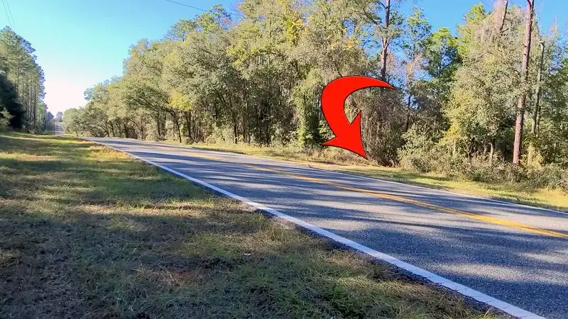
Plug 129 W Stage Coach Trail, Inverness, FL 34452 into your map. The Trail to Lizzie Hart Sink appears as a small hiking area with a 4.5 star rating and a handful of reviews. Parking is limited, so arrive early or plan a midweek visit for space.
There are no major facilities at the trailhead. Bring water, snacks, and a bag for trash. Coverage is decent near the road, then fades as you descend into the karst corridors.
Combine this hike with other Withlacoochee State Forest stops if you want a full day outdoors. However, give this loop unhurried attention because its geology rewards slow travel. You will exit feeling like you visited a different state.
Check current conditions before you go. Heavy rains can change footing and increase slip risk around the sink. A quick weather glance and a backup plan make the day simple and satisfying.