
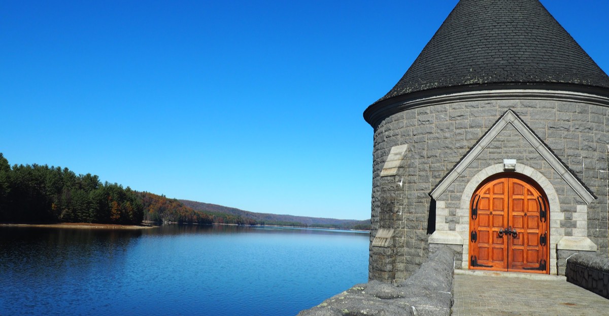
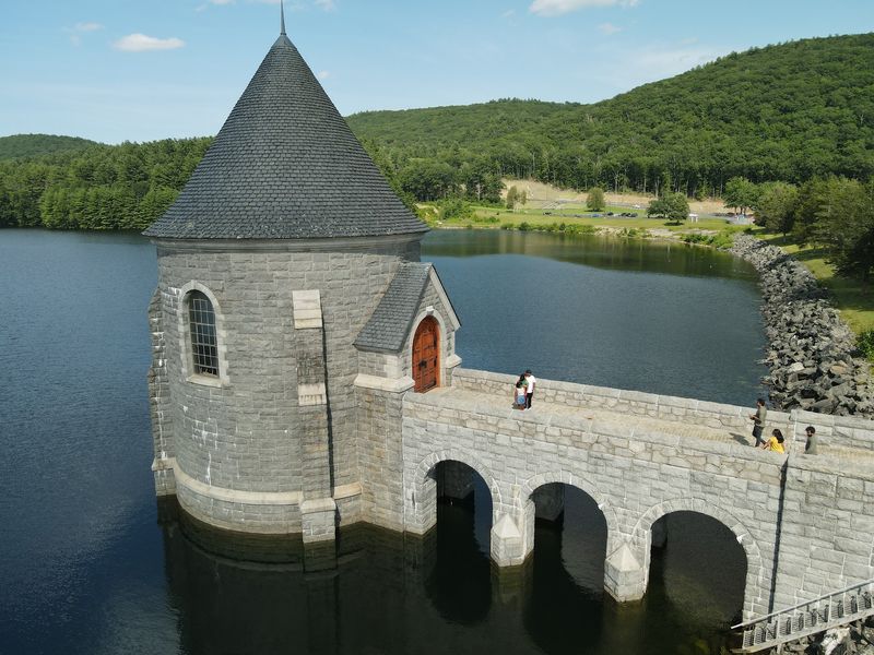
A stone tower with heavy wooden doors rises from the water like a castle somebody misplaced. It stands 181 feet from base to roof peak.
And 115 feet of it hides below the surface.
That tower guards the drinking water for a whole region of Connecticut. A curved stone wall stretches beside it for almost 2,000 feet.
A road runs right across the top, so you can drive over the whole thing.
I love places that do a serious job and still look gorgeous doing it. This one pulls that off without even trying.
The views stretch across miles of water and wooded hills.
Fall turns the scene into something that barely looks real. Sunset does it too.
Honestly, the hardest part might be convincing your friends your photos aren’t filtered.
A Castle Tower Rises Straight Out Of The Water
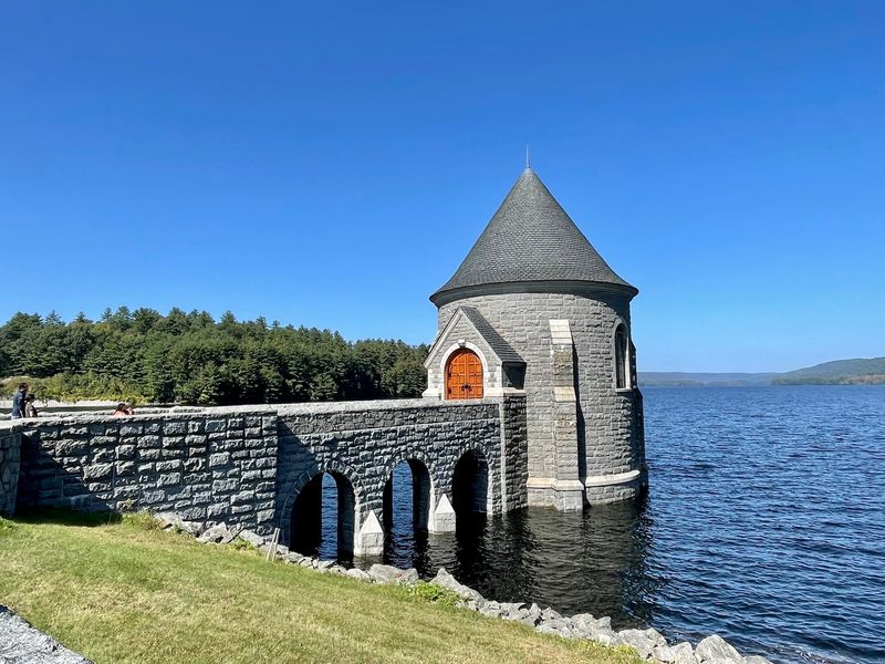
Medieval kingdoms didn’t make it to Connecticut, but somebody clearly forgot to tell the Saville Dam. Its gatehouse looks like a turret pulled straight from a storybook.
The tower is built from concrete and granite, with heavy wooden doors that resemble a drawbridge.
A stone Roman arch bridge connects the tower to land. That walkway is one reason photographers keep coming back.
The arches frame the water beautifully, especially when the reservoir is calm and glassy.
Now for the wild part. The tower stretches 181 feet from its base to the peak of its roof.
About 115 feet of that sits underwater, where you’ll never see it.
So the impressive tower you admire is really just the tip of the structure. Think of it as an iceberg wearing a fancy stone costume.
It’s a fun fact to share with kids who think the castle is small.
Bring a camera with a decent zoom if you have one. The stonework details look great up close.
Wide shots also work well, since the tower and the bridge balance each other nicely. Either way, you’ll leave with a frame-worthy picture.
You Can Literally Drive Across The Top Of It
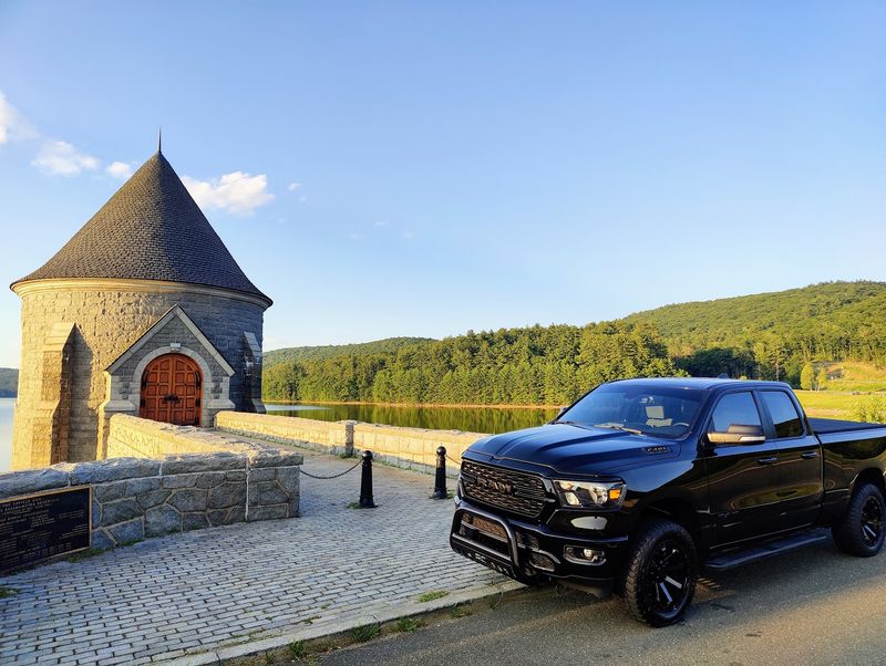
Most dams make you admire them from a distance. Not this one.
Connecticut Route 318, also called Saville Dam Road, runs right across the top.
That means your drive becomes part of the sightseeing. The reservoir spreads out on one side as you cross.
It feels a little like the road was built just to show off the view.
Of course, the best way to enjoy it is on foot. A small walking path follows the top of the dam.
Walking lets you stop, lean in, and actually take everything in.
The dam itself is impressive too. It stands 135 feet tall and runs 1,950 feet long.
That’s longer than five football fields lined up end to end.
Its shape adds extra charm. The dam follows a sweeping convex curve, so the wall seems to bend gracefully along the water.
Engineers loved it, and so do photographers.
Stay aware of traffic while you explore, since this is a working road. Keep little ones close and use the path.
A slow, careful stroll will reward you with far better views anyway.
Fall Colors Here Look Almost Too Good To Be Real
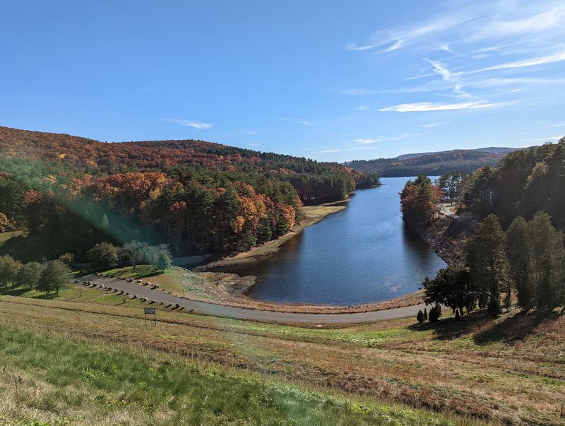
October in the Litchfield Hills is basically a nature show with no ticket required. Around the Saville Dam, the hillsides blaze with color.
The reservoir then reflects all of it back like a giant mirror.
Autumn is easily the most celebrated season here. The dam ranks as one of the most photographed spots in the Litchfield Hills.
It has even been called a top 10 beauty spot in Connecticut.
That’s where the painting comparison really earns its keep. Bright trees, blue water, and gray stonework make a ridiculously pretty combination.
You might catch yourself checking whether the colors are real.
Planning helps a lot. Peak foliage changes from year to year, so watch local leaf reports before heading out.
A sunny day will make the reds and oranges pop even more.
Layers are smart too, since mornings in the hills can feel chilly. Pack a snack and some patience for parking.
The small lot fills quickly on beautiful autumn weekends.
Here’s a tip for better photos. Try including the tower in your foliage shots for a sense of scale.
Those pictures tend to look like postcards.
Stay Until Sunset And Watch The Sky Show Off
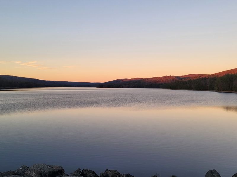
Golden hour hits differently when there are eight miles of water to catch the glow. The Barkhamsted Reservoir stretches far beyond the dam.
At sunset, that huge surface can light up with warm colors.
Sunset is one of the most praised times to visit the Saville Dam. The tower becomes a dark outline against the sky.
Meanwhile, the hills fade into soft layers of shadow.
Timing matters more than you’d expect. Check the sunset time before you leave home.
Arriving 30 to 45 minutes early gives you time to park and find your spot.
Walking the path at this hour feels relaxing and calm. It’s a great way to end a day exploring northwest Connecticut.
Couples, families, and solo wanderers can all enjoy it.
Photographers should bring a steady hand or a small tripod. Light changes fast once the sun drops.
The best colors sometimes show up a few minutes after sunset, so don’t rush off.
A light jacket is a smart move. Breezes off the water can cool things down quickly.
Comfort makes it much easier to stay for the grand finale.
Billions Of Gallons Sit Behind That Pretty Wall
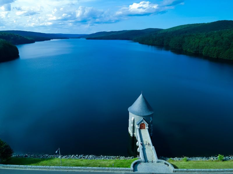
Here’s a number to impress your friends: roughly 30 billion gallons. Sources vary a bit, with some estimates climbing near 36.8 billion.
Either way, that’s a staggering amount of water.
The Barkhamsted Reservoir was created by the Saville Dam. It stretches about eight miles long.
Its northern waters reach into Hartland, close to the Massachusetts border.
This lake isn’t just for looks. It serves as the main drinking water source for Hartford and nearby communities.
So the scenery you admire also fills countless glasses across the region.
The Metropolitan District Commission, known as the MDC, operates the dam and reservoir. Protecting water quality is a big part of that job.
That’s why it’s smart to follow posted rules during your visit.
The dam sits in southwestern Barkhamsted and extends into central Hartland. Its official address is Saville Dam, Barkhamsted, CT 06063.
Your map app should guide you right to it.
Knowing all this makes the view feel even bigger. You’re looking at nature, engineering, and public service working together.
That’s a pretty cool combination for one scenic stop.
The Engineer Behind It Also Worked On The Panama Canal
Caleb Mills Saville had a résumé most engineers would envy. Before this project, he helped with the design of the Panama Canal.
Later, the dam was named in his honor as its chief engineer.
It wasn’t always called that, though. Before 1940, people knew it as Bill’s Brook Dam.
Some folks also call it the Barkhamsted Dam.
The project took years of planning. The MDC was formed in 1929 to manage water for the Hartford region.
It approved the Barkhamsted reservoir project in 1933.
Foundations and a diversion tunnel were finished in August 1934. Work on the main dam started in 1936.
Construction wrapped up in May 1940.
Then came the waiting game. Water first flowed to Hartford on December 21, 1944.
The reservoir didn’t reach full capacity until 1948.
Think about that next time a slow download tests your patience. Filling this reservoir took around eight years after the dam was done.
Some great things simply can’t be rushed.
Knowing the backstory adds depth to every photo. That curved wall represents years of skill and planning.
It’s history you can walk on.
A Whole Village Lies Beneath Those Calm Waters
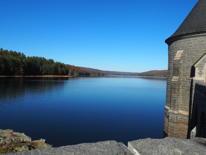
Under all that peaceful blue water lies a story many visitors never hear. Building the reservoir meant flooding farms, buildings, and the entire village of Barkhamsted Hollow.
More than a thousand residents had to relocate.
The valley was cleared by 1936 through buyouts and condemnations. Four church cemeteries were carefully moved to new ground.
More than 20 miles of highway also had to be rerouted.
That’s a huge change for one small corner of Connecticut. Families left homes their relatives had known for generations.
The calm view today carries that quiet history with it.
The Barkhamsted Historical Society helps keep these memories alive. Learning about the lost village gives the scenery real meaning.
It reminds us that big public projects often ask big sacrifices from local people.
Kids especially find this part fascinating. A town underwater sounds like something from an adventure story.
It can spark great conversations about how communities grow and change.
So pause for a moment while you’re on the walking path. Look across the water and remember who lived here before.
The view becomes more than pretty. It becomes thoughtful.
Lace Up Your Sneakers For Trails And Runs Nearby
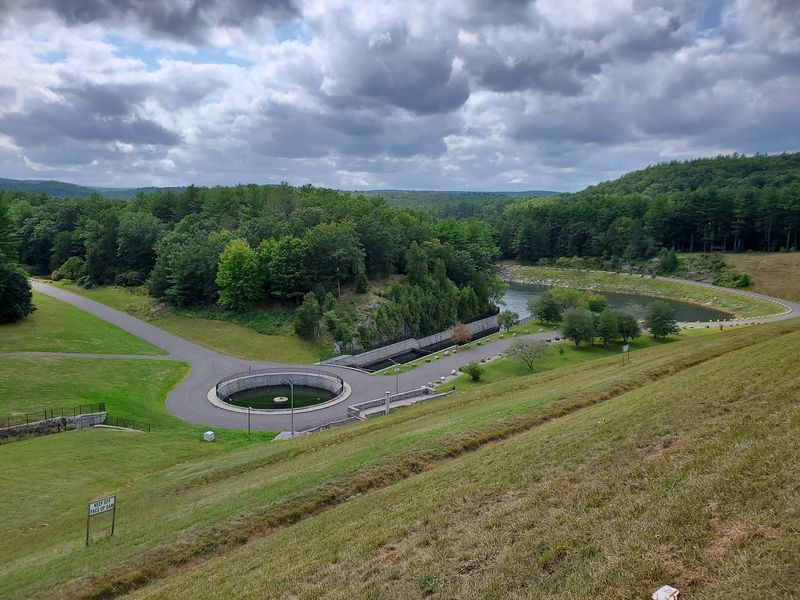
Walking the dam is a great warm-up, but the fun doesn’t have to stop there. The surrounding area is packed with outdoor options.
Hikers, bikers, and runners all have plenty to explore.
Runners will appreciate a mapped 3.8-mile out-and-back route. It follows Saville Dam Road and Beach Rock Road.
Dirt access roads around the reservoir can stretch the distance if you want more.
Nearby state forests add even more choices. Peoples State Forest and American Legion State Forest both offer trails to explore.
Their wooded paths make a nice contrast to the open reservoir views.
Paddlers aren’t left out either. The reservoir feeds the Farmington River downstream.
That river offers kayaking and canoeing opportunities for people who love being on the water.
Bring water, snacks, and sturdy shoes for any longer outing. Trail conditions can change with weather and season.
A quick check of maps before you go saves a lot of guesswork.
Pairing the dam with a hike makes for a full, happy day. You’ll get exercise, fresh air, and scenery in one trip.
Not a bad deal for a free afternoon.
Snag A Rare Peek Inside If A Tour Pops Up
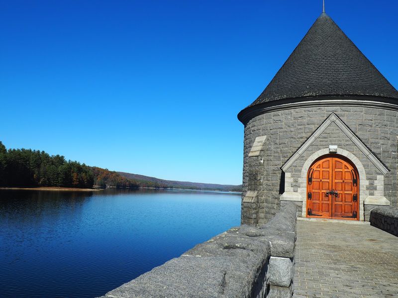
Those big wooden doors on the tower aren’t just decoration for curious eyes. Every so often, lucky visitors actually get to go inside the dam.
These tours happen infrequently, so they feel like a special treat.
The MDC, the Barkhamsted Historical Society, and the Farmington River Watershed Association coordinate them. Some tours may have a cost.
They were also paused for a while during the pandemic.
Keep an eye on those organizations if a tour sounds exciting. Spots for rare events like this can go fast.
Signing up early is your best bet.
Even without a tour, the Saville Dam rewards every visit. A small parking lot sits near the intersection of Routes 219 and 318.
The site is open to the public all year.
Spring brings fresh green hills, and winter brings quiet, crisp views. Every season paints its own version of the scene.
Clearly, this Connecticut masterpiece never really closes its gallery.