
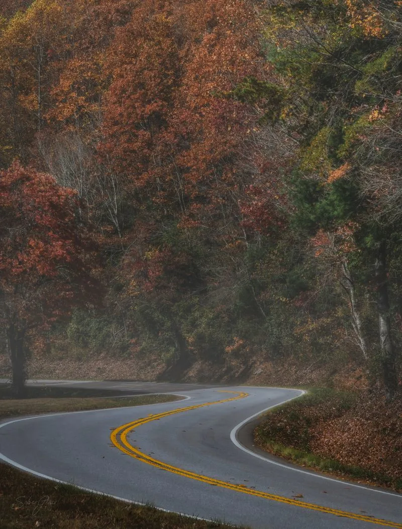
There is a quiet mountain road in North Georgia that feels like a secret, even though it loops through some of the state’s most breathtaking scenery.
The Russell-Brasstown National Scenic Byway winds over ridgelines, past waterfalls, and through misty valleys where the light changes by the minute. Drive it once and you will wonder how it stayed off your radar for so long.
Here is how to make every mile count, from the best overlooks to short trails worth pulling over for.
Overview and route planning essentials

The Russell-Brasstown National Scenic Byway forms a 40-plus mile loop through the Chattahoochee National Forest, linking twisting ridgelines, deep hollows, and evergreen coves. You will pass near Helen, GA, then climb past Hogpen Gap and Wolfpen Gap toward Brasstown Bald. Cell service fades in stretches, so download maps before rolling out and set expectations for a relaxed pace.
Most travelers drive clockwise to catch morning light along Dodd Creek and afternoon glow near Tesnatee Gap. Fuel up beforehand in Helen or Blairsville, and stash water plus a light jacket, since temperatures swing with elevation. Pullouts appear frequently, but sightlines can be short, so signal early and use hazards when stopping.
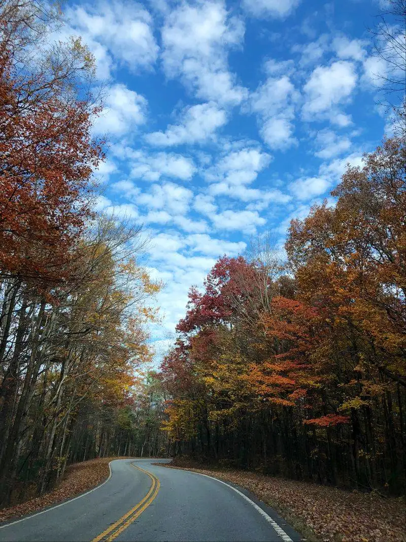
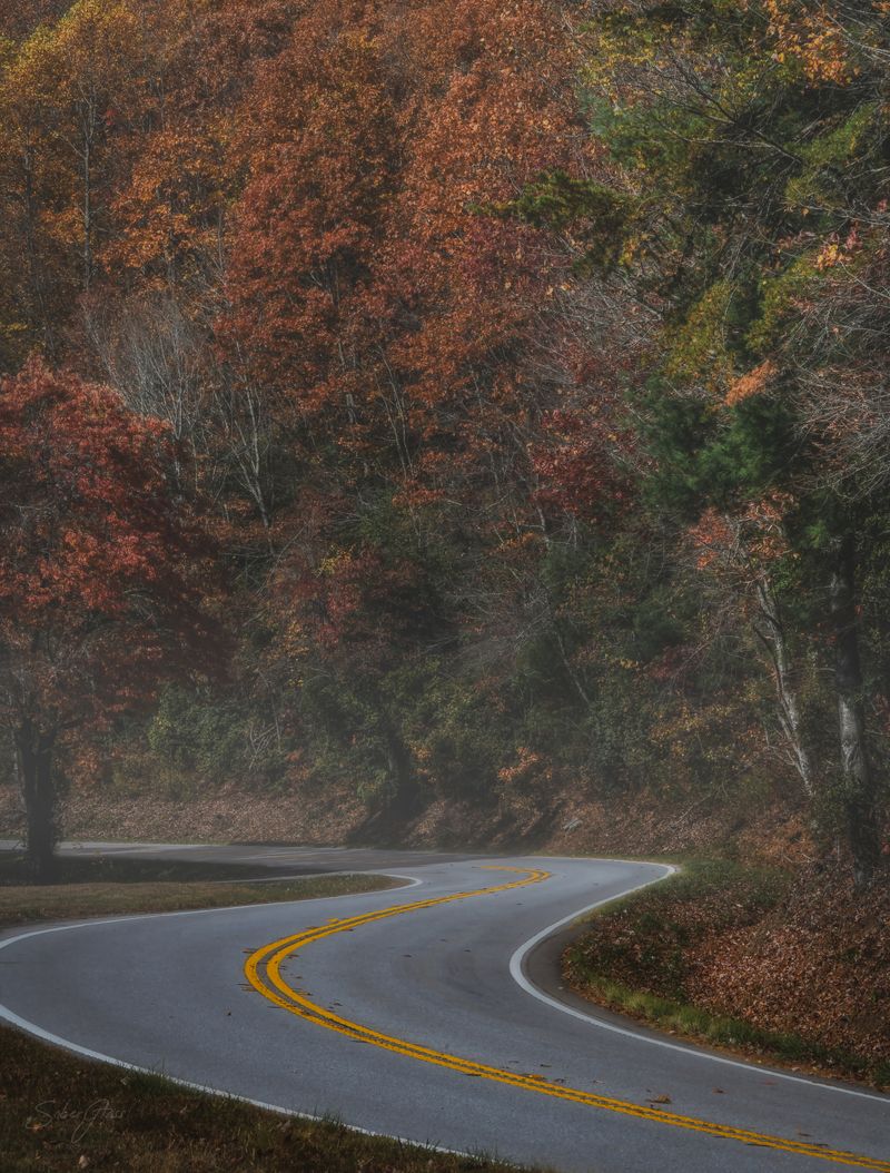
Timing matters. Spring brings wildflowers and rushing cascades after rains. Summer delivers lush shade and afternoon storms. Fall is the showstopper, with sugar maples and oaks streaking the slopes in amber and crimson, while winter reveals long views through leafless canopies.
Allow four to six hours with photo stops and a couple short hikes. Keep headlights on, watch for cyclists, and mind 35-45 mph limits. This is a scenic drive, not a race. Let the rhythm of the curves slow you, and you will catch details many miss.
Brasstown Bald spur and summit views

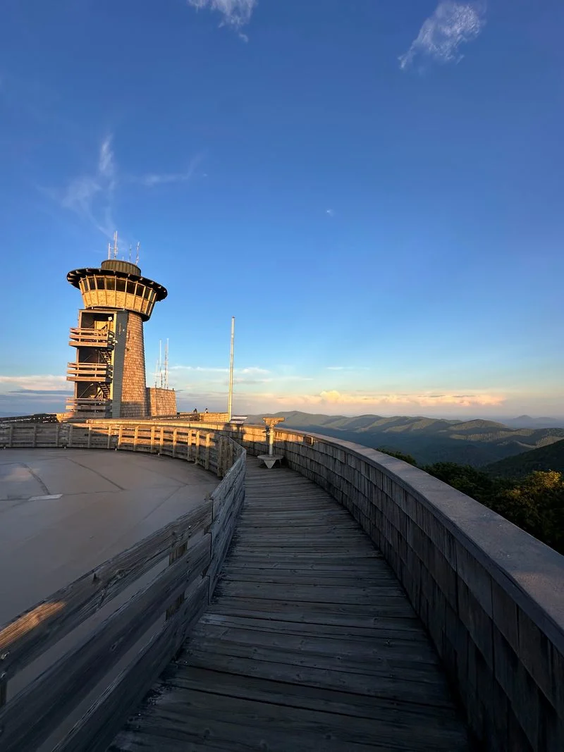
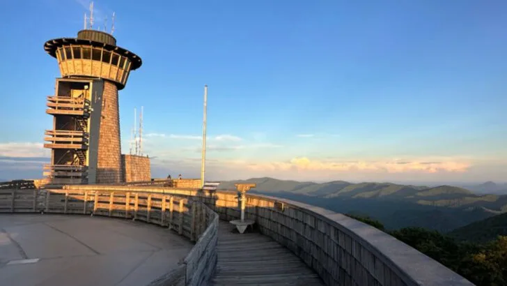
Brasstown Bald, Georgia’s highest point at 4,784 feet, sits just off the byway via a short spur road. Park at the visitor area, then ride the seasonal shuttle or walk the steep half-mile trail to the observation deck. On clear days you can spot four states, with blue layers rolling to the horizon like waves.
The summit offers exhibits about Cherokee heritage, high-elevation forests, and fire lookout history. Telescopes point toward Lake Chatuge, Tray Mountain, and distant South Carolina ridges. If you chase golden hour, arrive early since the parking area fills and winds can be biting even on warm afternoons.
Plan for a quick weather change. Clouds sweep over the crest and visibility can vanish. Bring a wind shell, water, and a hat, especially outside summer. After sunset, drive carefully down the spur, using low beams in fog and watching for deer edging the road.
Photography tips: shoot wide for layered ranges, then switch to a short telephoto to compress ridges. Polarizers tame haze but can uneven skies at high angles. Even if the view socks in, you will feel the mountain’s pulse, the cool resin scent of spruce-fir, and the quiet that follows the wind.
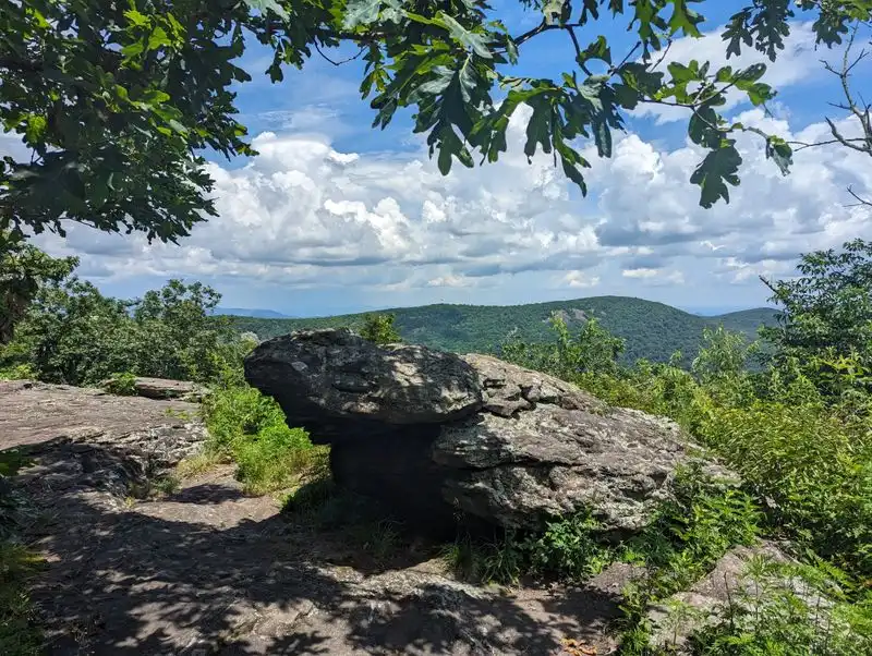
Hogpen Gap overlooks and curves

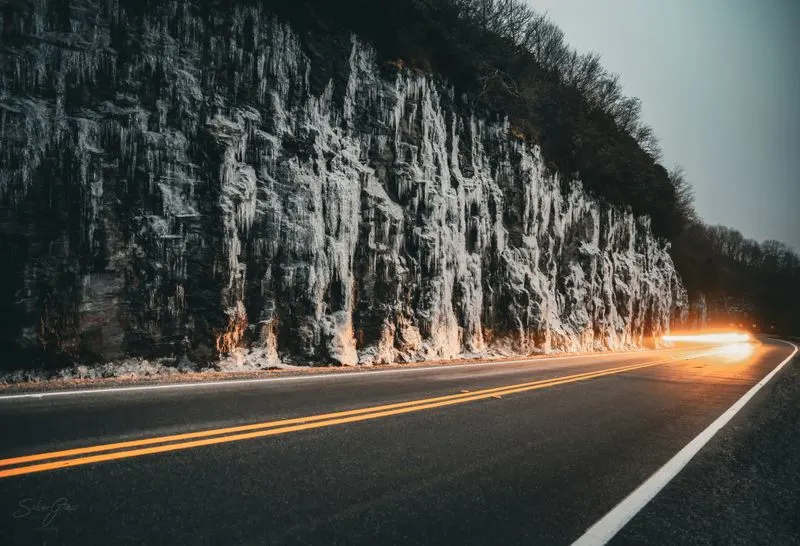
Hogpen Gap is where the byway shows its alpine personality. The climb is steady, the switchbacks tight, and the vistas open suddenly between bends. Use designated pullouts to gaze south toward ridges stacked like folded cloth, then step back as trucks and motorcycles ascend with a low growl.
Expect cooler air and stronger winds here. Even in summer, clouds nip the ridgeline and dampen the pavement. Keep traction smooth, brake early, and let the transmission hold speed on descents. This is a favorite training stretch for cyclists, so pass politely and give wide berth.
Short trails slip into the woods from nearby gaps, offering mossy boulders and rhododendron tunnels. In spring, pinkshell azalea and trillium dot the slopes. Fall lights everything up, from scarlet sourwood to amber hickory, and you will want extra time for photos as light rakes across the contours.
For a perfect stop, bring a thermos and linger at an overlook as the valley breathes below. The soundscape is wind, occasional birds, and the click of cooling brakes. You will leave calmer, with that mountain-quiet carried into the rest of your drive, ready for the next long blue view.
Raven Cliffs Falls trailhead stop
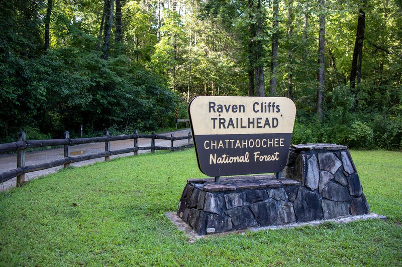
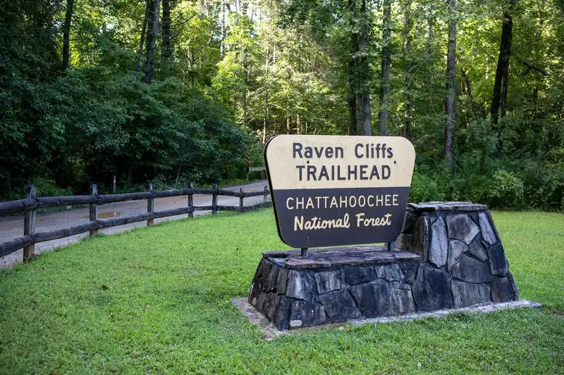
Right off the byway, the Raven Cliffs Falls trailhead invites a leg stretch along Dodd Creek. The path is mostly gentle, following the stream past small cascades and pools where kids toss pebbles. The full hike to the dramatic cleft falls is longer, but even a short wander rewards with cool shade and the hush of water.
Expect roots, rocks, and occasional mud after rains. Wear trail shoes, pack a snack, and bring a light rain shell because storms bubble up quickly. You will find photogenic footbridges and rhododendron archways, plus benches where you can listen to the creek’s steady chatter.
Parking fills fast on peak weekends. Arrive early or swing by late afternoon when day hikers trickle out. Keep food sealed and Leave No Trace, as small critters patrol the edges of picnic spots. Restrooms are basic and may be closed in winter, so plan accordingly.
Back on the byway, the transition from forest hush to winding pavement feels seamless. The creek’s cool air lingers in your hair, and your pace naturally settles down. Even if you do not make it to the main falls, this stop tunes your senses for the rest of the drive, attentive to the smallest sounds.
Dukes Creek Falls overlook and hike option


Dukes Creek Falls is an easy add, with a well-built trail and boardwalk system that switchbacks to a roaring confluence. You will hear it before you see it, a steady thunder that bounces off rock walls. The descent is friendly for families, with rails and benches placed where views open.
The falls explode into white ribbons, especially after rain. Photographers love long exposures here, so bring a small tripod and neutral density filter if you have one. Watch slick spots near spray zones, and keep kids within arm’s reach on platforms overlooking the plunge.
Time your stop for mid-morning or late day, when sun shafts filter through the canopy and mist glows. In fall, the amber canopy frames the water like stained glass. Return climbs are gradual, so pace yourself and sip water, then reward the effort with snacks at the trailhead.
From the parking area, the byway reconnects quickly, letting you pair this hike with Raven Cliffs or Smithgall Woods. The sound of Dukes Creek lingers as white noise in your head as tires roll. It is the perfect balance to long-view overlooks, grounding you in the valley’s cool heart.
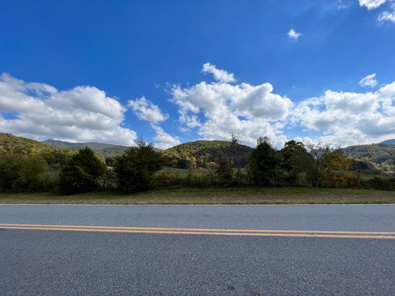
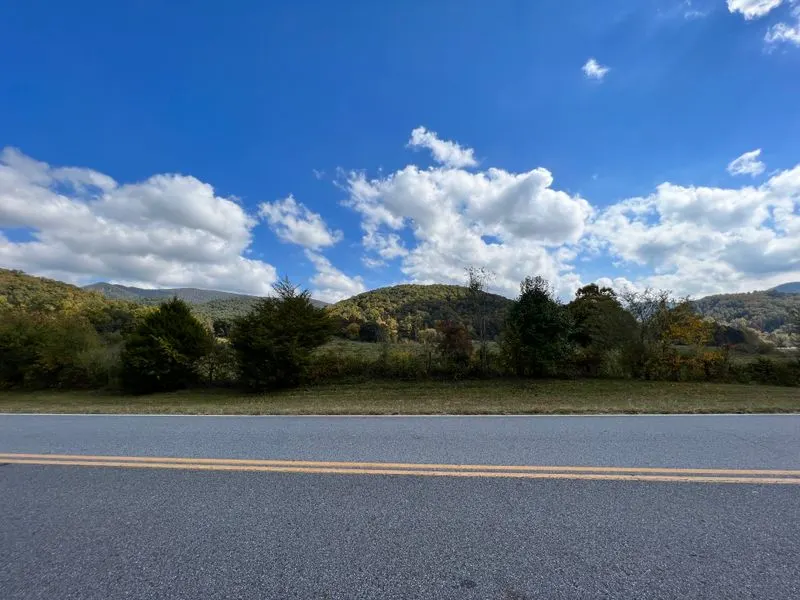
Scenic pullouts between Tesnatee Gap and Wolfpen Gap

Between Tesnatee Gap and Wolfpen Gap, the byway tracks the spine of the Blue Ridge with frequent pullouts. Each turnout frames a different valley, from patchwork farms to shadowed coves where creeks thread toward the Chattahoochee. You can hopscotch between viewpoints, chasing the best angle on shifting light.
These stops are perfect for quick breaths and photos. Keep doors tucked in when opening on the traffic side, and use hazard lights if visibility dips in fog. Bring a cloth to wipe lenses as breeze-blown mist and pollen can leave a film that softens images unexpectedly.
Interpretive signs at select overlooks highlight geology, forest recovery, and early mountain roads. Reading them adds context to the curves under your tires. Hardwood species change subtly with elevation, and you will notice red maple giving way to beech and birch near cooler saddles.
On windy days, lean on the low stone walls and feel the push. It is a good reminder to take the turns gently afterward. The rhythm becomes inhale at the overlook, exhale through the next bend, repeated until the miles blur into a single, satisfying memory of sky and distance.
Waterfall trifecta: roadside cascades and short spurs
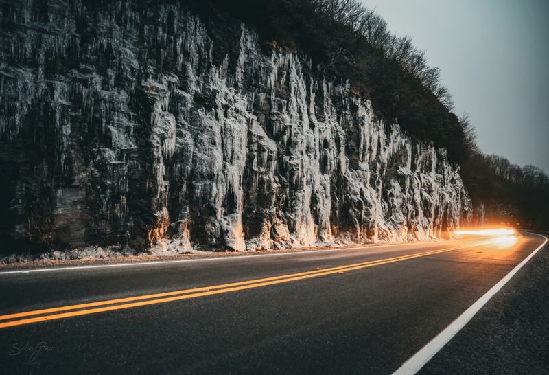
The byway’s watershed-rich terrain means cascades appear around many bends. After rains, unnamed seeps ribbon down rock faces like silver threads. Short spurs lead to named falls while roadside trickles invite five-minute photo stops that turn into twenty, the soundtrack a constant, happy rush.
Bring water shoes or sturdy sandals if you like creek wading. Stay aware of slick algae and sudden drop-offs. Photographers should pack a microfiber cloth and small tripod, plus a gallon bag to shield gear during spray. Overcast days are perfect for milky water shots and saturated greens.
Leave stones where they are and skip dam building. It disturbs aquatic life, and the creek will always look better natural. Keep an eye on afternoon thunderstorms, which can swell streams quickly. If water turns muddy and rises, step back to higher ground and reassess.
These small cascades often become your favorite memories because they are unplanned. A glint through trees, a quick pullout, shoes off, then laughter as cold water bites your ankles. The big-name falls are wonderful, but the byway’s roadside music is what makes the drive feel alive from mile to mile.
Wildlife and road etiquette on a mountain byway

Wildlife is part of the byway’s charm. You may spot deer at dawn in grassy openings, wild turkeys slipping across gravel, or a black bear disappearing into rhododendron thickets. Maintain a steady speed, scan ahead, and avoid swerving hard, which can lead to dangerous off-camber mistakes.
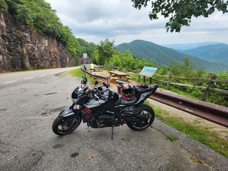
Use low beams in fog and early light, and keep sunglasses handy for sudden sun breaks. Give cyclists three feet or more when passing and wait for clear straights. Motorcyclists frequent these curves, so check mirrors before pulling back out from overlooks and signal early.
Sound travels far in quiet coves. Keep music low at pullouts and let engines idle briefly rather than rev. Pack out trash, including orange peels, and secure food to discourage roadside begging by animals. Teach kids to enjoy wildlife from a distance without feeding or chasing.
When traffic stacks behind you, use the next turnout to let faster drivers pass. It keeps the vibe friendly and your stress down. The byway rewards patience. With thoughtful road manners, everyone gets their moment of silence and a clean, unhurried line through the next sunlit curve.
Best picnic spots and quiet pull-offs

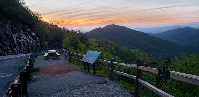
Pack a simple picnic and you will double the byway’s magic. Look for shaded pull-offs with a sliver of view and a safe shoulder, especially near ridge saddles where breezes move. A table is nice, but a blanket on smooth rock warms quickly under sun and makes sandwiches taste better.
Midweek is your friend if you want quiet. Aim for late breakfast or early dinner to dodge lunchtime rush. Keep an eye on ants and yellowjackets, seal sticky items, and whisk crumbs into a bag. A lightweight sit pad or camp chair turns any overlook into a lingering stop.
Pair your meal with a short stroll down an adjacent trail. Even five minutes into the woods softens road noise and brings birdsong close. In fall, a thermos of soup hits perfectly. In summer, crisp fruit and cold tea keep the mood refreshed and unhurried.
Leave spots cleaner than you found them. Fold up the blanket, shake it away from the edge, and take a last slow look over the valleys. These small, intentional pauses give the route its heartbeat, transforming a pretty drive into a day you will want to repeat.
Weather, road conditions, and safety planning
Mountain weather shifts quickly along this loop. Morning fog can dissolve into sun, then rebuild by afternoon as humid air rides upslope. Check 511GA for road updates before leaving Helen or Blairsville, and download offline maps since reception fades around ridges and hollows.
Carry basics: water, snacks, a compact first aid kit, headlamp, and a light insulating layer even in summer. A tire gauge and small compressor are handy after gravel pullouts. Keep fuel topped off early. If storms roll in, slow down, increase following distance, and skip exposed overlooks until lightning passes.
Brakes can warm on long descents. Downshift to manage speed and test pedal feel occasionally. If you smell hot pads, pull into a turnout and let things cool while you enjoy the view. Fallen branches appear after gusts, so scan pavement, especially in shadowy corners where contrast hides debris.
Share your plan with someone, including loop direction and estimated return. Respect dusk, when wildlife moves and contrast drops. With a little preparation, you will swap stress for confidence, and the byway’s curves will feel like choreography, each turn a steady breath in the mountain air.
Putting it all together: a perfect day itinerary
Start at sunrise near Tesnatee Gap to catch soft light on layered ridges. Roll toward Raven Cliffs for a creekside leg stretch, then continue to Dukes Creek Falls by mid-morning when mist still lingers. Grab coffee and fuel in Helen or Cleveland before tackling Hogpen’s curves and overlook pauses.
Midday, chase shade with a picnic at a quiet pull-off, then sample the Appalachian Trail from a nearby gap for an hour. Keep your pace unhurried and your plan flexible. If clouds build, lean into waterfall stops and forest walks. If skies clear, string together ridge views and long, easy breaths.
Late afternoon, head up the Brasstown Bald spur for golden hour. Bring a light jacket and patience as winds lift. Watch the mountains fade from green to blue to indigo while the day cools. After sunset, descend carefully, letting the day’s last light bracket the road.
Finish the loop as stars spark above the forest. You will feel that particular mountain tiredness that is mostly contentment. With this rhythm, the byway becomes more than a drive. It becomes a story you carry home, eager to share and ready to repeat next season.