
If you crave winding canyon walls, crimson cliffs, and cool mountain air, Arizona‘s State Route 89A delivers it all in one unforgettable ribbon of pavement. This 83.85-mile highway strings together Sedona, Oak Creek Canyon, Jerome, and Flagstaff with nonstop scenery and character. You will discover roadside overlooks, historic towns, and trailheads that reward even quick stops.
Buckle up and keep your camera handy, because 89A makes every mile feel like the highlight reel.
Overview of Arizona‘s State Route 89A

Arizona‘s State Route 89A is a scenic highway that threads from Sedona to Flagstaff through Oak Creek Canyon, with extensions connecting to Jerome and Prescott Valley. The roadway blends dramatic geology with approachable access, so you can mix casual sightseeing with active exploration. Curves feel intimate yet confidence inspiring, inviting careful driving and frequent pullouts.
Expect shifting biomes as you climb or descend. Red sandstone gives way to ponderosa pine, then to high country meadows and volcanic remnants near Flagstaff. Seasonal color adds personality, from spring greens to autumn’s golden aspen patches.
Services cluster in towns, while canyon stretches rely on pullouts and day-use areas. Cellular reception is spotty in narrow sections, so download maps and trail info ahead of time. Bring layers, water, and patience for traffic during peak weekends.
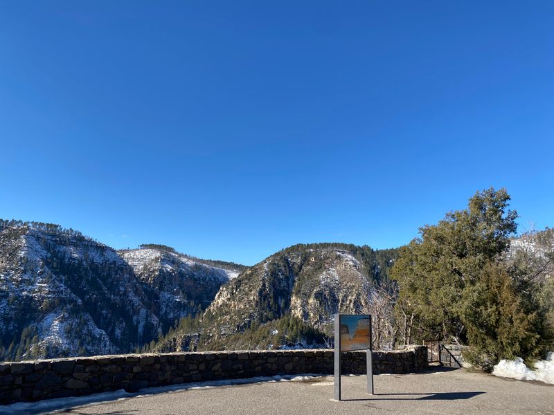
Major highlights include Slide Rock State Park, Midgley Bridge, switchbacks up Oak Creek Canyon, and Jerome’s hillside streets. Each stop offers a different angle on Arizona’s varied terrain. Plan extra time, because you will want to linger for photos, short hikes, and roadside snacks that taste better with those views.
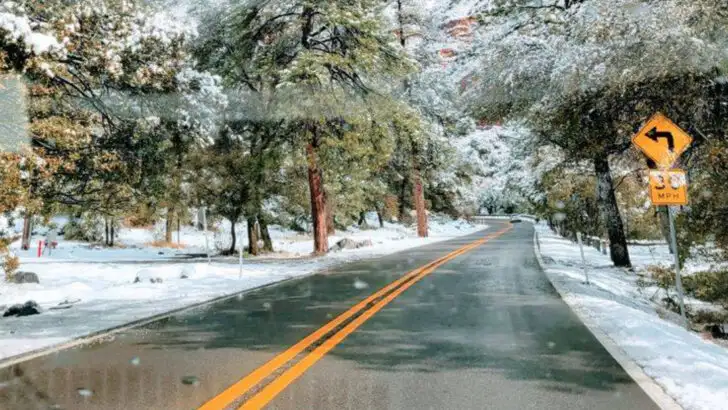
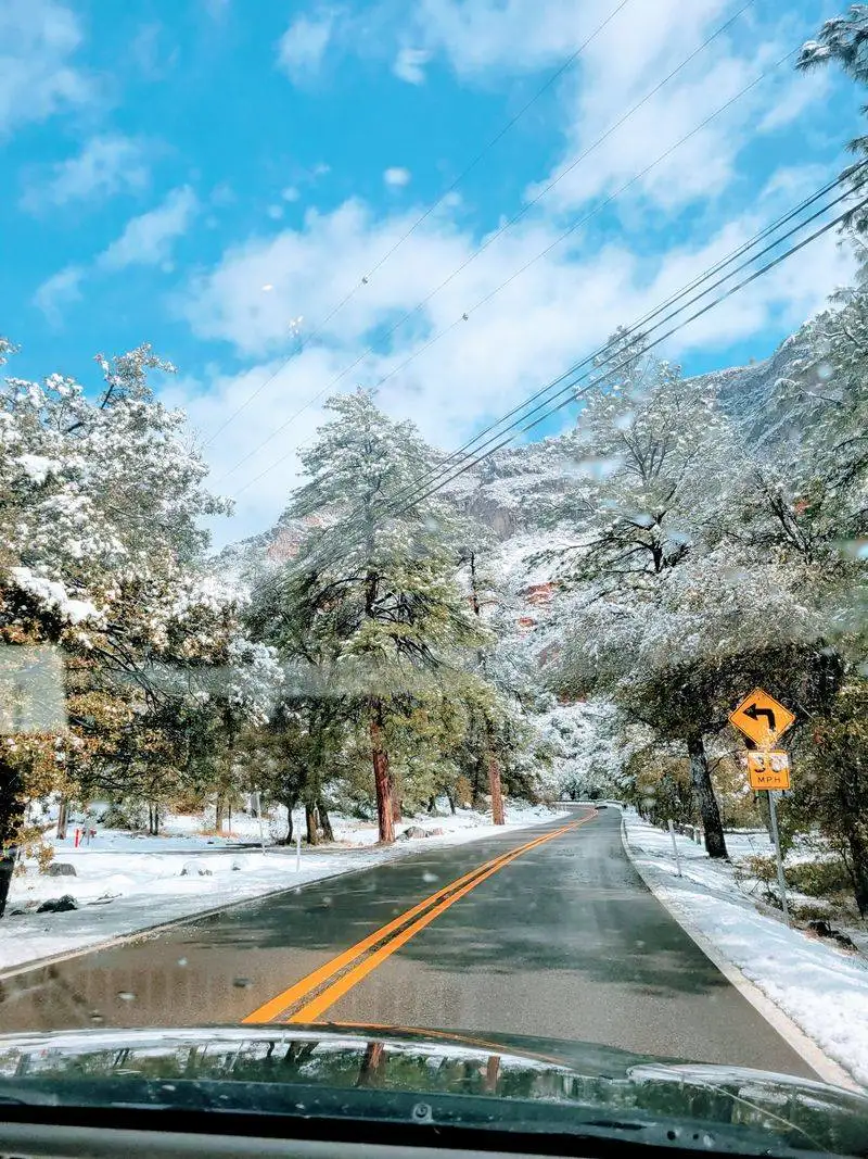
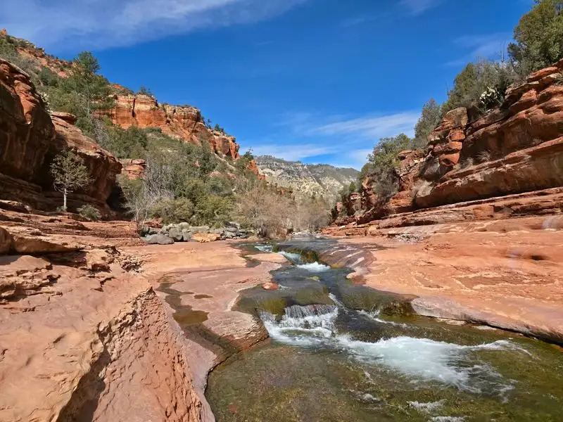
Driving Oak Creek Canyon switchbacks
The Oak Creek Canyon switchbacks are the heart-pounding crescendo on 89A. Tight curves carve into the canyon’s steep walls as the highway climbs from creek level toward the high country. You will want low gears, focused attention, and a willingness to pull over for slower traffic.
At overlooks, you can watch the road trace a zipper across the cliffs. The elevation change cools the air quickly, so summer afternoons feel refreshing near the top. In winter, check conditions because shaded corners hold slick spots longer.
Traffic ebbs and flows with weekend getaways, leaf-peeping season, and holidays. Leave space between vehicles and use turnouts generously. Patience pays off with scenery that unfolds like a living postcard.
Bring a camera with a polarizer to tame glare from the canyon walls and creek. Sunset light warms the red rock and gives the pines a luminous edge. Whether ascending or descending, the switchbacks are a rite of passage on this route that you will remember long after the engine cools.
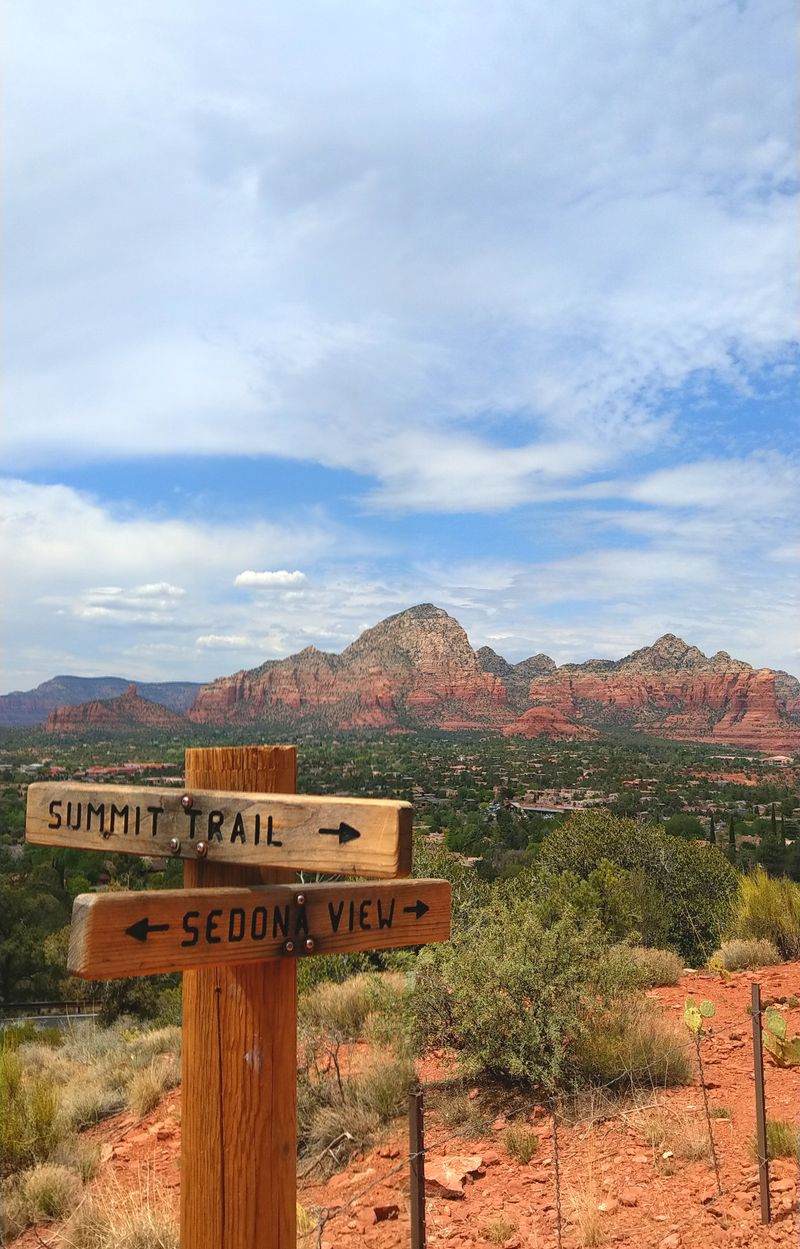
Sedona gateway and red rock vistas

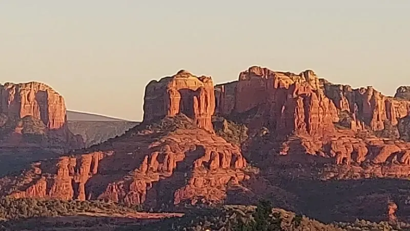
Sedona anchors the southern stretch of 89A with iconic red rock formations that feel impossibly sculpted. As you approach, buttes and spires rise from juniper flats, revealing layers of sandstone that blaze at sunrise and sunset. You can hop between trailheads, cafes, and galleries without leaving the scenic corridor.
89A doubles as Sedona’s main artery, so expect slow rolls through town during peak seasons. Turnouts and roundabouts keep things moving if you stay patient. Park once and wander, because many viewpoints sit within a short stroll.
Popular sights include Cathedral Rock, Coffee Pot Rock, and Airport Mesa’s overlook. Each spot offers different light angles and textures, so time your visit for the golden hours. A short hike can deliver big payoffs without strenuous effort.
For road-trippers, Sedona provides fuel, groceries, and gear rentals. You will find excellent bakeries for road snacks and espresso before tackling canyon climbs. With the car packed and camera ready, you can roll from town into wilderness in minutes, which is Sedona’s magic on 89A.
Slide Rock State Park essentials

Slide Rock State Park transforms Oak Creek into a natural waterslide where smooth sandstone funnels emerald water. Families, photographers, and heat-weary travelers converge here on warm days. You will want water shoes, sunscreen, and a dry bag for phones.
Arrive early on weekends because the parking lot fills quickly. When capacity is reached, rangers hold vehicles at the entrance, and the line can crawl. Weekdays and shoulder seasons feel calmer and just as beautiful.
Trails along the creek reveal classic Sedona red rock framed by cottonwoods. The water is chilly even in summer, which feels amazing after dusty hikes. Keep an eye on footing because algae makes certain slabs slick.
Facilities include restrooms, picnic areas, and lifeguards during peak times, but rules change seasonally. Check flow conditions and closures after storms. With a few preparations, you can slide, wade, and lounge beside a desert stream that feels like a secret oasis tucked right off 89A.
Midgley Bridge and canyon views

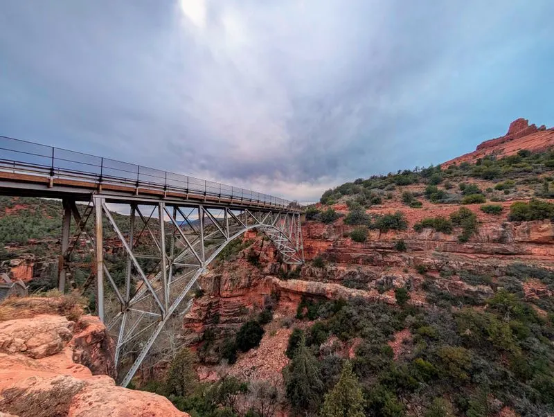
Midgley Bridge offers one of the quickest wow moments on 89A. The steel arch leaps across a deep cut in the sandstone, and the pullout lets you step right into the view. You can photograph both the bridge and the canyon without a long hike.
Morning light lifts shadows from the creek corridor, while late afternoon glows on the red walls. Traffic flows nearby, so stay alert when crossing the parking area. You will often see photographers setting up tripods to catch cars streaking across the span.
Short trails lead to additional vantage points, with prickly pear and agave dotting the slopes. Watch for seasonal wildflowers adding color pops between rocks. The drop-offs are real, so keep kids and pets close.
Midgley works as a quick stop or part of a longer hike network that connects deeper into Sedona’s backcountry. It is ideal when time is tight but you still want that classic canyon angle. Snap the shot, breathe the pine-scented air, and roll on toward the next curve.
Hiking trailheads along 89A

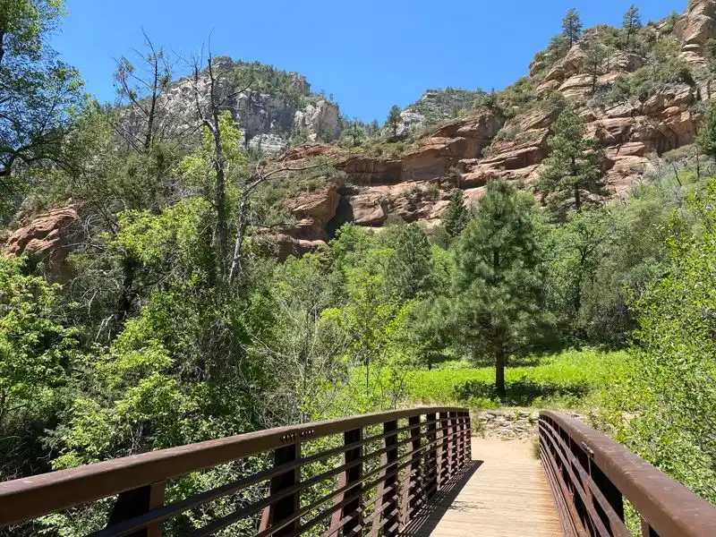
State Route 89A lines up a buffet of trailheads for every energy level. From creekside strolls to red rock scrambles and pine forest loops, you can tailor miles to your timeline. Bring water, sun protection, and downloaded maps since reception fades in the canyon.
Popular options include West Fork for shaded canyon walking, Airport Mesa for sunset panoramas, and Midgley-adjacent routes for quick access. Start early to secure parking and cooler temperatures. Trail etiquette matters with heavy use, so yield on narrow sections.
Footing shifts from sandy to rocky steps. Trekking poles help on steep segments, while water shoes suit creek crossings. Weather can shift quickly near the rim, so layers keep you comfortable.
Trailheads close to Sedona fill first, but options near the switchbacks sometimes open later in the day. If a lot is full, do not shoulder-park in unsafe spots on 89A. Choose another trail and circle back, because safety is worth the detour and the views will still be waiting.
Seasonal driving and weather tips

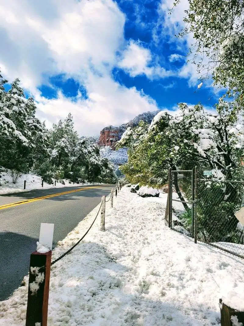
Seasons transform 89A’s character. Summer brings hot canyon floors and afternoon storms, while the rim stays cooler and breezier. Winter can dust the switchbacks with snow and ice, especially on shaded curves.
Check Arizona DOT updates before departure. Chains are rarely required but traction tires help in cold snaps. Monsoon storms can trigger debris on the roadway and sudden creek rises.
Pack layers, because temperatures swing dramatically between Sedona and Flagstaff. A lightweight puffy and rain shell cover most scenarios. Sunscreen is a year-round necessity at elevation.
Start drives early to beat heat, traffic, and glare. Late light can be mesmerizing but also blinding as the sun sits low across canyon walls. With a flexible plan and weather awareness, you can enjoy the full spectrum of 89A’s moods safely.
Historic Jerome side trip

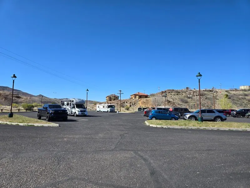
Jerome perches on Cleopatra Hill above the Verde Valley, a short detour via 89A that rewards curiosity with character. Once a copper mining boomtown, it now blends art studios, tasting rooms, and creaky boardwalks. The drive up reveals sweeping valley views that demand a pause.
Streets are narrow and parking is quirky, so small cars feel easier here. Take it slow and watch for pedestrians popping between storefronts. You will hear stories of hauntings, mine shafts, and colorful past residents.
Stop by the Jerome State Historic Park for context and hillside panoramas. Galleries showcase local copper-inspired pieces, while cafes serve strong coffee with stronger opinions. Photography is irresistible, especially in golden hour.
When you roll back toward 89A, you will appreciate how diverse this corridor is. One moment you are in red rock country, the next you are time traveling through a mountain hamlet. Jerome adds texture and narrative to an already stellar road trip.
Flagstaff rim and forest transition

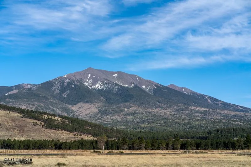
North of Oak Creek Canyon, 89A crests onto the Flagstaff rim and steps into ponderosa pine and higher elevation. The air cools, the light softens, and the road straightens compared to canyon curves. You will spot the San Francisco Peaks anchoring the horizon.
Trailheads here offer forest loops and meadows that bloom after summer rains. Wildlife sightings increase, from mule deer to curious ravens. Keep speeds moderate, especially at dawn and dusk.
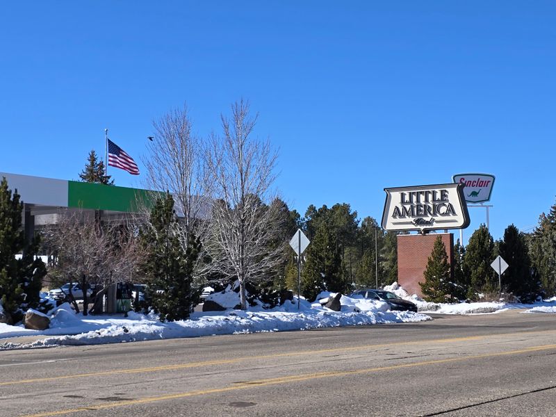
Flagstaff provides full services, breweries, and a historic downtown perfect for stretching legs. This is a good base if you want to day-trip back into the canyon without changing hotels. Parking is easier than Sedona during peak times.
As you transition between ecosystems, notice how geology, plants, and temperature tell a layered story. The shift makes 89A feel like multiple trips in one. It is a satisfying capstone after the canyon drama or a refreshing prologue before you descend.
Photography and sunrise to sunset planning

Light is the secret sauce on 89A. Sunrise kisses Sedona’s red rock with soft pastels, while sunset ignites cliffs and clouds. Midday works for creek scenes where reflections shimmer in the shade.
Scout turnouts the day before to avoid backtracking. Keep lenses handy and batteries charged because opportunities pop fast along the highway. You will want a polarizer, ND filter for water, and a telephoto for compressed canyon layers.
Plan a loop: sunrise near Airport Mesa, late morning at Slide Rock, golden hour at Midgley, and blue hour rolling toward the rim. When skies threaten, dramatic storm light can outshine bluebird conditions. Safety first, though, because wet roads demand slower speeds.
Respect no-fly zones for drones and give other photographers space at tight overlooks. A microfiber cloth saves the day when spray or dust collects on glass. With a flexible plan, you will bring home images that feel like the road itself, dynamic and alive.
Where to eat, fuel, and rest

Food, fuel, and rest spots cluster in Sedona, Jerome, and Flagstaff, with sparse options in the canyon itself. Top off the tank before committing to long scenic stretches. You will find roadside cafes serving pastries, tacos, and espresso that taste better after a hike.
In Sedona, plan a relaxed lunch to avoid rush-hour crawl. Flagstaff’s brewpubs and diners make satisfying finish-line meals. Jerome serves eclectic bites with vintage atmosphere and big views.
Carry snacks, water, and electrolytes so you are not beholden to the next town. Picnic pullouts turn simple meals into five-star experiences with a red rock backdrop. Dispose of trash responsibly so wildlife stays wild.
Restrooms appear at parks, major trailheads, and town centers, but not at every overlook. Short power naps are safest in proper parking areas, never on road shoulders. A little foresight keeps energy steady and spirits high for the next curve.