
Some of the best hikes in Maryland start from a parking lot so small you could miss it on the first drive by.
This one holds only about a dozen cars, charges nothing to enter, and drops you straight into one of the most loved corners of a big state park.
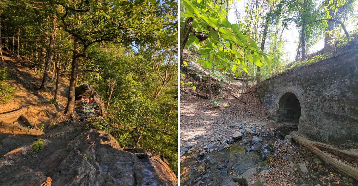
In a short loop of a few miles, you get a rocky overlook, creek crossings, a tunnel, a riverside paved path, and a climb that will remind your legs they exist. Families spot deer, sunset fans grab a quiet view, and weekend explorers stitch together extra loops for a longer day.
Keep reading to learn where it is, how to tackle the steep parts, and the small tips that make this trail worth a top spot on your 2027 list.
A Secret Lot With a Big Backyard
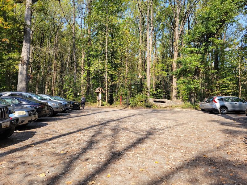
Small parking lots often guard the best adventures, and this one proves the rule. Buzzards Rock Trailhead sits in Catonsville, MD 21228, in Maryland, United States, and it serves as a quiet doorway into Patapsco Valley State Park.
The lot is off the road and holds roughly 10 to 13 cars. That is not a lot of space, so an early arrival is a smart move on nice weekends.
Here is the part locals love. Baltimore County has limited roadside parking near many park access points, which makes a real lot like this one extra valuable.
The trailhead is managed as part of the Maryland Department of Natural Resources park system. Its posted hours run from 9 am to 7 pm every day of the week, and the area closes at sunset.
One more practical note: there is no entrance fee here. Free parking plus free trails is a rare combo this close to Baltimore.
Keep the lot in mind as your home base, because every loop in this story starts and ends right here.
Where Two Trails Shake Hands
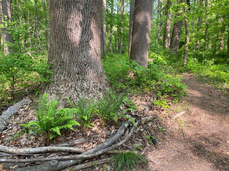
Trail junctions are like crossroads in a choose-your-own-adventure book. Right at this trailhead, the Buzzards Rock Trail meets the Sawmill Branch Trail, so you get options from your very first steps.
That meeting point is the secret to the flexible hike people rave about. You can keep the outing short and simple, or link trails and add loops until your legs politely ask you to stop.
The paths are well maintained and fairly clearly marked with painted blazes on the trees. A few spots have been known to miss signs, so pay attention to those blazes as you go.
A simple tip helps a lot here. Snap a photo of any trail map you find, or load one on your phone before you leave home, since cell signal can be spotty in river valleys.
Trails head off in different directions, which means two hikes from the same lot can feel completely different. That variety keeps people coming back season after season, and it is a big reason this spot earns bucket list status.
The Steep Bit Nobody Warns You About
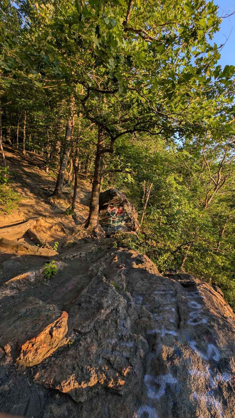
Gravity has opinions on this trail. The route from the parking lot down to the stream includes a steep, rocky section near the overlook, and it is easier going up than going down.
Sure-footed hikers usually handle it fine. Young children and older hikers may find it more challenging, so slow down and take your time.
Some people simply sit and scoot down the trickiest rocks. It may not look graceful, but it beats a slip, and nobody is handing out style points out here.
Good shoes make a huge difference. Pick hiking boots or trail runners with solid grip, and skip the flat sneakers.
Trekking poles are another helpful tool for this stretch. They give you extra balance on the descent and a little push on the climb back up.
The rest of the trail is mildly uneven but fairly easy, so this rocky drop is the main test. Respect it, and the remaining miles will feel like a reward instead of a workout you regret.
Rock Hopping Across the Creek
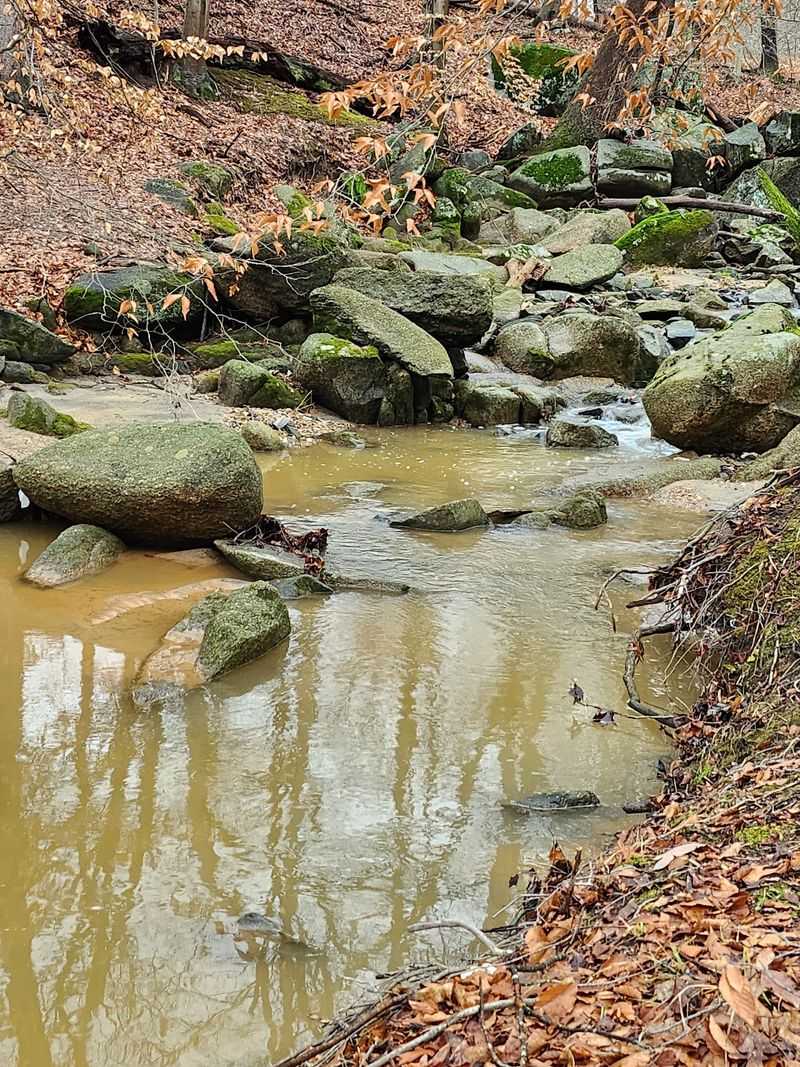
Few things make a hike feel like an adventure faster than a stream crossing. This area offers a couple of fun, easy ones that kids especially enjoy.
The creeks here feed into the Patapsco River, and the trails wind right alongside them. That makes for plenty of chances to stop, look for critters, and skip a stone or two.
Crossings are usually simple, but conditions change. After heavy rain, water can rise and rocks can get slick, so test each step before you commit your full weight.
Waterproof boots are a nice upgrade for this hike. A spare pair of socks tucked in your bag is an even cheaper fix for soggy feet.
Keep little ones close near the water, and teach them to cross slowly instead of leaping. A short pause on the far bank makes a good snack break, too.
Once you reach the water at the bottom, you face a choice of directions, and that decision shapes the rest of your day on the trail.
Through the Tunnel to the River Path
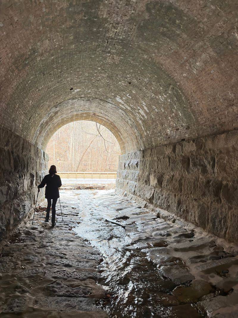
Here is a fun twist most short hikes do not offer: a tunnel. On a popular loop from the lot, you head toward the river, cross the creek at the bottom, and walk through the tunnel.
On the other side, you reach a paved path. Turn right and enjoy a smooth, flat stretch that feels like a break after the rocky descent.
Keep your eyes open before the bridge. Turn right off the paved path to rejoin the dirt trail and climb back up the hill toward the parking area.
That loop comes out to roughly 3 miles total, though shorter options trim it closer to 2.5. It mixes woods, water, pavement, and hills, which keeps every section feeling fresh.
If you prefer to keep exploring trails instead, turn left at the water rather than right. Either way, you get a solid sampler of what this park does best.
Write these turns down before you go, and your loop will flow as smoothly as the river beside you.
Furry and Feathered Neighbors
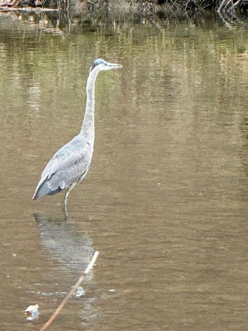
Deer do not need a ticket to use these trails, and they show up often. Families have spotted them right on the path, which turns a normal hike into a nature show.
Birds are plentiful, too. Squirrels race around everywhere, and little kids love trying to keep up with them.
To boost your odds of seeing wildlife, go early in the day and keep voices low. Animals tend to move away from loud groups.
A pair of small binoculars can make birdwatching way more fun. A free bird ID app also helps kids put names to what they see.
Remember to give every animal space. Never feed wildlife, and keep a respectful distance from deer, especially if young ones are around.
Leash laws apply, and dog owners should keep pets clipped in and pack out all waste bags. Sadly, a few bags have been left along the trail before, and nobody enjoys finding those.
Treat the forest like a shared home, and the animals will keep making surprise appearances.
Autumn Steals the Show
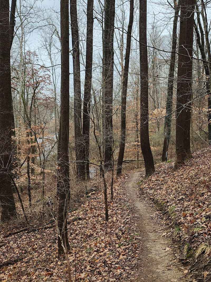
Mark your calendar for October. Fall is when this area becomes especially beautiful, and hikers call it prime exploration time.
The hardwood trees around the valley turn shades of orange, red, and gold. The overlook and river views look extra impressive with all that color.
Plan for one catch. Fallen leaves can hide rocks and roots, and the steep section gets slippery, so take it slow.
Weekends during peak color draw more people, and the lot only fits around a dozen cars. A weekday visit or an early morning start helps a lot.
Layers are your best friend this time of year. Cool mornings can turn warm by midday, especially after that climb back up the hill.
Bring a phone or camera with a full battery, because you will stop for photos more than you expect. Many people end up taking twice as long as planned.
If you can only pick one season for your 2027 trip, autumn makes a very strong case.
Winter Has Its Own Charm
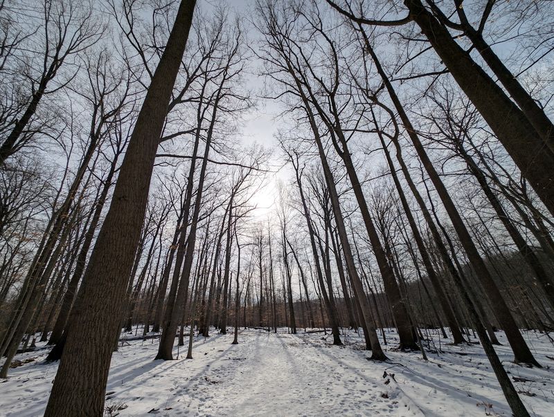
Snow turns familiar trails into something brand new. After the January 2025 snowstorm, this walk was a real treat for those who bundled up and went.
Cold months bring quieter trails and open views through bare trees. You can often see more of the valley and river once the leaves drop.
Still, winter calls for extra caution. The steep rocky section can get icy, so microspikes or traction cleats are a smart buy before your trip.
Also check access first. The trailhead parking lot has been closed during winter in past years, so look at the Maryland DNR Patapsco Valley page before heading out.
Short days matter, too. Sunset comes early in winter, and the area closes at sunset, so start your hike with plenty of daylight left.
Pack a thermos of hot cocoa, warm gloves, and a hat. A happy hiker is a warm hiker.
With a little planning, a frosty morning here can become the most memorable hike of your whole year.
Plan Smart, Hike Happy
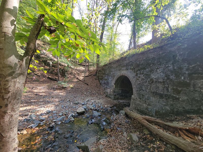
A little prep goes a long way on a trail this close to the suburbs. It feels like a quick escape from city life, but it still deserves real hiking gear.
Start with the basics. Pack water, snacks, sturdy shoes, a small first aid kit, and a charged phone with an offline map.
Check the hours before you go. The posted schedule runs from 9 am to 7 pm daily, and the area closes at sunset.
Difficulty depends on your route. Some paths are easy and kid friendly, while others include steeper climbs, so match your loop to your group.
Cyclists, take note. The area appears to be reachable by bike from the Baltimore County side, which can help when the small lot fills up.
Finally, leave it better than you found it. Pack out trash, stay on marked trails, and keep dogs leashed.
Follow these simple habits, and this compact hike can deliver a full day of fun, fresh air, and stories worth sharing all year long.