The dramatic drop in temperature and sudden transition from open mountain forest into narrow, shaded stone corridors creates an experience rarely associated with typical hiking routes on the East Coast.
Inside the massive sandstone formations, cool air and distinctive moisture levels persist even during the hottest months, giving visitors the sensation of exploring a hidden underground city beneath the open sky.
The landscape functions as a natural maze of rock, where the goal is not reaching a summit or crossing a meadow, but navigating a network of geological passageways carved over millions of years.
That unusual combination of cool sandstone chambers along a mountain ridge and remarkable botanical diversity sets this destination apart from others in the region.
The entire formation is protected within The Channels Natural Area Preserve, located near Rosedale, Virginia 24280.
We explored which trails provide the best access to this sandstone phenomenon and what hikers should bring to safely navigate its winding rock passages.
How Ancient Sandstone Became a Natural Labyrinth
Long before the modern Appalachian landscape took shape, this ridge held thick beds of sand that were buried, compacted, and cemented into hard quartz sandstone.
Later uplift raised those rocks high above nearby valleys, placing marine sediments on a mountain crest rather than along a coast.
Time then opened joints in the stone, giving water, frost, and gravity places to work.
Seasonal freezing widened cracks as moisture expanded inside them, while chemical weathering weakened exposed surfaces over thousands of years.
Gradual collapse and downslope movement broke the ridge top into huge angular blocks instead of rounded boulders.
Between those blocks, deep slots remained, creating corridors that resemble a rock maze more than a typical talus field.
Unlike western slot canyons carved mainly by running water, these passages formed through jointing, periglacial weathering, and mass movement on a high summit.
That difference matters because it explains why the channels feel enclosed even though they sit near the top of a mountain.
Every turn reflects deep time, climate change, and the slow reshaping of sandstone over millions of years.
A Climb Through Forested Appalachian Terrain
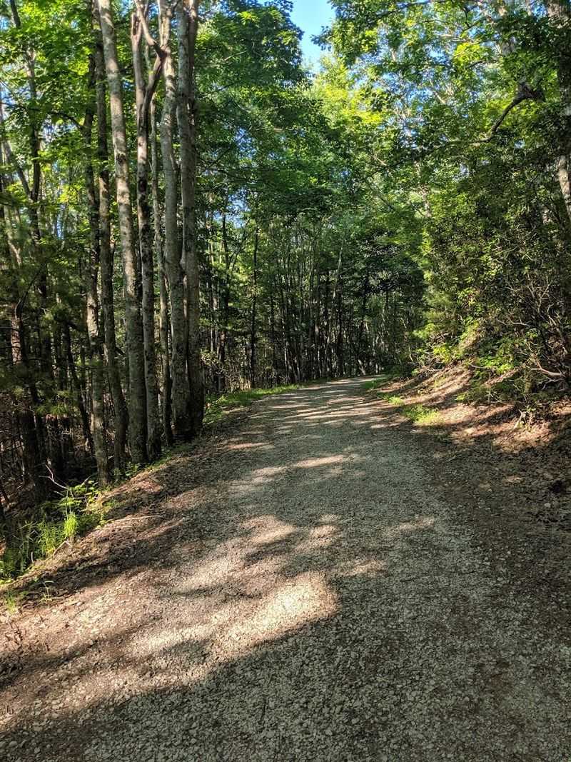
Beginning from the common Hayters Gap approach, the route gains elevation steadily rather than all at once, which makes the effort feel manageable for many hikers.
Much of the lower walk follows an old roadbed or wide trail, so footing is usually straightforward even when the grade starts to build.
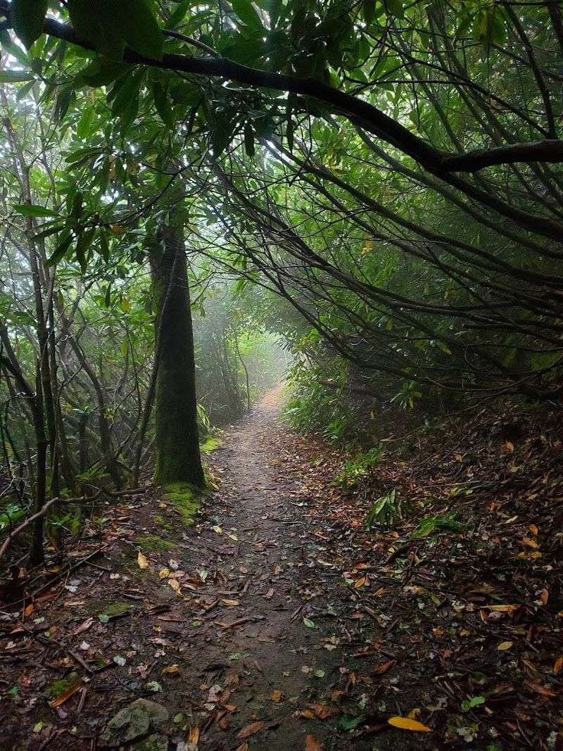
Higher up, the character shifts as rocks, roots, and damp patches appear more often.
Along the ascent, hardwood forest dominates with oak, maple, and other familiar Appalachian species providing shade through much of the growing season.
Rhododendron becomes more noticeable near upper sections, creating denser vegetation and a sense of nearing the ridge crest.
Because the preserve sits above 4,000 feet, temperatures can feel cooler than in surrounding valleys, especially in spring and fall.
Reaching the sandstone area takes patience because the most remarkable terrain arrives late in the hike. Reviewers often describe the walk as moderate to strenuous, especially on the uphill return from lower parking areas.
Preparation matters here since water, stable footwear, and enough daylight make the climb safer and far more comfortable.
Why This Landscape Feels Unusual in Virginia
Few Virginia hikes end in a landform that feels this structurally strange.
Many mountain destinations in the state center on overlooks, cascades, or open balds, but this ridge offers a dense sandstone network hidden within forest cover.
That contrast gives the outing a distinct identity among Appalachian day hikes.
Elsewhere in the region, rocky areas often appear as scattered outcrops or simple cliff lines.
Here, the stone is organized into long crevices, connected chambers, and parallel walls that can be walked between for extended stretches.
Scale plays a major role, since some openings are tall enough to create a canyon-like sensation despite their mountaintop setting.
Another reason the area stands out is the combination of geology and accessibility.
Although the hike requires real effort, the preserve can still be visited in a day without a remote backcountry commitment.
Visitors therefore encounter a landform with unusual scientific value and a memorable sense of place, yet one that remains reachable for prepared hikers exploring southwest Virginia.
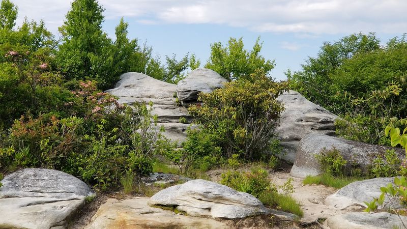
Walking Between Towering Rock Walls
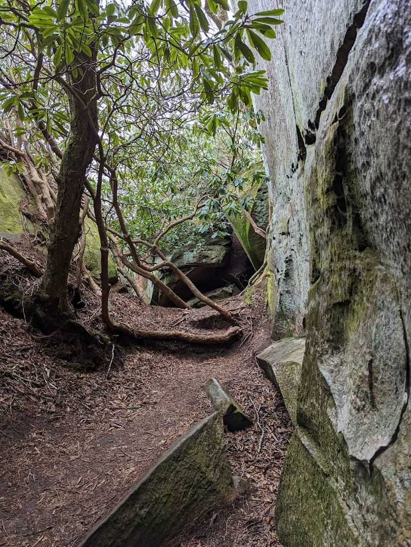
Inside the channels, movement changes immediately.
Straightforward hiking gives way to careful stepping, ducking, and turning as the route narrows between stone walls that rise well above shoulder height in places.
Light fades quickly within the deeper corridors, which makes the interior feel cooler, quieter, and more enclosed than the open ridge above.
Some passages are wide enough for easy walking, while others pinch down and require attention to slick rock, uneven footing, and low openings.
Orientation also becomes less obvious because several routes branch, reconnect, or end at blocky dead ends.
That maze effect is part of the attraction, yet it also explains why slow, deliberate movement is safer than rushing through.
Above the crevices, broad rock surfaces offer a completely different perspective on the same formation. Looking down into the slots reveals how tightly packed the blocks are and how extensive the fracture pattern remains across the summit.
Experiencing both levels matters because the preserve is not just a scenic viewpoint or a scramble zone, but a three-dimensional geological system.
A Surprising Ecosystem Hidden in the Crevices
Within the rock corridors, conditions differ sharply from those on sunlit slopes just a short distance away. Shade lingers longer, air circulation changes, and moisture is retained in protected cracks and ledges.
Such small climatic differences create habitat for species that benefit from cooler, damper surroundings.
Mosses, liverworts, lichens, and ferns often find refuge on sheltered stone surfaces where evaporation happens more slowly.
Organic matter also gathers in pockets between boulders, allowing thin soils to support additional plant life despite the harsh appearance of the terrain.
During warm months, that hidden dampness can make the channels feel noticeably cooler than the trail outside.
Microhabitats like these are important because they increase biological diversity across a relatively small area.
Sensitive plants and invertebrates can persist where temperature extremes are moderated by rock structure and shade.
Conservation staff place emphasis on staying on established paths and avoiding unnecessary trampling, since even minor disturbance in narrow crevices can damage fragile communities that took years to establish.
Why the Ridge Feels More Remote Than It Is
Despite being reachable as a day hike, the ridge often feels farther away than the map suggests.
Dense forest screens nearby roads, nearby towns remain out of sight, and the upper mountain holds a quiet that is uncommon in more heavily visited parks.
Once the climb begins, outside noise falls away quickly.
Limited parking contributes to that experience in practical ways.
Fewer cars at the trailhead generally mean fewer people on the route, which spreads visitors out and reduces the crowded atmosphere found at easier roadside landmarks.
Reports from hikers frequently mention long stretches of calm, broken mainly by wind in the trees, birdsong, or voices echoing through stone.
Remoteness here is therefore partly psychological and partly logistical.
The preserve is not wilderness in the strictest sense, yet the combination of elevation, restricted access, and enclosed geology creates a strong impression of separation.
That matters for visitor expectations because the outing rewards those seeking quiet observation and careful exploration more than those looking for quick scenery from the parking area.
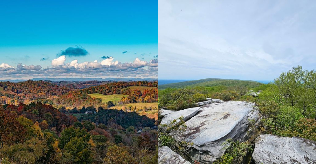
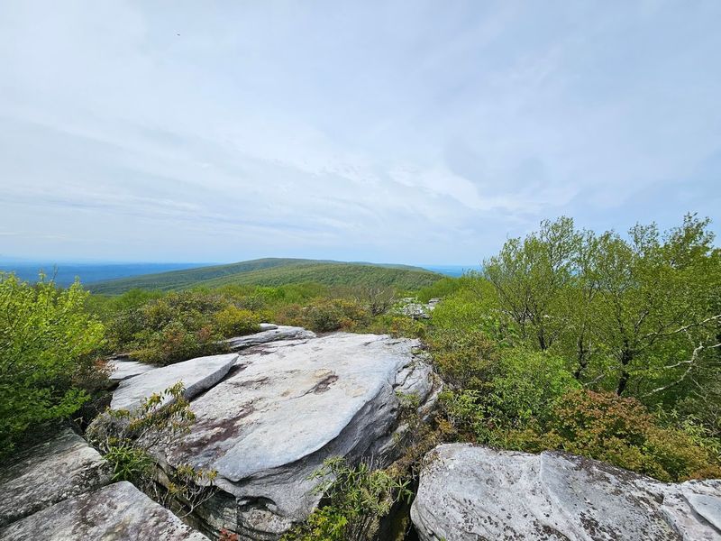
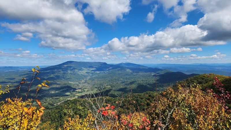
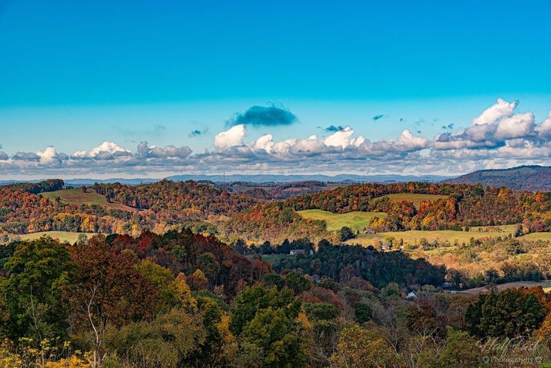
Mountain Views Before the Stone Maze
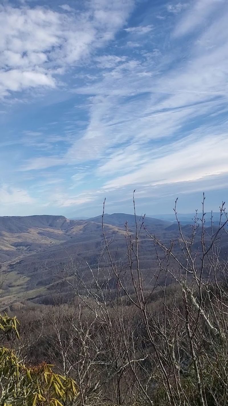
Before the maze itself comes into view, the ridge delivers broad perspectives across surrounding mountains and valleys.
Open rock near the old fire tower site provides one of the best chances to understand the preserve’s elevation and position on Clinch Mountain.
From there, the land reads as a series of long folded ridges typical of the Ridge-and-Valley province.
Seeing that wider setting adds context to the geology underfoot.
The sandstone channels did not form in isolation, but as part of a mountain system shaped by ancient seas, tectonic compression, uplift, and erosion.
Looking outward from the crest makes those processes easier to imagine because the preserved folds and aligned valleys show the regional structure clearly.
Historic features also contribute to the stop.
A Civilian Conservation Corps era fire tower once served forest management needs on this high point, and although it is no longer climbable, its presence reflects how people have long used prominent summits for observation.
Taken together, the overlook and tower area prepare hikers for the more intricate stone landscape hidden just beyond.
A Geological Story Written Across the Ridge
Beneath every step lies a record of environmental change that stretches far beyond human timescales.
The sandstone began as sediment laid down in ancient settings, then hardened into rock, then rose during mountain-building episodes tied to the formation of the Appalachians.
Later climates, including colder periods near the Ice Age, helped fracture and rearrange the summit blocks.
Regional geology explains why this place is scientifically useful.
Rock type, joint patterns, slope position, and freeze-thaw processes combine here in a way that can be directly observed without specialized equipment.
Students of geomorphology can read the ridge almost like an outdoor diagram, with each crevice illustrating how structure influences weathering.
Scientific value also depends on preservation.
When fragile surfaces are disturbed or loose material is moved, evidence of long natural processes can be obscured.
Treating the maze as more than a playground helps protect a site that demonstrates Appalachian history in unusually clear form, linking sedimentary origins, tectonic uplift, and modern weathering within one compact mountain-top landscape.