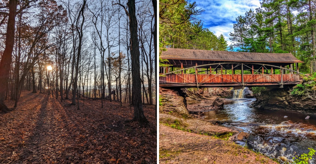
A waterfall can split around an island, and a lakeshore trail can put you between sand dunes and a Great Lake.
Those are real Wisconsin landscapes, and I love how they turn a simple drive into something worth planning a whole weekend around.
The scenery changes with the calendar, too, as spring runoff feeds rivers and fall color spreads across wooded bluffs.
Nearby small towns give you another reason to pause, stretch your legs, and leave a little room in the schedule.
I’d build these trips around one good outdoor stop rather than a race between parking lots, with time for a short walk and an unhurried lunch.
Check park alerts and weather before leaving, since trail access and conditions can change.
You can choose a lake day, a waterfall outing, or a bluff country ramble without making the trip complicated.
The harder choice might be deciding which view gets your next free Saturday.
Peninsula State Park
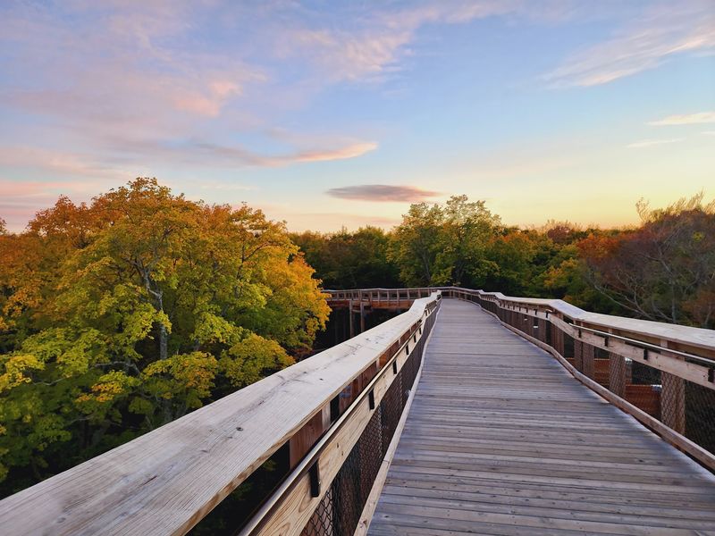
A peninsula gives you a useful excuse to keep changing your view. At Peninsula State Park, wooded roads and trails lead toward Green Bay along the Door County shoreline.
Make Fish Creek your nearby town stop, then give the park the larger share of your day. You can also pair the outing with Ephraim without turning the drive into a countywide scavenger hunt.
Eagle Tower is a major draw, with an accessible ramp leading to its observation deck. Check its availability before traveling, especially when weather might affect access.
For a closer look at the landscape, choose a trail that matches your comfort level. Eagle Trail includes rough footing and steep sections, so it deserves more preparation than a casual sidewalk stroll.
Summer suits a shoreline outing, while autumn adds leaf color to the wooded stretches. Spring and cooler fall days can also work nicely when your main goal is walking rather than swimming.
Bring layers because conditions near the water may differ from those inland. A picnic lets you stay longer without needing to leave the park halfway through your afternoon.
Wisconsin state park vehicle admission requirements apply, so review those before arriving. Check trail notices separately rather than assuming a scenic route will be suitable for your group.
Leave space for a town walk after your outdoor time, not another ambitious destination. The best souvenir here may be a camera roll that makes your usual commute look slightly underqualified.
Address: 9462 Shore Road, Fish Creek, WI 54212.
Whitefish Dunes State Park
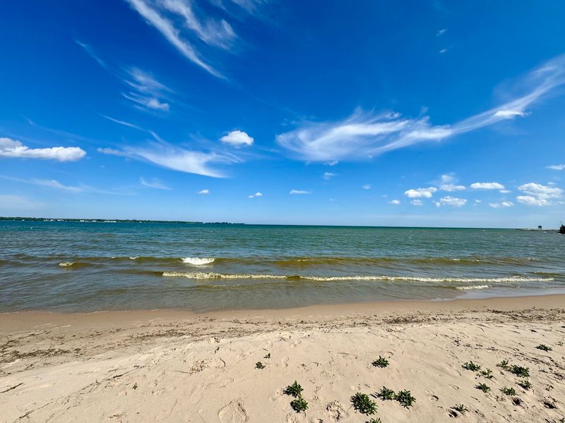
Sand gets a starring role on this stretch of Lake Michigan. Whitefish Dunes State Park offers a different Door County outing from the rocky shoreline scenes many travelers expect.
Use Sturgeon Bay as your town base, then head northeast toward the park. Keeping this trip focused gives you time to notice the shoreline instead of treating it as a quick photograph.
The protected dunes are the reason to follow marked routes carefully. Stay off closed areas and avoid climbing fragile slopes, even when a shortcut looks harmless.
Walking trails provide ways to explore beyond the beach itself. Choose your route using the park map, and remember that sand can make a short walk feel surprisingly demanding.
Lake Michigan deserves respect on a beach day, especially when waves or currents rise. Follow posted swimming guidance and keep your plans flexible if conditions make the water unsuitable.
Summer brings the clearest reason to pack beach supplies, while cooler seasons favor walking and shoreline watching. Spring weather can shift quickly, so an extra layer earns its seat in the car.
Nearby Cave Point County Park can complement the trip when access and conditions permit. Treat its rocky edges cautiously, and don’t confuse a dramatic view with a safe place to approach the water.
Bring lunch, drinking water, and footwear that works for both sand and trails. You can finish with time in Sturgeon Bay rather than squeezing another long drive into the same afternoon.
Address: 3275 Clark Lake Road, Sturgeon Bay, WI 54235.
High Cliff State Park
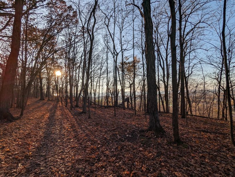
A lake view gets extra personality when limestone raises your vantage point. High Cliff State Park combines the shoreline of Lake Winnebago with part of the Niagara Escarpment.
Sherwood gives this outing a small town anchor near the park entrance. You can make a manageable day of it without building your schedule around a long series of stops.
The escarpment is the feature to keep in mind as you choose a walk. Trails offer different perspectives on the woods, rock formations, and lake rather than one single postcard scene.
Look for the park’s historic lime kiln remains during your visit. Interpretive information adds context, but you don’t need a lengthy history lesson to appreciate how the site connects industry and landscape.
Fall is an appealing season for wooded routes and changing leaves. Summer works for a longer outing, while spring may call for shoes that can handle damp ground.
Check the trail map before deciding how much distance to cover. Routes near cliffs deserve careful footing, and you should keep children close around exposed edges.
A picnic makes sense when your plan includes both walking and lake views. Pack drinking water rather than depending on a particular facility being available when you arrive.
Give the weather a vote in your itinerary, especially if wind or rain develops. You can shorten the park visit and spend more time in town without declaring the whole trip a failure.
Address: N7630 State Park Road, Sherwood, WI 54169.
Kohler Andrae State Park
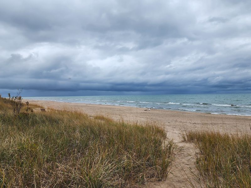
A walk across the dunes doesn’t have to become a sand wrestling match. Kohler Andrae State Park has designated cordwalk routes that help visitors explore its Lake Michigan dune landscape.
Start with the shoreline and dune areas rather than rushing toward a mileage goal. The setting rewards a slower outing, with time to compare the lakefront and the wooded parts of the park.
Sheboygan provides a nearby city stop, while Kohler offers a smaller village detour. Choose one for your remaining time so the day keeps its relaxed shape.
Stay on marked routes through the dunes to protect plants and sensitive ground. The cordwalk is part of the experience, not an invitation to wander across surrounding slopes.
Summer suits a beach focused visit, provided water conditions support your plans. On cooler days, the same shoreline can become a walking destination instead of a swimming stop.
Wind can make a lakeside outing feel quite different from your driveway forecast. Bring a jacket, even when you expect to spend most of the day outside in mild weather.
Review the park map for route lengths and accessibility information before choosing your walk. Footing can vary, so comfortable shoes matter more than dressing for a beach photograph.
Consider making this your main stop rather than adding several distant attractions afterward. A simple picnic and a village stroll can fill the day without asking your car to do overtime.
Address: 1020 Beach Park Lane, Sheboygan, WI 53081.
Devil’s Lake State Park
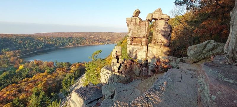
Those bluffs aren’t background decoration; they can become your afternoon workout. Devil’s Lake State Park pairs a lake setting with quartzite heights that reward careful route planning.
Baraboo makes a practical town partner for this Wisconsin trip. Save time for a downtown stroll instead of assuming the park needs to consume your entire schedule.
Decide first whether you want a shoreline outing or a climb. Bluff trails can include steep grades, uneven rock, and steps, which makes footwear and fitness more important than enthusiasm alone.
The names on a trail map don’t tell the whole story about difficulty. Read route descriptions before choosing a loop, and turn around when conditions exceed your comfort level.
Autumn adds color around the lake and across the hillsides. Summer supports a broader mix of recreation, while spring visits require attention to wet or slippery surfaces.
Bring water and a snack even for a walk that looks short. Elevation changes can stretch your timing, especially when you stop often to enjoy the view.
Use designated viewpoints and keep your distance from cliff edges. A good photograph should never require a balancing act that belongs in a different kind of weekend plan.
Check park alerts, admission requirements, and your chosen access area before leaving home. With two main beach areas and several trail choices, knowing your starting point saves useful time.
Address: S5975 Park Road, Baraboo, WI 53913.
Governor Dodge State Park
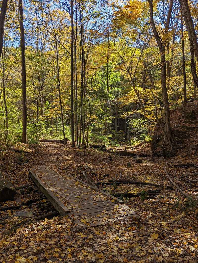
Two lakes give an indecisive road trip planner a pleasant problem. Governor Dodge State Park offers wooded hills, walking routes, and water views near Dodgeville.
Build your day around one lake area and one manageable trail. That approach leaves time to enjoy the landscape without spending the afternoon moving between parking areas.
Stephens’ Falls is another reason to consider the park, though waterfall flow depends on conditions. Check the route and recent weather before making it the centerpiece of your outing.
Dodgeville works as your small town stop before or after the park. Nearby Mineral Point offers another option, but choosing one town keeps your schedule from growing extra elbows.
Fall suits a drive through this part of southwestern Wisconsin, with wooded slopes adding seasonal interest. Summer lets you plan around lake recreation, subject to posted conditions and available facilities.
Don’t assume rolling terrain means an effortless walk. Review trail distances and surfaces, especially if your group includes people who prefer shorter routes.
Pack a lunch and give yourself permission to linger at a picnic stop. An outdoor day doesn’t need a competitive step count to feel worthwhile.
Before traveling, check alerts for your intended trails and recreation areas. Seasonal changes can affect facilities, and a backup route helps you adapt without losing the point of the trip.
Leave your final hour open for the town rather than another distant destination. Your itinerary will feel less like homework and more like the break you wanted.
Address: 4175 State Highway 23, Dodgeville, WI 53533.
Wyalusing State Park
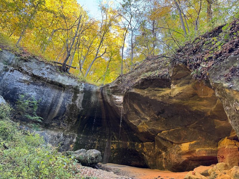
Two major rivers make one overlook feel like a geography lesson worth attending. Wyalusing State Park sits above the meeting of the Wisconsin and Mississippi rivers.
The bluff setting is the main reason to give this drive time. Choose designated overlooks and walking routes rather than expecting one roadside stop to explain the whole landscape.
Bagley provides the nearby small town connection, while Prairie du Chien can support a longer regional outing. Pick your town stop according to your direction of travel instead of adding miles just to collect names.
Start with the park map and identify a route that fits your group. Bluff country can bring elevation changes, and some paths require more attention than their distances suggest.
Autumn is an appealing choice for wooded slopes and wide views. Spring can bring changing river conditions, while summer calls for drinking water and a plan for sunny stretches.
Binoculars are useful if you enjoy watching birds or studying the river landscape. You don’t need to identify a single species to appreciate a closer look.
Allow time to sit at a suitable picnic area between walks. A packed lunch makes it easier to stay with the scenery instead of interrupting the day for another drive.
Check access notices and weather before setting out, particularly after heavy rain. Flexible plans matter more here than squeezing in the longest possible hike.
Keep the return drive unhurried and stop only where parking is permitted. The rivers provide enough drama without your itinerary competing for attention.
Address: 13081 State Park Lane, Bagley, WI 53801.
Perrot State Park
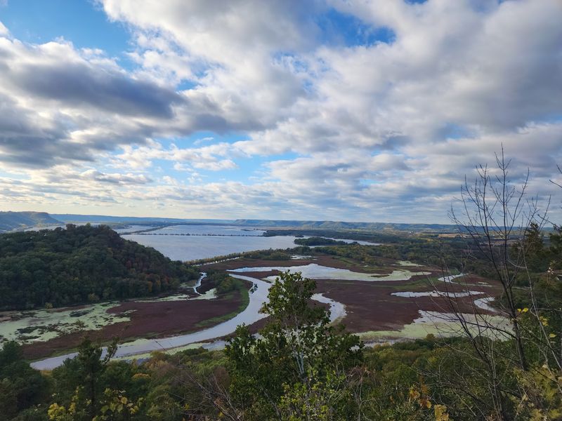
Your legs may notice the bluff before your camera captures the river. Perrot State Park brings Mississippi River scenery together with trails that can involve a meaningful climb.
Trempealeau gives this outing a small town setting beside the river. Pair a park walk with time in town instead of treating the village as merely a turn on your directions.
Brady’s Bluff is a well known hiking destination within the park. Read the route information carefully, since a view from above usually comes with work on the way up.
A shorter plan can still make a satisfying trip if climbing isn’t your goal. Use the park map to choose a route that suits your mobility and available time.
The surrounding river landscape includes channels, wetlands, and wooded heights. Looking closely at those different features adds interest beyond taking a single broad photograph.
Fall color gives the bluffs another reason to claim your attention. Summer visits call for water and sun protection, while spring outings benefit from checking conditions after rain.
Wear shoes with reliable traction and keep hands free on demanding sections. Carrying a drink, phone, and snack separately can become a surprisingly awkward juggling assignment.
Consider a picnic before heading into Trempealeau for your town stroll. Leaving room between activities keeps the trip from feeling like a timed exercise.
Check park notices before committing to a particular trail or recreation plan. You want a memorable river view, not an itinerary that depends on ignoring changed conditions.
Address: W26247 Sullivan Road, Trempealeau, WI 54661.
Interstate State Park
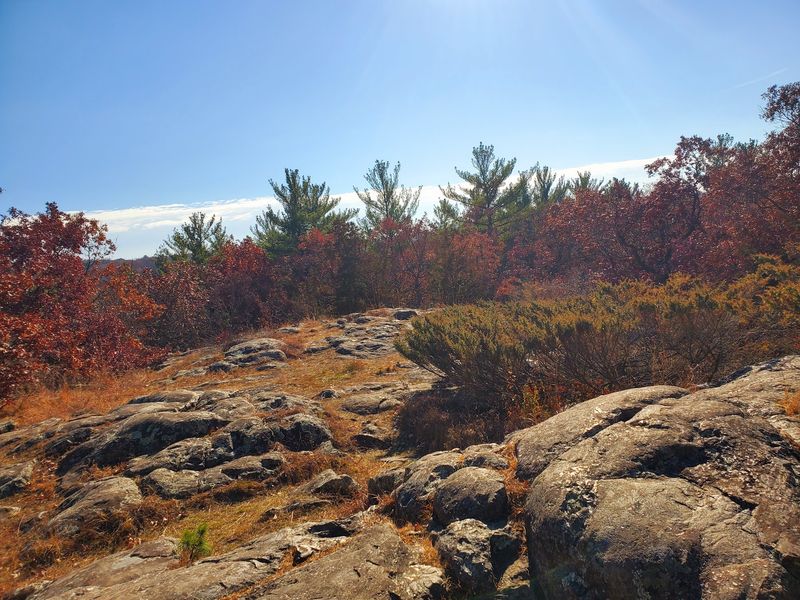
A hole in the rock can be the attraction rather than a maintenance problem. Interstate State Park features glacial potholes that make its exposed bedrock especially interesting to explore.
Head to the Wisconsin park entrance in St. Croix Falls for this outing. Minnesota has a neighboring park with the same name, so confirm which side your directions are sending you toward.
The St. Croix River gorge supplies the larger scenic backdrop. Combine a geological stop with a suitable trail rather than rushing straight to the next viewpoint.
Use marked routes around rock formations and keep a careful distance from edges. Uneven stone deserves attention, especially when rain leaves surfaces slick.
St. Croix Falls gives you a convenient town stop close to the park. You can make a full day of the area without scheduling a long detour afterward.
Autumn works well for river views framed by changing leaves. Spring highlights the need to check weather and trail conditions, while summer makes drinking water an essential part of your bag.
Read the interpretive information if you’d like to understand how the potholes formed. The landscape is more interesting when those rounded shapes become clues rather than just unusual places for photographs.
Choose your walking distance before starting, but leave time for pauses along the route. This is a good trip for curiosity, not a contest with your fitness tracker.
Check admission and access information before leaving home. A little planning keeps the state line from becoming the day’s most confusing attraction.
Address: 1275 State Highway 35, St. Croix Falls, WI 54024.
Copper Falls State Park
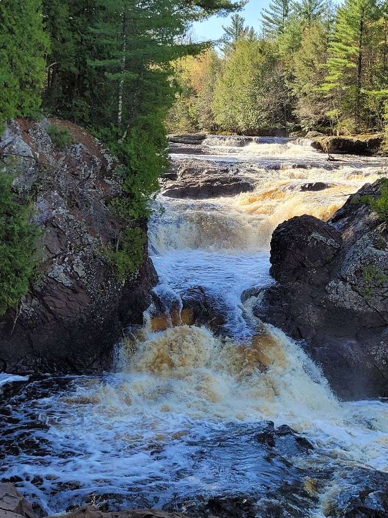
Waterfalls give the trail a destination that doesn’t need much salesmanship. Copper Falls State Park brings river scenery and rocky gorges into a northern Wisconsin outing near Mellen.
The Doughboys Nature Trail is a central route for seeing the park’s waterfall landscape. Check its conditions and access before traveling rather than assuming a familiar trail name guarantees an open route.
Copper Falls and Brownstone Falls are the major named water features to plan around. Their appearance changes with river flow, so photographs from another season shouldn’t set your exact expectations.
Stay on designated trails and use viewing areas as intended. Gorge edges and moving water call for sensible distance, even when a closer angle seems tempting.
Mellen provides the small town connection for this trip. Build in a stop before or after the park instead of making the drive north solely about the trailhead.
Spring can bring stronger runoff, but wet conditions may complicate walking. Autumn adds color to the woods, while summer makes a longer outdoor day easier to organize.
Bring sturdy shoes, water, and a layer for changing temperatures. Insect protection can also be useful during the warmer part of the year.
Allow more time than the trail distance alone suggests, since viewing stops are part of the point. Waterfall sightseeing loses some charm when you’re checking your watch at each turn.
Review park alerts and available facilities before setting out on a longer drive. Your backup plan should include a shorter walk, not a faster one.
Address: 36764 Copper Falls Road, Mellen, WI 54546.
Amnicon Falls State Park
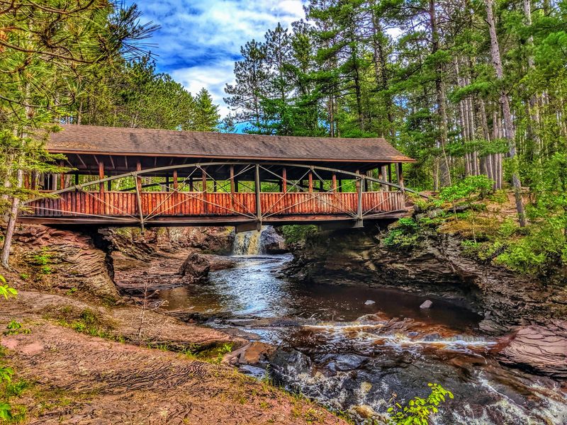
A covered bridge gives this waterfall outing an extra reason to pause. Amnicon Falls State Park combines river cascades, exposed rock, and walking routes near South Range.
The Amnicon River divides around an island within the park’s waterfall area. That layout offers different views without requiring you to make the day about a long backcountry hike.
Use the designated paths and bridge to explore at a sensible pace. Water, rock, and changing footing deserve your attention even when the walking distance seems manageable.
South Range supplies the nearby small town setting for your drive. Superior can serve as a larger regional stop if it fits your route, but there’s no need to force both into the afternoon.
Spring runoff can change the strength and appearance of the falls. Summer and autumn offer different reasons to visit, though water levels remain part of the experience rather than a promise.
Pack shoes with traction and keep a spare layer in the car. A waterfall stop can involve more time outside than you originally planned, especially when several viewpoints catch your interest.
Bring a picnic if you’d like to extend the outing without another drive. Choose a designated area and leave the river edges for careful viewing.
Check park alerts before departure and adjust your plan to posted conditions. Seasonal weather can affect access, so don’t build your day around one photograph you saw online.
Finish with time to appreciate the smaller details along the trail. Your final stop doesn’t need the tallest waterfall to make a satisfying ending.
Address: 4279 County Highway U, South Range, WI 54874.