Texas has a way of making you feel small in the best possible way, especially once you’re standing on a ridge with the horizon stretching out forever.
We went looking for big views and kept finding even bigger reasons to stay a while longer.
Granite domes rose out of the hillside, canyons cut deep gashes of red and orange rock, and clear spring-fed pools tempted us to jump in.
Every trail seemed to lead somewhere unexpected, whether it was a hidden waterfall or a summit with views for fifty miles.
We climbed higher than we planned and lingered longer than we meant to at every overlook.
By the last trailhead, our list of places to return to had only gotten longer.
Here are eleven Texas trails with views big enough to keep us exploring for years to come.
1. Enchanted Rock Summit Trail, Fredericksburg, Gillespie County
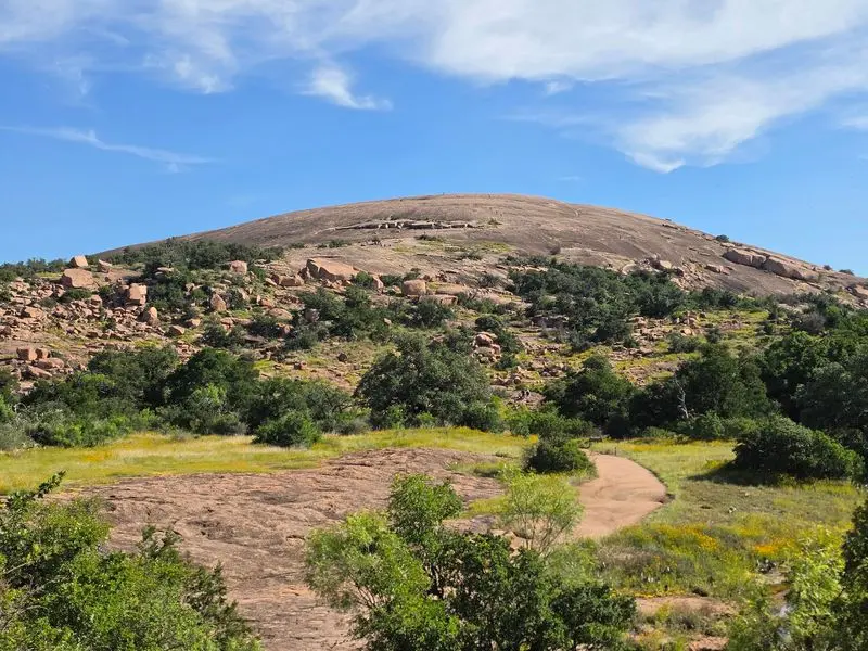
Pink granite under your shoes can make a short hike feel like a small mountain adventure.
That is the magic waiting on Enchanted Rock Summit Trail, where the climb rises quickly above the Hill Country near Fredericksburg.
The trail is only about eight tenths of a mile one way, but the smooth rock can feel steep, especially in warm weather.
Go early, bring more water than you think you need, and avoid the dome during storms because lightning is a real danger.
At the top, the reward is a huge view of rolling hills, oak trees, and open Texas sky.
Many visitors pause here because the summit feels quiet even when the park is busy below.
Respect the fragile vernal pools on the rock, since tiny plants and animals live in them after rain.
The park often reaches capacity, so reservations are smart.
For families, this trail teaches a simple lesson: big views do not always require a long route, but they do ask for care, patience, and safe footing.
Afterward, explore lower loops, watch for birds, and enjoy how the granite glows near sunset if your day pass allows extra wandering.
2. Lost Maples Maple Trail, Vanderpool, Bandera County
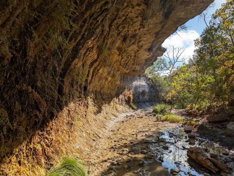
Autumn feels almost secret in Texas until the maples turn red, orange, and gold.
Along Lost Maples Maple Trail near Vanderpool, the color gathers in cool canyons beside clear streams and limestone walls.
The trail is fairly short, but it connects easily with longer routes if your group wants more climbing.
Fall weekends are very popular, so weekday visits and advance day passes can save you stress.
Even outside peak color, the area is worth exploring because bigtooth maples, sycamores, birds, and rocky bluffs give the walk plenty of character.
Wear shoes that can handle uneven stone and shallow water crossings after rain.
Kids often enjoy looking for fallen leaves, but remind them to leave natural things in the park for others to enjoy.
Bring layers, since shaded canyon air can feel cooler than the parking lot.
The best views often appear when you slow down, listen for the creek, and look up through the branches.
For anyone who thinks Texas is only cactus and dry plains, this trail offers a colorful surprise that feels like a quiet postcard from another region.
3. Guadalupe Peak Trail, Salt Flat, Culberson County
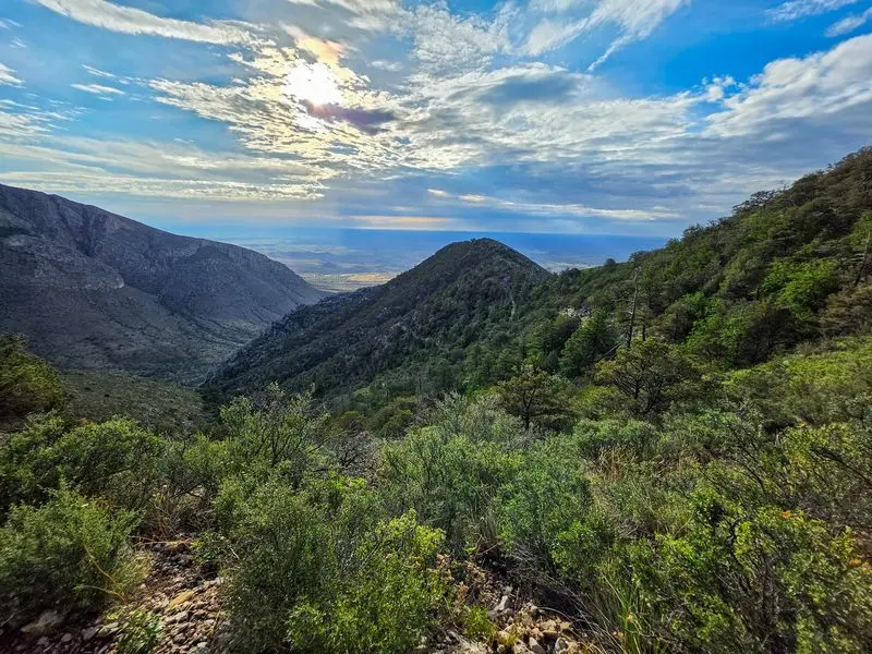
Standing on the highest natural point in Texas is not something you reach by accident.
Guadalupe Peak Trail near Salt Flat climbs about 3,000 feet, so it asks for steady legs, early planning, and respect for mountain weather.
The round trip is about eight and a half miles, with switchbacks, rocky steps, and open slopes that can feel windy.
Start near sunrise, carry plenty of water, and pack salty snacks because the dry air can fool you.
The trail moves through desert plants, pine pockets, and rugged limestone before opening to views that seem to stretch forever.
At the summit, a metal pyramid marks the top, and the wide sweep of West Texas makes every careful step feel worthwhile.
This is not the best first hike for beginners, but prepared hikers may find it unforgettable.
Check conditions before you go, since high winds can make the ridge unsafe.
Take breaks before you feel tired, not after.
The bigger reason to keep exploring here is simple: Guadalupe Mountains National Park shows Texas as high, wild, ancient, and far more dramatic than many people expect.
4. Devil’s Waterhole Trail, Burnet, Burnet County
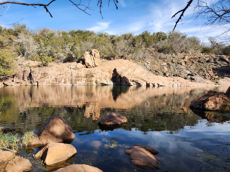
Splashing water between rough pink rocks gives this hike a playful mood from the start.
Devil’s Waterhole Trail at Inks Lake State Park near Burnet leads visitors toward one of the park’s most loved swimming and paddling spots.
The route is short compared with many Texas hikes, but the setting feels packed with action.
You may see kayaks, cliffside rocks, sunlit water, and families resting along the shore.
Stay on marked paths because the rock can be slick, uneven, and hotter than it looks.
If swimming is allowed during your visit, check water conditions first and never jump from unknown heights.
The area is also a good place to notice how ancient rock shapes the Hill Country landscape.
Bring sunscreen, water shoes for the shoreline, and a trash bag so snacks do not leave a trace.
Early morning is calmer, while afternoons bring more energy and noise.
For newer hikers, this trail is a friendly reminder that exploration does not have to mean a hard climb.
Sometimes the best view is sunlight flashing across a quiet cove while friends laugh nearby.
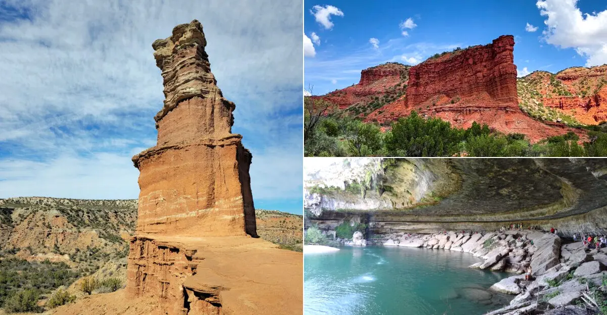
5. Palo Duro Canyon Lighthouse Trail, Canyon, Randall County
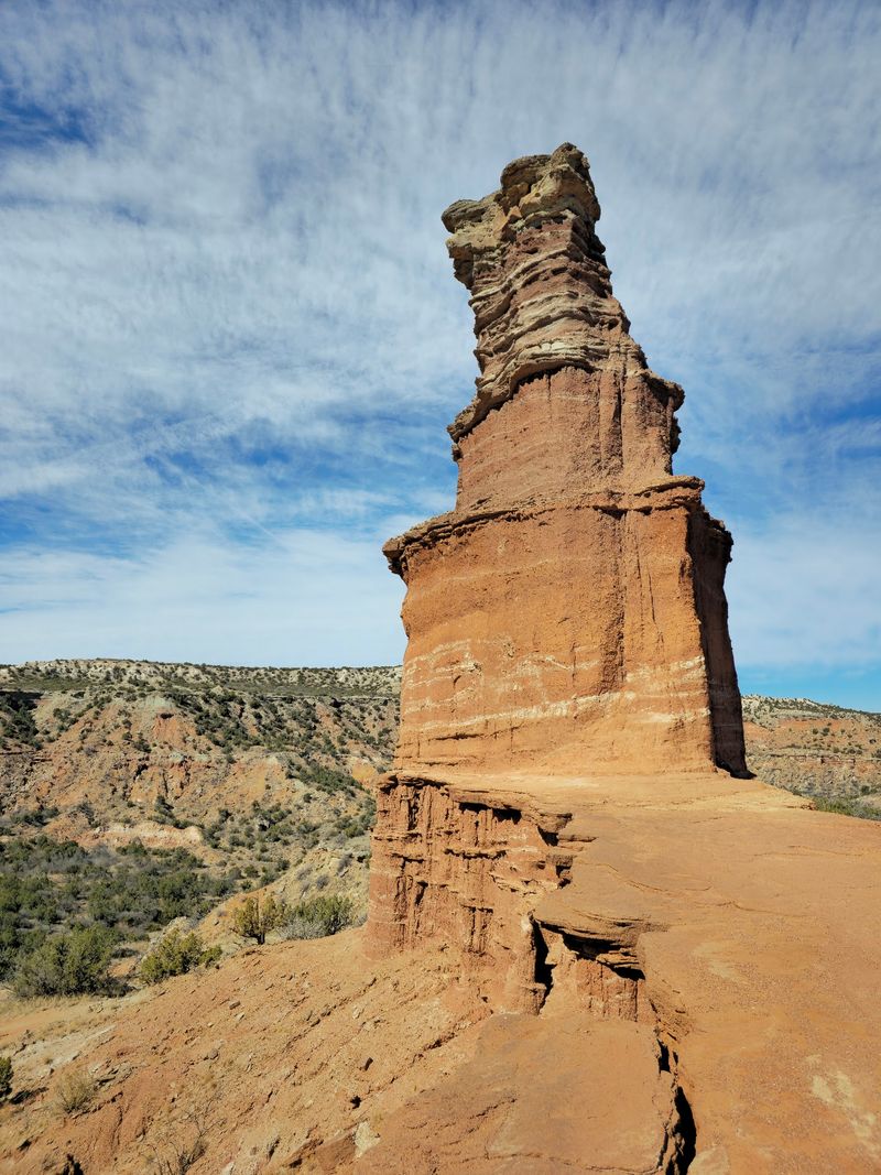
Red canyon walls have a way of making every footstep feel like part of a western movie.
The Lighthouse Trail in Palo Duro Canyon State Park near Canyon leads to the park’s most famous rock formation, a tall stone tower rising from bright layers of earth.
The route is about six miles round trip, mostly open, sandy, and exposed to the sun.
Heat is the main challenge, so start very early, carry serious water, and turn back if anyone feels dizzy or weak.
The final approach to the formation includes rougher ground, but the view is worth the careful pace.
Along the way, watch for lizards, hardy plants, and changing bands of red, orange, and tan rock.
The canyon is often called the second largest in the United States, which makes the scenery feel even more special.
A hat, sunscreen, and closed-toe shoes are not extras here; they are part of the plan.
Give yourself time to stop and look behind you, because the return views are just as strong.
This trail rewards curiosity with color, scale, and a proud reminder of the Texas Panhandle’s wild side.
6. Hamilton Pool Trail, Dripping Springs, Travis County
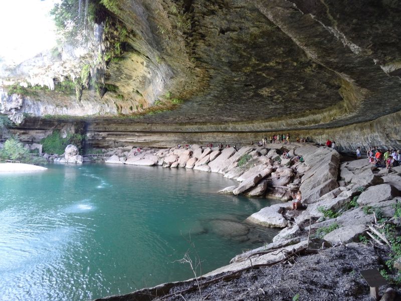
A shaded path, a curved limestone wall, and a green pool create the feeling of entering a hidden room outdoors.
Hamilton Pool Trail near Dripping Springs is short, but the destination is one of Central Texas’s most memorable natural places.
The preserve protects a collapsed grotto where water spills over a high ledge after enough rain.
Reservations are usually required, and swimming is not always allowed, so check official updates before leaving home.
The trail can include steps, rocks, mud, and slippery spots, especially after wet weather.
Move slowly, hold railings where provided, and keep children close near ledges and water.
The pool is beautiful, but the bigger lesson is protection.
Visitors are asked to stay on the trail because the area is sensitive, and too much foot traffic can harm plants, soil, and water quality.
Bring drinking water, but leave pets at home because they are not allowed in the preserve.
Photos are tempting, yet quiet looking may be the best part.
When sunlight reaches the grotto, the scene feels almost unreal, proving that a small trail can leave a giant memory.
7. Pedernales Falls Trail, Johnson City, Blanco County
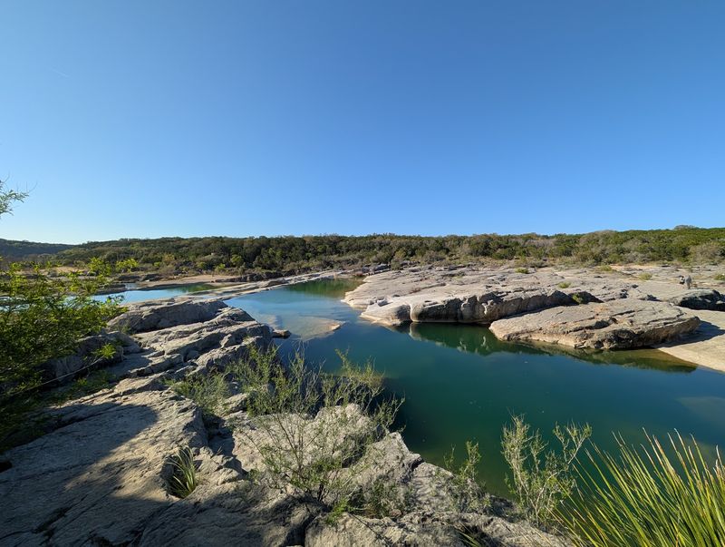
Wide sheets of limestone make the river look like it is sliding across a giant stone staircase.
Pedernales Falls Trail near Johnson City offers easy access to overlooks where the Pedernales River spreads, drops, and shines over pale rock.
The walk to the falls area is not long, but the scenery feels broad and powerful.
Do not let calm water fool you, because flash floods can happen quickly in this region.
Stay out of closed areas, follow signs, and leave the riverbed when skies turn dark or rangers give warnings.
Good shoes help on the uneven rock, and a camera is useful because every angle looks different.
The park has other trails too, so this stop can become part of a longer day of hiking, birding, or picnicking.
Many people enjoy visiting after moderate rain, when the falls have more movement, but safety should always come first.
For families, the trail is a strong pick because the payoff comes without a huge climb.
The bigger reason to keep exploring is the river itself, showing how water can shape stone, mood, and memory over time.
8. Government Canyon Overlook Trail, San Antonio, Bexar County
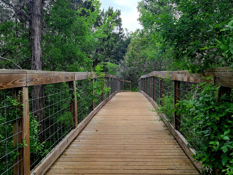
Just beyond busy streets, rugged hills remind San Antonio that wild country is still close by.
Government Canyon Overlook Trail in Government Canyon State Natural Area gives hikers a chance to trade traffic sounds for limestone paths, oak shade, and wide views.
The overlook is reached by combining designated trails, so study the map before you start.
Distances can feel longer than expected because the ground is rocky and shade comes and goes.
Bring water, a charged phone, and shoes with good grip.
The natural area often closes after heavy rain to protect trails, so check the schedule before your visit.
One fun reason to explore here is the park’s dinosaur tracks, found in another section and protected for careful viewing.
Even if your goal is the overlook, knowing ancient animals once crossed this land adds wonder to the day.
Move quietly and you may spot deer, songbirds, or butterflies near the brush.
This hike suits people who want a wilder challenge without driving far from the city.
From the high points, the mix of urban edge and rough Hill Country makes the view feel earned and surprising.
9. Colorado Bend Gorman Falls Trail, Bend, San Saba County
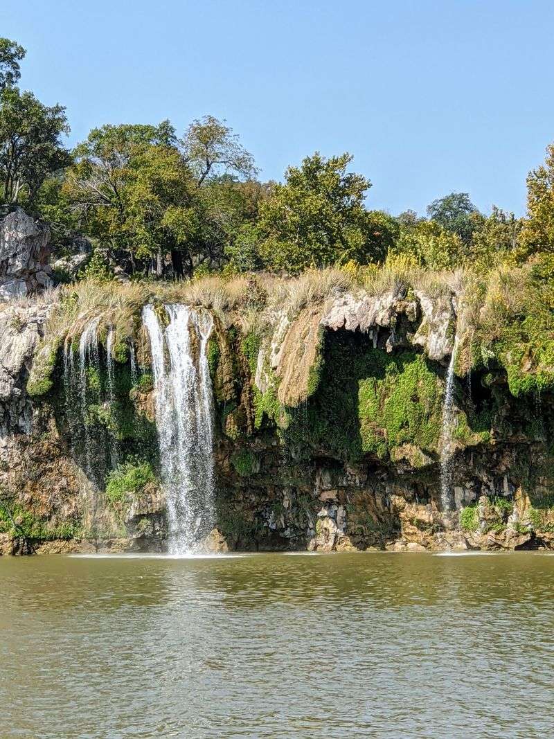
A waterfall in the middle of dry-looking ranch country feels like a magic trick, but the trail makes you earn it.
Gorman Falls Trail at Colorado Bend State Park near Bend crosses rocky, sunlit ground before dropping toward a lush, fern-covered waterfall.
The round trip is about three miles, and the last section can be steep and rough.
Use the cable handrail if conditions require it, and take your time on loose stone.
The falls are made of delicate travertine, so visitors must stay behind barriers and never climb on the formation.
That protection matters because the living rock grows slowly and can be damaged by one careless step.
Carry water, especially in warm months, since shade is limited along much of the route.
The reward is a cool, green scene that feels far removed from the exposed trail above.
Listen for falling water before you see it, then enjoy the reveal.
Colorado Bend also offers caves, river access, and other hikes, making it easy to turn one trail into a full weekend of discovery.
Few Texas paths change mood so sharply, from scrubby upland to dripping garden.
10. Caprock Canyons Upper Canyon Trail, Quitaque, Briscoe County
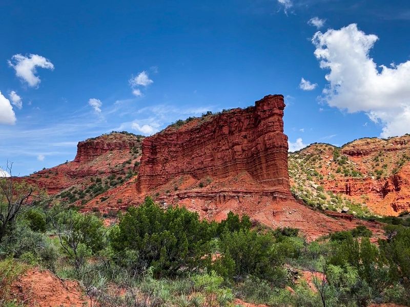
Out here, silence feels huge, broken only by wind, boots, and maybe the distant grunt of bison.
Upper Canyon Trail at Caprock Canyons State Park near Quitaque carries hikers into rough red country where the Texas Panhandle drops into colorful breaks.
The route can be challenging, with elevation changes, loose surfaces, and exposed stretches that demand preparation.
Maps matter here, because canyon trails can connect in ways that surprise tired hikers.
Start early, bring extra water, and tell someone your plan before heading out.
The park is home to the official Texas State Bison Herd, but give these animals lots of space and never approach for a photo.
The views feel raw and open, with red cliffs, pale grasses, and sky taking turns as the main event.
Weather can shift quickly, so check forecasts and avoid hiking during dangerous heat or storms.
This trail is best for hikers who enjoy quiet miles and do not need constant signs of comfort.
The reason to keep going is not one single overlook.
It is the feeling of moving through a bold, wind-carved landscape that seems older and bigger with every bend.
11. Big Bend Lost Mine Trail, Terlingua, Brewster County
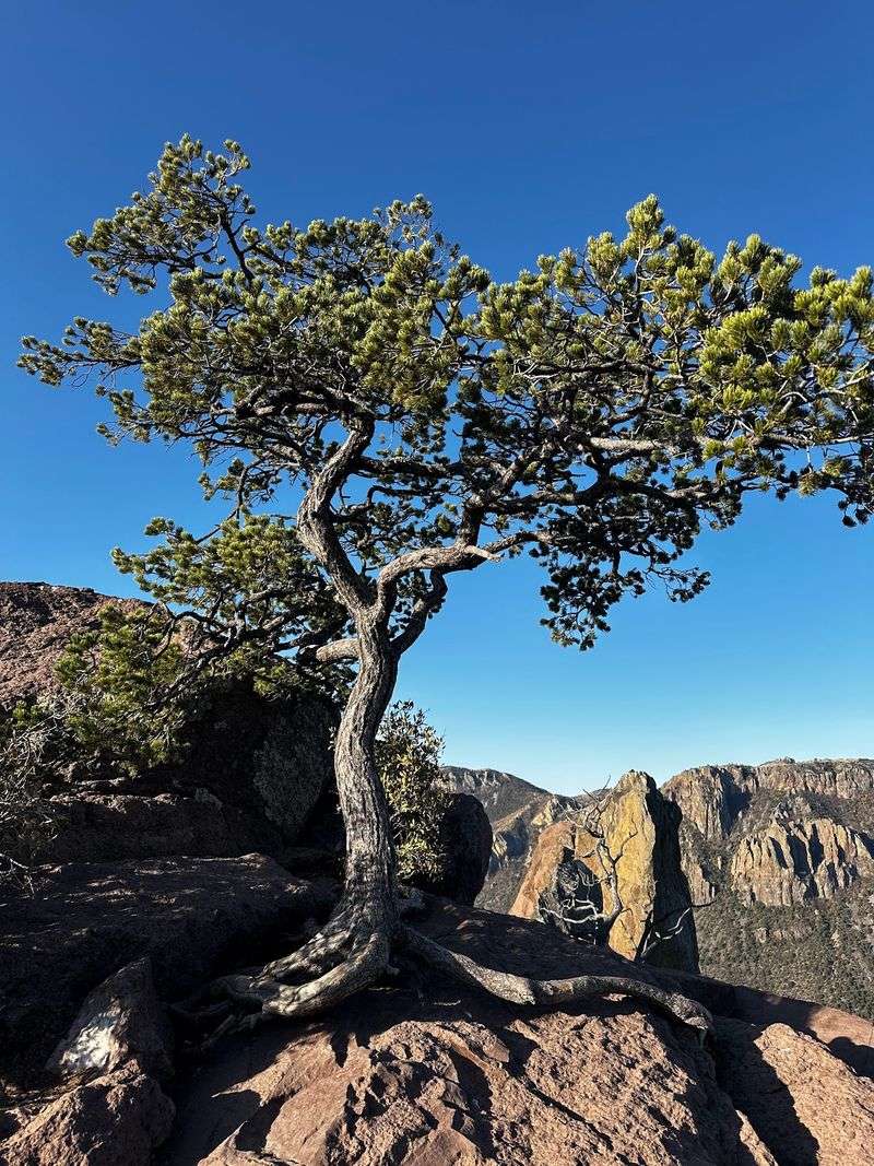
Morning light in the Chisos Mountains can make the whole desert seem to wake up at once.
Lost Mine Trail in Big Bend National Park near Terlingua is famous for giving hikers grand views without requiring an all-day trek.
The route is about five miles round trip, climbing through switchbacks, pines, agaves, and rocky overlooks.
Parking is limited, so arriving early is one of the smartest choices you can make.
Carry water, sun protection, and layers because mountain weather can feel different from the desert floor.
The trail’s name comes from local legend about a hidden mine, adding a little mystery to each turn.
Even if treasure never appears, the views toward Casa Grande, Juniper Canyon, and distant ridges are rich enough.
Take breaks at pullouts so faster hikers can pass safely on narrow sections.
Black bears live in the park, so store food properly and follow ranger advice.
This hike is popular for good reason: it mixes challenge, shade, story, and scenery in a balanced way.
By the final overlook, Big Bend feels less like a map corner and more like a living, breathing mountain world.