A quiet trail can lead past an old farmhouse, across a former travel route, or into a landscape where generations once worked, struggled, and built their lives. In Virginia, these places make history feel tangible because the stories are connected to the ground beneath your feet.
Across Virginia, historic parks preserve battlefields, farm grounds, early roads, and other sites tied to the people and events that helped shape the country. Walking among old structures, open fields, wooded paths, and preserved landmarks offers a more personal way to understand the past.
Instead of simply reading about important moments, visitors can pause where they happened and imagine the lives behind them.
That connection can change the way you see familiar history. We walked through 12 historic parks in Virginia and came away with a whole new appreciation for the past.
Douthat State Park
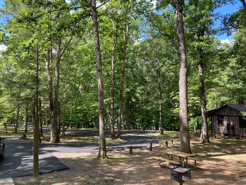
Cool mountain air and the soft crunch of gravel made the morning feel older than it was. Stone steps, sturdy cabins, and a quiet lake gave the whole place a hand-built look that photos never fully capture.
Walking there felt less like entering a park and more like stepping into a careful plan from another era.
Later, we learned that Douthat State Park opened in 1936 as one of Virginia’s original six state parks. The Civilian Conservation Corps shaped much of what visitors still see, including the dam, roads, cabins, and trails.
Their rustic style, using timber and local stone, helped define the look many people picture when they think of classic state parks.
The historic district is worth exploring slowly, especially near the lake and original buildings. Bring water, take the easier paths if you need a break, and read the signs instead of rushing past them.
Even a simple picnic bench seemed to carry a story, reminding us that hard work from the 1930s still shapes weekends here.
Sky Meadows State Park
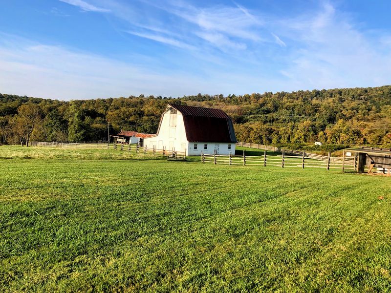
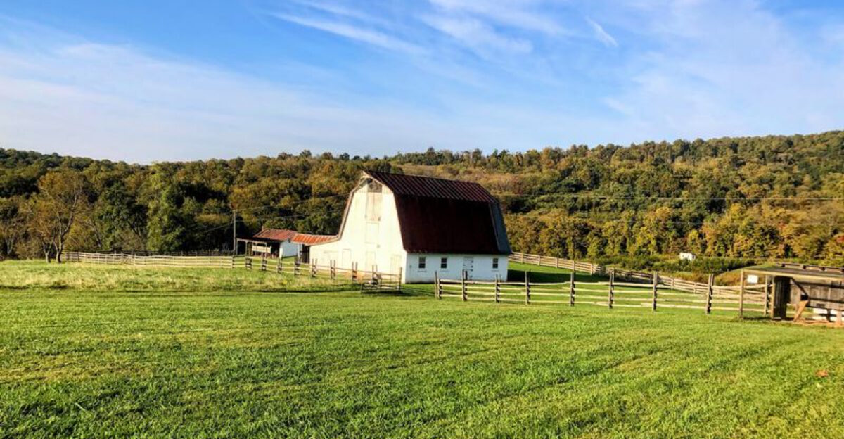
A breeze moved through the tall grass, and suddenly the whole field seemed to whisper. Fences, hills, and weathered farm buildings created a scene that felt calm on the surface but full of hard work underneath.
It was easy to picture families measuring seasons by chores, crops, and the color of the sky.
That feeling settled in even more once we reached Sky Meadows State Park in Delaplane. The land preserves a long agricultural story, and Mount Bleak House, built in the 1840s, gives visitors a direct link to it.
Nearby barns, lanes, and open pastures help show how farm life changed over generations, from colonial times through the Civil War and beyond.
The self-guided historic grounds walk makes the visit easy to follow, even for first-timers. Wear shoes that can handle grass and uneven spots, and bring a snack because the wide views invite you to linger.
More than anything, the park shows that history is not only found in museums. Sometimes it is written across a hillside.
Sailor’s Creek Battlefield State Park
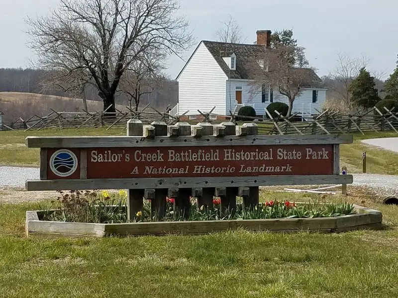
The silence felt almost surprising. Birds moved through the trees, but the broad fields carried a heaviness that made every step seem slower.
Standing there, it was hard not to think about fear, exhaustion, and the confusion that must have filled this ground during the final days of the Civil War.
Those feelings became sharper as we walked through Sailor’s Creek Battlefield State Park near Rice. The battle fought here on April 6, 1865, was one of the last major clashes in Virginia, and it helped speed up Robert E.
Lee’s surrender at Appomattox. Trails across the battlefield make the retreat easier to picture, especially when you remember that thousands of Confederate soldiers were captured here.
The Overton-Hillsman House leaves the deepest impression because it served as a field hospital. Go slowly, read the markers, and give yourself time to absorb the scale of what happened.
Unlike a textbook page, this National Historic Landmark lets you feel how close the war’s ending was, and how painful that final stretch became for everyone involved.
Staunton River Battlefield State Park
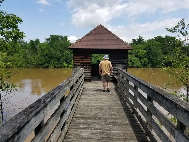
At first glance, the ground looks peaceful, almost modest. Then the earthworks come into view, and the shapes in the land start telling a tougher story.
Suddenly, a quiet walk turns into a lesson about strategy, nerve, and how much could depend on one bridge.
Staunton River Battlefield State Park preserves the site where roughly 700 Confederate defenders held off about 5,000 Union cavalry. That imbalance is hard to ignore, and it gives the landscape real tension even today.
The historic bridge trail helps explain why this crossing mattered so much, because control of transportation routes could shift the wider war in serious ways.
The preserved defenses are the star, but the park adds more depth with exhibits on Native American archaeology too. Wear sturdy shoes, since some paths can feel uneven, and pause often to study the shape of the ground instead of just the signs.
By the end, the battlefield feels less like an empty field and more like a place where planning, luck, and stubborn resistance all collided.
Wilderness Road State Park
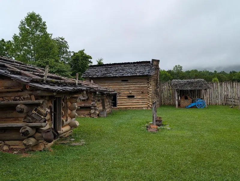
Dusty paths have a way of stirring the imagination. One moment you are looking at grass and timber walls, and the next you are thinking about wagons, boots, tools, and the sound of people starting over.
The place carries a restless energy, as if movement itself is part of the story.
That mood fits Wilderness Road State Park in Ewing, where the route connected to Daniel Boone’s 1775 road west. More than 300,000 settlers traveled this corridor through Cumberland Gap by 1800, which is an astonishing number when you are standing in such a green, quiet setting.
The reconstructed Martin’s Station helps make frontier life easier to picture, with palisade walls and living history details that feel concrete instead of abstract.
The park also includes the later Karlan Mansion, which adds another chapter to the land. If you visit, give yourself enough time for both the frontier area and the grounds around it.
We left with a better sense that westward expansion was not just an idea. It happened one rough mile, one family, and one risky decision at a time.
Chippokes State Park
Rich soil has its own kind of presence. Even before we saw the big house and farm buildings, the land felt worked, measured, and known.
There was something moving about standing in a place where growing food was not a short chapter but a thread running through centuries.
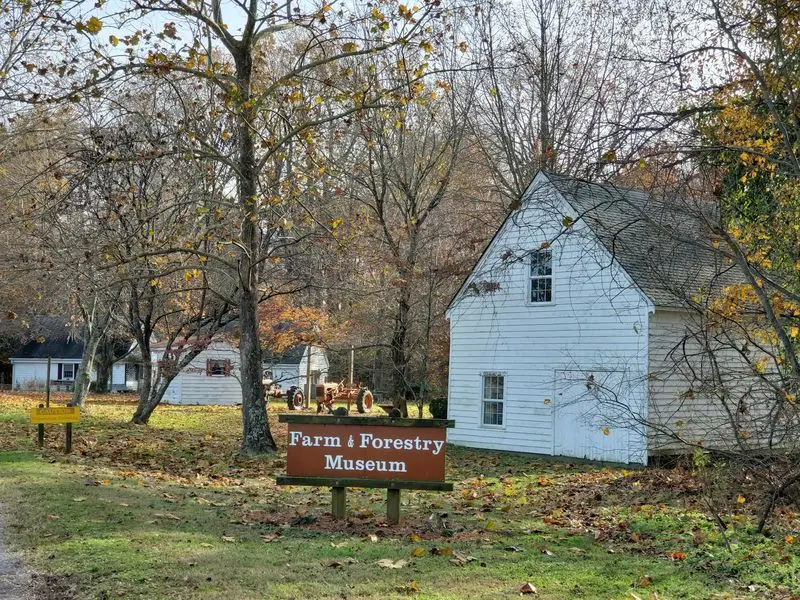
Chippokes State Park in Surry has been continuously farmed since 1619, and that fact changes how you look at everything around you. The Chippokes Mansion and the River House reveal later layers of life on the property, while the Farm and Forestry Museum adds texture with hundreds of old tools and objects.
Instead of offering only pretty scenery, the park shows the long, practical history of labor, land use, and change.
Try to leave time for both the grounds and the museum collections, because they work best together. A field tells one story, but a worn tool makes that story more personal.
We came away thinking about how rare it is for a landscape to keep its agricultural identity for so long, and how much quiet endurance that really takes.
Leesylvania State Park
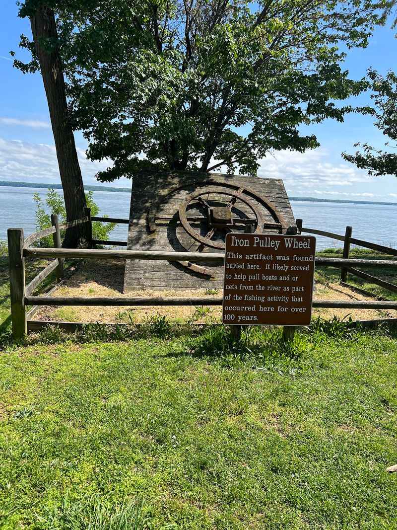
The Potomac looked wide and calm, but the history along its edge felt anything but simple. A shoreline like this can hold many lives at once, and that was the first impression here.
Every overlook seemed to open onto another layer of Virginia’s past.
Leesylvania State Park in Woodbridge preserves land with a remarkably long timeline. Native peoples occupied the area for thousands of years, Captain John Smith visited the region in 1608, and the property later became home to Henry Lee II.
It is also tied to Henry Light-Horse Harry Lee, the Revolutionary War officer and governor of Virginia who was the father of Robert E. Lee, giving the site a direct link to both colonial and national history.
Traces of the old estate encourage a slower kind of visit, one where imagination matters as much as landmarks. Bring binoculars for river views and take time with the interpretive displays, because context makes the landscape come alive.
What stays with you most is the sense of continuity, a feeling that this waterfront has watched America change for a very long time.
Natural Bridge State Park
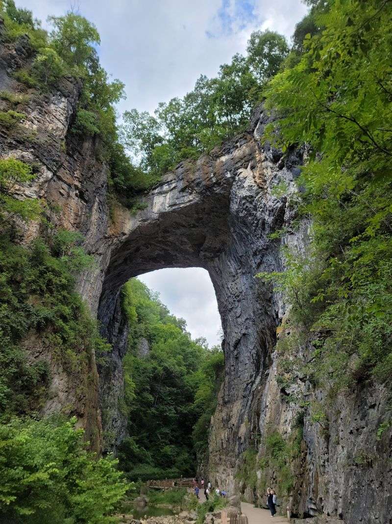
Nothing prepares you for the first full look upward. The stone arch feels huge, calm, and somehow theatrical, as if nature built a monument and then waited for people to gather stories around it.
Even the short walk toward it has a slow-building sense of suspense.
Natural Bridge State Park is famous for the rock formation itself, but the human history around it is just as interesting. Thomas Jefferson admired the bridge and bought the land in 1774, which says a lot about how important the site already seemed in the eighteenth century.
Long before it became a state park, travelers came here to witness the landmark, turning it into a destination with a deep tradition of curiosity and wonder.
The best approach is to look beyond the obvious wow factor. Notice the path, the viewpoints, and the way interpretation connects geology with preservation and ownership over time.
A visit works well for families because the main attraction is easy to understand, yet the backstory adds extra depth. We left feeling that the bridge honors both natural power and human efforts to protect it.
Hungry Mother State Park
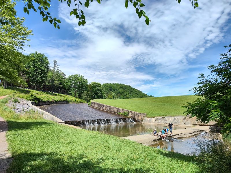
Some places catch your attention with a name before you even arrive. Hungry Mother does that, and once we stepped out near the lake, the curiosity only grew stronger.
The mountains framed everything so neatly that the park felt both welcoming and a little mysterious.
Hungry Mother State Park near Marion is one of Virginia’s original six state parks, and much of what visitors enjoy today comes from Civilian Conservation Corps work completed between 1933 and 1941. Roads, cabins, trails, the dam, and the bathhouse all show the careful craftsmanship of that era.
The unusual name often leads visitors toward the local legend, but the surviving architecture tells a second story about work, skill, and public investment during hard times.
Walking around the lake is the easiest way to feel both parts of the park’s identity at once. You get the beauty that draws families in, then the historic details that make the visit stick in your memory.
Read a little about the CCC before you go, and the buildings become much more than background scenery. They become the reason the park feels so grounded.
Pocahontas State Park
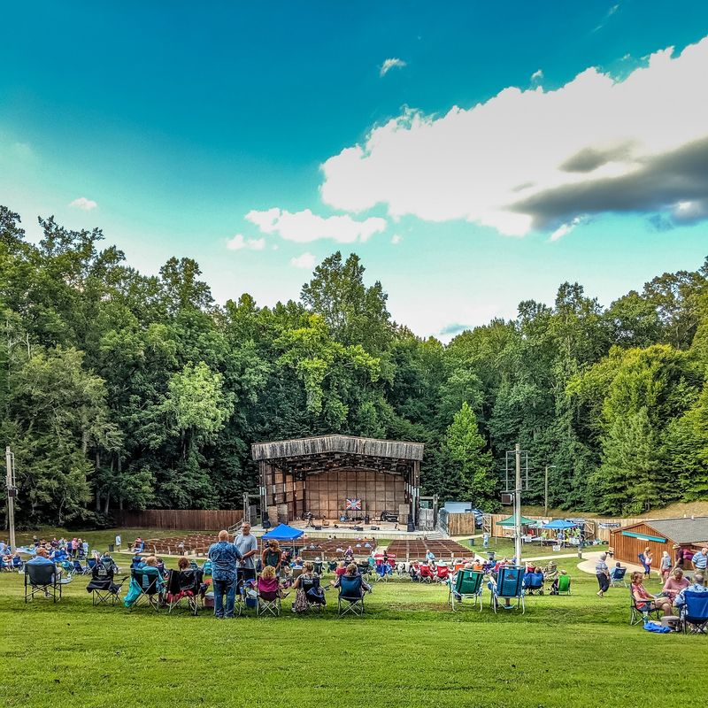
Wide woods and open water can make a park feel timeless, but this one carries a story of reinvention. We expected a big outdoor escape and found that, yes, but also a landscape shaped by national programs, wartime needs, and a changing idea of recreation.
The past here feels practical rather than distant.
Pocahontas State Park in Chesterfield began on former farmland and timberland before the Civilian Conservation Corps transformed it. From 1938 to 1942, the National Park Service operated it as the Swift Creek Recreation Demonstration Area, one of several New Deal efforts designed to create public outdoor spaces.
During World War II, soldiers used the area for recreation, and in 1946 it officially became part of Virginia State Parks.
That long transition gives the park unusual depth. A lake view or wooded trail may seem simple at first, but it rests on decades of planning and adaptation.
If you visit, stop by any historic interpretation you can find instead of heading only for the busiest recreation spots. Knowing the background makes the park feel less like a backdrop and more like a living public project.
Great Falls Park
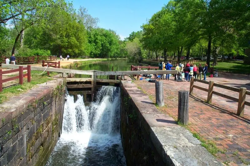
The roar of the water arrives before the full view does, and it changes the mood instantly. Rocks, mist, and rushing force make the scene feel wild, yet just beside that drama sits evidence of careful human ambition.
Few places show nature and early American engineering in such close conversation.
Great Falls Park in McLean preserves remains of George Washington’s Patowmack Canal, an ambitious project built between 1786 and 1802. Washington hoped the canal system would help make the Potomac navigable and strengthen trade with the Ohio River Valley.
Standing near those remnants while the river crashes past makes his plan easier to understand, because you can see exactly what kind of obstacle he was trying to overcome.
The overlook views are reason enough to visit, but the canal history turns the outing into something richer. Good walking shoes matter here, and a little patience helps since the best moments come when you stop and study the landscape.
We left impressed not only by the falls but by the size of the young nation’s dreams, even when those dreams met stubborn stone and water.
Manassas National Battlefield Park
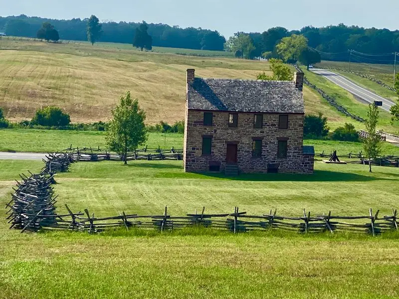
Open fields can seem ordinary until you know what happened on them. Then every rise in the land starts to matter, and the quiet becomes almost unsettling.
That was our experience here, where space itself felt charged with memory.
Manassas National Battlefield Park preserves the ground of both the First and Second Battles of Manassas, two major early Civil War clashes in Virginia. The Henry Hill area gives visitors a strong place to begin, with context that helps the fields make sense.
Once you understand that these battles shaped expectations about the war’s scale and length, the landscape no longer feels passive. It feels like a witness.
Take time to move between monuments, open views, and interpretive stops instead of treating the park like a single quick photo stop. Even small changes in elevation help explain troop movement and line of sight.
The visit becomes most powerful when you imagine how fast familiar farmland turned into a battlefield. We came away thinking about how war reshapes not only people and politics, but also the meaning of a place itself.