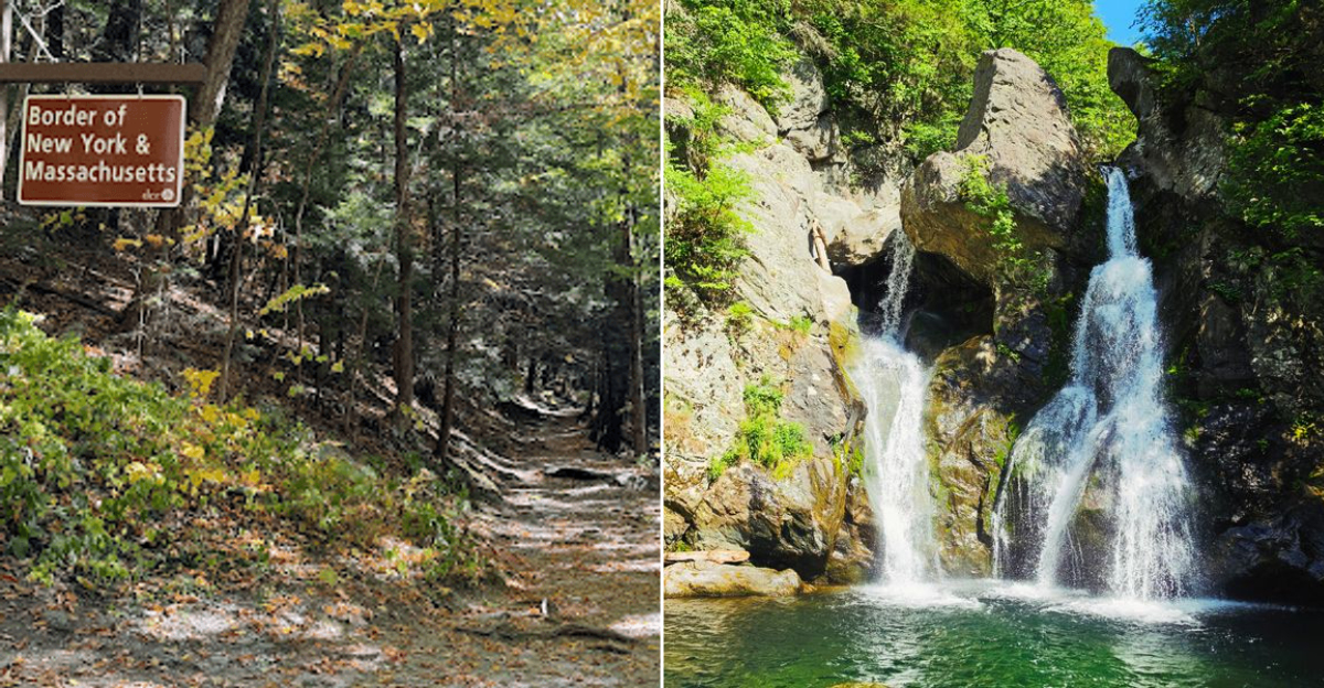
You can cross a state line before you ever realize the waterfall is getting close. On the western edge of Massachusetts, a wooded trail winds through the border country between New York and Massachusetts before the sound of rushing water grows louder between the trees.
That trail leads to Bash Bish Falls State Park, where Bash Bish Falls tumbles dramatically beside a massive boulder, creating one of the Berkshires’ most striking natural scenes. The hike has an unusual charm: depending on where you begin, you can walk from New York into Massachusetts almost casually, with forest underfoot and the roar of the falls drawing you onward.
Ferns crowd the trail, cool mist hangs near the water, and the landscape feels wonderfully removed from the ordinary.
There is more here than a beautiful cascade. From the curious border crossing to the details that make the hike memorable, each part of the experience adds another reason to keep exploring.
Two States, One Waterfall
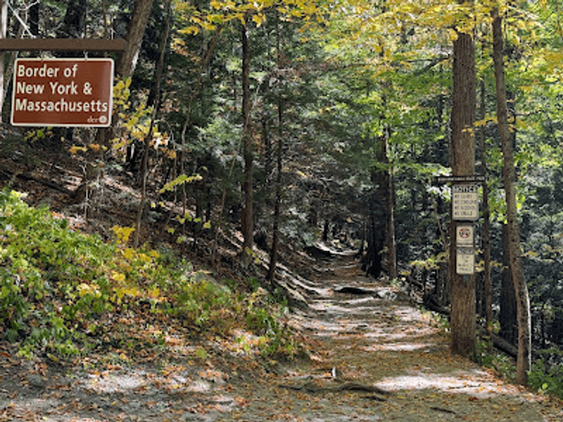
Few hikes let you cross a state line without a single road sign or toll booth. Yet that is exactly what happens on the way to the falls.
Bash Bish Falls State Park sits on Falls Road in Mt Washington, Massachusetts, but the water tumbles down a gorge that spills toward New York farmland. Because of that geography, there are two separate trailheads, one in each state, both leading to the same thundering prize.
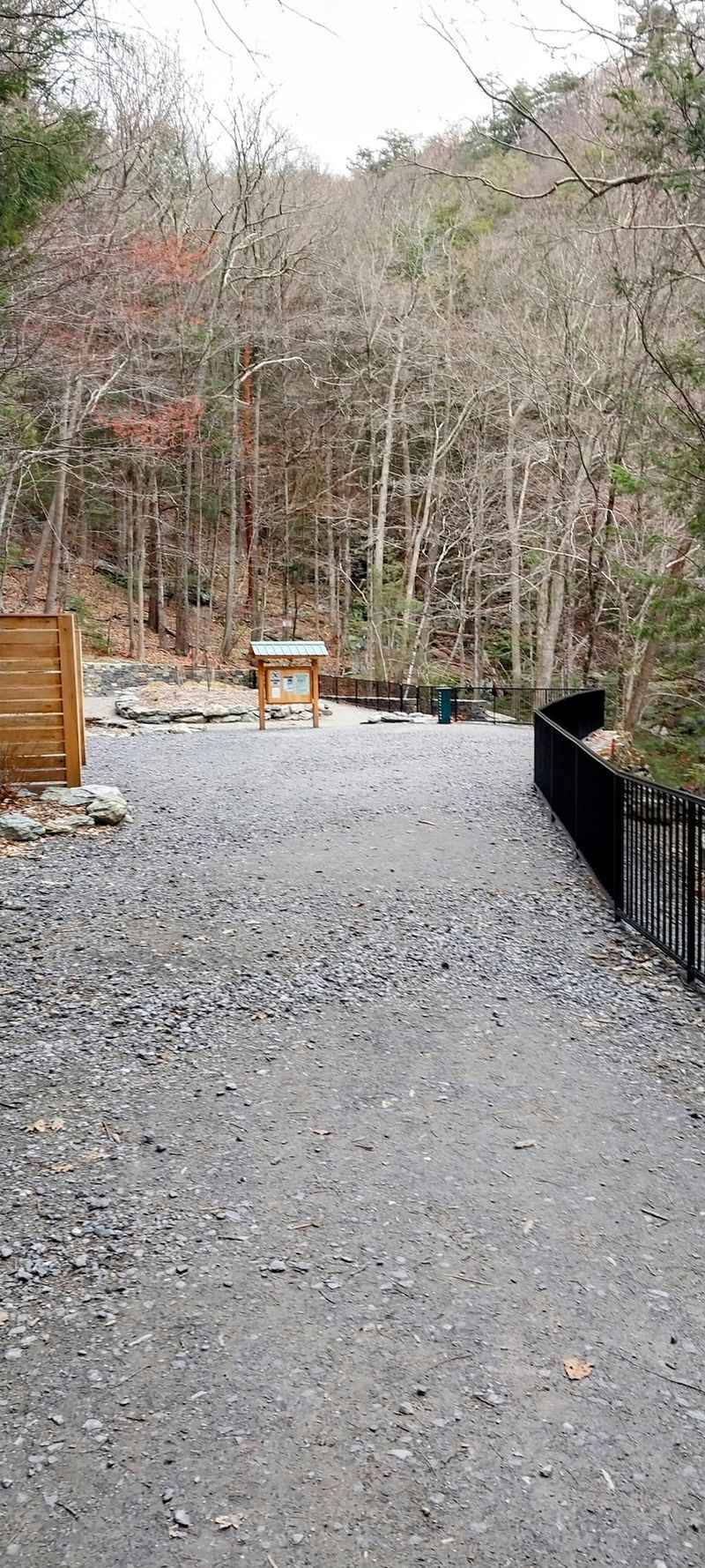
Hikers coming from New York follow a wide, mostly flat gravel path along the brook for roughly three quarters of a mile. Those parking on the Massachusetts side face a shorter but steeper, rockier descent that gets your legs working.
Neither route is long, and both end at the same viewing area high above the plunge pool. Choosing between them usually comes down to how much you enjoy climbing back up.
The border crossing is quiet and unmarked, which somehow makes the whole trip feel like a small secret shared between two states.
The Easier Walk Starts in New York
Longer does not always mean harder, and this park proves it beautifully.
The lower parking area on the New York side sends you along a broad gravel road that hugs Bash Bish Brook. There are benches scattered along the way, plus flat stretches where kids can run ahead and parents can breathe easy.
Round trip runs close to two miles with only about 300 feet of elevation change, which many visitors describe as one of the best effort-to-reward ratios in New England. Water gurgles beside you almost the entire time, and mossy boulders lean over the trail like old guardians.
Hikers who tried both entrances usually agree that the New York approach is friendlier on knees and ankles, even though it adds distance.
Plan on an hour and a half to two hours if you stop for photos and simply sit at the falls. The gentle grade makes this the smart pick for families, older visitors, or anyone hiking in warm weather.
The Massachusetts Descent Is Short and Steep
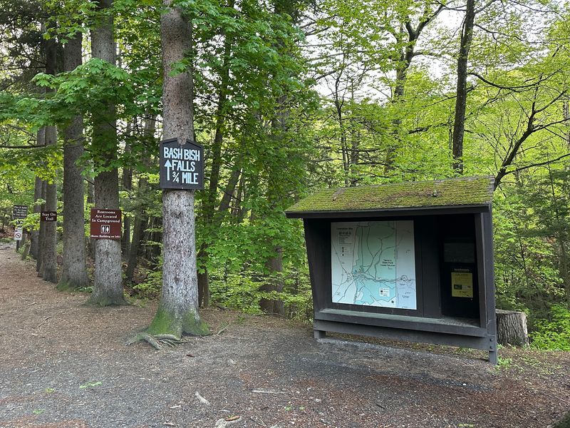
Steep, rocky, and over quickly. That sums up the trail leaving the upper lot in Mt Washington.
From this side, the walk to the falls covers roughly seven tenths of a mile, but you drop fast down a rugged path with loose stone and built-in steps. Reviewers regularly call it heart-pumping on the return climb, though well maintained and clearly marked.
Sturdy shoes matter here more than anywhere else in the park. Sneakers with worn tread can turn a fun outing into a careful shuffle, especially after rain when the rocks stay slick.
The payoff arrives in about fifteen to twenty minutes, and it is loud. Cool air rises from the gorge, and mist drifts up toward the overlook on hot afternoons.
Strollers will not work on this route, so bring a carrier for little ones. Anyone who wants the workout without a long day on the trail will find this side genuinely satisfying.
That Famous Split Around the Boulder
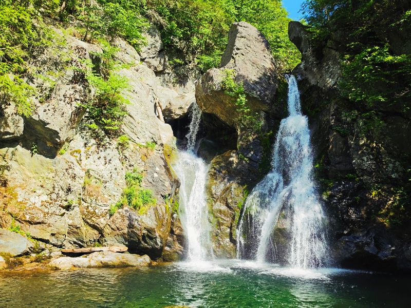
Photographers keep coming back for one reason: the boulder.
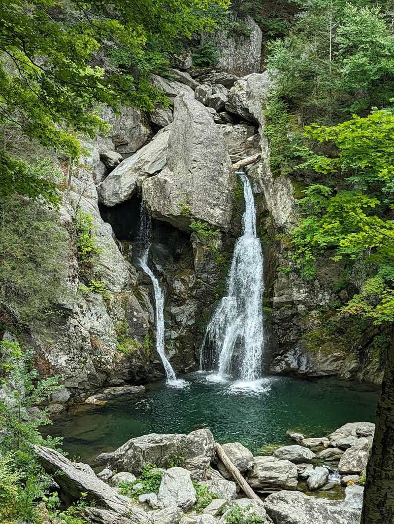
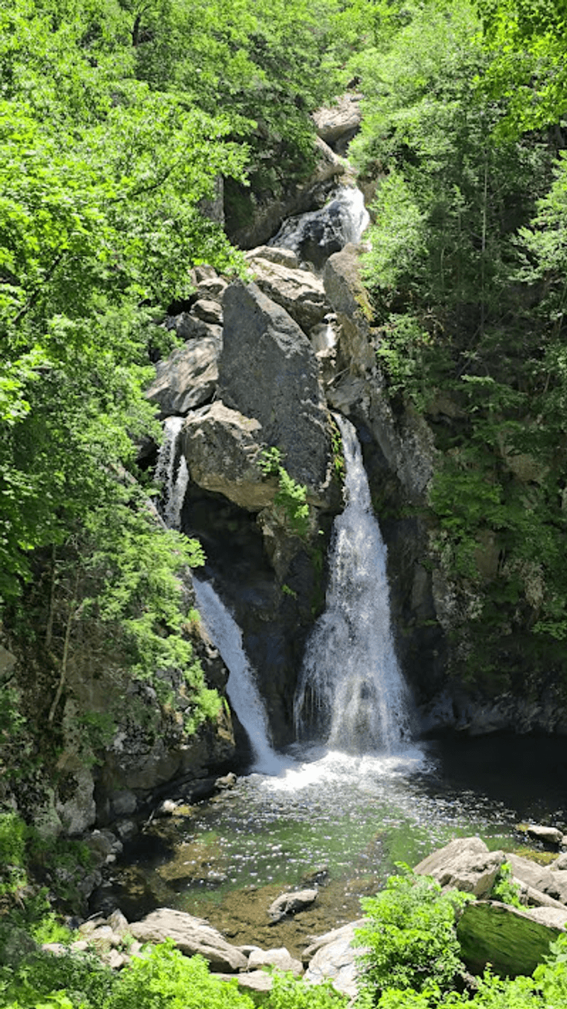
Right at the lip of the drop, a massive rock divides the flow into two glittering ribbons that rejoin in the pool below. The effect makes Bash Bish Falls instantly recognizable, and it is why this spot appears on so many New England bucket lists.
At roughly eighty feet, it holds the title of the tallest single-drop waterfall in Massachusetts. Pictures rarely capture the scale, and first-time visitors often say the falls looked bigger in person than they expected.
Spring runoff turns the water into a roaring wall of white. Late summer slows the flow but reveals more of the gorge walls, with green light bouncing off the pool.
Bring a camera you can steady, since the best shots come from the overlook where mist and low light can blur handheld photos.
Even without a lens, standing there listening is enough. The sound fills the whole ravine.
Why the Base of the Falls Is Fenced Off
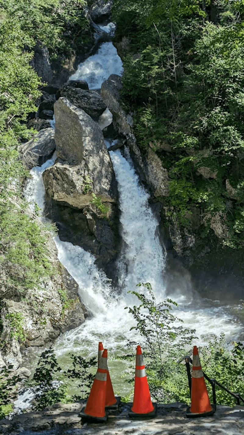
Longtime visitors remember wading in the plunge pool decades ago. Those days are over, and there is a reason.
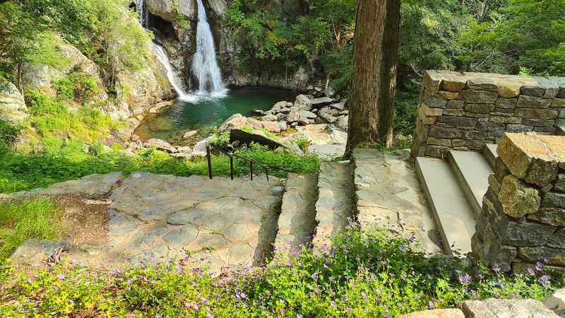
Since 2020, direct access to the bottom of the falls has been blocked with fencing, closed stairs, and posted signs. Trash, risky behavior, and serious accidents pushed park managers to protect both the gorge and the people visiting it.
Rangers and staff are often stationed nearby to answer questions and keep folks on the safe side of the barrier. Some hikers admit disappointment, wishing they could stand at the base for a closer look.
Still, the viewing area delivers a wide, unobstructed look straight down at the drop. You feel the spray and hear the roar even from above.
Swimming is not permitted, and climbing the gate is both unsafe and against the rules.
Treat the fence as part of the deal. The falls have survived generations of admirers, and respecting the boundary helps keep this corner of Mt Washington open for everyone.
Sunset Rock and the Overlook Scramble
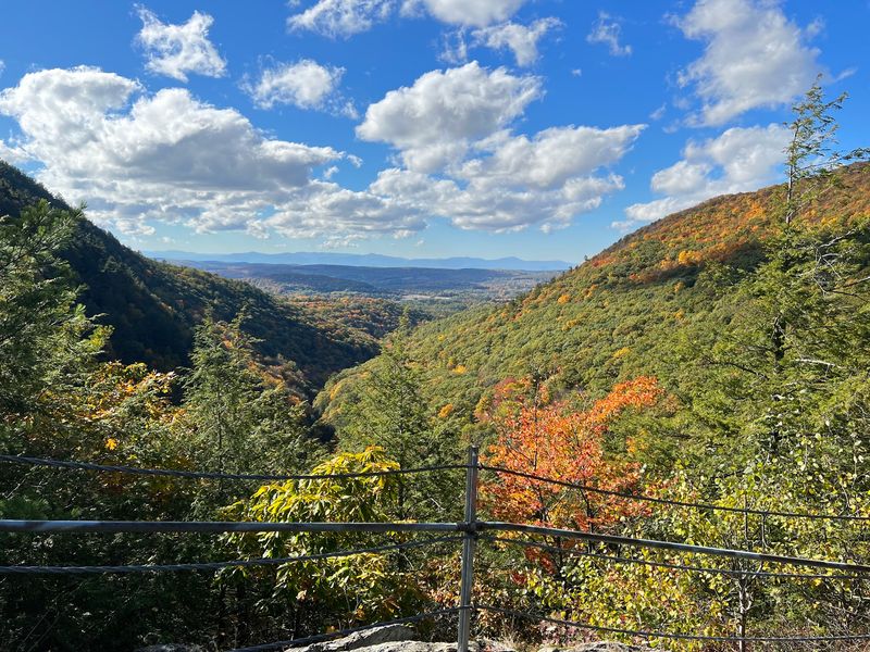
Most people head straight downhill and miss the best view in the park.
Just off the Massachusetts parking lot, a short scramble up rocks leads to an open ledge sometimes called Sunset Rock. The climb takes only a few minutes, though it does involve hands-on stepping over stone.
From the top, the Berkshire hills roll out toward the Taconic ridge, with farm valleys stretching into New York. Late afternoon light turns the whole scene warm and gold.
Hikers who do both the falls and the overlook describe them as completely different experiences that pair perfectly. One is enclosed, wet, and thunderous.
The other is open, breezy, and quiet.
Bring a snack and sit for a while, since the ledge rarely gets crowded even when the trailhead lot fills.
Add maybe twenty minutes to your visit for this side trip. Skipping it would be a shame after driving all the way up Falls Road.
Parking, Hours, and Arriving Early
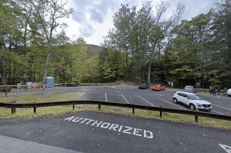
Bash Bish Falls – Sunset RocK
Sunrise visitors sometimes have the whole gorge to themselves. By noon on a July Saturday, that is a different story.
The park opens at 7 AM and closes at 6 PM daily, and parking is free at both trailheads. The upper Massachusetts lot sits closest to the falls but holds only a handful of cars, and it has occasionally closed for construction.
When that happens, or when it fills, drive down to the larger New York lot below the bridge. Portable toilets are usually available near the parking area and closer to the falls.
Cell service in Mt Washington is unreliable, so download directions before you leave. Questions can go to the park at 413-528-0330.
The road in is narrow, winding, and a little rough in places, though the scenery through the woods makes the drive part of the fun.
Arriving before 9 AM remains the single best trick for a peaceful visit.
Watch Your Step: Rattlesnakes and Slick Rocks
A posted sign near the trail mentions timber rattlesnakes, and that tends to get people’s attention.
These shy snakes live in the rocky ledges of the Taconic range and want nothing to do with hikers. Staying on the marked trail is the simplest way to avoid any surprise encounter, and it also protects fragile plants along the gorge.
Wet rocks pose the more common hazard. Spray from the falls keeps stones near the overlook damp, and the Massachusetts trail turns genuinely slippery after storms.
Boots with real grip beat fashion sneakers every time. Trekking poles help on the steep return climb if your knees complain.
Keep dogs leashed, keep kids within arm’s reach near drop-offs, and skip the temptation to explore off-trail ledges above the water.
Sensible caution costs nothing here. Do the small things right and this becomes one of the most relaxing short hikes in western Massachusetts.
Old Iron Mines and Woodpeckers Along the Way
History hides in these woods for anyone willing to wander a little.
Beyond the main path, walkers have found remnants of an old iron mining site, a reminder that this quiet valley once hummed with industry. Stone foundations and cuts in the hillside sit half-swallowed by moss and ferns.
Wildlife shows up too. Visitors report spotting pileated woodpeckers, those big crow-sized birds with flaming red crests that hammer dead trees loud enough to echo.
Additional trails branch off from both parking areas, letting you stretch a twenty-minute walk into a full morning. Some follow the brook downstream, offering creekside scenery without the waterfall view.
The name Bash Bish itself carries local legend, tied to stories of a Mohican woman said to have vanished over the falls.
Layering a bit of history onto the hike changes how the place feels. You stop just looking at scenery and start noticing the past underfoot.
Best Seasons to Plan Your Trip
Timing changes everything about this waterfall.
Snowmelt in April and early May pushes the most water over the ledge, and the noise alone is worth the drive. Trails can be muddy and icy in shaded spots, so traction helps.
Summer brings cool relief. The shaded trail and rushing brook drop the temperature noticeably, though weekends get busy and the closest lot fills early.
Autumn may be the sweet spot. Maples light up the gorge in orange and gold, the air turns crisp, and crowds thin out considerably after peak leaf weekends.
Late fall and winter visits reward the hardy with near-empty parking lots and ice formations clinging to the rock walls, but the access road gets rough.
Picnicking is not allowed at the falls area now, so eat before or after your walk.
Whenever you go, give yourself two hours and go slowly. Rushing through Bash Bish Falls State Park misses the point entirely.