North Carolina’s mountain roads turn every drive into an adventure when you roll down those windows.
Fresh mountain air, incredible views around every bend, and the freedom of the open road make these routes unforgettable.
From legendary parkways to twisty forest roads, these ten drives showcase the best scenery the state has to offer.
Grab your keys and get ready to explore some of the most beautiful mountain roads in America.
Blue Ridge Parkway (Asheville to Boone)
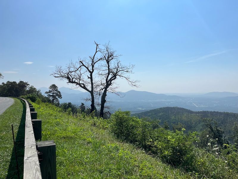
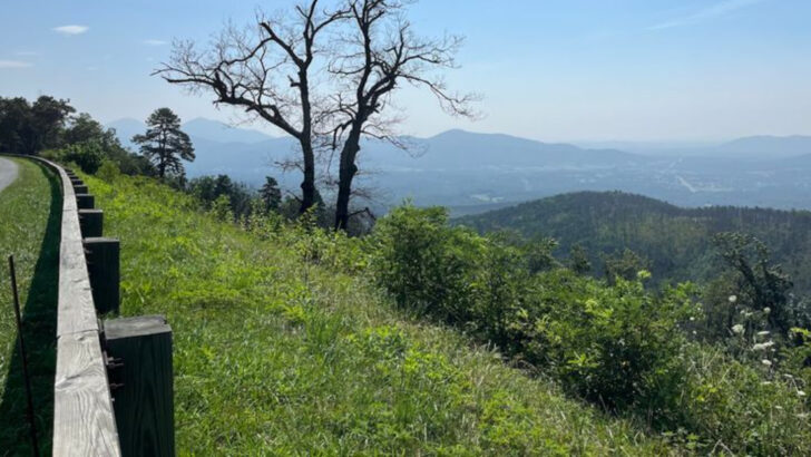
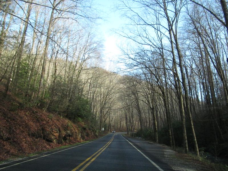
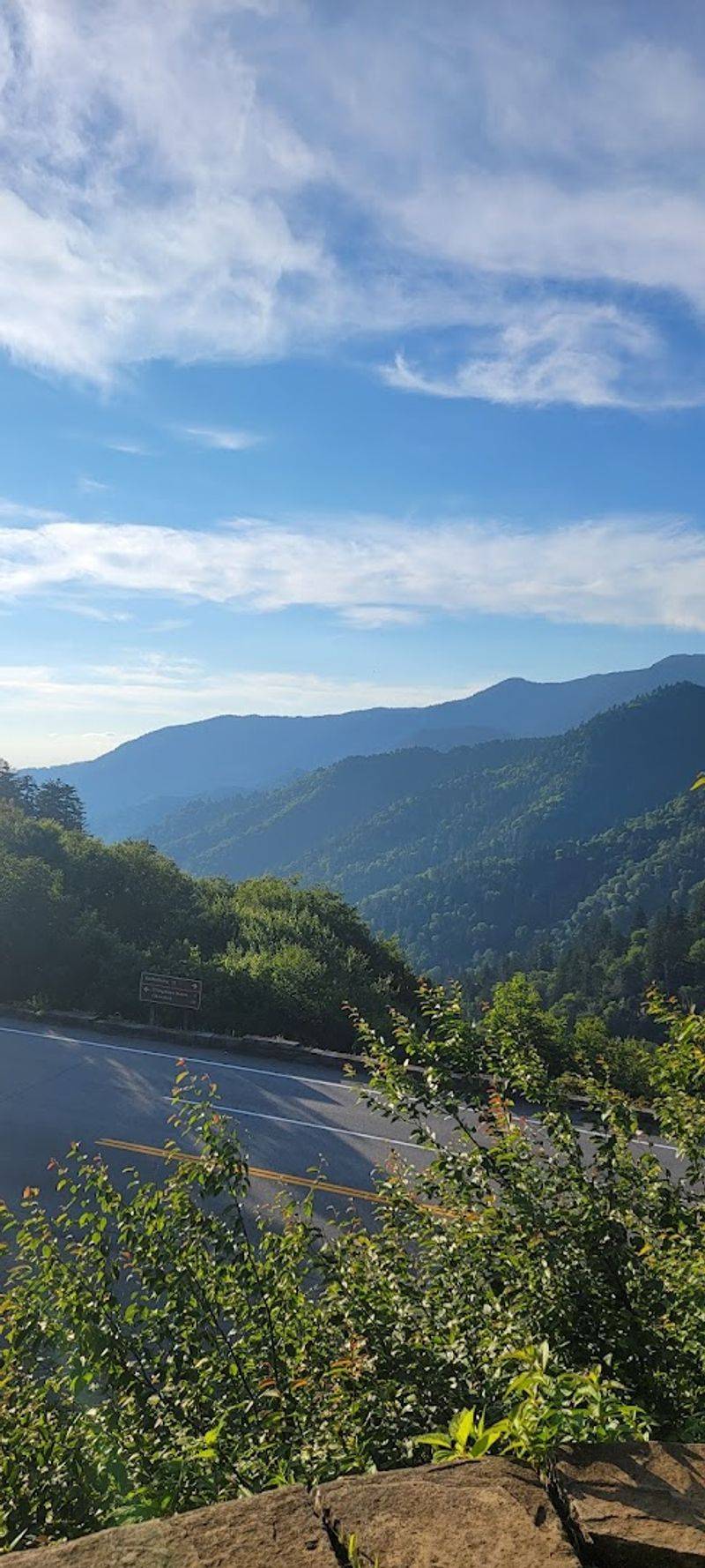
America’s favorite drive earned its reputation for good reason. This 469-mile scenic highway follows mountain ridges through the Appalachian Highlands, offering nonstop overlooks where clouds drift below you.
Stone tunnels carved through solid rock alternate with open vistas that stretch for miles.
The section between Asheville and Boone ranks among the most spectacular stretches. You’ll pass wildflower meadows in spring, waterfalls tucked into forest corners, and historic landmarks like Moses Cone Manor.
Fall transforms the landscape into an explosion of red, orange, and gold that photographers dream about.
Speed limits stay low at 45 mph, perfect for a leisurely cruise with windows down. Pull off at any of the countless overlooks to breathe in mountain air that smells like pine and possibility.
Pack a picnic, bring your camera, and plan for a full day. This drive deserves your time and attention, rewarding every moment spent on its winding curves.
Tail of the Dragon (US 129)
Fasten your seatbelt for the wildest ride in the Southeast. With 318 curves packed into just 11 miles, this legendary stretch challenges even experienced drivers.
Each hairpin turn whips you through dense forest where sunlight filters through thick canopy overhead.
Motorcyclists travel from across the country to conquer this road. The Dragon hugs steep mountainsides along the Tennessee-North Carolina border, dipping and climbing through rugged Smoky Mountain terrain.
Signs warn of the technical difficulty, but the thrill keeps people coming back.
Windows-down driving here means feeling every shift in temperature as you drop into cool hollows and climb into warm ridges. The forest closes in tight around you, creating a green tunnel effect.
Photographers station themselves at Deal’s Gap to capture vehicles navigating the famous curves. Just remember to stay focused on the road ahead because these turns come fast and furious, demanding your full attention and respect for this iconic mountain challenge.
Cherohala Skyway
High above the crowds, this peaceful highway delivers pure mountain serenity. The Cherohala Skyway climbs to over 5,000 feet elevation, where the air turns crisp and views extend for miles in every direction.
Unlike busier routes nearby, you might drive for stretches without seeing another car.
This 43-mile scenic byway connects Robbinsville, North Carolina, to Tellico Plains, Tennessee. The Cherokee and Nantahala National Forests inspired its name, and their protected wilderness surrounds you completely.
Vast forests stretch to distant ridges that fade into blue haze on the horizon.
Roll those windows down and taste the thin mountain air. Weather changes quickly up here, with fog rolling in without warning to create mystical driving conditions.
Spring brings blooming rhododendrons and mountain laurels along the roadside. The skyway offers numerous pullouts where you can stop, stretch your legs, and soak in the solitude.
It’s the perfect escape when you want spectacular scenery without the tourist traffic.
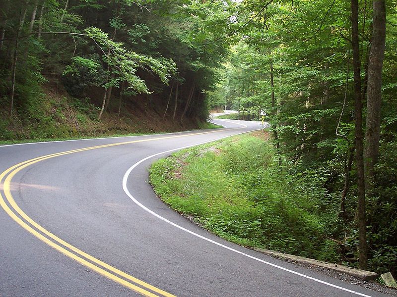
US Highway 276 (Pisgah National Forest)
Water music accompanies your entire journey through this mountain forest paradise. Highway 276 winds through the heart of Pisgah National Forest, passing multiple waterfalls that rumble beside the road.
Looking Glass Falls plunges 60 feet right next to the highway, close enough to feel the spray with your windows down.
Dense hardwood forests create a canopy overhead that dapples the road with shifting light patterns. The route takes you past Sliding Rock, where brave souls ride down a natural waterfall slide into freezing mountain pools.
Autumn transforms these woods into a kaleidoscope that rivals any fall foliage drive in America.
Near Brevard, the road climbs toward the Blue Ridge Parkway through classic Appalachian scenery. Trout streams bubble alongside the pavement, and hiking trails branch off every few miles.
The cool, moist air smells like moss and fresh water. Summer heat disappears under the forest shade, making this route particularly refreshing on hot afternoons when you crave mountain coolness.
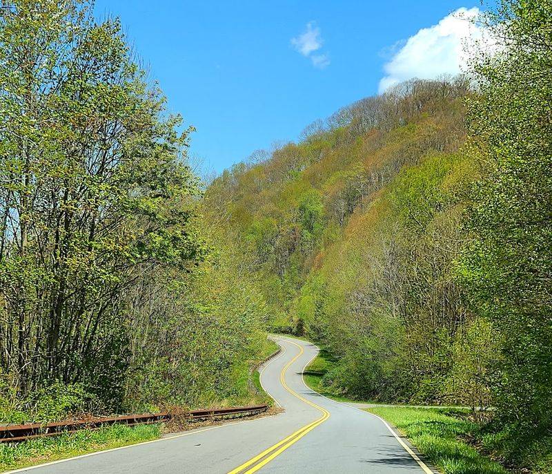
NC Highway 28 (Franklin to Highlands)
Waterfalls practically line this mountain corridor like natural decorations. Highway 28 curves through river valleys and climbs forested ridges between Franklin and Highlands, passing roadside cascades that tempt you to stop every few miles.
Bridal Veil Falls flows right over the road, letting brave drivers pass underneath the tumbling water.
The approach into Highlands offers some of North Carolina’s most charming mountain-town scenery. Elegant summer homes peek through the trees, and the elevation climbs steadily until you reach this resort community perched at 4,118 feet.
Fresh mountain air flows through your open windows, carrying scents of rhododendron and fresh water.
This route showcases Southern Appalachian beauty at its finest. The Cullasaja River gorges beside portions of the highway, creating dramatic drop-offs and rushing rapids below.
Spring runoff makes the waterfalls particularly impressive, while fall colors paint the forested mountainsides in brilliant shades. Take your time navigating the curves, and stop often to explore the natural attractions that make this drive truly special.
NC Highway 215 (Balsam Grove to Canton Area)
Forget the crowds and discover this hidden mountain gem. Highway 215 winds through remote Appalachian wilderness where cell service fades and nature takes over completely.
Thick forests press close to the narrow pavement, creating an intimate driving experience far from tourist traffic.
This lesser-traveled route connects the Balsam Grove area with Canton through some of the most unspoiled mountain terrain in the state. Clear streams cross under the road, and wildlife sightings happen regularly in these quiet woods.
The road climbs and dips through hollows where morning mist lingers long after sunrise.
Windows-down driving here means total immersion in forest sounds and smells. Birds call from the canopy, and you might hear distant waterfalls tumbling down mountainsides.
The pavement twists and turns constantly, keeping you engaged without overwhelming you. Few guardrails separate you from the forest, creating a feeling of wilderness adventure.
When you want solitude and genuine Appalachian mountain character without the tourist development, this route delivers exactly that authentic experience you’re seeking.
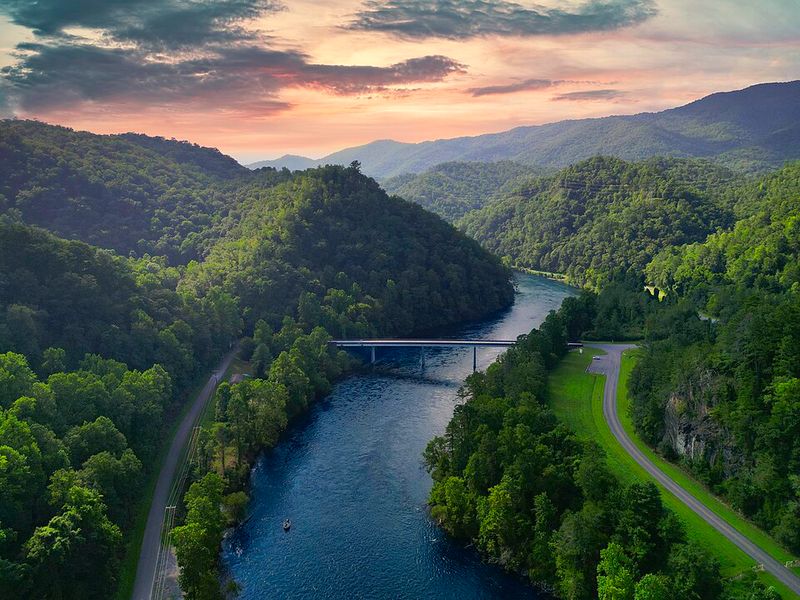
US Highway 64 (Highlands to Cashiers to Lake Lure Corridor)
Mountain lakes and resort towns define this elegant western North Carolina route. Highway 64 connects a string of beautiful communities while showcasing sparkling waters, forested ridges, and classic Southern mountain charm.
The stretch around Cashiers and Lake Glenville stands out as particularly photogenic.
Lake Glenville’s emerald waters reflect surrounding mountains, creating postcard views around every bend. Small bridges cross rushing streams, and roadside shops offer local crafts and mountain goods.
The route continues toward Lake Lure, where dramatic rock formations rise above the water.
Cool breezes flow through your open windows as you cruise between these highland communities. Summer brings wildflowers to the roadside meadows, while autumn sets the hardwood forests ablaze with color.
The road maintains a relaxed pace, perfect for admiring the scenery without feeling rushed. Stop at local cafes for fresh-baked goods or pull off at lake overlooks to snap photos.
This drive combines natural beauty with mountain culture, offering glimpses of upscale resort life nestled in wilderness settings that seem impossibly perfect.
Great Smoky Mountains National Park Loop Roads (Newfound Gap Road)
Wildlife might stop you in your tracks on this national park adventure. Newfound Gap Road climbs from North Carolina into Tennessee through the heart of Great Smoky Mountains National Park, where black bears, deer, and wild turkeys roam freely.
Fog-covered ridges create mystical driving conditions that photographers dream about capturing.
The major mountain pass reaches 5,046 feet elevation at Newfound Gap, where you can stand on the state line. Dense forests transition from hardwoods to spruce-fir as you climb, demonstrating distinct ecological zones.
Morning often brings low-hanging clouds that part dramatically as the sun rises higher.
Windows down means breathing air that hasn’t changed in centuries. Ancient forests surround you, protected within the nation’s most-visited national park.
The road twists constantly, revealing new vistas around every curve. Pullouts dot the route where you can stop to marvel at mountain vistas or watch for wildlife.
Traffic moves slowly here, but nobody minds because the scenery deserves close attention and the unhurried pace lets you truly experience these ancient mountains.
US Highway 19 / 19E (Asheville to Maggie Valley to Cherokee)
River valleys and mountain ridges alternate along this classic corridor. Highway 19 sweeps through western North Carolina, following natural pathways carved by ancient waters.
The route toward Cherokee offers especially dramatic elevation changes as you approach the entrance to Great Smoky Mountains National Park.
Maggie Valley nestles into the mountains along this route, providing small-town charm and spectacular surroundings. The Pigeon River follows portions of the highway, its rushing waters visible from your window as you cruise past.
Open valleys suddenly give way to narrow gorges where mountains close in tight.
Fresh mountain air carries the scent of water and forest when you drive with windows down. The Cherokee Indian Reservation adds cultural interest at the route’s western end, where authentic Appalachian and Native American traditions blend.
Spring brings white dogwood blooms along the roadside, while summer transforms the valleys into lush green wonderlands. The constantly changing scenery keeps every mile interesting, with views of the Smokies appearing and disappearing as the road winds through the landscape’s natural contours and dramatic features.
NC Highway 80 (Bakersville to Blue Ridge Parkway / Mount Mitchell Area)
NC Highway 80 is one of the most underrated mountain drives in North Carolina, especially for travelers seeking a quieter alternative to the more crowded scenic routes.
Winding through the rugged Black Mountains, this highway connects the Bakersville area with the Blue Ridge Parkway near Mount Mitchell State Park, the highest peak in the eastern United States.
The road climbs steadily through dense hardwood forests, offering a mix of sharp curves, steep grades, and occasional openings where layered ridgelines stretch into the distance.
What makes this drive especially memorable is its sense of isolation and elevation. As you ascend, the air cools noticeably, and the landscape shifts into a more remote, high-mountain environment.
In autumn, the route becomes even more striking, with brilliant foliage covering the slopes in shades of red, orange, and gold.
Near the top, access to Mount Mitchell State Park and nearby overlooks on the Blue Ridge Parkway provide sweeping panoramic views that feel far removed from everyday life.
It’s a short but rewarding drive that captures the raw, quiet beauty of western North Carolina’s highest terrain.