Most people think standing on the roof of a region takes days of hiking, heavy packs, and sore knees. In western North Carolina, it mostly takes a car, a full gas tank, and a short walk from the parking lot.
The tallest summit in the eastern United States sits just outside Burnsville, and the road gets you almost all the way there. Up top, the weather can feel like another state entirely, and the views on a clear day stretch across ridge after ridge of the Blue Ridge Mountains.
There is also a story here about a professor, a measuring contest, and a mountain that was named for the man who got it right. Keep reading to learn what makes this peak special, how to plan the trip, and which trails, views, and small details deserve a spot on your list.
The Peak With a Big Title
Sitting at 6,684 feet, this summit holds the title of highest point east of the Mississippi River. That is a big claim, and the mountain backs it up every day.
Mount Mitchell State Park is found at 2388 NC-128, Burnsville, NC 28714, in the Black Mountains of western North Carolina. The park sits in Yancey County, about an hour northeast of Asheville.
Here is the fun part for road trippers. A paved road climbs almost to the top, so the hardest work is a short, steep walk from the summit parking area to the observation deck.
That makes the peak one of the easiest high points in the country to reach. Families with young kids, older travelers, and anyone who prefers wheels over hiking boots can all share the same view.
The park also has a long history as a protected place. It became the very first state park in North Carolina in 1915, which means people have been working to protect this summit for more than a century.
A Professor, a Measurement, and a Mystery
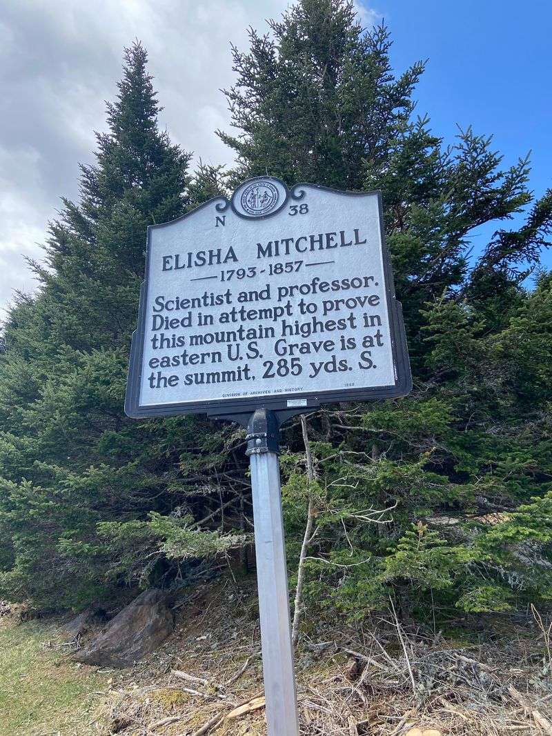
Long before GPS, a college professor set out to prove which mountain was tallest. Elisha Mitchell taught at the University of North Carolina, and in the 1830s he began measuring the Black Mountains.
His work suggested this peak was higher than Mount Washington in New Hampshire, which many people then believed was the eastern champion. That idea sparked a friendly rivalry over the numbers.
Another public figure, Thomas Clingman, challenged Mitchell’s claims. The debate grew heated, and Mitchell returned to the mountains in 1857 to check his work again.
During that trip, Mitchell slipped near a waterfall and did not make it home. His story became part of the mountain’s identity, and the summit was later named in his honor.
Today, his burial place rests at the top of the peak he studied. A marker there reminds guests that science once required ropes, notebooks, and a lot of patience.
Read the signs near the summit before heading back down, since they add real meaning to the view.
The Drive That Does the Climbing
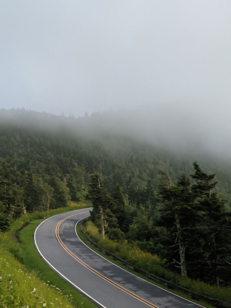
Getting here is half the adventure. Most travelers arrive by way of the Blue Ridge Parkway, turning onto NC-128 near milepost 355.
From that turn, the park road winds about five miles up the mountain. The curves are steady, so a slower pace makes the ride more relaxed for everyone.
Pull-offs along the way give drivers a chance to stop and look around. Use them, since the driver deserves to enjoy the scenery too.
Fill your gas tank before you reach the parkway. Stations are not common along this stretch, and mountain driving uses more fuel than flat highways.
Check the parkway status before leaving home. Sections can close in winter or after storms, and the park road itself may close during icy weather.
The National Park Service posts closure updates online, and the state park shares its own alerts. A quick look at both can save a long detour.
Once the summit lot appears, the remaining climb is short, but the payoff is anything but small.
The Short Walk to the Top
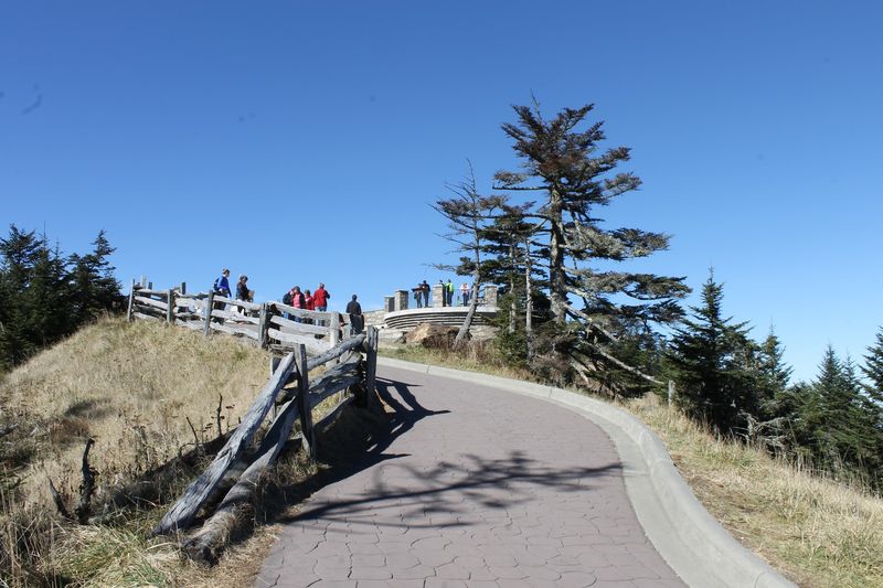
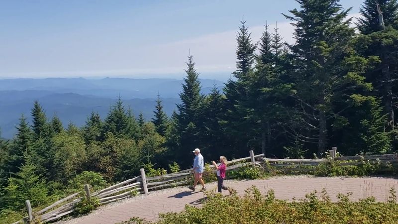
Only a few hundred yards separate the parking lot from the highest spot in the East. The paved summit trail is short, but it climbs, so take your time.
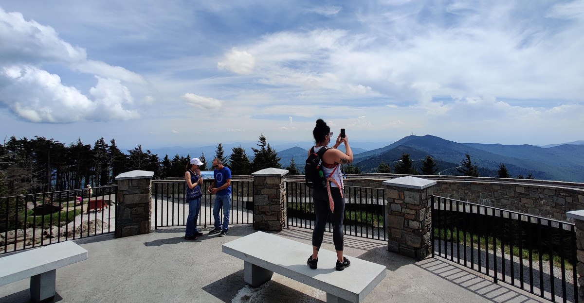
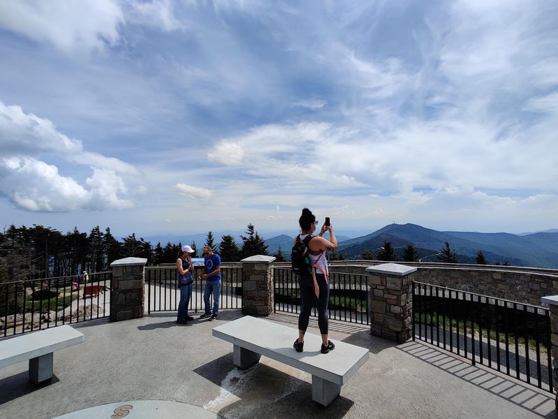
At the end waits a circular observation deck built in 2009. The design is accessible, with a ramp that lets wheelchairs and strollers reach the platform.
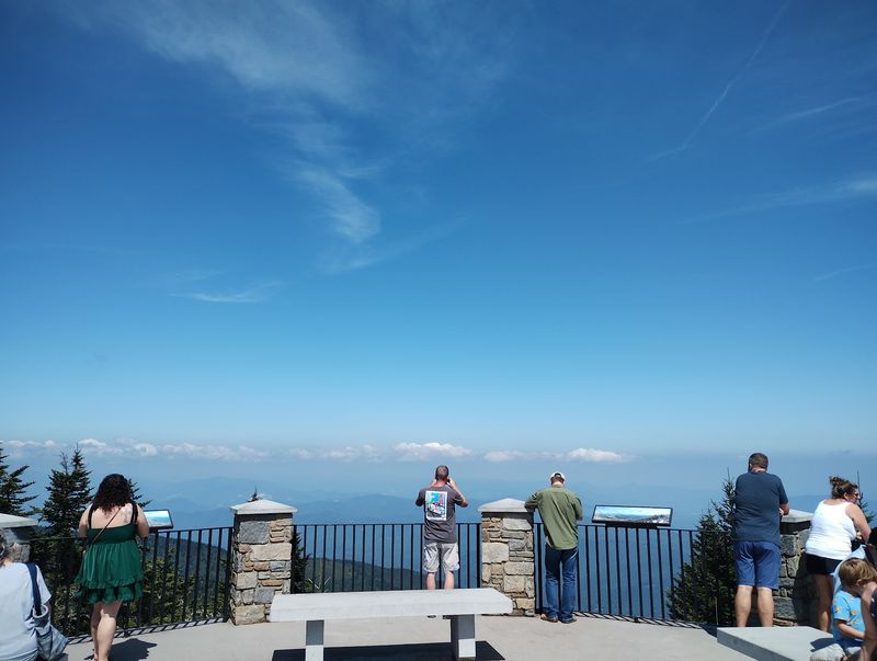
On a clear day, the deck offers wide views across the Black Mountains and beyond. Some days you can see far into neighboring ranges, and other days clouds wrap the summit completely.
Do not let a cloudy morning ruin your plans. Weather changes quickly up here, and fog can lift within an hour.
Bring a light jacket even in July. Summit temperatures often run much cooler than the valleys below.
Benches near the path make good rest stops for anyone catching their breath. Thin mountain air can make a short walk feel longer than expected.
Snap the classic summit photo, then stick around a bit, since the view often shifts minute by minute.
Weather With a Mind of Its Own
Pack for Canada, even if your calendar says August. The summit climate is closer to what you would find much farther north.
Summer highs are usually mild, often staying in the 60s or low 70s. Nights can be chilly, and fog rolls through often.
Wind is another regular guest. Gusts on the summit can be strong enough to send a loose hat flying toward Tennessee.
Winter is a different story. Snow and ice are common, and the mountain has recorded some very cold temperatures over the years.
Because of that, the park road and facilities may close or change hours during cold months. Always check conditions before you go.
Layers are the smartest choice. A rain jacket, a warm top, and sturdy shoes cover most situations.
Thunderstorms can pop up on summer afternoons. If storms appear, head back to your car and wait them out.
Morning visits often bring clearer skies, so an early start can boost your chances of a wide-open view from the top.
A Forest Borrowed From the North
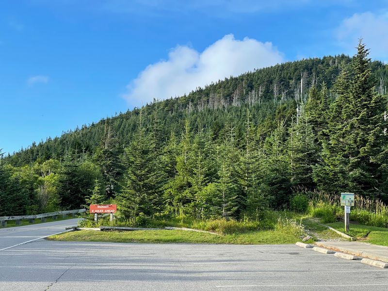
Few places in the South grow trees like these. The upper slopes hold a spruce-fir forest, the kind usually found in places like Canada or northern New England.
Red spruce and Fraser fir are the stars here. The Fraser fir only grows naturally in the southern Appalachian Mountains, which makes it a true local.
Many people know the Fraser fir as a popular holiday tree. Up here, though, it grows wild on the mountain.
Not every tree is healthy. An insect called the balsam woolly adelgid harmed many Fraser firs over the years, and acid rain added more stress.
Some gray, bare trunks still stand as reminders of those challenges. Younger trees are growing in many areas, which is good news for the forest.
Exhibits in the park explain how scientists watch this special habitat. Learning about it makes the hike more interesting.
Stay on marked trails to protect fragile plants. A few careless steps can harm growth that took years to appear.
Trails for Every Kind of Hiker
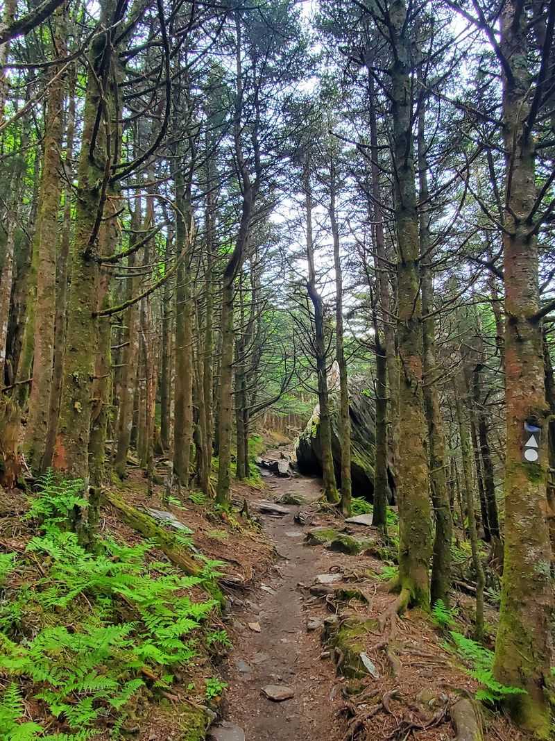
Hikers who want more than a summit stroll have plenty of choices. The park has several trails ranging from easy loops to tough climbs.
The Balsam Nature Trail is a short loop near the summit. It works well for families and includes signs about the plants and trees.
The Old Mitchell Trail connects the summit area with the park office and restaurant area. It has rocky stretches, so wear good shoes.
Big Tom Trail heads north along the Black Mountain Crest. That path is steep and rugged, and it connects to other peaks above 6,000 feet.
For a serious challenge, the Mount Mitchell Trail climbs from the Black Mountain Campground far below. It gains thousands of feet and takes most of the day.
Trail maps are available at the park office. Ask a ranger about current trail conditions before setting out.
Carry water, snacks, and rain gear on longer hikes. Fog can roll in quickly, and the trails stay muddy after storms.
Where to Learn and Rest
Curious minds will find more than scenery near the summit. A small museum area shares the story of the mountain, its forest, and its weather.
Displays cover the history of the park and the people who explored the Black Mountains. Kids often enjoy the exhibits about wildlife and plants.
A gift shop near the summit parking lot sells souvenirs, maps, and other items. Hours can change by season, so check before you count on it.
Restrooms are available near the summit area. That small detail matters after a long drive up the parkway.
The park office sits a bit below the summit. Rangers there can answer questions, share trail advice, and explain current conditions.
A restaurant has operated in the park in past seasons, but its status can change. Plan to bring your own snacks just in case.
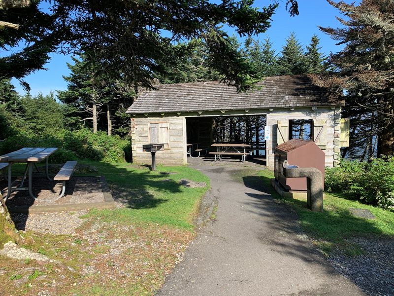
Picnic areas offer tables and grills for a mountain lunch. Grabbing a table with a view may be the most relaxing part of the whole visit.
Camping Close to the Clouds
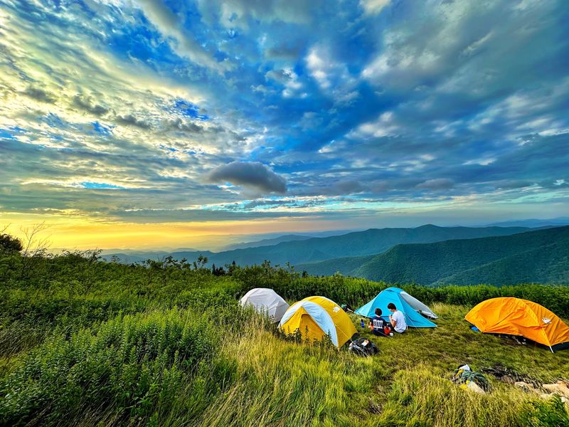
Spending the night on the tallest mountain in the East sounds like a bragging right. The park offers a small tent campground for exactly that.
The campground has only a handful of sites, so reservations are a smart idea. Sites usually open during the warmer months and close in the colder season.
These are tent sites, not spots for large RVs. Expect a simple setup with access to basic facilities.
Nights get cold, even in summer. Pack a warm sleeping bag and extra layers.
Clear nights can offer a great look at the stars. Far from city lights, the sky looks much busier than at home.
Wind and rain can arrive without much notice. Stake your tent well and keep gear covered.
Store food properly, since the park is home to wildlife, including black bears. Rangers can explain the rules when you check in.
Waking up above most of the eastern United States is a pretty great way to start the day.
Best Seasons for a Summit Trip
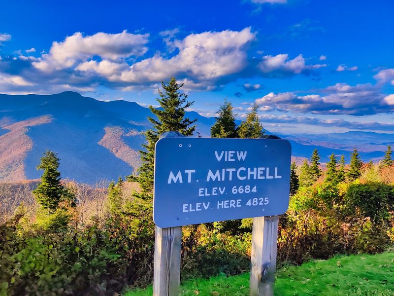
Timing can make or break a trip to the top. Each season brings its own perks and challenges.
Late spring and summer offer the most reliable road access. Mild temperatures make it a favorite time for families escaping the heat below.
Fall is a crowd favorite. The slopes below the evergreen summit show bright autumn color, usually from late September into October.
Expect more traffic during peak leaf season, especially on weekends. Arriving early helps you find parking near the summit.
Winter is the quietest season, but it is also the trickiest. Snow and ice can close the road, and parkway sections often shut down too.
Weekdays tend to be calmer in any season. A Tuesday visit can feel very different from a busy Saturday.
Clear days are the real prize. Check the forecast and webcams if available, since a cloud-covered summit may hide the view entirely.
Flexible plans give you the best shot at seeing the mountain at its finest.
Small Tips for a Smooth Day
A little planning goes a long way on a mountain this tall. Simple steps can keep the day stress-free.
Entry to the park is free. That leaves more budget for gas and souvenirs.
Bring water, snacks, and a warm layer. Services are limited on the parkway, and summit weather can shift quickly.
Cell service may be spotty in the area. Download maps ahead of time so you do not get lost.
Leashed pets are welcome on trails and in many areas. Pack water for them too.
Watch your step on rocky paths, since roots and wet stones can be slippery. Good shoes beat flip-flops every time.
Park hours change through the year, so check the official schedule before leaving. Gates close in the evening.
Pair the trip with other parkway stops, like nearby overlooks or Craggy Gardens. A full day of mountain sights fits nicely around the summit visit.
Head home with photos, stories, and the fun fact that you stood higher than anyone else in the East.