Pennsylvania’s rivers do far more than fill maps with blue ribbons – they built cities, moved coal and timber, powered factories, sparked battles, and handed weekend explorers some seriously beautiful scenery.
Follow these waterways and you can trace the state’s whole personality, from rugged mountain gaps to busy old port towns, with plenty of fish tales and flood stories along the way.
Some rivers swagger across the landscape in broad bends, while others slip through steep valleys like they know a shortcut the rest of us missed.
If you want to understand how Pennsylvania became Pennsylvania, start where the current runs strongest, because these ten giants shaped the history, economy, culture, and views in ways that still ripple today.
Grab your mental paddle, maybe a sandwich for the riverbank, and come along – this tour of the Commonwealth’s biggest rivers is equal parts geography lesson, time machine, and scenic daydream.
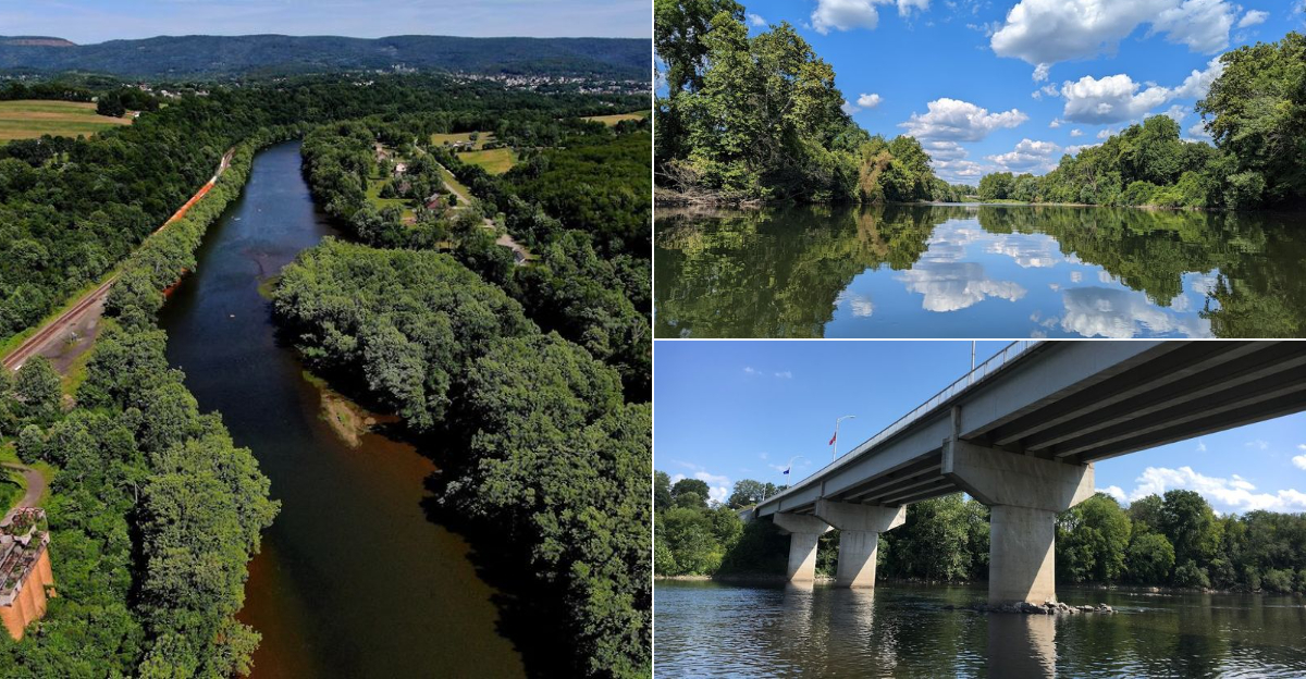
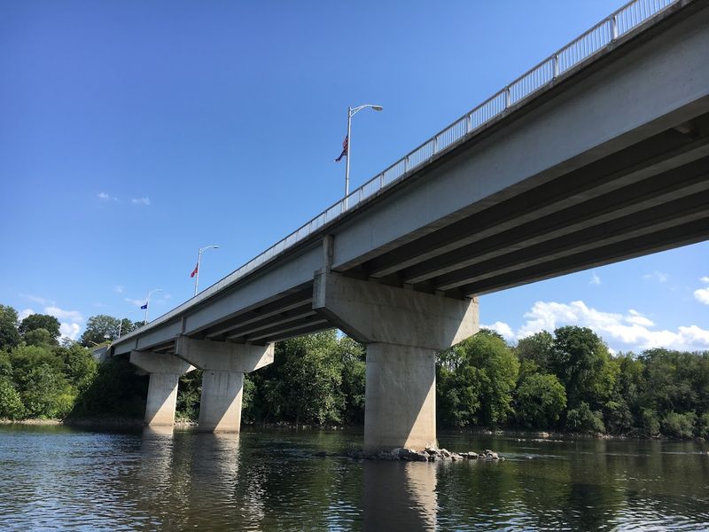
1. Susquehanna River
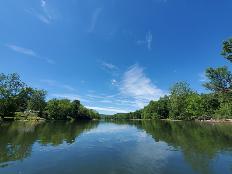
Broad, brawny, and impossible to ignore, the Susquehanna River is Pennsylvania’s headliner.
Stretching across much of the state, it is one of the oldest major river systems in North America.
Its North and West branches meet at Sunbury, then the river rolls south toward the Chesapeake Bay.
For centuries, Indigenous communities relied on this waterway for travel, trade, and food.
Later, settlers used it to float lumber, move grain, and connect inland towns to larger markets.
Canals and bridges followed, and riverside communities grew because this channel made commerce possible before highways stole the spotlight.
The Susquehanna also shaped the landscape in dramatic ways.
Its wide valley, islands, and floodplains created rich farmland and memorable views, especially near Harrisburg and the river hills farther north.
Even today, bald eagles, shad, and migrating birds remind you that this is not just history class with better scenery.
Standing on its banks, you feel the scale immediately.
This river has carried industry, weathered floods, and watched Pennsylvania reinvent itself again and again.
If the state had a liquid backbone, the Susquehanna would wear the title without bragging, though it certainly could.
2. Delaware River
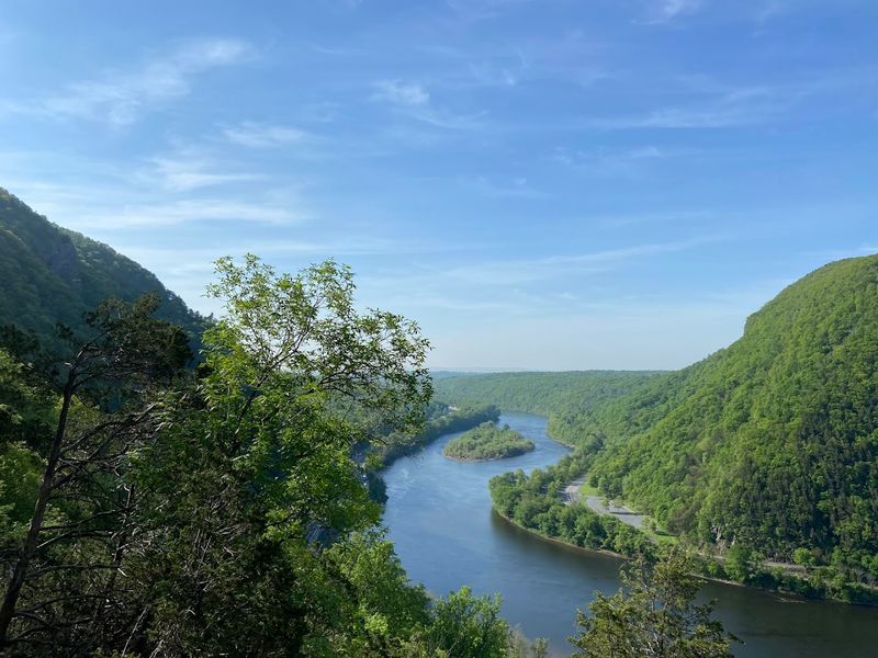
Few rivers in Pennsylvania mix raw scenery and national history quite like the Delaware.
Forming the state’s eastern border, it slides past wooded slopes, river towns, and the dramatic Delaware Water Gap.
It is both a natural boundary and a working corridor that helped define Pennsylvania’s place in the region.
Long before vacationers packed coolers for tubing trips, Indigenous peoples used the river for travel and trade.
European settlement expanded around its banks, and Philadelphia rose near its tidal reach as one of America’s great port cities.
Goods, immigrants, and ideas poured through this river system, making it a force in commerce as much as geography.
The Delaware’s landscapes are wonderfully varied.
Upstream, riffles, islands, and steep hills create a wilder feel, while downstream sections connect to urban history and ship traffic.
Protected stretches have preserved habitats for fish, birds, and recreation, which means the river still gives back without charging admission.
What makes the Delaware memorable is its double life.
It can feel peaceful and pastoral one moment, then deeply consequential the next because so much early American history gathered along its shores.
In Pennsylvania, this river is not just a border line on a map – it is a living front row seat.
3. Ohio River
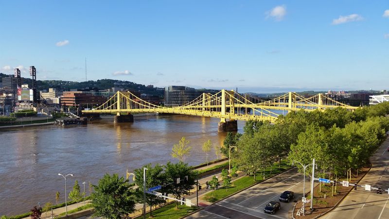
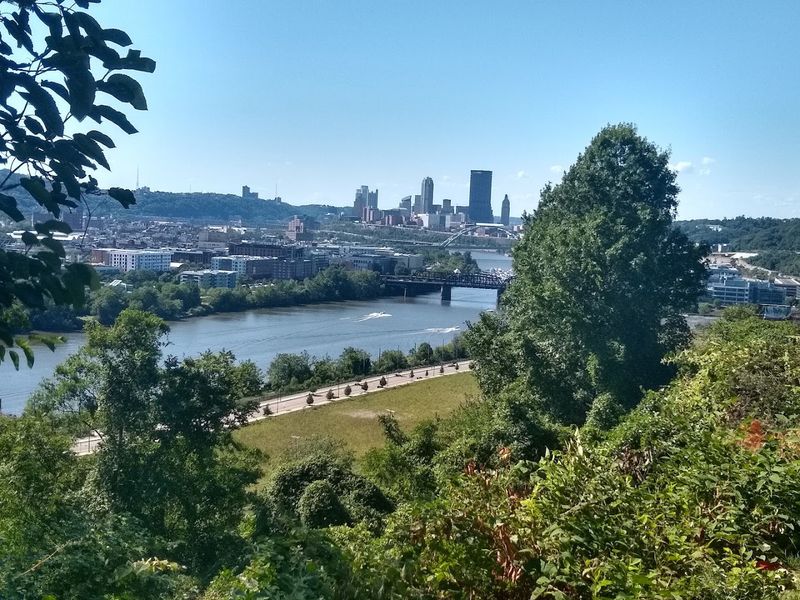
At Pittsburgh’s Point, the Ohio River begins with a flourish worthy of a stage entrance.
Created where the Allegheny and Monongahela meet, it starts in Pennsylvania and then heads west carrying the state’s influence with it.
That short Pennsylvania segment has an outsized historical punch.
The Ohio became a gateway to the interior of North America.
Traders, soldiers, settlers, and eventually industrial cargo moved along this route, tying Pennsylvania to the growing frontier and the wider nation.
Its strategic importance made the Forks of the Ohio a contested place in the eighteenth century, long before steel mills gave the skyline its famous grit.
Though Pennsylvania holds only the river’s opening stretch, the landscape there matters immensely.
Steep hills, urban bridges, and the meeting of three rivers create one of the state’s most recognizable scenes.
It is hard not to admire the choreography of water and city when you stand at Point State Park.
The Ohio also symbolizes movement.
It turned western Pennsylvania into a launching point for trade and expansion, then supported the industries that reshaped the region.
In pure mileage within the state it is not the biggest star, but in consequence, swagger, and historical heft, the Ohio absolutely earns a place at this table.
4. Allegheny River
Cool, winding, and quietly powerful, the Allegheny River gives western Pennsylvania much of its character.
It rises in New York, arcs into Pennsylvania, and eventually reaches Pittsburgh, where it joins the Monongahela.
Along the way, it threads through forests, small towns, and valleys that feel both scenic and hard working.
This river played a central role in transportation long before railroads became the noisy favorite.
Indigenous communities traveled it, and later settlers used it to move timber, oil, and manufactured goods.
As river commerce expanded, towns along the Allegheny gained economic importance and stronger ties to regional markets.
The river also helped shape an impressive natural corridor.
Sections of the Allegheny remain especially beautiful, with broad pools, wooded islands, and access to the Allegheny National Forest nearby.
In some places, the water reflects the hills so perfectly that even the clouds seem tempted to stay for a second look.
By the time the Allegheny reaches Pittsburgh, it has done a lot of quiet heavy lifting.
It fed industry, supported recreation, and linked rural landscapes to one of America’s major industrial cities.
If Pennsylvania’s rivers were a band, the Allegheny might be the understated guitarist – not always loud, but absolutely essential to the sound.
5. Monongahela River
The Monongahela River has a name that sounds musical and a history that clangs like steel.
Flowing north from West Virginia into Pennsylvania, it reaches Pittsburgh and merges with the Allegheny.
That journey made it one of the great industrial arteries of the state.
Coal country depended on the Monongahela.
Barges loaded with coal moved along its channel to fuel furnaces, factories, and the rise of Pittsburgh as a steel powerhouse.
River improvements, locks, and dams helped turn this waterway into a dependable transportation route, which was excellent news for industry and less excellent for anyone hoping for a quiet nap nearby.
Its landscape tells the story of adaptation.
Steep hillsides, river towns, and former mill sites line the banks, mixing natural topography with the marks of heavy manufacturing.
Today, parts of the Monongahela corridor feel renewed, with trails, overlooks, and riverfront development giving old industrial spaces a second act.
Historically, the river was a lifeline.
It connected resources to markets, workers to jobs, and communities to the wider economy of the region.
Even now, when you look across its water in southwestern Pennsylvania, you can sense how strongly this river shaped the state’s identity – equal parts grit, motion, and reinvention.
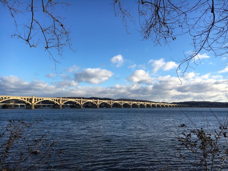
6. Schuylkill River
Curving from coal country to Philadelphia, the Schuylkill River is a classic overachiever.
It helped power industry, fed canals, supplied water, and gave one of America’s great cities a defining landscape.
For a river with such an elegant name, it has done plenty of gritty work.
The Schuylkill was crucial during Pennsylvania’s industrial rise.
Anthracite coal from the interior moved through its valley, and the Schuylkill Canal once helped connect mines, mills, and markets.
That transportation network supported manufacturing growth and tied southeastern Pennsylvania more tightly to national commerce.
Landscape is where the river really shows off.
From wooded stretches upstream to the famous urban scenery of Philadelphia, the Schuylkill shifts personalities without losing its identity.
Boathouse Row, trails, bridges, and riverfront parks make it one of the state’s most publicly enjoyed waterways, which is a lovely upgrade from being treated like a workhorse.
The Schuylkill also tells a story of recovery.
After heavy pollution in earlier eras, cleanup and restoration efforts improved water quality and public access.
Today, the river still carries history in every bend, but it also offers a modern reminder that Pennsylvania’s landscapes are not fixed museum pieces – they can heal, evolve, and surprise you.
7. Lehigh River
Fast in places and full of personality, the Lehigh River slices through eastern Pennsylvania with purpose.
It rises in the Pocono region and runs south through valleys and the famous Lehigh Gorge.
That route made it both a natural wonder and a major industrial helper.
In the nineteenth century, the Lehigh was central to moving anthracite coal.
The Lehigh Canal and related navigation improvements allowed coal from northeastern Pennsylvania to reach broader markets, fueling homes and factories alike.
Without this river corridor, the region’s economic growth would have looked very different and probably much less energetic.
The scenery along the Lehigh deserves applause.
Steep walls, rocky rapids, and forested slopes create one of the state’s standout outdoor settings.
Today, rafters, hikers, cyclists, and train riders enjoy views that once echoed with the sounds of extraction and transport, proving landscapes can change their careers quite successfully.
The Lehigh also helped shape communities such as Allentown, Bethlehem, and Easton.
Industry, trade, and settlement clustered around its banks because water meant opportunity.
Now the river balances heritage and recreation in a way that feels distinctly Pennsylvanian – practical, scenic, and just rugged enough to make your photos look more adventurous than your actual itinerary.
8. Juniata River
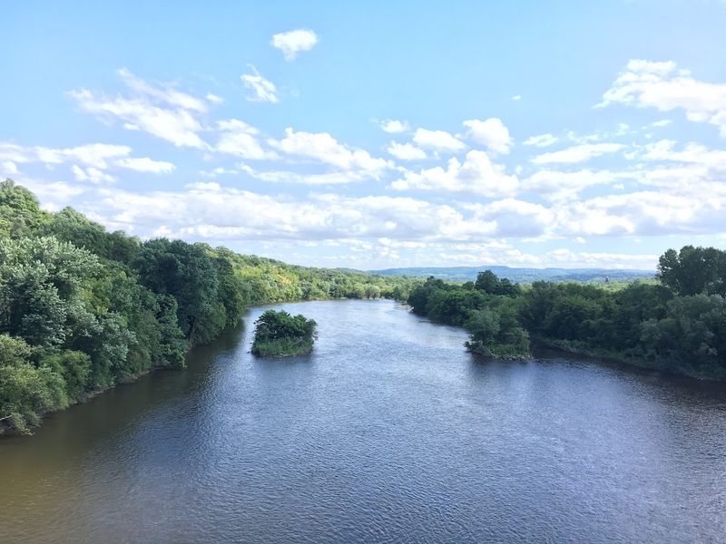
If you like your rivers with a side of farmland and mountain drama, the Juniata delivers.
This central Pennsylvania river winds through ridges and valleys before joining the Susquehanna near Duncannon.
Its basin covers a large rural region that has long depended on the water and the land beside it.
The Juniata served Indigenous communities and later became important to settlement and local trade.
Agricultural products moved through its valley, and transportation routes followed the natural openings it created in the landscape.
Towns developed where the river provided access, fertile bottomlands, and a dependable geographic guide through otherwise rugged terrain.
Visually, the Juniata feels classic Pennsylvania.
Broad bends, wooded hills, limestone landscapes, and patchwork farms give it a quieter charm than some of the state’s more famous waterways.
It does not shout for attention, but it absolutely knows how to hold a view, especially when morning fog hangs over the valley like a slow curtain rise.
Historically, the river mattered because it stitched together communities across central counties.
It supported farming, travel, and everyday life while helping shape roads, rail corridors, and settlement patterns.
The Juniata may not always top tourist lists, yet it remains one of Pennsylvania’s most important landscape makers – steady, useful, and far more influential than its modest reputation suggests.
9. Youghiogheny River
The Youghiogheny River wins points immediately for having one of the most unforgettable names in Pennsylvania.
Often called the Yough, it flows through the southwest and crosses landscapes that are rugged, green, and adventure ready.
Its course through Fayette County gives the river both scenic flair and historical importance.
This waterway helped support transportation, industry, and local settlement in a region shaped by coal, timber, and railroads.
Communities near the river depended on it for practical reasons, while nearby resources drove economic development through the broader watershed.
Though smaller than the state’s biggest commercial giants, the Yough played an outsized role in southwestern Pennsylvania’s working landscape.
Where the river really steals the show is in its topography.
The Youghiogheny River Gorge features steep slopes, rock formations, and energetic rapids that now draw rafters, anglers, and hikers.
Ohiopyle State Park has turned the river into an outdoor celebrity, and honestly, it wears the title well.
The Yough reveals how rivers can shape both history and recreation.
It once supported the region’s extractive economy, and today it anchors tourism and conservation in one of Pennsylvania’s prettiest corners.
That blend of past labor and present play makes the Youghiogheny especially memorable – a river that worked hard, then somehow learned to have fun.
10. West Branch Susquehanna River
Wide valleys and mountain backdrops give the West Branch Susquehanna River a quietly grand presence.
Flowing across north central Pennsylvania to meet the main Susquehanna at Sunbury, it drains a large and varied region.
Its scale and reach made it a major force in the development of the interior.
The river was vital during the lumber era.
Logs were floated downstream from heavily forested uplands, feeding sawmills and helping build communities tied to timber wealth.
Settlement expanded along the corridor because the river offered transportation, fertile floodplains, and connections to larger markets farther south.
The landscape along the West Branch mixes pastoral openness with rugged uplands.
You find broad water, rolling farms, wooded ridges, and towns such as Williamsport that grew in close relationship with the river.
At times it feels expansive and calm, though anyone who knows its flood history understands that this river can change moods very quickly.
Historically, the West Branch mattered because it opened a huge section of Pennsylvania to economic growth.
It linked remote resources to industry and helped shape where people lived, worked, and built infrastructure.
Today, it remains a defining feature of the region – less flashy than some rivers, perhaps, but deeply woven into the state’s environmental story and human geography.