Pennsylvania’s highways and backroads offer more than just a way to get from point A to point B.
When you roll down the windows and feel the breeze, these scenic routes transform into memorable adventures filled with fresh mountain air, forest scents, and beautiful views.
Whether you’re chasing fall foliage or cruising through summer afternoons, these drives showcase the state’s diverse landscapes.
From river valleys to mountain ridges, each route delivers its own unique atmosphere that’s best enjoyed with the windows wide open.
Route 6 Through the Pennsylvania Wilds
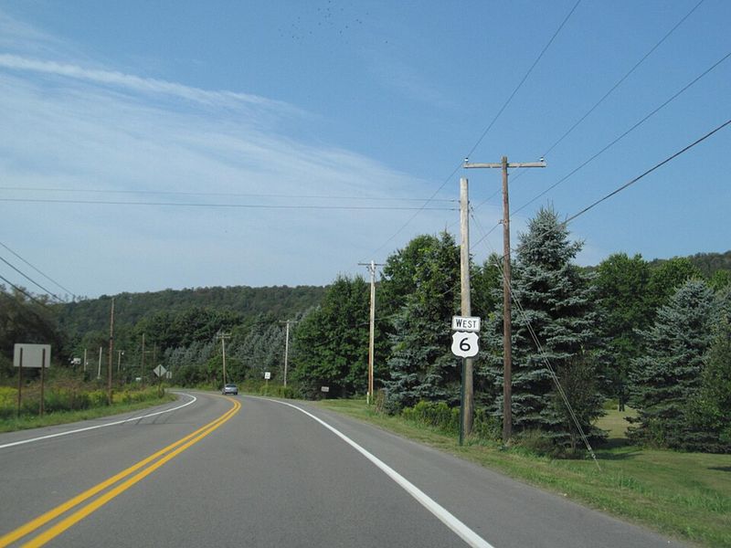
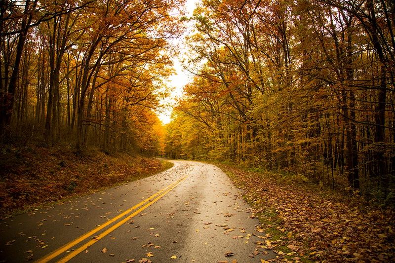
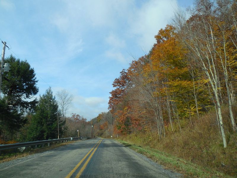
Spanning nearly 400 miles across Pennsylvania’s northern border, Route 6 ranks among America’s longest and most scenic east-west highways. The stretch through the Pennsylvania Wilds feels worlds away from city life, passing through dense hardwood forests and past charming main streets where time seems to move slower.
Fall brings the route to life when sugar maples, birches, and oaks turn brilliant shades of orange, red, and gold. Summer afternoons offer something different—cool forest breezes mixing with the warmth of sunshine as you cruise past farm stands and historic downtowns.
The overlooks along this route provide perfect spots to pull over and breathe in the mountain air.
Small towns like Wellsboro and Coudersport dot the landscape, offering local diners and antique shops worth exploring. Traffic stays light most days, making this an ideal choice for drivers who want to set their own pace.
With minimal development between communities, the wilderness character remains strong throughout the entire journey across Pennsylvania’s northern tier.
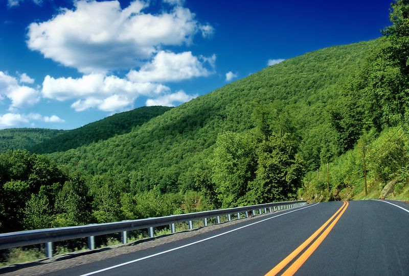
Laurel Highlands Scenic Byway
Fresh mountain air rushes through your car the moment you enter the winding roads of southwestern Pennsylvania’s Laurel Highlands. This designated scenic byway delivers layer after layer of forested ridges, tucked-away waterfalls, and historic landmarks that tell stories of early American settlement and natural beauty.
The route connects several state parks including Ohiopyle and Laurel Ridge, where hiking trails and whitewater rapids add adventure options beyond driving. Historic sites like Fort Necessity and Frank Lloyd Wright’s Fallingwater sit just minutes from the main road.
Each curve reveals something new—whether it’s a cascading stream, a mountain vista, or a quiet picnic area shaded by towering hemlocks.
Spring brings wildflowers blooming along roadside banks, while autumn paints the hillsides in warm tones. Small mountain communities offer local restaurants serving comfort food and homemade pie.
The byway’s moderate elevation changes make it accessible for all skill levels, yet the scenery feels dramatic and memorable. Cool breezes from the surrounding forests create perfect conditions for windows-down driving throughout most months.
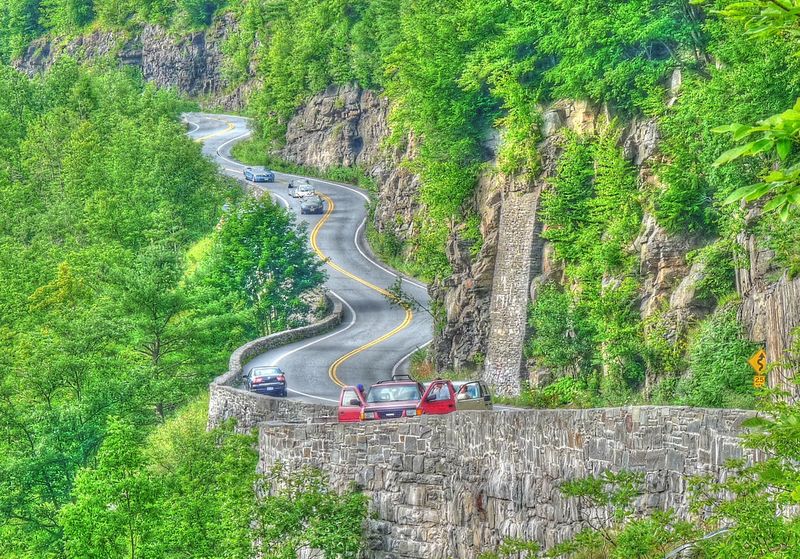
Route 30 Through the Lincoln Highway Corridor
America’s first coast-to-coast highway still carries echoes of road trip glory days, especially through Pennsylvania’s mountain sections. Vintage motels with neon signs, classic diners with chrome trim, and roadside attractions remind travelers of an era when the journey mattered as much as the destination.
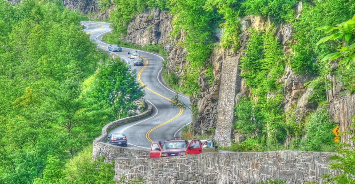
The stretch near Bedford showcases some of the route’s most dramatic scenery. Mountain tunnels carved through solid rock alternate with sweeping valley views and forested slopes.
Original Lincoln Highway markers still stand at various points, connecting modern drivers to nearly a century of travel history.
Rolling down your windows here means breathing in mountain air mixed with hints of roadside grills and bakeries. The route climbs through the Allegheny Mountains with enough elevation change to pop your ears but gentle enough grades to stay comfortable.
Coffee shops and ice cream stands preserved from the mid-century highway boom provide natural stopping points. Local history museums document the road’s importance to American culture.
This drive celebrates both natural beauty and the evolution of American road travel across generations.
Longhouse National Scenic Byway
Solitude becomes the defining feature once you enter Allegheny National Forest on the Longhouse National Scenic Byway. Named for the traditional Seneca Nation dwelling, this route honors indigenous heritage while showcasing some of Pennsylvania’s most untouched wilderness.
Traffic virtually disappears on weekdays, leaving you alone with towering trees and pristine lake views.
The Kinzua Dam and Allegheny Reservoir create stunning water vistas that appear unexpectedly around forested bends. Pull over at designated overlooks and you’ll hear nothing but wind through pine branches and distant bird calls.
The scent of evergreen forest becomes especially strong with windows down, mixing with earthy notes from the forest floor.
Campgrounds and hiking trailheads provide access to deeper wilderness experiences, though the drive itself offers plenty of natural beauty. Spring brings blooming mountain laurel, Pennsylvania’s state flower, creating white and pink corridors along the roadside.
Fall transforms the hardwood forests into golden canopies overhead. The byway stays relatively cool even in summer thanks to dense forest cover and higher elevations throughout the route.
Route 44 Through Pine Creek Gorge
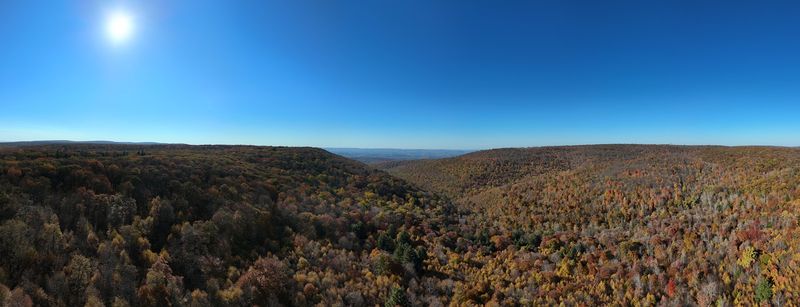
Pennsylvania’s Grand Canyon might not match Arizona’s scale, but Pine Creek Gorge delivers impressive drama all its own. Route 44 follows the rim of this thousand-foot-deep canyon, offering overlooks that drop away dramatically into wooded valleys below.
The nickname fits perfectly when autumn arrives and the entire gorge explodes into brilliant reds, oranges, and yellows.
Leonard Harrison State Park provides the most famous viewpoint, where you can stand at the canyon edge and watch hawks riding thermal currents. The drive itself winds through northern hardwood forests with sudden clearings that reveal long-distance mountain views.
Cool air rising from the creek below creates natural breezes even on warm days.
Small communities along the route maintain a quiet, rural character with general stores and local cafes serving hearty meals. The Pennsylvania Grand Canyon bike trail runs along the gorge floor, occasionally visible from above as a thin ribbon through the forest.
Spring runoff swells Pine Creek into a rushing waterway, while summer brings lush green canopies and perfect temperatures for open-window cruising through this geological wonder.
River Road Along the Delaware Water Gap
Following the Delaware River feels like stepping back to a simpler time when roads curved naturally with the landscape rather than cutting straight through it. This historic route hugs the riverbank through eastern Pennsylvania, passing under canopies of mature sycamores and oaks that have shaded travelers for generations.
The pace here demands slowing down—narrow lanes and frequent curves require attention, but that’s part of the charm. Stone houses dating to colonial times sit close to the road, their walls built from river rock by early settlers.
Small river towns offer antique shops, riverside restaurants, and kayak rental operations for those wanting to experience the water up close.
Access points to Delaware Water Gap National Recreation Area appear regularly, providing hiking trails and swimming holes. The river itself sparkles in sunlight, sometimes calm and mirror-like, other times showing gentle ripples from passing boats.
Spring brings flowering dogwoods and redbuds along the roadside. Cool river breezes make this drive especially refreshing on hot summer afternoons when the water moderates temperatures noticeably.
Historic covered bridges add photographic interest throughout the scenic corridor.
Route 144 Through Bald Eagle State Forest
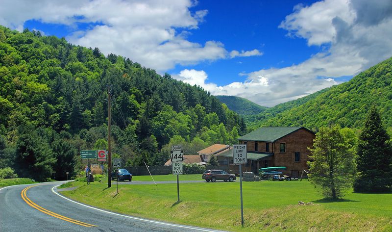
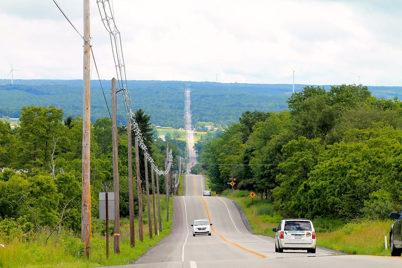
Isolation defines Route 144 as it cuts through central Pennsylvania’s longest continuous mountain ridges. Miles pass without seeing another vehicle, much less a building or development.
This remoteness attracts drivers seeking genuine escape from populated areas and busy highways, offering meditation through motion and landscape.
The route climbs steadily through Bald Eagle State Forest, where management practices maintain healthy timber stands and wildlife habitats. Ridge-top sections provide sweeping views across parallel mountain ranges that fade into blue haze at the horizon.
Valley floors far below show patchwork farms and meandering streams barely visible from this elevation.
Forest composition changes with altitude—oak and hickory at lower elevations giving way to mountain laurel thickets and eventually wind-stunted pines near the highest points. With windows down, temperature drops become noticeable during these climbs, bringing refreshing coolness even on summer days.
Wildlife sightings increase here due to limited human presence—white-tailed deer, wild turkeys, and occasional black bears utilize these protected forests. Small parking areas at scenic overlooks provide the only infrastructure, preserving the wilderness character that makes this route special for solitude seekers.
PA Route 666 Near Tionesta
Don’t let the number fool you—Route 666 offers heavenly forest scenery rather than anything ominous. This northwestern Pennsylvania route winds through some of Allegheny National Forest’s prettiest sections, where curves follow natural topography and every turn brings new woodland vistas.
The designation comes simply from the state’s highway numbering system, though locals enjoy the irony of such peaceful beauty bearing such an infamous number. Sweeping turns through mature forest create a driving rhythm that feels almost musical, with elevation changes adding dynamic interest without becoming challenging.
Sunlight filters through the canopy in constantly changing patterns across the pavement.
Tionesta Creek parallels portions of the route, its clear water visible through gaps in the vegetation. Fishing access points and informal pulloffs let you stop and enjoy the forest sounds—rushing water, rustling leaves, and bird songs replacing traffic noise.
The forest here grows thick and healthy, showing successful conservation management. Spring brings emerging green leaves that create a luminous quality to the forest light.
Autumn turns the canopy golden and red. Even without dramatic overlooks, the continuous immersion in quality forest makes this drive memorable and calming.
Route 32 Along the Delaware River
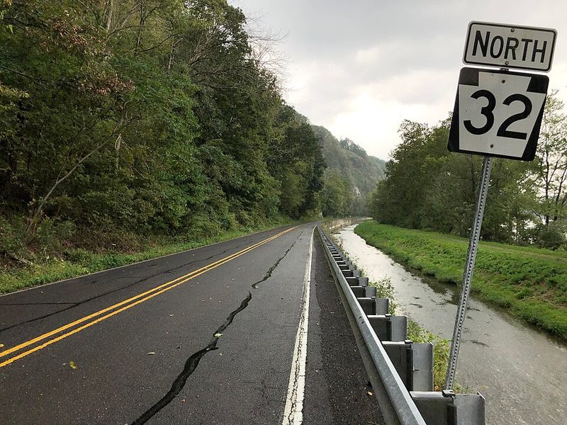
Colonial history lives along every mile of Route 32 through Bucks County. Stone houses built centuries ago still stand solid beside the road, their thick walls and small windows testifying to pioneer craftsmanship.
Covered bridges span tributaries feeding the Delaware River, their wooden structures preserved as working monuments to 19th-century engineering.
The two-lane road requires slow speeds, which perfectly suits the landscape. Historic markers appear frequently, noting Revolutionary War events, early mills, and significant buildings.
Small river towns maintain their traditional character—no chain stores or modern development disrupts the rural atmosphere that attracted Philadelphia artists and writers generations ago.
Spring transforms roadside banks into wildflower gardens, while autumn brings spectacular foliage reflected in the adjacent river. The Delaware flows peacefully here, its width and calm current attracting kayakers and tubing enthusiasts.
Numerous riverside parks and boat launches provide access to the water. Local farm stands sell seasonal produce, and historic inns offer lunch stops with river views.
Cool breezes off the water make this drive particularly pleasant during warm months. The historic and natural elements combine into an experience that feels both educational and relaxing.
Elk Scenic Drive Around Benezette
Few Pennsylvania drives offer potential wildlife encounters like the roads circling Benezette in Elk County. North America’s largest land mammals roam freely here, often grazing in open meadows visible from the road.
Early morning and evening hours bring the best sighting opportunities when elk emerge from forest cover to feed.
The scenic drive loops through reclaimed strip mine land that has regenerated into prime elk habitat. What was once industrial scarring has transformed into productive grasslands and young forests that support Pennsylvania’s growing elk population.
Designated viewing areas let you pull safely off the road to watch and photograph these impressive animals.
Mountain scenery surrounds the elk areas, with forested ridges rising on all sides. During autumn rutting season, bull elk bugle calls echo across the valleys—an unforgettable sound that draws nature enthusiasts from across the region.
The cooler air at this elevation makes windows-down driving comfortable from spring through fall. Beyond elk, the area supports abundant bird life and other wildlife.
Local businesses cater to wildlife watchers with guides, tours, and photography advice. The combination of dramatic animals and beautiful mountain landscape creates a unique Pennsylvania experience.
Route 125 Through the Appalachian Coal Region
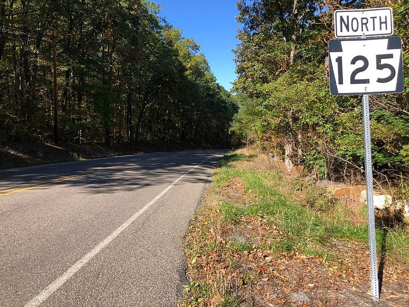
Hidden among eastern Pennsylvania’s highest ridges, Route 125 delivers drama through sheer topography and historical layers. This route climbs through mountain gaps where coal seams once fueled American industry, passing abandoned mining operations now reclaimed by aggressive forest growth.
Steep grades and hairpin turns make it memorable for drivers who appreciate challenging roads.
Old coal towns cling to narrow valleys between mountains, their architecture and layout reflecting the industry that created them. Company houses line steep hillsides, and massive coal breakers sit silent as monuments to a bygone era.
The forest has recovered remarkably, now covering slopes that were once stripped bare by mining activity.
Elevation changes bring noticeable temperature drops as you climb—perfect for natural air conditioning through open windows. The route’s remoteness means light traffic and genuine solitude between communities.
Mountain streams cutting through rock formations create scenic waterfalls during spring runoff. Overlooks at the highest points reveal ridge after ridge fading into the distance.
This drive combines industrial history with raw mountain beauty, showing how nature persists and recovers even after intensive human use of the landscape.