Some forests make you feel small. Congaree makes you feel tiny.
At South Carolina’s Congaree National Park, towering old-growth trees rise above a floodplain forest that feels almost prehistoric.
Giant bald cypress, loblolly pines, oaks, tupelos, and other hardwoods create a canopy soaring more than 100 feet overhead.
The magic is that you don’t need to be an expert hiker to experience it.
A wooden boardwalk winds through the forest, crossing wetlands and passing enormous trees that seem to disappear into the sky.
For those craving more adventure, longer trails lead deeper into the wilderness, where muddy paths, quiet waterways, and dense woods replace the easy footing.
This is a forest built for wandering, looking up, and wondering just how something this enormous survived for so long.
A Forest Where the Trees Tower Above You
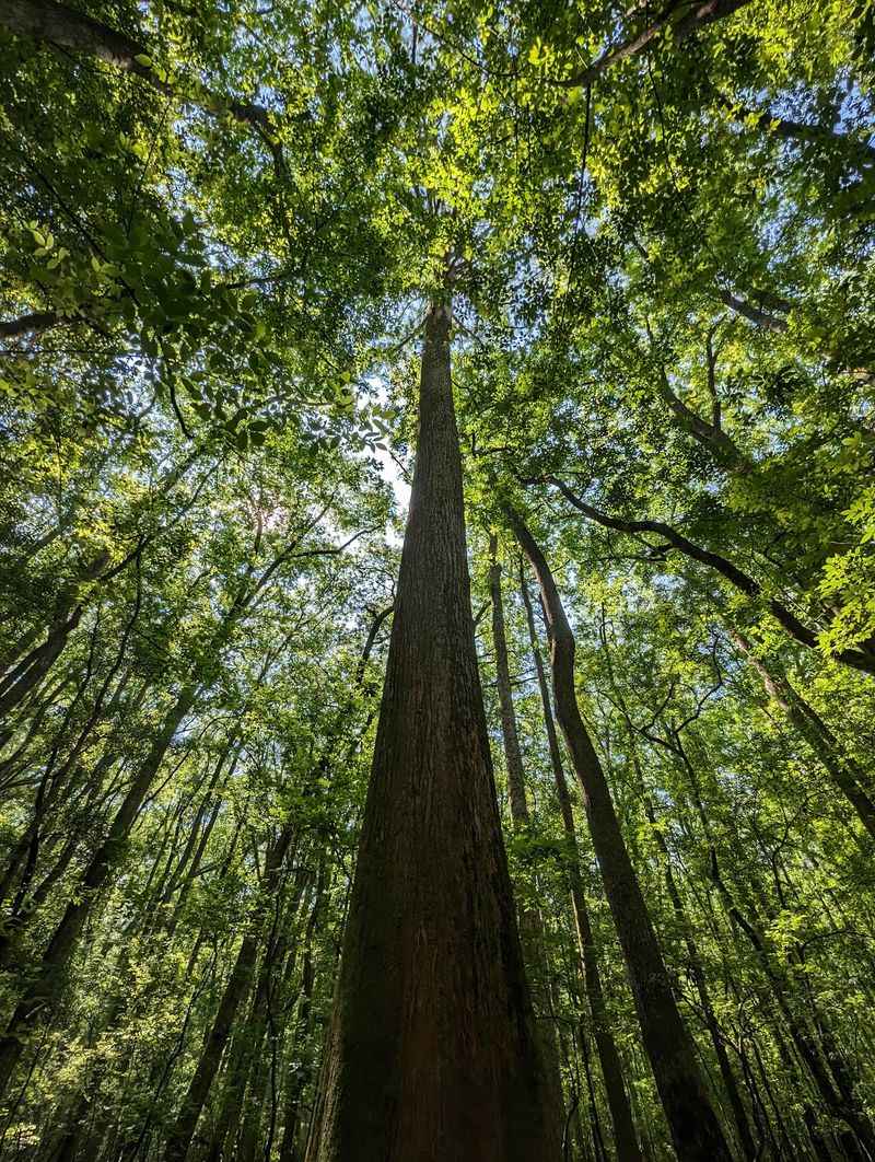
Stepping into Congaree National Park immediately reveals something extraordinary about this place. The forest canopy soars more than 100 feet above your head, creating an experience unlike anything you’ll find in most eastern woodlands.
Standing beneath these giants feels similar to entering a massive natural cathedral, where the columns are living trees and the roof is a ceiling of green leaves.
The scale becomes even more impressive when you learn that Congaree holds the highest concentration of champion-sized trees in North America. These aren’t just tall trees scattered here and there.
You’re surrounded by record-breaking specimens everywhere you look.
The National Park Service has documented this incredible collection, confirming what visitors notice within minutes of arrival. Walking through Congaree means constantly looking up in amazement.
Your neck might get sore from tilting your head back, but the view is absolutely worth it.
Many people travel across the country just to witness this vertical landscape in person.
This Is a Bottomland Forest, Not a Typical Swamp
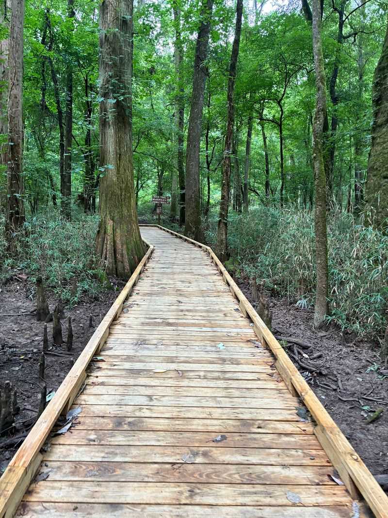
Most visitors arrive expecting a permanently soggy, mosquito-filled swamp that requires wading through murky water. That mental image couldn’t be further from reality.
Congaree protects a bottomland hardwood forest, which operates on an entirely different system than what most people picture.
The key difference lies in how water interacts with the land here. When the Congaree River rises, floodwaters spread across the forest floor, bringing nutrients and sediment.
Between these periodic floods, much of the forest floor stays relatively dry and perfectly walkable.
This cycling between wet and dry conditions creates the special ecosystem that supports such enormous trees. The periodic flooding provides nutrients without drowning the forest permanently.
Think of it as nature’s fertilization system, delivering exactly what these giants need to thrive.
Understanding this pattern helps explain why Congaree looks so different from traditional swamps. You can explore much of the park comfortably on dry trails most of the year.
The Boardwalk Is the Easiest Way to Enter the Old-Growth Forest
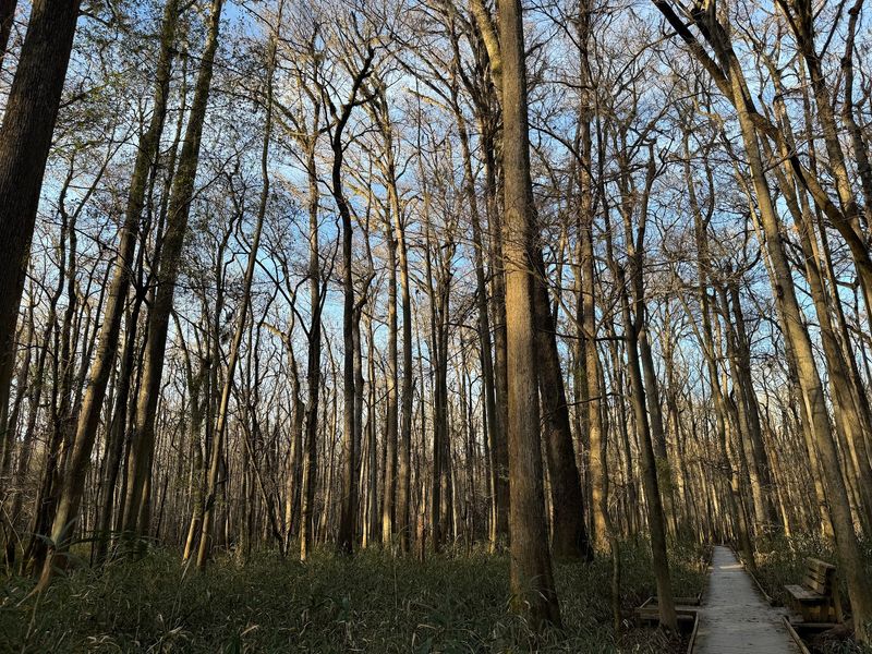
Starting your Congaree adventure becomes incredibly simple thanks to the 2.6-mile Boardwalk Trail. This elevated walkway leaves from the Harry Hampton Visitor Center and descends directly into the heart of the old-growth forest.
Within minutes, you’re surrounded by towering bald cypress, tupelo, loblolly pines, oaks, maples, and hollies.
The boardwalk design makes the forest accessible to almost everyone. Wheelchairs and strollers roll smoothly along the entire route.
Benches positioned at intervals offer perfect spots to rest and absorb the forest atmosphere.
Families with young children particularly appreciate this trail’s gentle nature. No special hiking skills or equipment are needed.
Just show up, step onto the boardwalk, and the ancient forest welcomes you immediately.
First-time visitors should absolutely begin here before venturing onto other trails. The boardwalk provides an excellent introduction to what makes Congaree special.
You’ll see champion trees, experience the unique bottomland environment, and get oriented to the park’s layout, all without breaking a sweat.
Look Up for Congaree’s Champion Trees
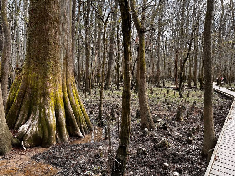
Champion trees represent the largest known specimens of their species, and Congaree contains an astonishing collection of these record-holders. A national champion loblolly pine measured 170 feet tall during its last official recording.
That’s roughly the height of a 17-story building growing straight out of the forest floor.
What makes Congaree truly remarkable is how accessible these champions are. You don’t need backcountry hiking experience or special permits to encounter them.
Many record-breaking trees stand within easy reach of the main boardwalk and popular trails.
Walking among these giants provides perspective that photographs simply cannot capture. Your eyes travel up and up the massive trunks, finally reaching branches that seem impossibly distant.
Other visitors often stand with their mouths open, cameras pointed skyward, trying to frame the entire tree.
The park maintains records of numerous state and national champions growing here. Each visit might reveal a new favorite, depending on which trail you choose and where the light falls through the canopy.
Cypress Knees, Sloughs, and Oxbow Lakes Add to the Strange Landscape
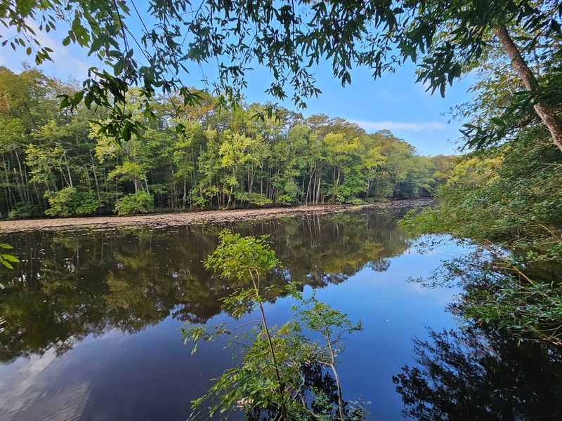
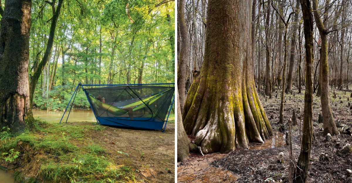
Beyond the towering trees, Congaree’s landscape reveals fascinating watery features that look almost alien. Cypress knees poke up from the ground and water like wooden stalagmites, creating an otherworldly scene.
These knobby projections are part of the cypress tree’s root system, and scientists still debate their exact purpose.
The Weston Lake Trail provides an excellent route for experiencing these unique features up close. Following Cedar Creek and winding through a cypress-tupelo slough, the trail showcases the wetland character woven throughout the forest.
The dark, tannin-stained water reflects the towering trees above, doubling their already impressive height.
Oxbow lakes scattered through the park tell stories of how waterways shift and change over time. Rivers carve new paths, leaving behind these crescent-shaped bodies of water.
Each oxbow creates its own distinct micro-environment.
These watery elements make Congaree feel mysterious and ancient. The combination of massive trees and these strange aquatic features produces a landscape unlike anywhere else in the Southeast.
Weston Lake Trail Goes Deeper Into the Forest
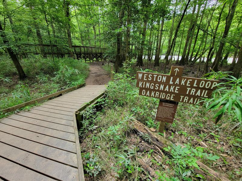
After experiencing the boardwalk, many visitors crave more immersion in Congaree’s wild beauty. The 4.5-mile Weston Lake Trail delivers exactly that, taking you deeper into sections of old-growth cypress-tupelo forest.
This route feels significantly more remote than the busy boardwalk, even though you’re still within the same park.
Portions of the trail follow Cedar Creek and skirt Weston Lake itself. The changing perspectives on water and forest create constantly shifting scenery.
One moment you’re walking beneath towering hardwoods on relatively dry ground, the next you’re following a dark creek lined with cypress.
Wildlife viewing opportunities increase significantly on this trail. The National Park Service highlights frequent sightings of otters playing in the waterways.
Wading birds stalk through the shallows, hunting for fish and amphibians.
This trail requires more time and energy than the boardwalk but doesn’t demand serious backcountry skills. It strikes a perfect balance for visitors ready to explore beyond the introductory route while still maintaining reasonable accessibility and clear trail conditions.
Water Shapes Nearly Everything You See
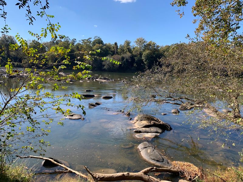
Understanding Congaree requires understanding the central role water plays in creating everything you observe. Nearly 80% of the park lies within the Congaree River floodplain, making flooding a defining characteristic rather than an occasional problem.
Water rises through the forest roughly ten times each year, transforming the landscape completely.
These floods aren’t disasters but rather essential events. Rising water carries nutrients and sediment deep into the forest, distributing natural fertilizer throughout the ecosystem.
This regular delivery system maintains the incredibly productive plant community that supports the towering trees.
Think of the flooding as the forest’s heartbeat, a regular rhythm that keeps everything healthy and growing. Without these periodic inundations, Congaree’s giants would struggle to reach their record-breaking sizes.
The water brings exactly what they need, exactly when they need it.
Visitors who witness the forest during high water see an entirely different park. Trails disappear underwater, the character shifts dramatically, and the bottomland forest reveals its true aquatic nature.
Planning around water levels becomes part of the Congaree experience.
The Forest Changes With the Seasons
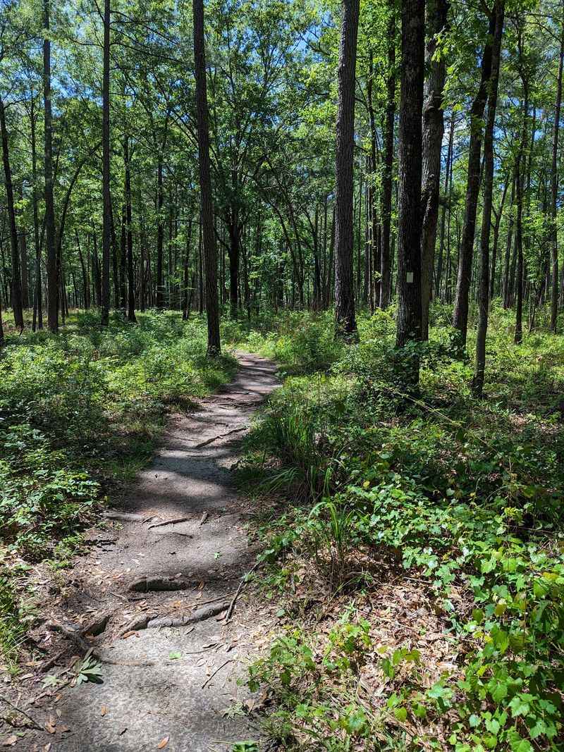
Visiting Congaree in April feels completely different from arriving in August or November. Spring transforms the forest into a explosion of fresh green growth and wildflowers carpeting the forest floor.
Wildlife activity peaks as animals raise young and take advantage of abundant food sources.
Summer brings intense heat and humidity that can make hiking challenging. Mosquito populations explode during wet periods, sometimes reaching legendary proportions.
Smart visitors come prepared with insect repellent and realistic expectations about comfort levels.
Late spring offers one of Congaree’s most magical experiences: synchronous firefly displays along the Firefly Trail. These special insects flash in coordinated patterns, creating a living light show that draws visitors from across the country.
Reservations and lottery systems often control access during peak firefly season.
Wetter periods dramatically alter which trails remain accessible and how the forest looks. Water levels can shift rapidly, turning previously dry paths into shallow streams.
Checking current conditions before visiting helps avoid disappointment and ensures you can actually reach your planned destinations.
What to Know Before You Go
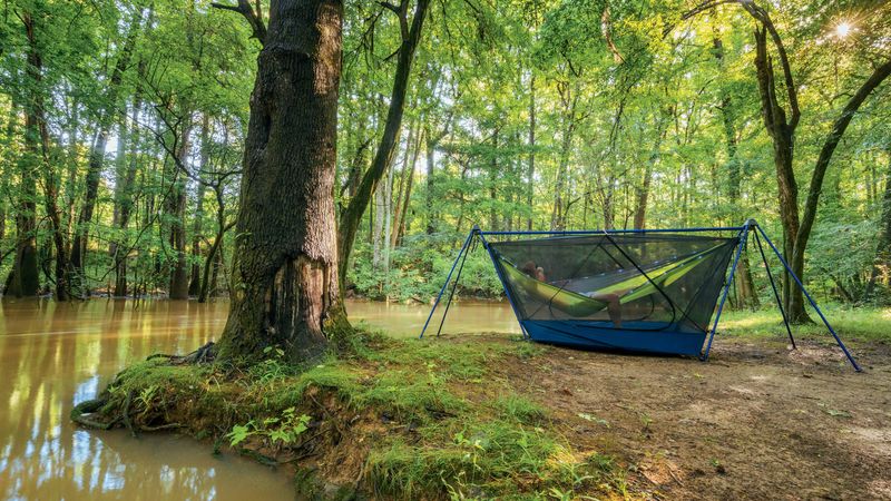
Planning your Congaree visit starts with understanding the basics. The park charges no entrance fee and stays open 24 hours daily year-round.
The Harry Hampton Visitor Center typically operates from 9 a.m. to 5 p.m., providing maps, current trail conditions, and ranger advice.
Finding the park is straightforward: the address is 100 National Park Road, Hopkins, SC 29061. GPS coordinates work reliably for navigation.
Checking current alerts before leaving home proves essential, as conditions change rapidly throughout the year.
Most trails face potential hazards including flooding, downed trees, thick mud, and other wilderness challenges. What looked passable yesterday might be underwater today.
Cell phone service can be unreliable once you leave the visitor center area, so don’t depend on it for navigation or emergencies.
Pack plenty of water, wear appropriate footwear that can get wet and muddy, bring insect repellent regardless of season, carry a detailed map, and keep your navigation device fully charged. These simple preparations transform your visit from potentially frustrating to genuinely enjoyable.