
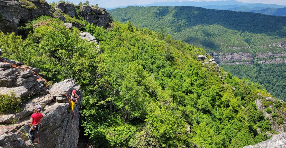
North Carolina has a canyon, and most people drive right past it. Tucked into the mountains outside Morganton, a river has spent ages carving a deep, rocky trench through the Blue Ridge.
The walls are lined with cliffs, the trails drop hard toward the water, and the overlooks make even seasoned hikers stop and stare. Folks around here have a nickname for it that sounds like a bold claim, yet it holds up the moment you reach the rim.
Getting there takes some planning, a sturdy pair of boots, and a healthy respect for rough roads. In return, you get waterfalls, rock towers, free camping, and nights with more stars than streetlights.
Keep reading to learn where it is, what to see, and how to visit without getting in over your head.
Where the Canyon Hides
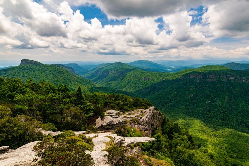
Finding a canyon in the North Carolina mountains sounds like a riddle, but the answer is the Linville Gorge Wilderness Area in Morganton, NC 28655, United States. It sits inside Pisgah National Forest in the western part of the state.
The Linville River runs along the bottom of the gorge. Steep walls rise on both sides, topped with rocky peaks and overlooks.
Because it is a protected wilderness area, the land stays wild on purpose. You will not find gift shops or paved loops deep inside the gorge.
The area is open 24 hours a day, every day of the week. That makes it a good fit for sunrise hikers and overnight campers alike.
Entry is free, which is a nice bonus for families on a budget. You just need to bring your own supplies and plans.
Many people call it the Grand Canyon of the East. Once you stand at an overlook, that nickname starts to make a lot of sense.
Why the Big Nickname Fits
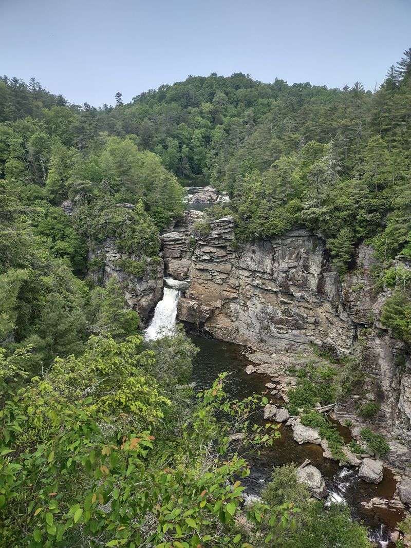
Calling any place the Grand Canyon of the East is a big swing. Linville Gorge earns the title by being one of the deepest gorges in the eastern United States.
The Arizona version is far larger, of course. Still, nothing else in North Carolina comes close to this mix of sheer cliffs and long drops.
Overlooks on the rims show the river snaking through the bottom. From up high, the trees look tiny and the rock walls seem to go on forever.
The gorge stretches for miles, so the views change as you move along the rim. One spot shows a waterfall, while another faces jagged rock towers.
Most trails either head down into the canyon or up to a lookout. Some lucky routes do both in one outing.
Plan on at least a full day to start exploring. Plenty of people say a week would barely scratch the surface, and they are not wrong.
Falls That Steal the Show
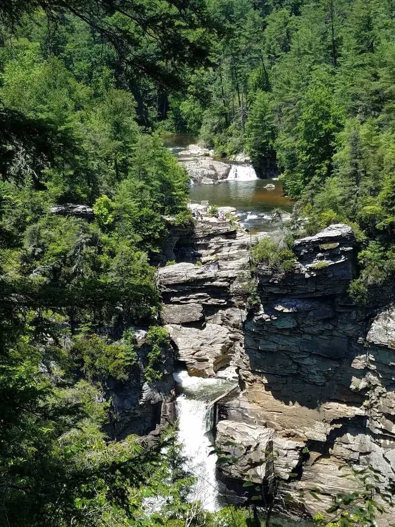
Waterfalls rank near the top of the reasons people come here. Linville Falls, at the north end of the gorge, ranks among the best known falls in the state.
A short trail leads to the Upper Falls. The walk out is easy, but the climb back up to the parking area is steep, so save some energy.
Another path heads down toward the base of the falls. Many hikers think the view from below beats the view from the top.
The ground on these trails is uneven, with roots and rocks along the way. Comfortable shoes with good grip will make the trip much smoother.
Picnic areas and portable toilets can be found in parts of this section. Indoor restrooms are hard to come by, so plan ahead.
Trail access can change after big storms. Check with the Forest Service before you go, since some routes near the falls were closed for a while after Hurricane Helene.
Table Rock and the Chimneys
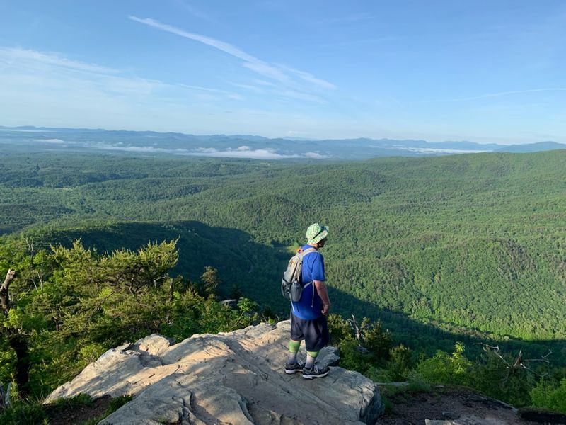
On the east rim, a flat-topped peak called Table Rock stands out from miles away. Its shape is so distinct that it works like a landmark for the whole gorge.
A popular day hike starts from the forest service road and climbs to the summit. From there, many hikers continue to the Chimneys.
The Chimneys are a cluster of rocky spires along the ridge. They make for great photos and some fun scrambling for careful hikers.
Unusual plant life grows around these rocks. In the right season, monarch butterflies also pass through in impressive numbers.
The views stretch across the gorge to the west rim and beyond. On a clear day, ridges line up one after another toward the horizon.
Bring water, snacks, and a layer for wind on the exposed rock. The top can feel much cooler than the parking lot, and the trip is better when you are ready for it.
West Rim Lookouts Worth the Detour
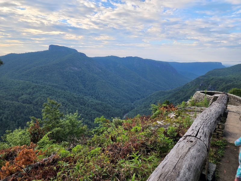
Some of the easiest big views in the gorge sit along the west rim. Wiseman’s View is the classic stop, with a short walk to a lookout facing Table Rock.
Babel Tower is another favorite. The trail drops toward a rocky point surrounded on several sides by the river far below.
Bynum Bluff offers its own sweeping look at the Linville River and the canyon walls. It also connects to routes that head deeper into the gorge.
These spots are reached from Old NC 105, the gravel road along the west side. Each trailhead has small parking areas that fill fast on weekends.
Trails here are usually easy to follow at the top. They get steep quickly if you choose to keep heading down.
After Hurricane Helene, crews worked hard to clear and reopen many of these paths. Wiseman’s View, Babel Tower, and Bynum Bluff were back open by early 2025, which is great news for rim lovers.
Down at River Level
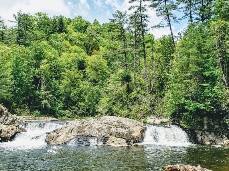
The bottom of the gorge is a whole different world from the rim. The Linville River winds past huge boulders, quiet pools, and rocky banks.
The Linville Gorge Trail follows the river for a long stretch. Hikers often drop in on one trail, walk along the water, and climb out on another.
Big rocks along the river are fun to climb on during warm months. There are also calm spots where people cool off in the water.
Always check the current before you step in. Water levels can rise after rain, and slick rocks deserve respect.
Rhododendrons crowd the banks, and their white blooms sometimes cover the trail in early summer. Moss-covered stones add to the wild look.
Crossing the river can be tricky in places where bridges are out. Expect wet feet or a tough crossing, and only try it if you have experience.
Getting back up is the real workout, so pace yourself on the way down.
Rock Climbers Take Note
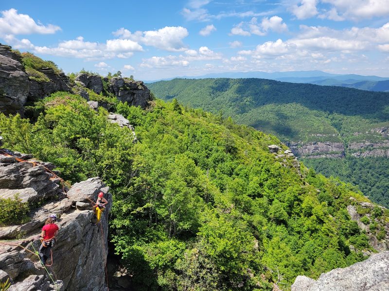
Climbers from all over the East Coast have this gorge circled on their maps. The cliffs here offer tall, exposed routes that are rare east of the Mississippi.
Most of the rock is quartzite. It is known for traditional, or trad, climbing, where climbers place their own gear as they go.
Some routes stretch five or six hundred feet with multiple pitches. That means long days on the wall and serious planning on the ground.
Table Rock and the Chimneys area are well known climbing spots. Other cliffs line the gorge walls for those who know where to look.
This is not a place for first-timers to figure things out alone. Go with skilled partners or a local guide who knows the routes.
Bring a guidebook, check the weather, and leave early. Climbing in a wilderness area means help can be far away, so smart choices matter as much as strong arms.
Free Camping Under Big Skies
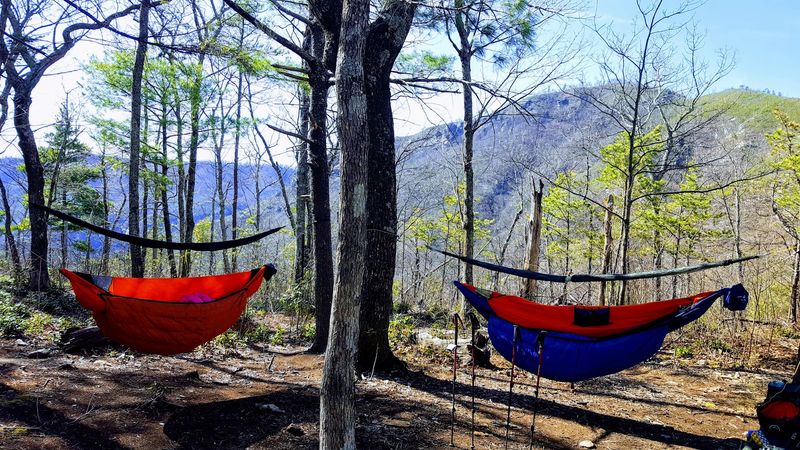
Good news for budget travelers: camping here can cost exactly nothing. Free dispersed campsites line Old NC 105 along the west rim.
Many sites are surprisingly roomy, with space for several tents and vehicles. Fire rings are common, though picnic tables are not.
Trees make for easy hammock setups. Fallen wood is usually plentiful for campfires, but always follow current fire rules.
There are no restrooms, no water spigots, and no hookups. Pack in all your supplies, plus extra water for cooking and cleanup.
Weekdays tend to be quieter, with more open sites to choose from. Weekends can get busy, especially in nice weather.
Nights are usually calm, and the star views are excellent away from city lights. Bring bug spray, since some days are buzzing more than others.
Backpackers can also camp inside the gorge. Check Forest Service rules first, since permits may be needed on certain dates.
Maps, Markers, and Staying Found
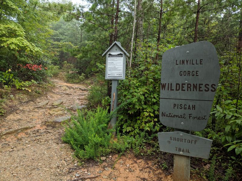
Getting lost here is easier than many people expect. The gorge is a true wilderness, and trail signs are few and far between.
Some junctions have several paths meeting with no markers at all. Paper maps may not show every route.
Download an offline trail map on your phone before you leave home. Apps that work without signal are a big help.
Bring a paper map and compass as a backup. Phones can break, and batteries drain faster than you think.
Cell service is limited and often missing. Tell someone your plans and when you expect to return.
Watch your progress compared to the river and the rims. That helps you confirm you are on the right path.
Steep climbs and rocky footing call for sturdy hiking boots, not sandals. Good boots protect your ankles on rough ground.
A little prep goes a long way, and it turns a confusing day into a great adventure.
Picking Your Season
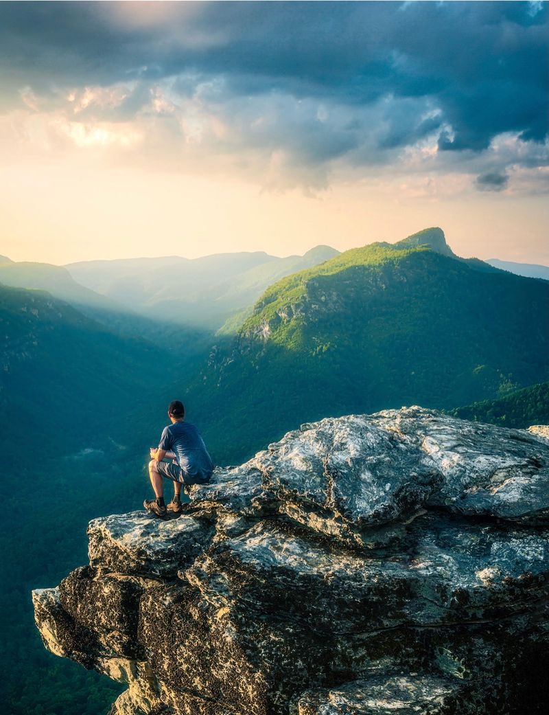
Every season gives the gorge a new personality. Choosing when to go depends on what kind of trip you want.
Spring and early summer bring rhododendron blooms along the trails. The river runs strong after spring rains.
Summer is popular for river swimming and camping. Bring bug spray and start hikes early to beat the afternoon heat.
Fall is a favorite for many hikers. Cool mornings, often in the 40s and 50s, make long climbs more comfortable.
Winter can be beautiful but tough. Snow, ice, and strong winds on exposed rocks are common.
Pack a face covering and something for your ears if you visit in cold weather. The wind at overlooks can bite.
Icy roads may stop cars before reaching the far trailheads. Have a backup plan if conditions change.
No matter the month, the views deliver. With the right gear and timing, North Carolina’s own canyon is ready whenever you are, and it rarely lets anyone leave unimpressed.